|
|

|
|
|
|
Sample Trip
|
 One
of the most beautiful marsh areas in Death Valley, the ponds of Saratoga Springs
support migrating birds and its own unique species of pupfish.
In addition to the lush plant and animal life you'll find here, this area has
old mines to explore, too. Man has been around these springs since prehistoric
times and, more recently, has mined talc. The Saratoga Mine was the largest
producer of talc in southern Death Valley. And, the famous twenty-mule-teams
stopped here on their route across the desert.
One
of the most beautiful marsh areas in Death Valley, the ponds of Saratoga Springs
support migrating birds and its own unique species of pupfish.
In addition to the lush plant and animal life you'll find here, this area has
old mines to explore, too. Man has been around these springs since prehistoric
times and, more recently, has mined talc. The Saratoga Mine was the largest
producer of talc in southern Death Valley. And, the famous twenty-mule-teams
stopped here on their route across the desert.
|
|
Books That We Recommend:
![]() Getting There
Getting There
Saratoga Springs is located in the southeastern corner
of Death Valley National Park (the Ibex Hills Area), and can be accessed from
four different directions. The most popular route, from S.R. 127, is normally
easy for any vehicle class to travel but there are several river crossings that,
at times, can be difficult or impossible without high clearance. Please
read your entire route description below before taking this trip.
See the Ibex Hills Area chapter for directions to the area, then follow the directions below.
From the south (Baker): From Salt Creek Hills, continue on S.R. 127 for 0.9 miles and look for the wide dirt road and the historical marker on the left. This is the well-graded Harry Wade Road; turn left. See * below for further directions.
From the north (Shoshone): From Ibex Springs Road, continue on S.R. 127 for 9.9 miles and look for the wide dirt road and the historical marker on the right. This is the well-graded Harry Wade Road; turn right. See * below for further directions.
From the north (Badwater Road): This route requires a high clearance vehicle and, depending on road conditions, may require 4WD. From the junction of Badwater Road and S.R. 178 (near Ashford Mill), go south on Harry Wade Road for 25.7 miles. Look for the sign to Saratoga Springs and turn left onto Saratoga Springs Road. See ** below for further directions.
*Once on Harry Wade Road, go west 5.9 miles. Be aware that many maps label this section of Harry Wade Road, from S.R. 127 to the turn off to Saratoga Springs Road, as Saratoga Springs Road so don't let that confuse you. You are on the right road. Watch for the sign to Saratoga Springs and turn right onto Saratoga Springs Road. See ** below for further directions.
**Once on Saratoga Springs Road, it is 2.7 miles to the junction with the road that goes to the springs. This section of Saratoga Springs Road is where the Amargosa River crosses the road in several places and where you may need a high clearance vehicle. Although these river crossings normally have just a small amount of water running in them, during wet years or right after a rainstorm, they could be difficult or even impossible to get through for any class of vehicle - even one with high clearance. Use common sense when deciding if you should continue or not.
The first set of river crossings is about 0.75 miles from the junction with Harry Wade Road. At 2.2 miles, there is another wet area to watch for. Once you get past these potential obstacles and have traveled the 2.7 miles on Saratoga Springs Road, turn left onto the dirt road that leads you another 1.2 miles to the parking area.
From Ibex Springs: You can get to Saratoga Springs via a dirt road that connects to the road to Ibex Springs but you will need high clearance and 4WD. We have not yet traveled this 6.4 mile section of road but understand that parts of it are in deep, soft sand that are best traveled going downhill, from north to south.
About Saratoga Springs
The three large ponds at Saratoga Springs are fed
by several underground springs. These ponds encompass almost seven acres
making Saratoga Springs the third largest marsh habitat in the Park. Some
of the other marsh habitats in this area include
Ash Meadows, the
Amargosa River Canyon, nearby
Salt Creek Hills and neighboring
Saline Valley.
This unique desert wetland supports a rich community of plants and animals including some that are rare. The Saratoga Springs Pupfish (Cyprinodon Nevadensis nevadensis) is found here and nowhere else in the world! In addition, there are five rare invertebrate species here; the Amargosa tryonia snail, Amargosa spring snail, the Saratoga Springs belostoma bug and the Death Valley June beetle. These wetlands are also a regular stop for migrating birds and is a great place for bird watching.
 |
|
The unique variety of pup fish (male) found only at Saratoga Springs |
For biologists, the pupfish are the main attraction here. Like their cousins at Ash Meadows and Salt Creek (north of Furnace Creek), these fish are descendants of what was once a more generalized pupfish population that swam in the lakes that once filled Death Valley some 10 to 20 thousand years ago.
As the climate changed and the lakes dried up, the pupfish became isolated into small ponds and have evolved into separate species. They have all had to adapt to the extreme temperature changes that they are subjected to because of being in such shallow ponds. The water gets extremely hot in the summer and near freezing in the winter. Pupfish feed on small larvae and other small organisms and have developed long intestines allowing them to also feed on different types of bacteria found in the water.
History
Saratoga Springs has a long history of human occupation.
Archeologists have uncovered evidence of prehistoric human existence here from
as far back as 1 AD but the area probably was used even further back than that.
Those people just didn't leave any traces for us to find.
The Native Americans in the area, as well as the first "foreign" travelers, knew Saratoga Springs as a source of year-round water in the otherwise dry desert. In the 1880's, the famous twenty-mule teams would stop here to rest on their way from the Amargosa Borax Works. They were probably the people who built the two stone houses to the east of the springs that are now just ruins. In 1902, the California Sate Mining Bureau issued a report that there were rich nitrate deposits in this area and started a "rush". Soon, hundreds of people had flooded into the Ibex Hills but they had wasted their time. One week later, the Geologic Survey reported that mining such a cheap commodity in such a remote area was futile.
Talc was discovered in the mid 1930's and mining began in 1940 at the Superior Mine just north of Saratoga Springs. This was the most successful talc mine in southern Death Valley, producing 141,000 tons of talc from 1940 to 1959. For a short time, one resourceful man even started a water bottling business and a small tourist resort at Saratoga Springs. Both enterprises, however, failed due the the gasoline rationing of WWII.
To learn more about the history of this area, we suggest reading both the Hiking Death Valley and Death Valley and the Amargosa books [references].
![]() Hiking
the Area
Hiking
the Area
When you get to the parking area for Saratoga
Springs, where the road ends, the springs are nowhere in sight. But, just
a short walk to the north, over a small hill and there it is before you!
There is much to see here whether you're a photographer, wildlife enthusiast, bird watcher or mine explorer so plan on spending some time to wander around. Look into the water for the unique Saratoga Springs pupfish or some frogs, watch the reeds for birds and look at the ground for the tracks of coyotes, rabbits and other animals. Try to be still for a while and see what critters come out.
After cresting the small hill, there are trails leading both left and right. The trail to the left (west) takes you down a rocky hill and to a path that will take you through some of the thick brush to the edge of the pond. This is where we saw the many, one-inch long pupfish.
Heading to the right (east) will take you around the ponds or to the old talc mines. To walk around the ponds, a distance of about 1.0 miles, look for the trail in that direction. The trail around the ponds can be faint in some places because of changes in water level so you may have to do a little navigating on your own for short distances. You may also run across some slippery, muddy patches but we found that there are plenty of higher-ground embankments to walk along, if necessary.
To hike the 1.6 miles to the first of the mines, look for the old mining road that hugs the mountains and follow it. We have not yet explored the mines here but understand that the Saratoga Mine is really three groups of mines. The middle group is said to have the best ruins. For details to these mines, we recommend reading Hiking Death Valley [references].
![]() Photo
Tour:
Photo
Tour:
Click on picture
to enlarge
Pictures taken: March 2003
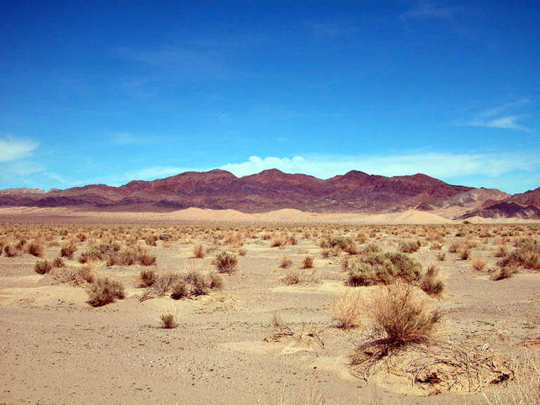 |
Traveling north on Saratoga Springs Road, you will see the Ibex Dunes on the right. |
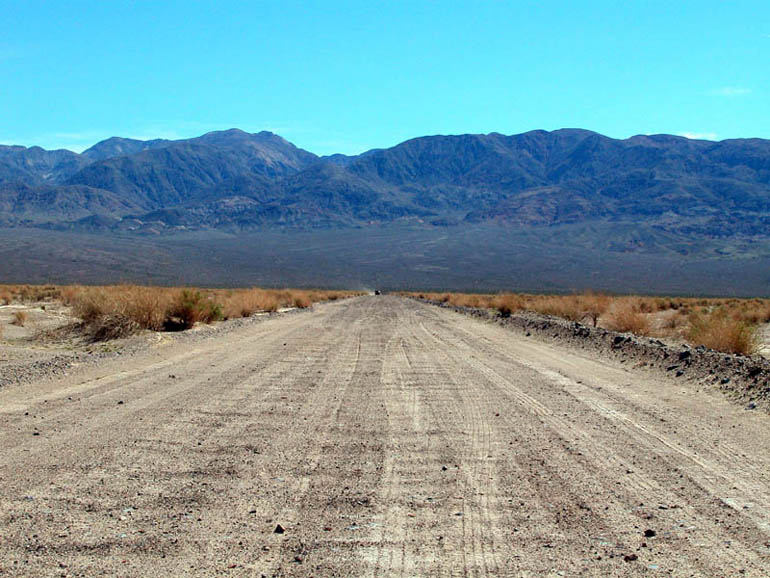 |
View of Saratoga Springs Road looking south towards Harry Wade Road and the Avawatz Mountains. |
 |
View looking north from the top of the small hill from the parking area. |
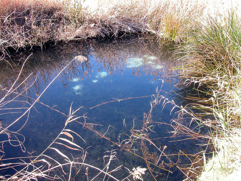 |
One of the small ponds to the left of the small hill. |
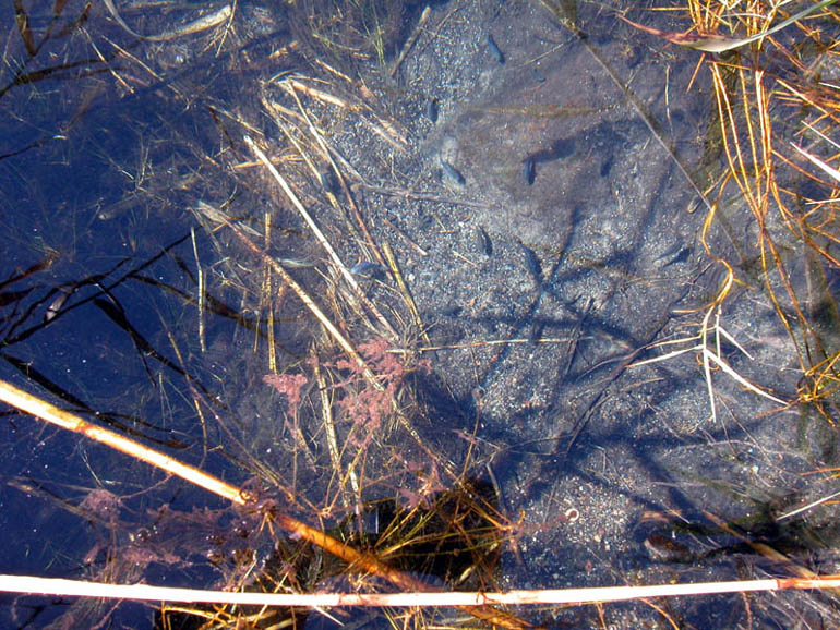 |
Saratoga Springs Pupfish can be seen in this pond. |
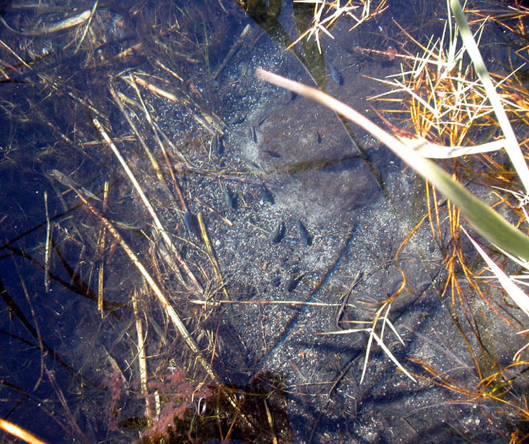 |
More of the rare pupfish. |
 |
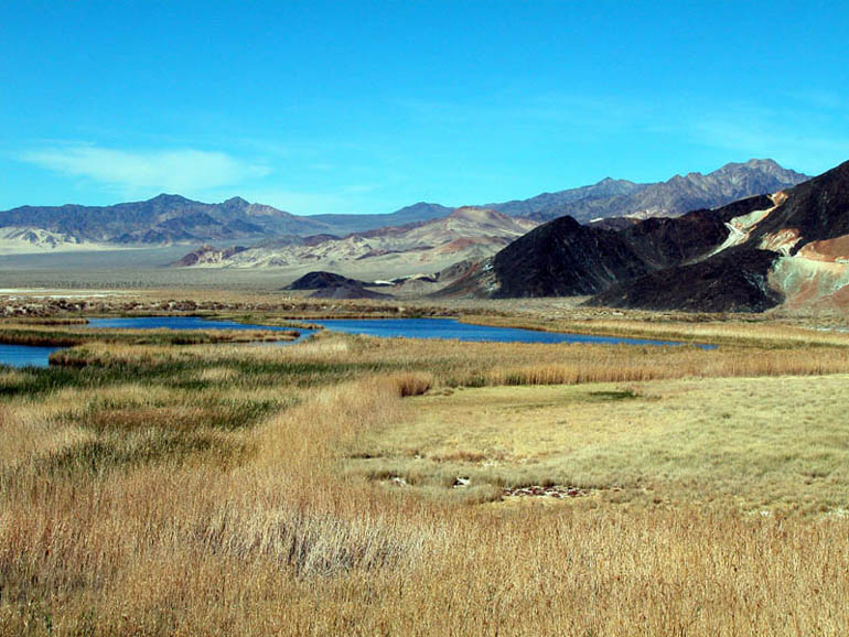
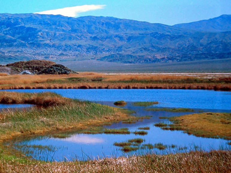
Another view of one of the small ponds. |
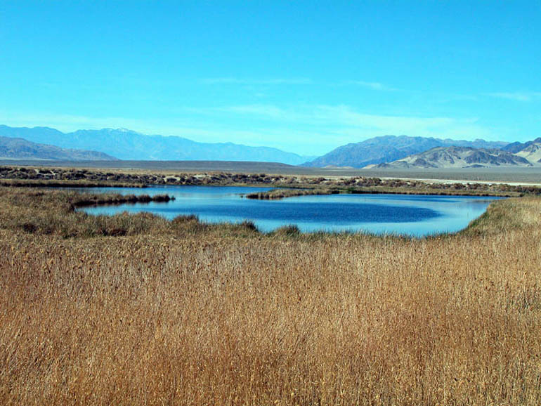 |
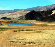
A view of one of the bigger ponds as you look north into Death Valley. The higher, snow-capped peak on the left is Telescope Peak. |
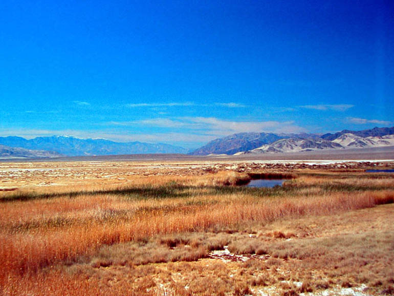 |
Another view of the Saratoga Springs area. The Black Mountains with the Amargosa Chaos are the darker mountains in the center of the picture. |
 |
Looking south towards the Avawatz Mountains from the north end of the ponds. The small dark specs on the water and in the air are ducks. |
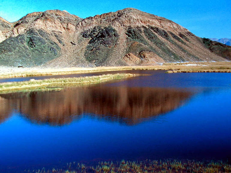 |
The mountains on the east side of the ponds. |
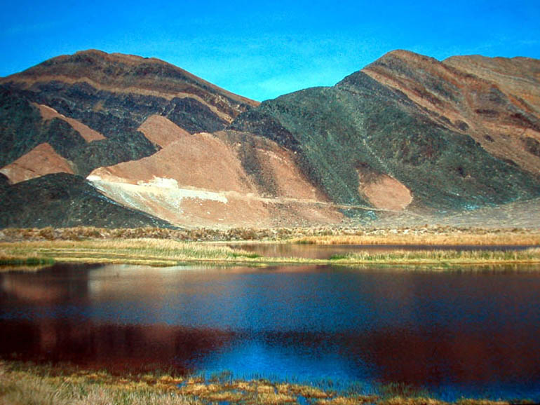 |
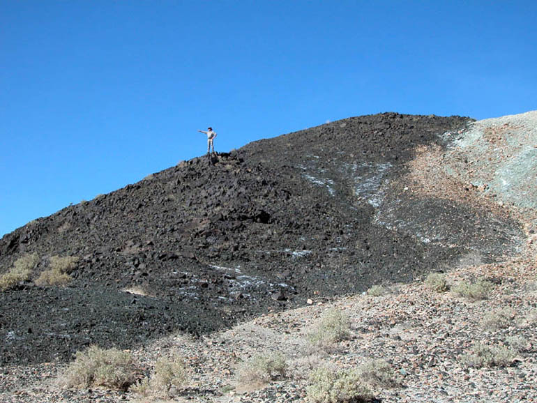
More of the mountains on the east side of the pond. Notice the road etched into the mountain that lead to the Saratoga Mine. Ironically, mountains that contain the powdery, white talc are often black on the surface. |
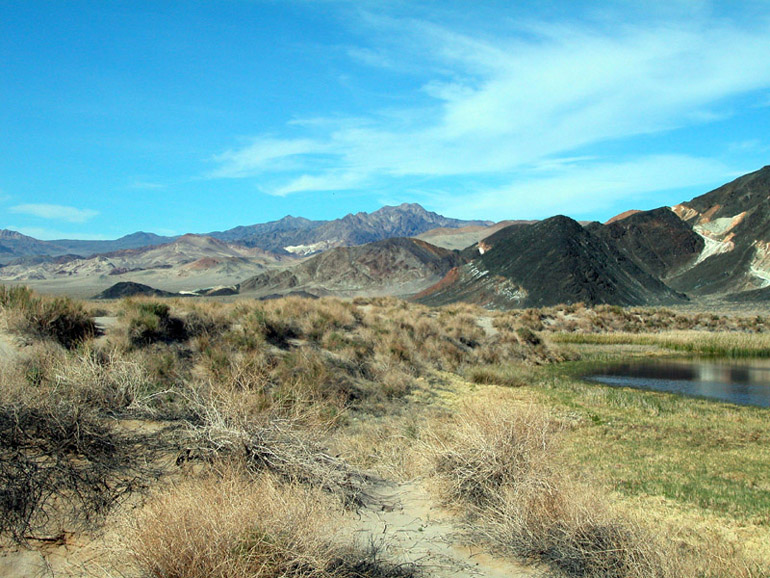 |
The trail, on top of an embankment, on the west side of the ponds. This view is looking towards the north. The white digs on the far mountains in the center of the picture are the mines near Ibex Springs. |
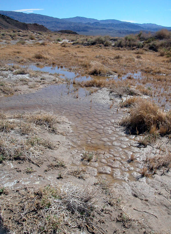 |
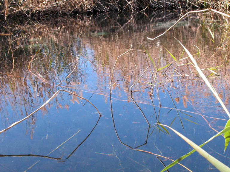
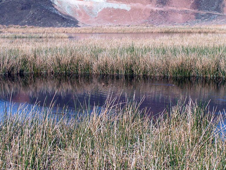
Wet area on the north side of the ponds. |
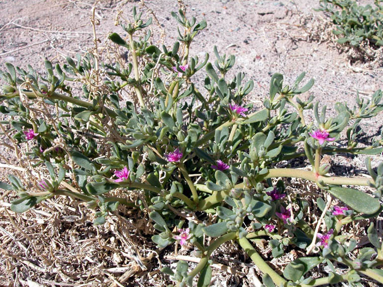 |
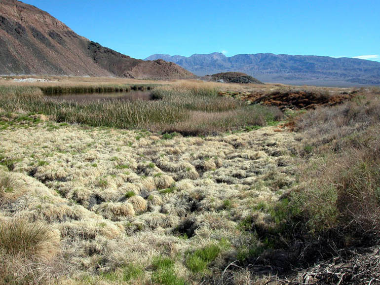
One of the types of vegetation found around the ponds. We have not been able to identified this plant yet. |
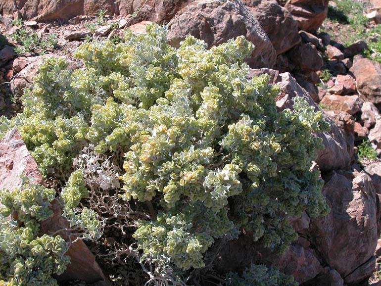 |
The Desert Holly (atriplex bymenelytra) is found here. |
 |
The Saratoga Talc Mine is just beyond these hills. |
 |
On our last visit we were surprised to find what looked like two beavers in one of the ponds! |
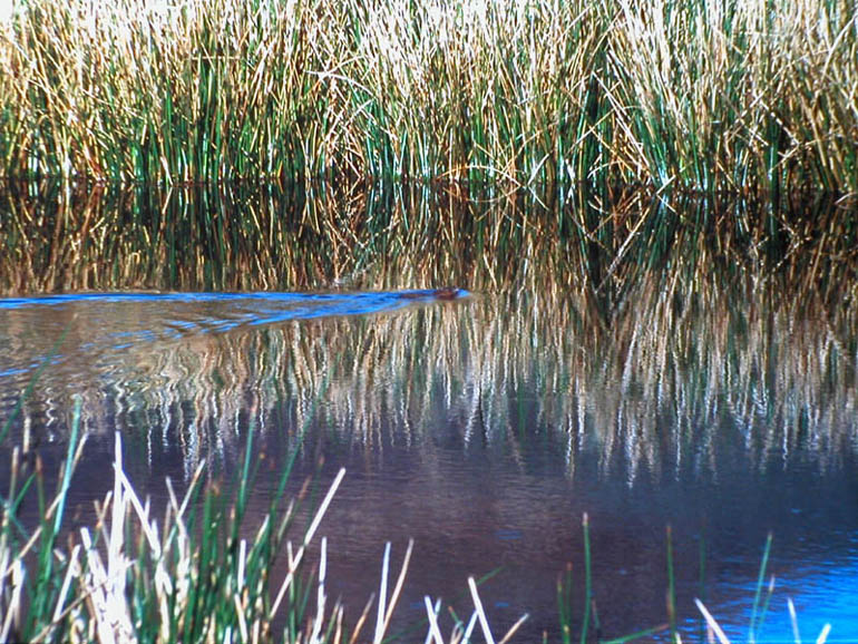 |
A closer look at one of the beavers. We've been told that there are no beavers here but what else could this be? |
 |
View from the north side of the ponds looking south, towards the parking area. |
Back to Photo Tour, Back to top of page or Back to Ibex Hills Area
Back to Sample Trips
Last updated November 06, 2011.
![]()
Copyright (c) 2004, BackRoadsWest.com