Salt Creek Hills: on the edge of Death Valley
Located at the southeastern tip of Death Valley and just outside of the park boundary are the Salt Creek Hills. This small oasis offers an easy hike through the oasis to the old gold mines of Amargosa Spring and is a great place to stop, stretch your legs and enjoy the desert serenity for an hour or two. The small parking area that leads to the trailhead is just off of Hwy 127 which is the main road leading to Death Valley from the I-15 at Baker.


The Salt Creek Hills are located very close to Dumont Dunes, a popular place for OHV’s and dune buggies, so the Bureau of Land Management (B.L.M.) felt it necessary to designate Salt Creek Hills as an ACEC (Area of Critical Environmental Concern) to help protect this historical and fragile riparian area.
Providing a rare source of water in this wide desert expanse, Salt Creek Hills is rich with history of the Old Spanish Trail, mining operations from the 1800’s and, no doubt, prehistoric Native Americans were here, too. Today, Salt Creek Hills is home to the oldest standing structure in San Bernardino County. The rock building known as the Amargosa House was built in the early 1850’s.
Interestingly, Salt Creek drains a significant portion of the Mojave Desert. The entire area to the south of the Salt Creek Hills area and about 30 miles to the east, which includes draining half of the large Kingston and Clark Mountain ranges. You wouldn’t have guessed it, but a lot of water can potentially pass by this point. After passing by the oasis located here, it travels a short distance to the Amargosa River just 4.5 miles northwest. From there, water in the Amargosa River drains into Death Valley and ends roughly near the lowest spot in the USA – Badwater.
The B.L.M. has put a lot of effort into this area. The trail is well-marked and easy to follow with many interesting interpretive signs, making this hike particularly enjoyable. They have also put picnic tables underneath the nice, big trees that are just a short distance from the parking area.
Getting There
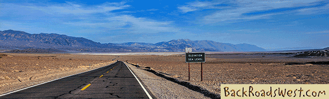
Located along Hwy 127, the trailhead for Salt Creek Hills is 29 miles north of Baker or 27 miles south of the small town of Shoshone. The turnoff to the parking area is well signed and restrooms are located there.
The Hike
This is an easy, relatively flat hike. There is a lot to see if you include wandering around the old mine sites and inspecting the area. And, if you include a stop under the big shade tree for lunch or a snack, you could easily spend several hours. Time is easily forgotten when you’re distracted by the beauty of nature.
From the parking area, follow the well-marked and well-maintained trail northeast towards a large group of trees. Be sure to stop and read the interpretive signs that are all along the trial; they are very informative. The trail runs along the left (west) side of Salt Creek and, after 0.2 mile, the trail crosses Salt Creek itself via a wooden bridge. Look to your right, under the trees, for the picnic tables.
More…
Pictures
Below are some pictures of what you will see along the way.


Panoramic view with call-outs of the Salt Creek Hills area
Shop for Death Valley items
Scroll down to see and shop for Death Valley related items from Amazon.
Books Recommended on Amazon
Virtual Tour on YouTube
From the picnic area, the trail crosses a small stream and heads into a short, narrow and shallow canyon. The trail is a little difficult to see here because the floor of the canyon is made mostly of solid rock so just continue up-canyon until the trail reappears. Look for the trail leaving the canyon on the right. As you exit the canyon, the scenery changes to open desert. Take a few moments here to enjoy the wonderful vistas of the Valjean Valley and the Silurian Hills to the south.
The trail continues on its northeastern route towards Amargosa Spring which is located in the saddle between the two hills visible ahead. The trail then tops a small summit and turns to the left, now heading due north. At this turn, you’ll get your first glimpse of the old mining camp ruins.
All around Amargosa Spring are various mining tunnels and prospect holes. Although most of the vertical shafts in the area are now protected with large metal grates, you should still watch where you step! These metal grates serve two purposes; one is to help prevent people from falling in and the other is to offer the local bats a place to roost. The extra effort that was made to add these grates, instead of simply filling in the holes, is a great way to give a little back to Mother Nature after taking her minerals. Bats fill an important ecological spot and help to keep the insect population in check.
Continuing on the trail, you’ll pass the small mining camp that grew up around Amargosa Spring and more mines. The trial ends at another entrance to Salt Creek Hills, this one used by people who are enjoying the Dumont Dunes Recreational Area located just to the north.
History
In the 1820’s, Amargosa Spring was a stop along the Old Spanish Trail. Later, around 1850, this same route was used by Mormon settlers traveling to the San Bernardino region and became known as the Mormon Road. Look for the faint traces of their wagon wheel tracks in the area.
The centerpiece of Amargosa Spring is the “Amargosa House”. Built around 1850, the only remnants remaining today are the rock walls. You can walk into the Amargosa House for a close up look. There are other ruins to see in the area of the Amargosa House, too.
The ruins that you see of the Amargosa House have been maintained by local historians. If it wasn’t for the time and hard work that these people endured, the ruins would have eroded away a long time ago. To learn more about the restoration process, as well as other restoration projects in this area, contact the Mojave River Valley Museum in Barstow.
In the 1880’s, an unusual stamp mill was built on the west slope of Amargosa Spring. This stamp mill looks very different as compared to the other mills in the Death Valley area from this era and parts of it are made of concrete. The mine was bought and sold many times and mining continued here until the 1890’s.
Trip Map
Support Us
Help us fill up our tank with gas for our next trip by donating $5 and we’ll bring you back more quality virtual tours of our trips!
Your credit card payment is safe and easy using PayPal. Click the [Donate] button to get started:
Subscribe
See all our comprehensive virtual tour guides at:
![]()