|
|

"Knowledge for the western back roads explorer..." |
|
|
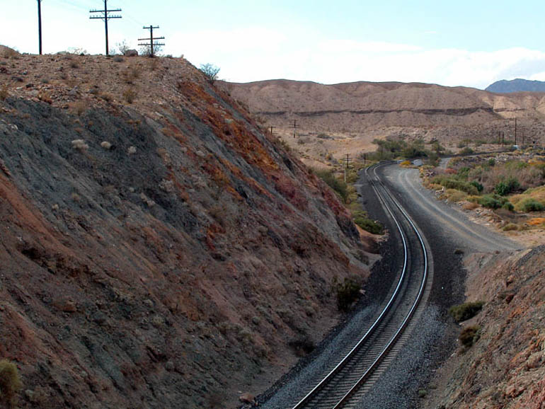
Afton Canyon
|
 Often
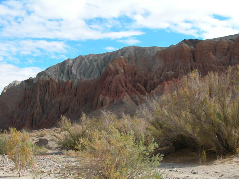
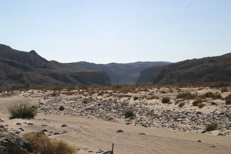
referred to as the "Grand Canyon of the Mojave", Afton Canyon is a colorful,
steep-walled canyon that was created by a massive flood nearly 18,000 years
ago. Today, the Mojave River continues to carve the canyon ever deeper
but at a much slower pace. This is one of the only spots along the river's
140 mile length where water flows above ground all year.
Often
referred to as the "Grand Canyon of the Mojave", Afton Canyon is a colorful,
steep-walled canyon that was created by a massive flood nearly 18,000 years
ago. Today, the Mojave River continues to carve the canyon ever deeper
but at a much slower pace. This is one of the only spots along the river's
140 mile length where water flows above ground all year.|
|
Unique and colorful geology |
|
|
Slot canyons |
|
|
Hike to the "Caves" |
|
|
Historical Mojave Road sites |
|
|
Railroad trestles and bridges |
Be sure to read the Trip Log for details about where you'll find these places along the way.
|
|
|
Books That We Recommend For This Area:
Getting There

Afton Canyon can be accessed from either end of this road trip and each end has an exit from the I-15 freeway. The route we describe starts at the Afton Canyon Road exit (western end), heads generally eastward, and ends at the Basin Road exit. To take the trip in reverse, exit I-15 at Basin Road and use the Other Way mileages in the Trip Log to guide you.
You will need a vehicle with both 4WD and high clearance to complete this Road Trip. Although the starting and ending sections can be done with a Class A vehicle for a short distance, there are two river crossings and patches of soft sand that cannot be safely crossed without the required vehicle. For those who do not have that type of vehicle, parking at the campground and hiking into the canyon can also be very rewarding.
Be sure to have plenty of fuel and supplies before heading out on this Road Trip. The nearest supplies are either in Baker (20 miles to the northeast) or in Yermo (26 miles to the southwest). From time to time there are gas stations and/or convenience stores at the other exits nearby but they are unreliable.
Restrooms are located in the Afton Canyon campground at the western end of the Road Trip.
From Spring Valley Lake:
Drive out of the parkway and turn right on Bear Valley and continue to I-15.
Take I-15 north to Barstow/Las Vegas. Continue on I-15 north for just under
74 miles from Bear Valley Road to Afton Canyon. The exit is found 4 miles (the
next exit) past a rest area along I-15. Exit on Afton Road and turn right.
From the west (Barstow):
From the Main Street exit in Barstow, reset your odometer and go north on I-15
for 36.6 miles (58.9 km) to the Afton Road exit. At the top of the exit,
turn right (southeast) and the pavement quickly changes to a well-graded dirt
road. Follow the road for 3.4 miles (5.5 km) to the Afton Canyon campground.
The campground is where all Class A vehicles will need to stop and park, where
the restrooms are located and where the
Pyramid Canyon Hike starts.
This is also the point where the Mojave River enters the canyon (from the west).
From the east (Baker):
From Baker, go south on I-15 for 16 miles (25.8 km) to the Basin Road exit.
At the top of the exit, turn left (over the freeway) and continue on the well-graded
dirt road for 1.5 miles (2.4 km). At the junction, bear left onto the
less-traveled dirt road and follow the Other Way directions of the Trip Log.
Continuing on the the well-graded road takes you to the mine.
If you choose to travel through Afton Canyon from west to east, continue past the Basin Road exit for 8.8 miles (14.2 km) to the Afton Road exit.
Area Hikes
Getting out of your vehicle and hiking into one of the many side canyons of Afton Canyon will certainly add to your enjoyment of this Road Trip. We have only explored two of them so far, Pyramid Canyon (below) and the small slot canyon described in the Photo Tour, but the topography of this area looks very promising for many more interesting side canyon hikes.
|
This side canyon of Afton Canyon offers a great hike into the heart of the heavily eroded landscape this area is known for. |
Along with the spectacular geology found in Afton Canyon itself are other hidden geologic gems - slot canyons. |
 Pyramid
Canyon Hike
Pyramid
Canyon Hike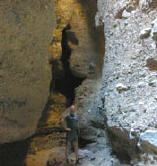 Slot
Canyon Hikes of Afton
Slot
Canyon Hikes of Afton
The Road
The entire length of the road through Afton Canyon is dirt and, as stated in Getting There, you will need a vehicle with both high clearance and 4WD for the spots with deep sand and for the two times you will cross the Mojave River. At both river crossings, be sure to get out of your vehicle and test the depth of the water before deciding whether or not it is safe for you to cross. The Mojave River typically runs higher in the winter but summer thunderstorms upstream can make the river swell quickly and generate flash floods so be cautious any time of year. There will be times when even a high clearance vehicle will not be able to cross the river.
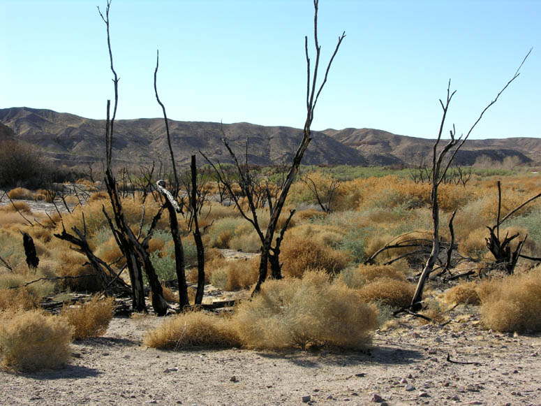
Navigating this road can be tricky in certain sections so be sure to use the Trip Log and the Maps. Some sections have been overgrown by the thick vegetation of the salt cedar bush. The best way to get through these sections is to follow the previous tire tracks until the road clears again. The salt-cedar, a very invasive bush, spreads quickly in the washes of Afton Canyon and is an on-going problem for the B.L.M (the organization who manages Afton Canyon). They have been working hard to eradicate this non-native plant and have been aggressively burning them (which seems to be the only way to actually kill them). You are likely to see some of these burnt areas on your Road Trip [see picture].
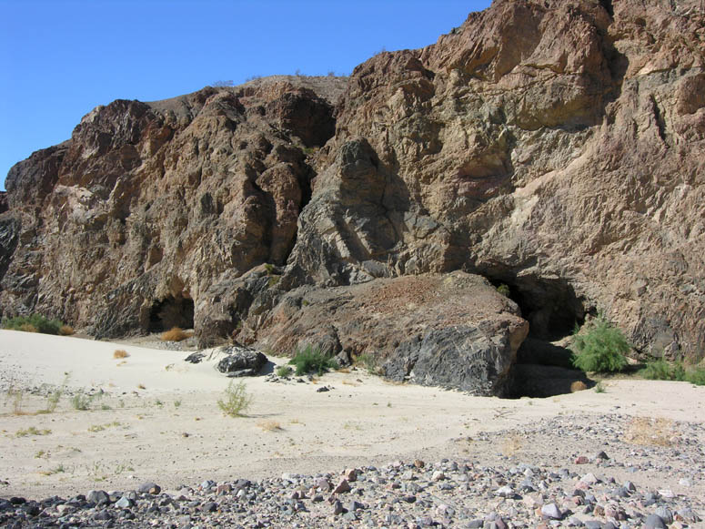
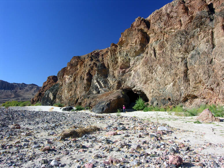
After the campground, the first river crossing is reached. Continue on the road and you will pass an old railroad town named Afton where nothing is left. Then, the second railroad bridge and river crossing on the road is reached. You can park your vehicle just before the second river crossing and take the short hike to the south to see the historic caves that were used when the historic Mojave Road was in use in the 1860s.
After the second river crossing the road runs along the railroad tracks for a short distance and then goes into the sandy bed of the Mojave River. This is where you definitely need 4WD, otherwise you will get stuck!
Another tricky navigational spot is at the exit of the canyon near the third steel railroad bridge. A few hundred feet before the railroad bridge is a road leading off to the right and up a hill. At the top of the hill is a great view of the Devil's Playground. This road continues on and will eventually lead back to the I-15 but we don't recommend it because it crosses the railroad tracks at a point where trains are often stopped for long periods of time.
After enjoying the view, turn around and return to the riverbed route you were on. If there are no trains blocking the tracks, continue on this road east and cross at the railroad crossing. Or, go under the railroad bridge and continue eastward, following the best tire tracks/route until you are lead to the right (south) and out of the riverbed. Follow this road for about 0.75 miles (1.2 km) as it goes along the railroad tracks and then turn left (north). Continue until it meets with the well-graded road of the mine then take that road to the Basin Road on/off ramp of the I-15.
Geology
Many geologists believe that the dramatic, sheer walls of the Afton Canyon we see today were carved in only a few days when a massive flood rushed through the canyon approximately 18,000 years ago. Back then, the hills surrounding Afton Canyon were a natural dam for the Mojave River and helped to create a large, ancient lake called Lake Manix. From the mouth of today's Afton Canyon, this lake stretched west almost to modern-day Barstow and southeast into the valley that today is traversed by Interstate 40 and was approximately 1,800 feet (550 m) deep according to the shoreline rings that were left behind.
Geologists today have two possible theories as to how this large lake was drained in such a short amount of time. One theory is that the Manix Fault, a major fault that runs along the west side of the hills of Afton Canyon, moved. This movement created a breach in the natural dam of Lake Manix and the huge volume of water of the lake that had been held back now rampaged through the canyon, completely draining the lake in as little as a few days! This still-active fault moved again in 1947 and produced an earthquake registering 6.2 on the Richter Scale.
The other theory is that an extremely wet season filled the lake to the brim where the water encountered a softer, more vulnerable section of the natural dam. The water eroded this section to the point where the dam was breached and, once started, the water could not be stopped. As in the other theory, the lake was drained in a very short time - somewhere between three days and two weeks.
Water, of course, travels downhill and the floodwaters from Lake Manix flowed and spread out into the Devil's Playground, Soda Lake and Silver Lake (north of Baker). After the creation of Afton Canyon, Lake Manix never formed again and the official end of the Mojave River today is at Soda Lake with an occasional overflow into Silver Lake.
Further evidence that there was once a lake here are the small, rounded rocks you can see just off the paved road after you exit the freeway at Afton Road. Pull off the road just southeast of the freeway overpass and take a look at the pebbles on the embankment of right side of the road. You'll see that they are "beach rocks"; tumbled, rounded and smooth (see pictures #2 & #3 in the Photo Tour).
Mining in and around Afton Canyon has been going on for almost a century. Magnesite (Magnesium Carbonate) was mined briefly in 1917. This mine employed a 1,900 foot (580 m) aerial tramway (now gone) to carry ore from the top of the canyon down to the railroad below. Although there was nearly 200,000 tons of ore on the side of the canyon (just east of the slot canyon pictured below in the Photo Tour), only a few train car loads of ore were actually shipped away to be milled. The rest of the ore is still within the southern wall of Afton Canyon today.
As of 2003, there was a large limestone and marble mining operation on the east end of the canyon. This operation is the reason for the well-maintained section of road between the mine and the Basin Road exit. There is another, older mine located about 0.2 miles (320 m) northeast of the third steel railroad bridge on the east end of the canyon. These remains are easily accessed by foot.
History
In addition to its rich geologic history, Afton Canyon has a long and rich human history, too. The canyon was, and still is, a thoroughfare for many people traveling through this desert area.
Archeologists have collected artifacts from what was once the shoreline of ancient Lake Manix that are evidence of an ancient race that once lived here thousands of years ago. At the nearby Calico Early Man Site, just off of I-15 near Yermo (northeast of Barstow), similar research is currently being done and tools used by these ancient people have been found.
More recently, in the mid-1800's, the canyon became part of the historic Mojave Road as it followed the Mojave River. Caves located about halfway through the canyon were welcome sights to travelers who used them as an escape from the hot, midday sun and, occasionally, as an overnight camp spot. One of these caves was even big enough for them to pull their wagons into for shelter. This section of the canyon was known as the "Caves" and is where the canyon got its original name: Cave Canyon. It is also where the highest and most noticeable nearby peak got its name: Cave Mountain. This peak can be seen from many miles away, in all directions, and was used as a navigational beacon for travelers of the Mojave Road. To see these caves yourself, take the Caves Hike described below. To see what the Caves section of the canyon looks like, go to the Caves Hike photo tour below.
In 1867, a band of Indians attacked some travelers just after they left the Caves following a lunch stop. A group of three passengers were in a mail buggy headed for Arizona from San Bernardino when they were ambushed by 15 to 20 Indians who attacked with both guns and arrows. The travelers managed to escape and hightailed it that night to the next stop at Soda Springs (now called Zzyzx). One of the travelers, a doctor and an officer in the Army, was wounded in the neck. Even though there were about 150 militia stationed at Soda Springs, they decided not to go after the Indians. The Army doctor died the following morning.
Although we don't know what it means, the name Afton came from the railroad. Located just east of the current campground used to be a maintenance station and siding that the railroad used until around 1980. The buildings and rails were removed sometime after 1980 but evidence of the siding can still be seen today between the bridge near the campground and the second bridge. Because Afton Canyon was a high maintenance section of the railroad, the Union Pacific kept workers here to monitor the condition of the tracks through the canyon.
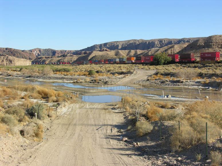
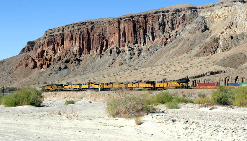
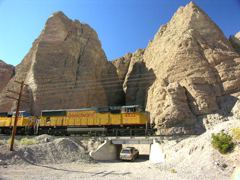
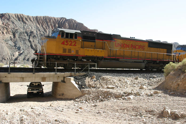
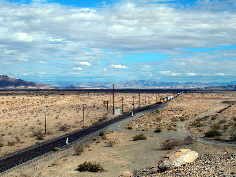
Today, Union Pacific Railroad still uses the canyon as a vital mainline in their system. On a good day, you can easily see several dozen trains pass through and, since there is only one set of tracks through the canyon itself, you can sometimes see trains sitting, waiting their turn on either side.
 The
Caves Hike
The
Caves Hike
| Level
of Difficulty: 2 (see chart) Length: 0.5 miles (0.8 km) round trip |
Elevation Gain:
10 feet (3 m) Main Attractions: Riparian area, caves |
The hike to the Caves section of Afton Canyon is easy, short and includes passing through some wetlands. In this part of Afton Canyon, the Mojave River makes a wide, 180° curve that the road does not follow. There are two caves here and, although the History section above says that one was large enough for horse-drawn wagons to fit into, today neither cave is that big.
Start the hike by parking your vehicle near the second bridge, off the main road, and follow the river, not the road, as you hike south (down-river). The size of the wetlands area here will, of course, vary with the seasons and amount of recent rainfall. This means that the path you follow into the canyon will depend on where the driest route is on that day. Test any soil that looks soggy with a gentle touch of your shoe before taking a step and possibly sinking into water up to your ankle.
The caves are located on the right side of the canyon at about 0.3 miles (0.5 km) from the second bridge and are near each other. We walked to about the middle of the 180° curve and turned around.
 Photo
Tours
Photo
Tours
Road Trip
Click on picture to enlarge
Pictures taken: November 2003 and February 2006
 |
Western entrance to Afton Canyon from the Afton Road exit. |
 |
Just as the dirt road begins, after exiting the freeway, pull over and look down the embankment on the right (south) side of the road. There are many small, polished pebbles here that are similar to pebbles found along a sea or lake shore. This was the shoreline of ancient Lake Manix where the wave action polished them more that 18,000 years ago . |
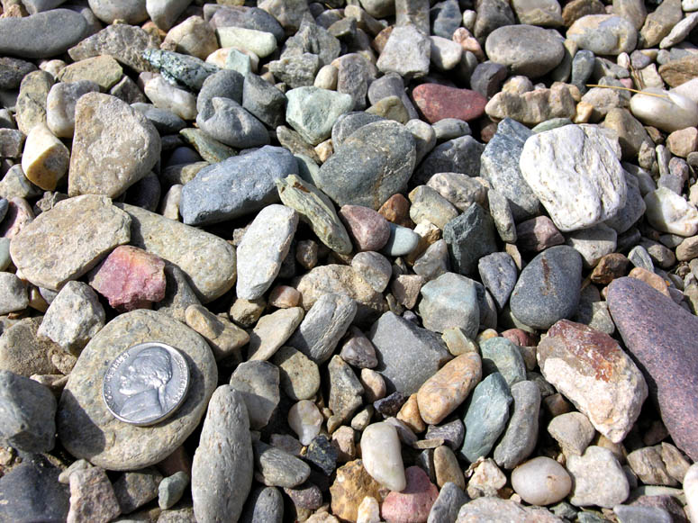 |
A closer look at these polished pebbles - a nickel is used for scale. |
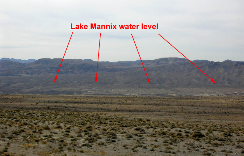 |
At this same spot, look up and south across the valley towards the Mojave River and you can make out the "bathtub" rings of the old shoreline of ancient Lake Manix. |
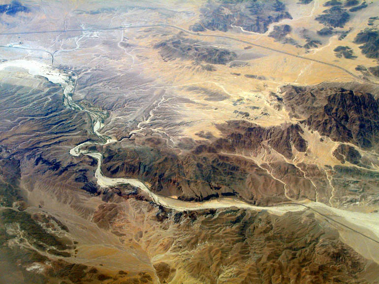 |
Aerial view of Afton Canyon from about 30,000 feet (9,400 m). |
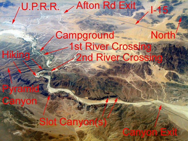 |
Same view as above but with callouts. |
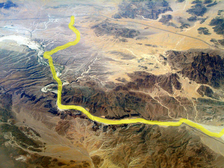 |
Same view as above but showing the Road Trip route. |
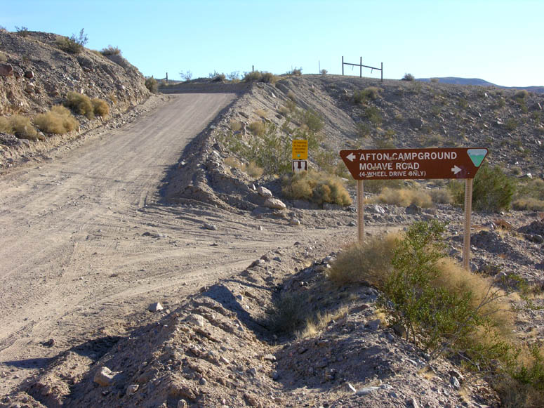 |
Before reaching the campground, a side road heads off to the right, under a railroad bridge, and leads to the continuation of the Mojave Road. |
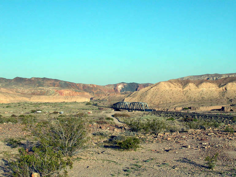 |
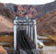
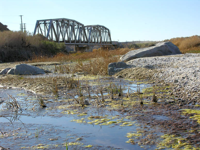
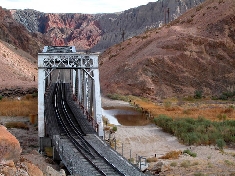
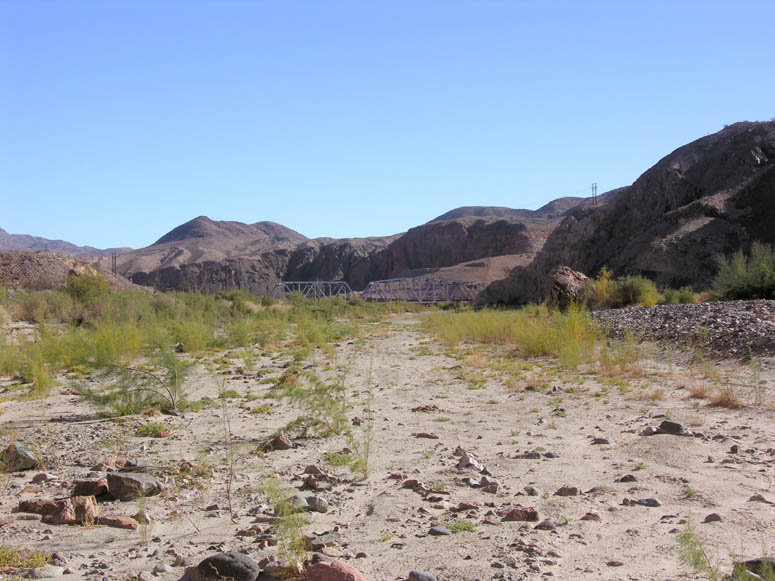
The Union Pacific Railroad goes through Afton Canyon on a single rail line. You'll see three steel bridges (like the one in this picture) on this Road Trip. |
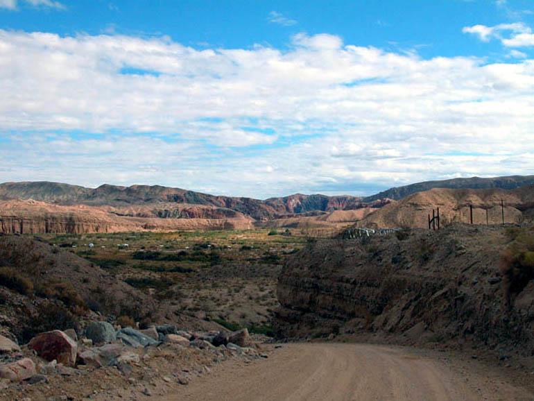 |
After exiting I-15, the road goes through a canyon and descends one last time to the floor of the Mojave River. The Afton Canyon campground is in the distance. View is looking east-southeast and is about 3 miles (4.8 km) from the freeway. |
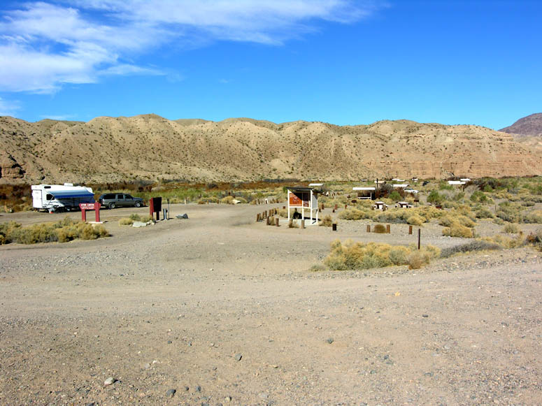 |
At the campground, there are about 15 campsites and each has a table and fire grate. |
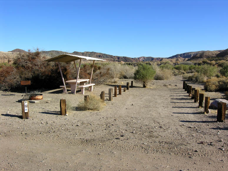 |
One of the campsites. |
 |
Campers be aware: the railroad tracks are close to the campground and the trains run all night long! |
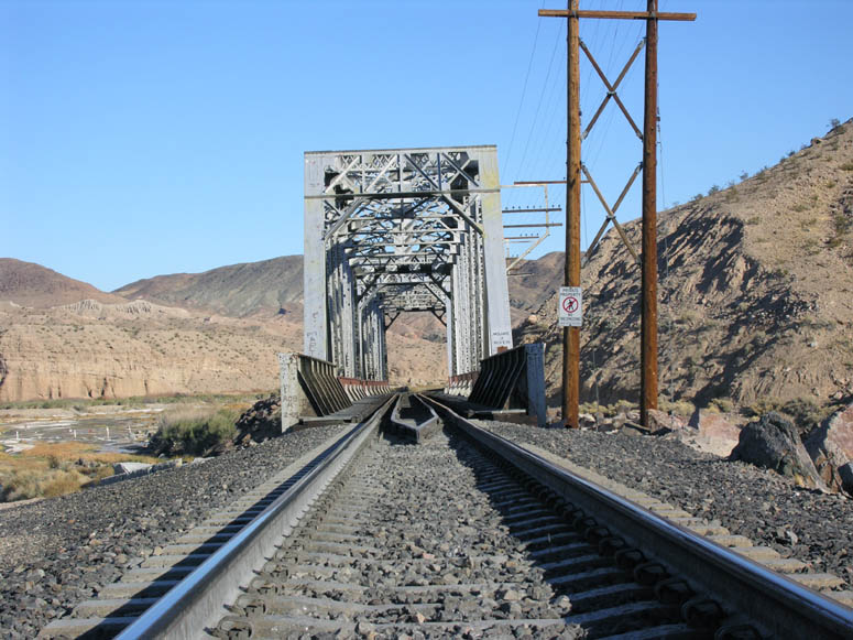 |
Looking through the first steel bridge. |
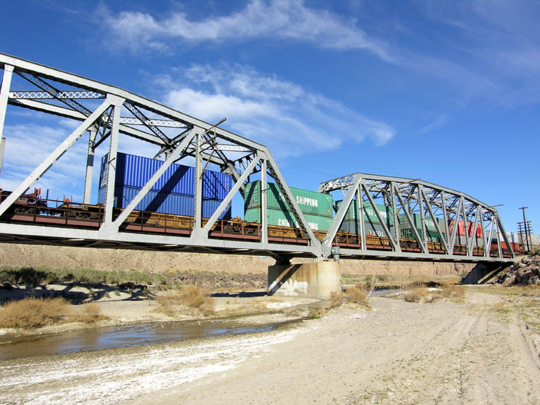 |
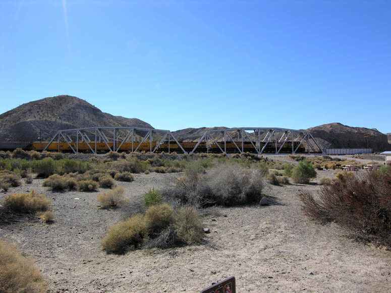
The first steel bridge with a train. Notice that the double stack trains barely fit under the steel crossbeams. |
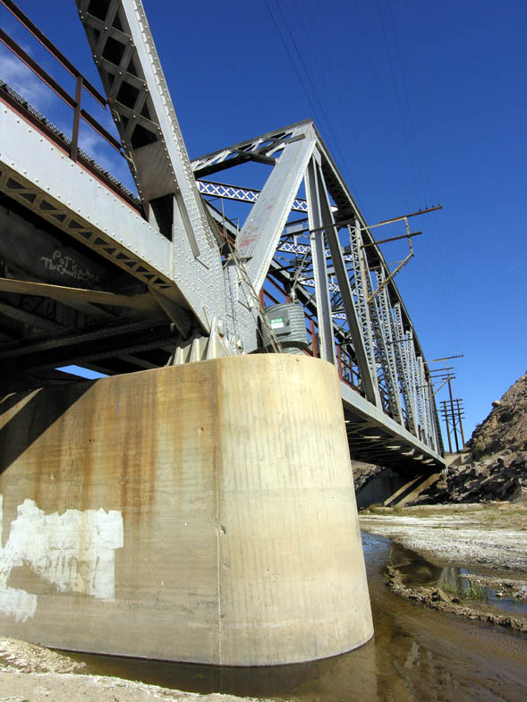 |
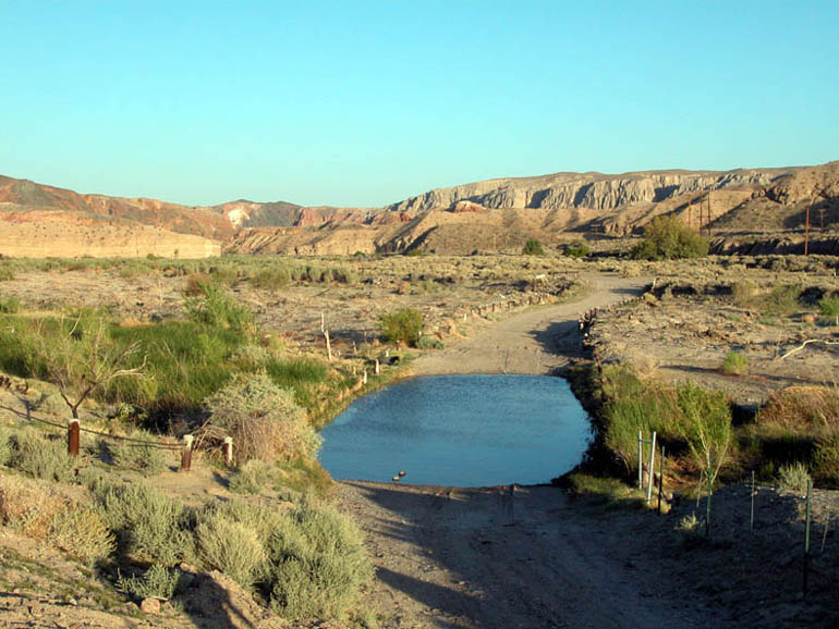
As noted in the Pyramid Canyon chapter, there is a gauging station on the first bridge. A gauging station is used to measure the volume of water flowing in a river. |
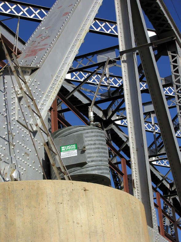 |
Close up of the gauging station. Although the Mojave River is one of the five largest rivers in Southern California, this is one of the few spots where the water flows above ground. |
 |
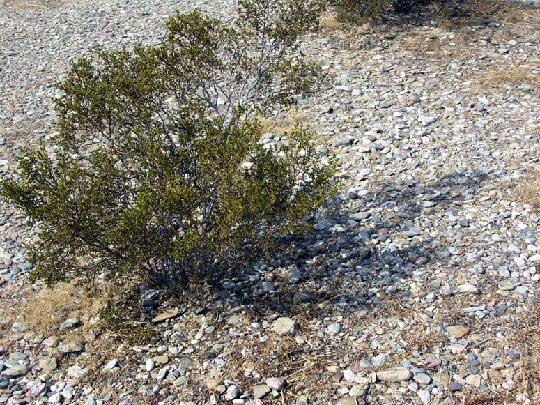
Some burnt stumps of the invasive, non-native salt cedar bush. |
 |
The first of the two river crossings is just after the first steel railroad bridge. Be sure to get out and test the water depth before attempting to cross. |
 |
During the typically dry month of February, the river crossing can be very tame. |
 |
The wetlands of the Mojave River. |
 |
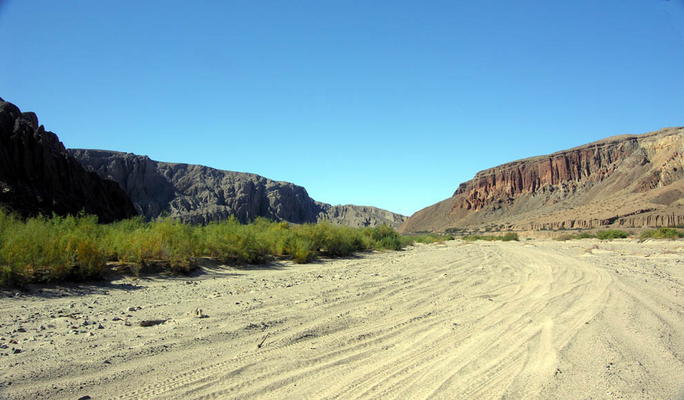
Looking west, towards the I-15, where the Mojave River enters the canyon. |
 |
The second river crossing is at the second steel bridge. This is where the Caves Hike begins. |
 |
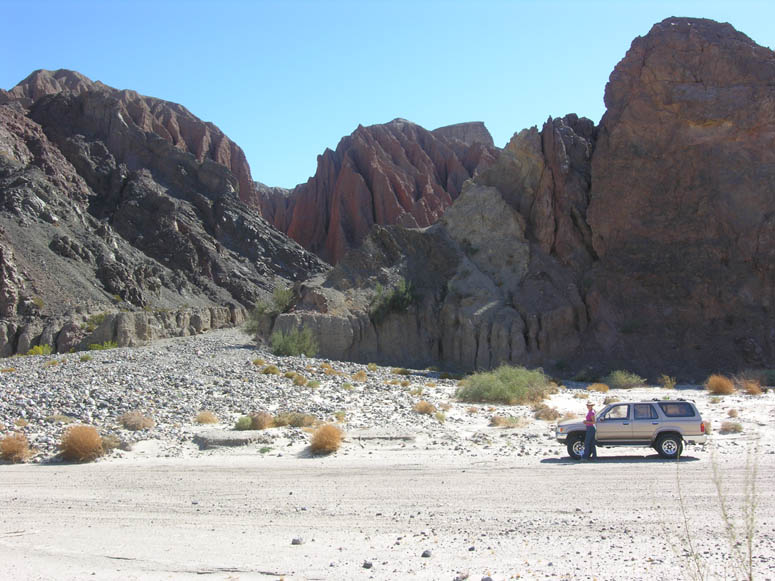
Back on the road and after conquering the second river crossing, the canyon becomes more interesting and colorful. Notice the road leading to the short slot canyon on the right. Also notice the Manix Fault contact spot (red and white soil) on the far canyon wall; this is explained several pictures down. |
 |
A short distance beyond the previous picture, the river drops down into the sands of the Mojave River. View is looking back, up-canyon to the west. From this view, the short slot canyon is on your left (right side of canyon). |
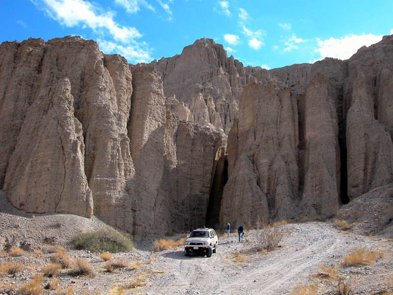 |
Closer view of the short slot canyon after crossing the sandy riverbed. |
 |
Driving and then walking the small distance to the short slot canyon is worth the effort. Hiking along the river (heading south or down river) in the vicinity of the second steel railroad bridge are many other slot canyons that we have not explored yet. |
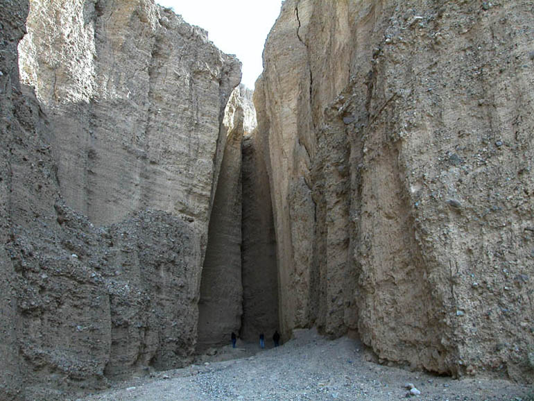 |
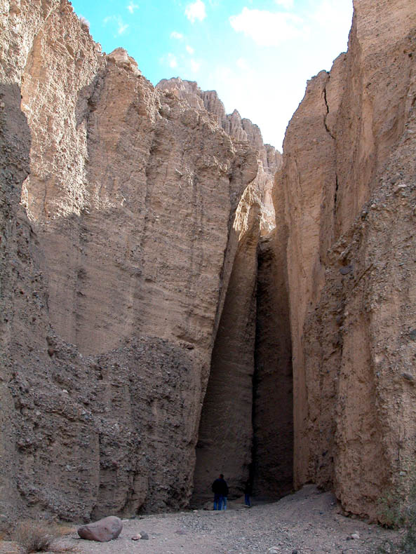
Another view of the slot canyon. A few thousand years of erosion has cut through the loosely-cemented sedimentary layers to create this little canyon. |
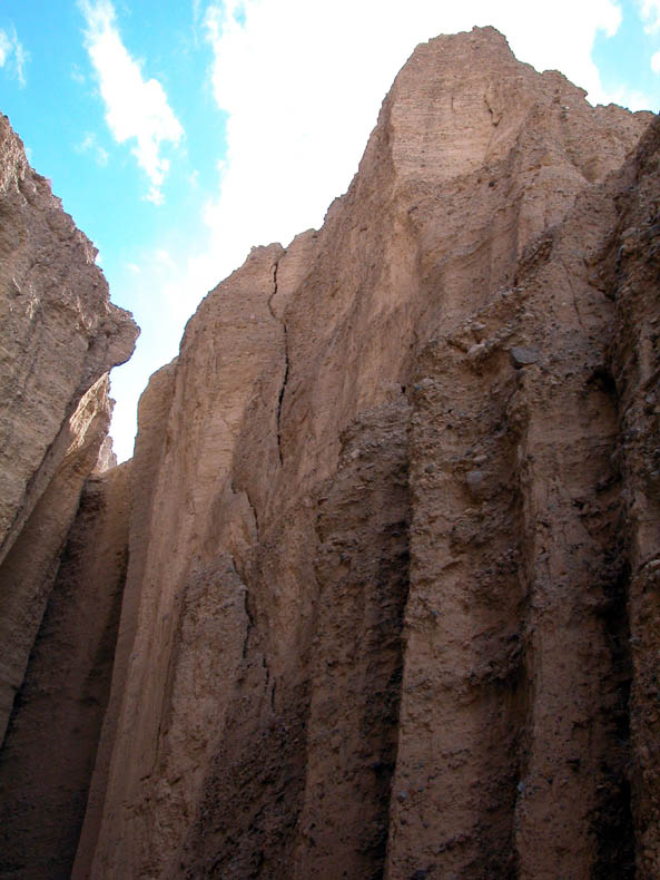 |
Closer inspection of this canyon wall shows a crack that reminds us of how quickly things can change in the canyon. |
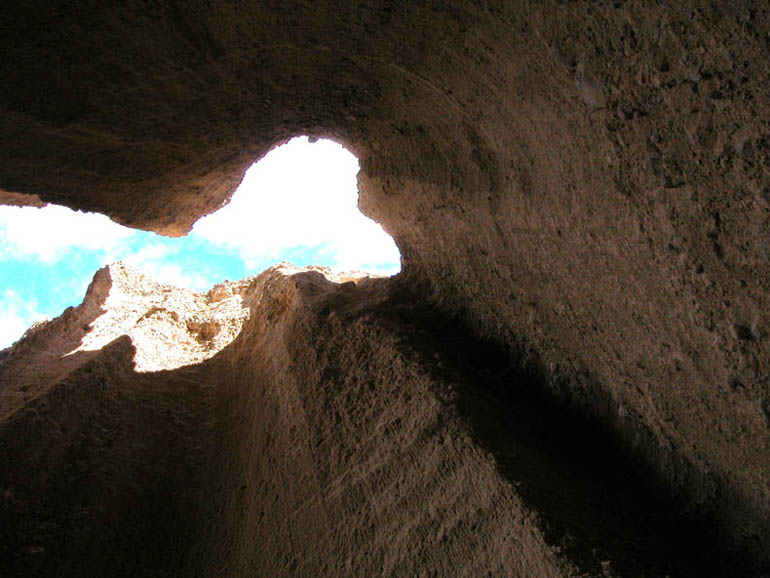 |
Looking straight up after reaching the end of the slot canyon. |
 |
View looking out of the slot canyon. As you can see, it is rather short. |
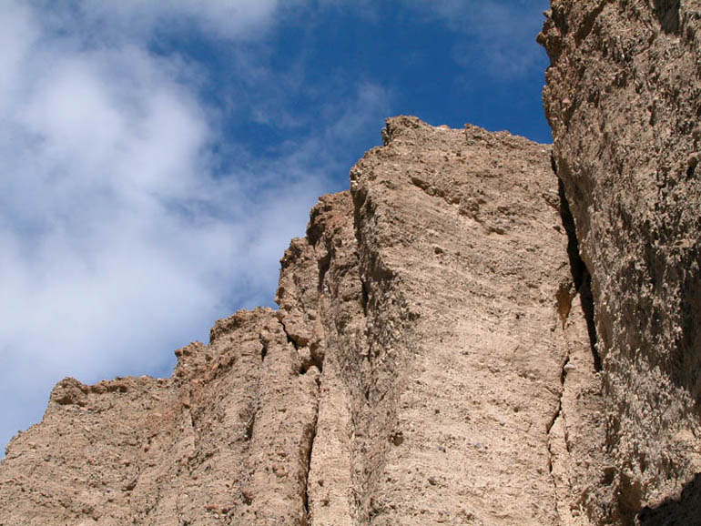 |
Looking up at some of the strata near the entrance of the short slot canyon. |
 |
View from near the mouth of the slot canyon looking down-canyon (northeast). |
 |
Just past the slot canyon, on the south side of the canyon, is a good view of one of the contact spots of the Manix Fault that caused an earthquake registering 6.2 on the Richter Scale in 1947. It is movement along this fault that geologists think may have caused the rapid draining of Lake Manix which, in turn, resulted in the creation of the Afton Canyon we see today. |
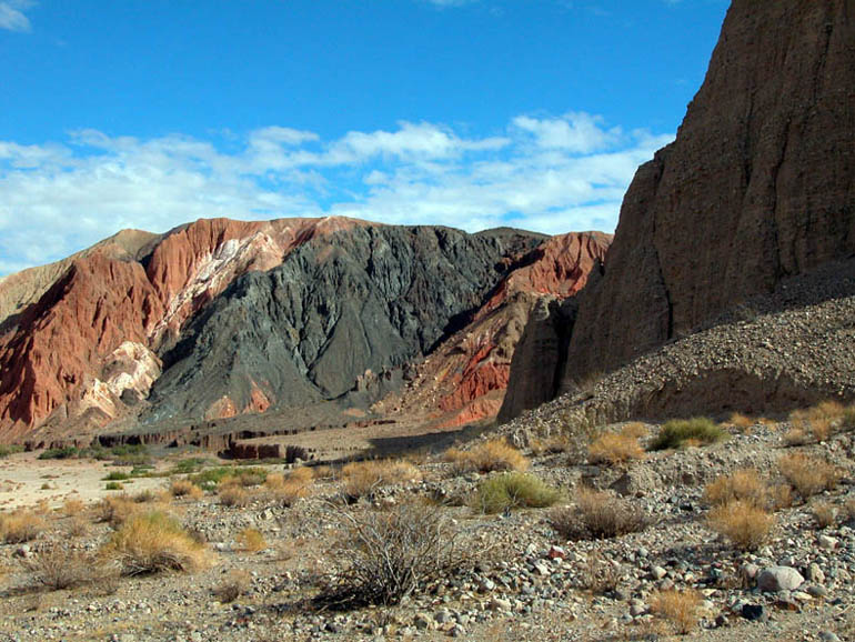 |
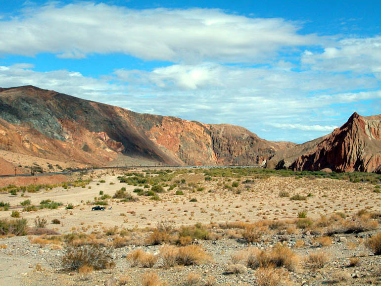
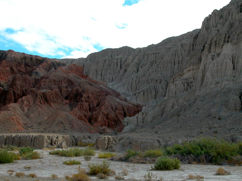
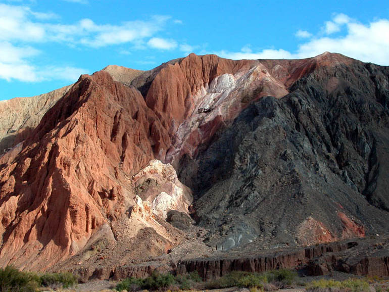
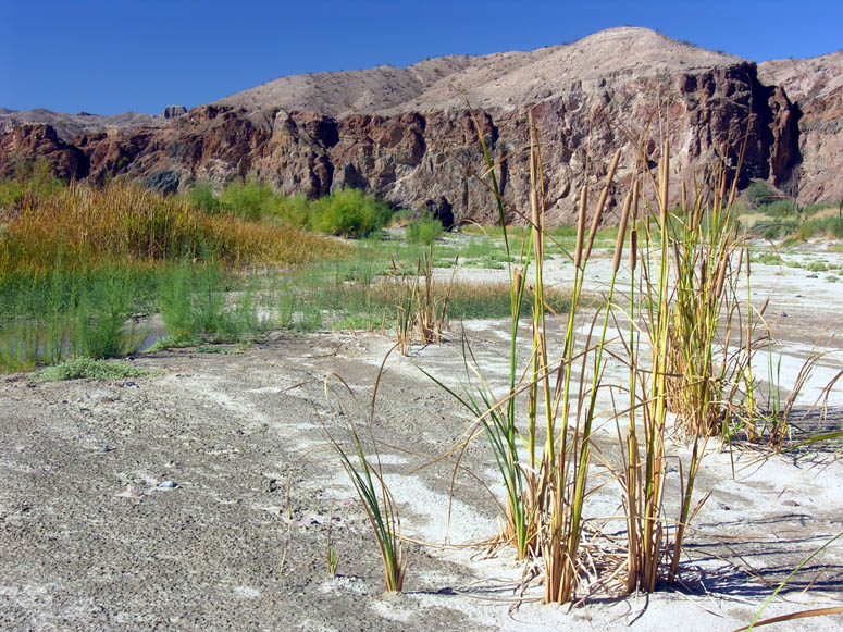
The walls of the canyon have many different colors which translates to there being many different minerals here. Thanks to the power of the Mojave River, these colors have been exposed for us to see. |
 |
A short distance down-canyon from the slot canyon (and on the same side), are some mining ruins. These are the remains of a 1917 magnesite mining operation. Although mining structures were built, including an aerial tramway, the ore was never mined and is still in the hillside today. |
 |
The canyon walls near these mining ruins are very jagged and colorful. It is worth a stop here to closely examine their beauty. |
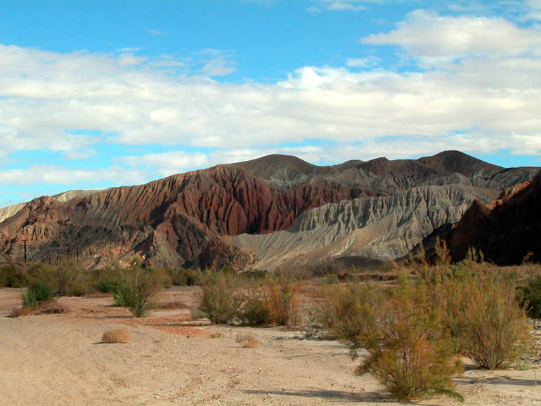 |
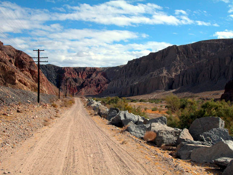
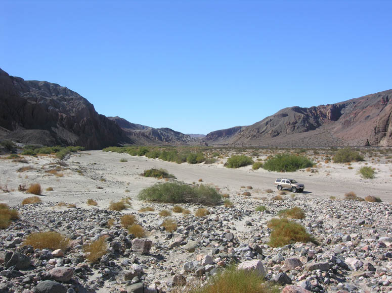
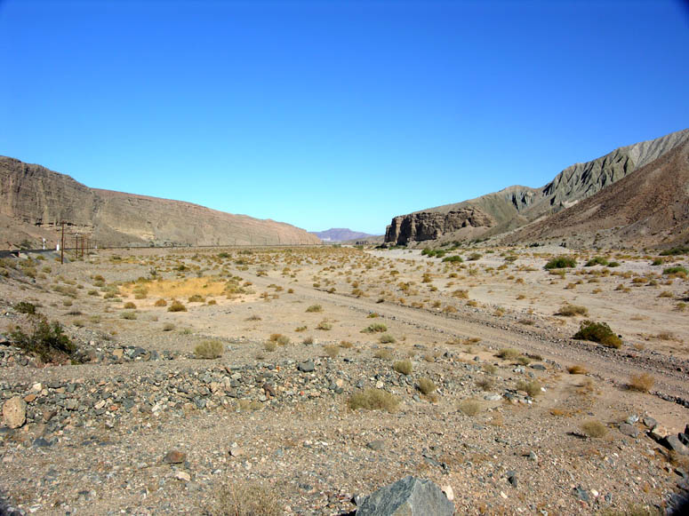
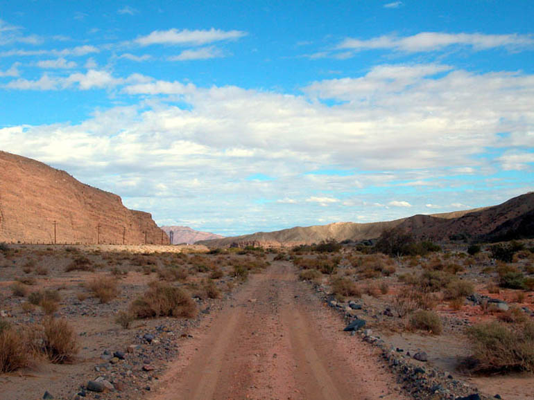
More of the landscape along the south side of Afton Canyon. At this point, the road through the canyon is a little difficult to follow due to the thick vegetation. |
 |
Another view of the canyon landscape. |
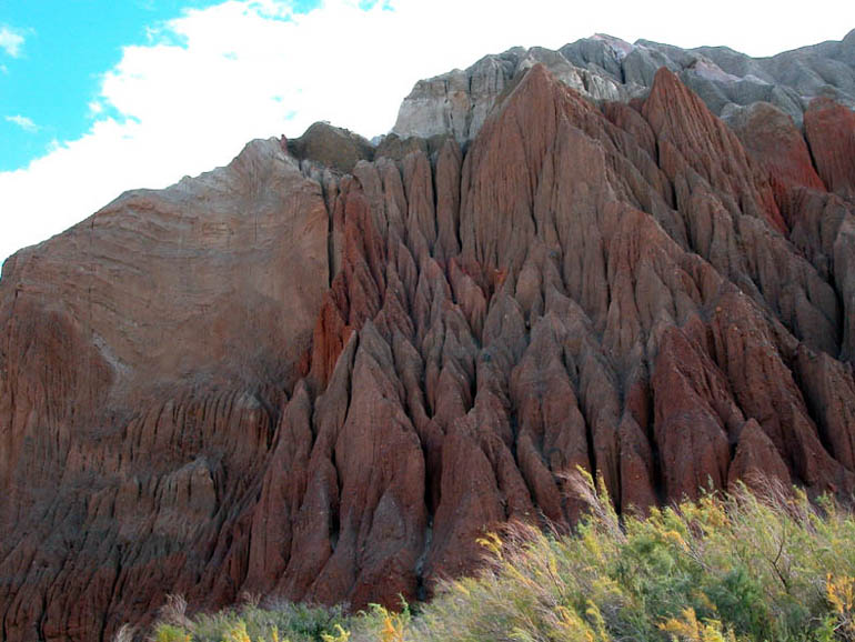 |
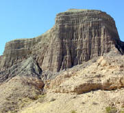
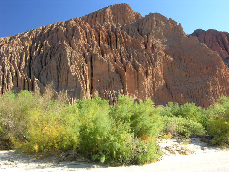
One of the many heavily-eroded walls you will typically see on the south side of the canyon. |
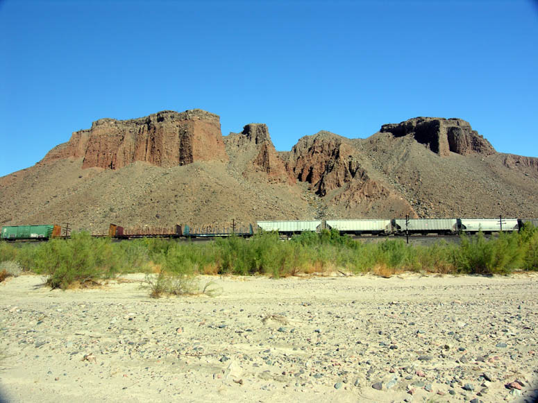 |
A train passes under some of the interesting geology of Afton Canyon. |
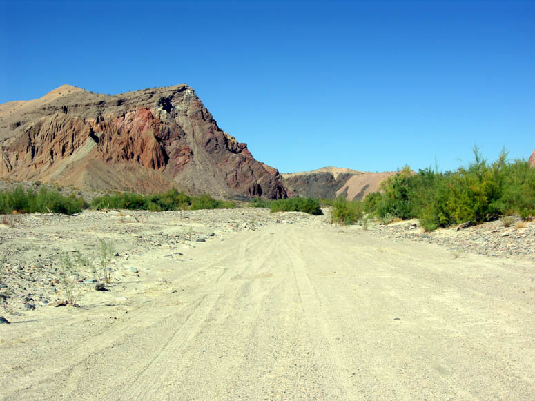 |
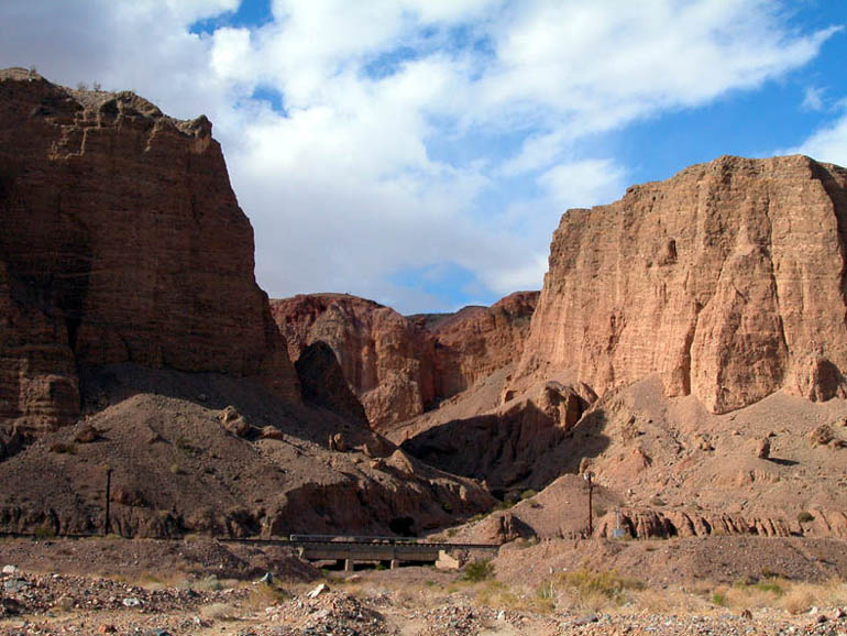
The road passes by some very steep cliffs that rise above the river floor. |
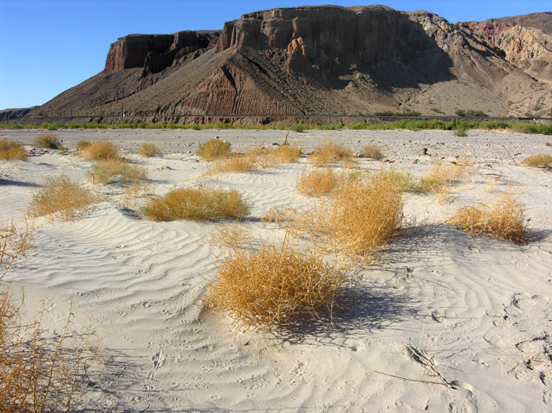 |
Because the road follows the riverbed most of the time, there are many sandy spots along the way. As you get out and walk around, look for undisturbed patches of sand to see what kind of animal tracks you can find. |
 |
More of the impressive palisades (or cliffs) you'll find in some sections of the canyon. Many, like these are quite colorful. |
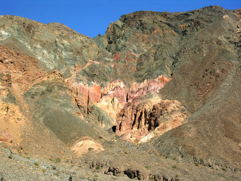 |
Close-up of some of the colorful soil found on the canyon walls. |
 |
Looking west from the middle of the Mojave River (which
is also the middle of the road). (you may need to use the scroll bar at the bottom of your screen) |
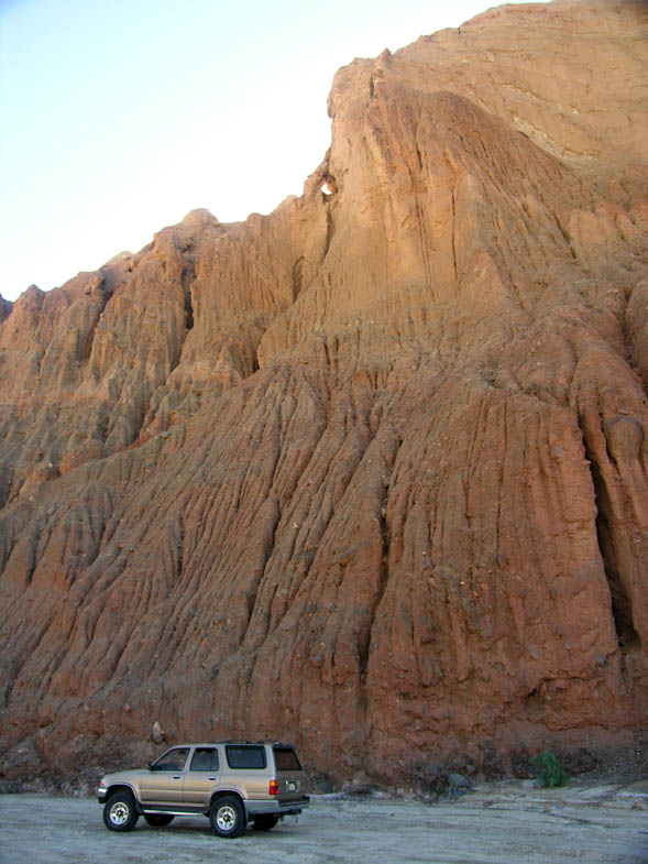 |
One of the sheer cliffs about halfway through the canyon. Using a vehicle for scale gives you an idea of just how tall these walls are. |
 |
Looking down into the riverbed from the First Canyon Hike of the Slot Canyon Hikes of Afton chapter. View is looking west, up-canyon. |
 |
Looking south from the riverbed of Afton Canyon towards the First Canyon trailhead . |
 |
On the north side of the canyon (where the railroad tracks are), there are many canyons that look interesting to explore on foot. |
 |
Train passing over bridge number 194.65. Just behind this bridge is the beginning of the 194.65 Canyon Hike. |
 |
Same train as above but seen from the other side of the bridge. |
 |
View to the east and near the end of Afton canyon. Here, the road is much more defined and close to the railroad tracks. |
 |
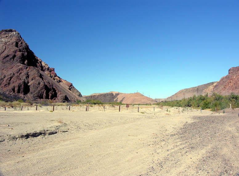
Almost at the end of Afton Canyon. The great expanse of the Mojave Preserve will soon be in view. |
 |
Looking southwest back into Afton Canyon at its east entrance. |
 |
View looking east towards the Devil's Playground and the Kelso Dunes from atop the small hill near the third steel railroad bridge. Notice the train blocking the railroad crossing - this is the reason we don't recommend continuing on this route. |
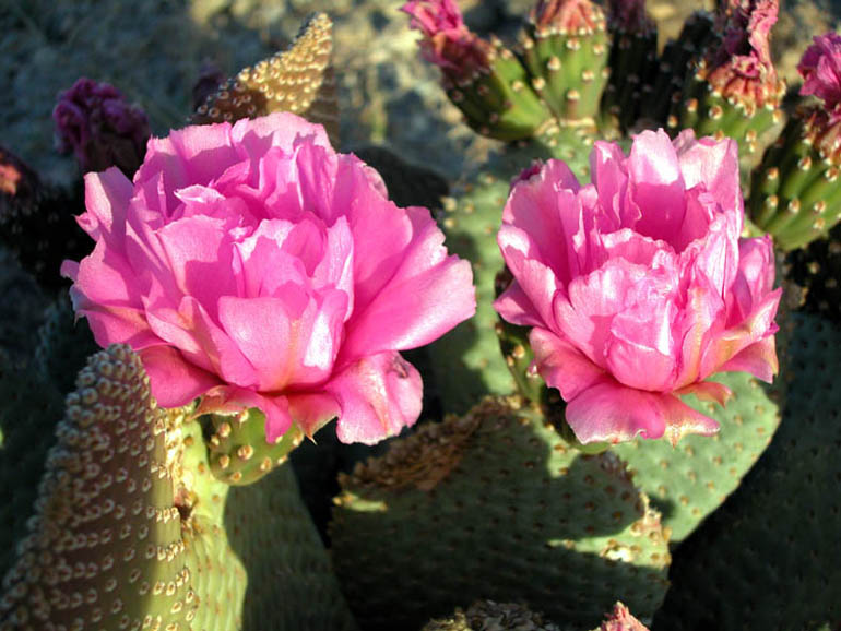 |
One of the types of plants seen in Afton Canyon is the beavertail cactus. They are easy to see around the month of April when their brilliant purple flowers are in bloom. |
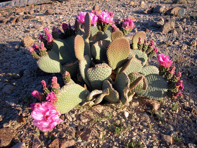 |
A beavertail cactus in full bloom. |
Back to Road Trip photo tour or back to Top
![]()
Caves Hike
Click on picture
to enlarge
Pictures taken: November 2003 and February 2006
 |
View looking back at the second bridge where you started the Caves Hike. |
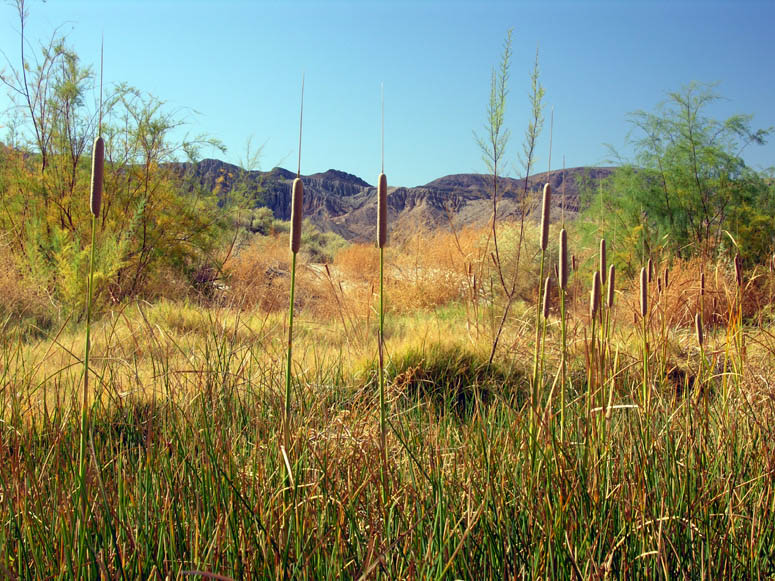 |
Cattails are plentiful in this part of the canyon. |
 |
Since some years are wetter than others, the amount of vegetation found growing here will vary. The salt cedar you see here is always a threat as it chokes out the native plant species. |
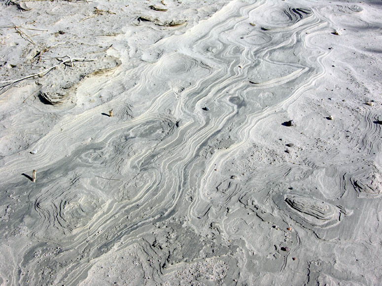 |
Watch for interesting formations in the sand. |
 |
Both of the Caves are located at about 0.3 miles (0.5 km) south of the second bridge. |
 |
View of the first cave that was a regular lunch stop along the historic Mojave Road. These caves gave Afton Canyon its first name of Cave Canyon. |
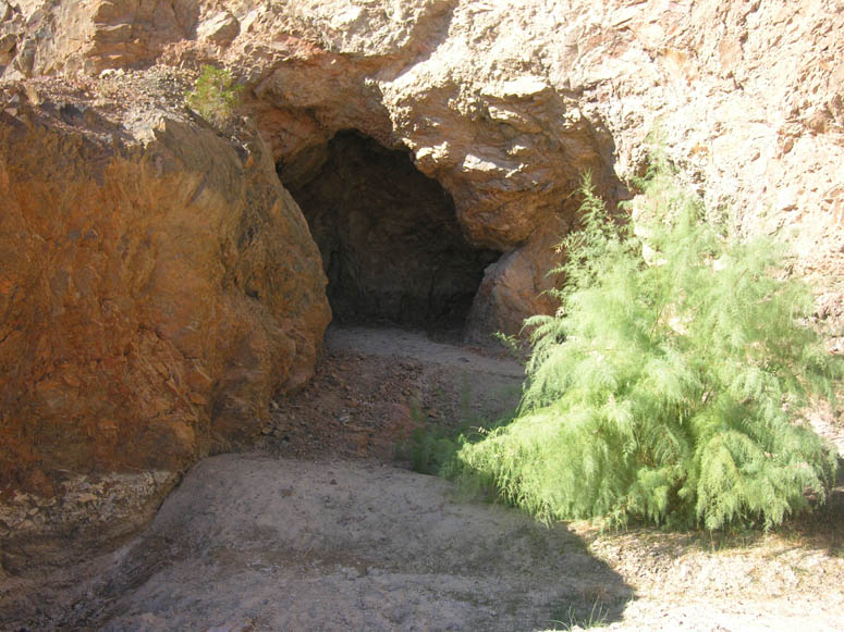 |
Closer look at the entrance of the first cave. |
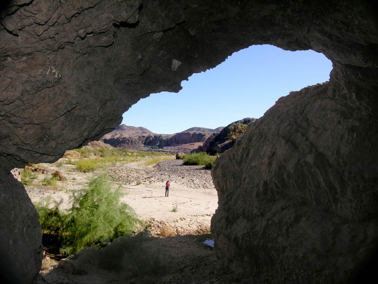 |
Inside the first cave looking out. You can see the second bridge in the background. |
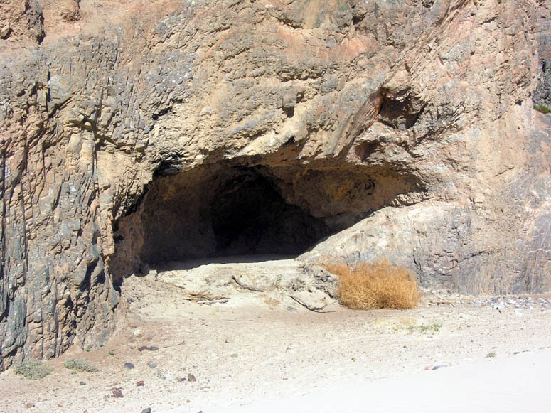 |
View of the second cave. Back during the heyday of the Mojave Road, the caves were supposedly much bigger and entire wagons, including their teams of horses, could be driven into the cave and even turned around. |
|
|
Panorama of the 180° bend that the Mojave River makes in
this part of Afton Canyon. (you may need to use the scroll bar at the bottom of your screen) |
|
|
Same picture as above but with callouts. |
Back to Caves Hike photo tour, back to Photo Tours or back to Top
 Trip
Log
Trip
Log
By using this Trip Log with your vehicles' trip odometer and/or your GPS device, you'll know exactly which turn in the road to take and where the different points of interest are along your route.
The top (larger, black) number in the Mileage column reflects mileage
based on our direction of travel as described in The Road
section above. The bottom (smaller, purple) number reflects mileage
based on travel from the opposite direction.
Note: all GPS waypoints assume
Northern hemisphere latitude and Western hemisphere longitude
and use WGS84 datum.
| What You Will See and Where: | Mileage: Other Way: |
Next Event: | Waypoints: Latitude / Long. |
| Junction of I-15 and Afton Road. Go southeast on Afton Canyon Road. | 0 14.1 |
3.4 miles | 35° 4.26' 116° 24.75' |
| Campground is on left side. First steel railroad bridge is on right. Walk under bridge to reach Pyramid Canyon. First river crossing is 0.1 miles beyond campground. | 3.4 10.7 |
1.3 | 35° 2.28' 116° 23.09' |
| Cross under second steel railroad bridge and make second river crossing. Trailhead for Caves Hike. | 4.7 9.4 |
1.0 | 35° 1.87' 116° 22.01' |
| Into the main part of the canyon. Short slot canyon (as seen in Photo Tour) is on the right (south) side. | 5.7 8.4 |
1.3 | 35° 1.43' 116° 21.18' |
| Road continues to meander through ever-changing riparian area - be careful to follow road. | N/A | ||
| First Canyon Hike (of the Slot Canyon Hikes of Afton) is on right (south) side of canyon. 194.65 Canyon Hike is 0.2 miles south of here on the north (opposite) side of Afton Canyon. | 7.0 7.1 |
0.7 | 35° 1.68' 116° 19.85' |
| Road through riparian area ends. Head towards railroad tracks and get on road that parallels tracks above riverbed. | 7.7 6.4 |
1.0 | 35° 2.10' 116° 19.34' |
| Third steel railroad bridge. For a good viewpoint, look for a road a few hundred feet before the bridge leading to the right. Return from the viewpoint to this junction and cross underneath the bridge to continue exiting the east end of Afton Canyon. | 8.7 5.4 |
0.4 | 35° 2.55' 116° 18.53' |
| Getting to the junction with Basin Road. Turn right towards railroad tracks, then left onto another road just before crossing (don't cross tracks) to head east and parallel the tracks for about 1 mile. road turns 90 degrees to the left (north, I-15) Turning left at the junction on Basin Road takes you to the mine. | 9.1 5.0 |
3.7 | 35° 2.64' 116° 18.18' |
| Road parallels railroad tracks for 0.5 miles and turns left. Road continues 3.2 miles and reconnects with the well-maintained Basin Road. | 12.8 1.3 |
1.3 | 35° 4.91' 116° 16.10' |
| Junction of I-15 and Basin Road. | 14.1 0 |
35° 6.09' 116° 15.86' |
Back to Top of Page or Sample Trips
Last updated November 06, 2011.