|
|

"Knowledge for the western back roads explorer..." |
|
|
Blue Ridge in the San Gabriel
Mountains
|
 This
is the second in a series of articles about places to explore near SVL. Since
this article will appear in the August Breeze, we selected a region that
will be irresistible to visit on a hot desert day.
This
is the second in a series of articles about places to explore near SVL. Since
this article will appear in the August Breeze, we selected a region that
will be irresistible to visit on a hot desert day.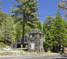 Continue
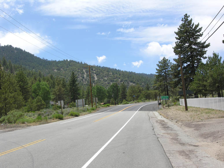
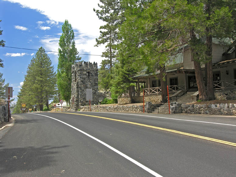
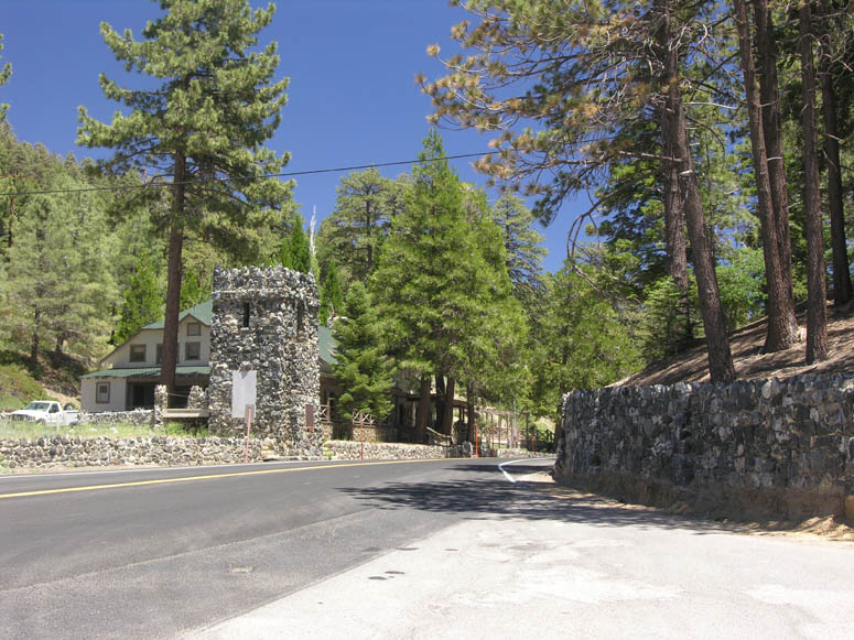
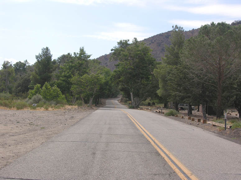
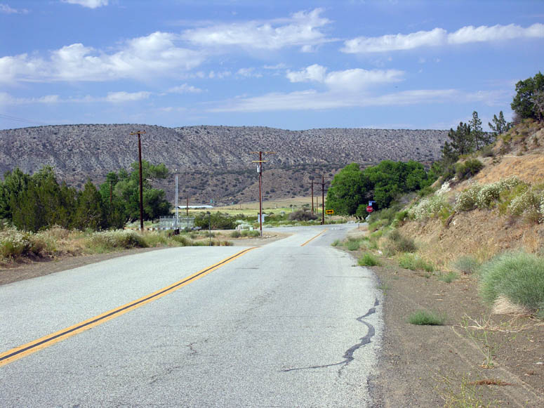
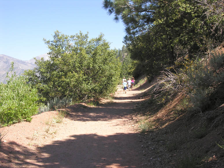
on Hwy 2. The county line is soon crossed and you will next see the first
ski area on the left. This is Mountain High East. This resort was
originally known as Holiday Hill. A short distance later, the Big Pines
recreation area is reached and you will pass through what remains of the Davidson
Arch. What remains looks like a small castle. The arch used to span Hwy
2 [
Continue
on Hwy 2. The county line is soon crossed and you will next see the first
ski area on the left. This is Mountain High East. This resort was
originally known as Holiday Hill. A short distance later, the Big Pines
recreation area is reached and you will pass through what remains of the Davidson
Arch. What remains looks like a small castle. The arch used to span Hwy
2 [|
|
View
document (PDF) on the attractions around Big Pines |
|
|
For more information on Table Mountain, see http://tmf-web.jpl.nasa.gov |
Blue Ridge
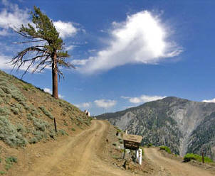
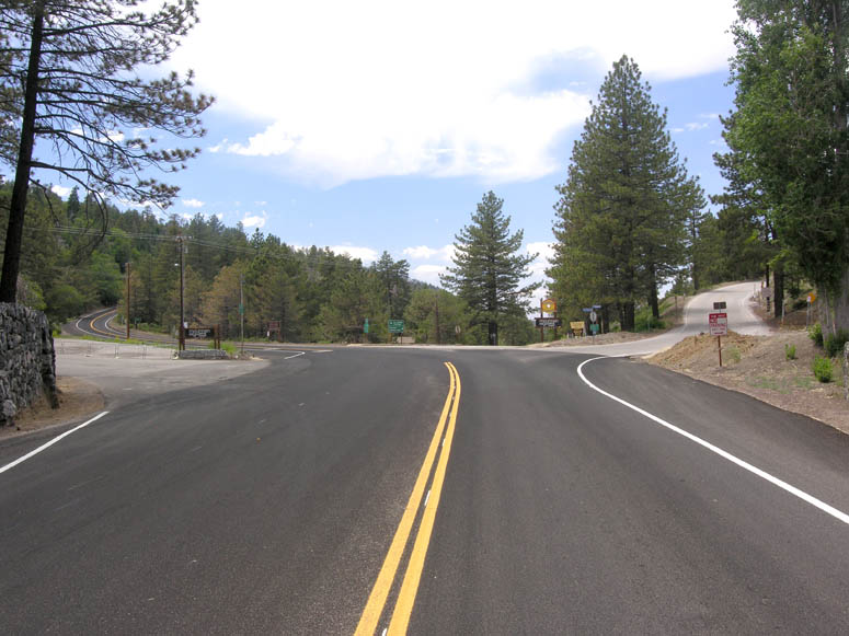
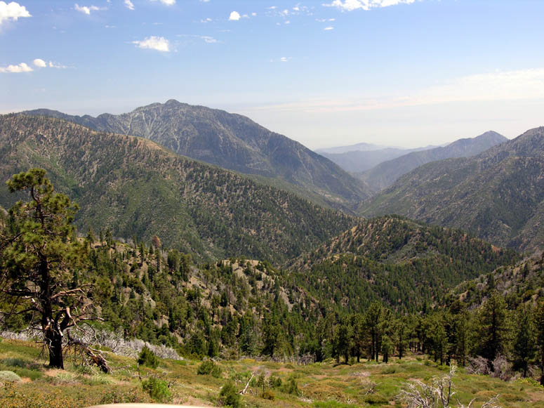
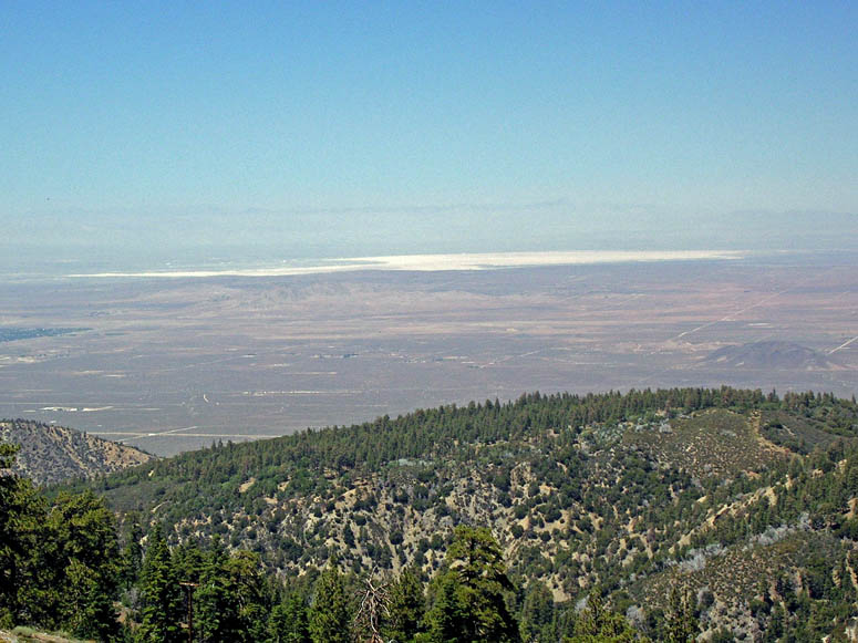
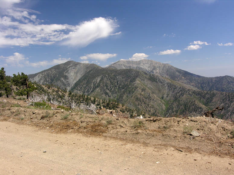
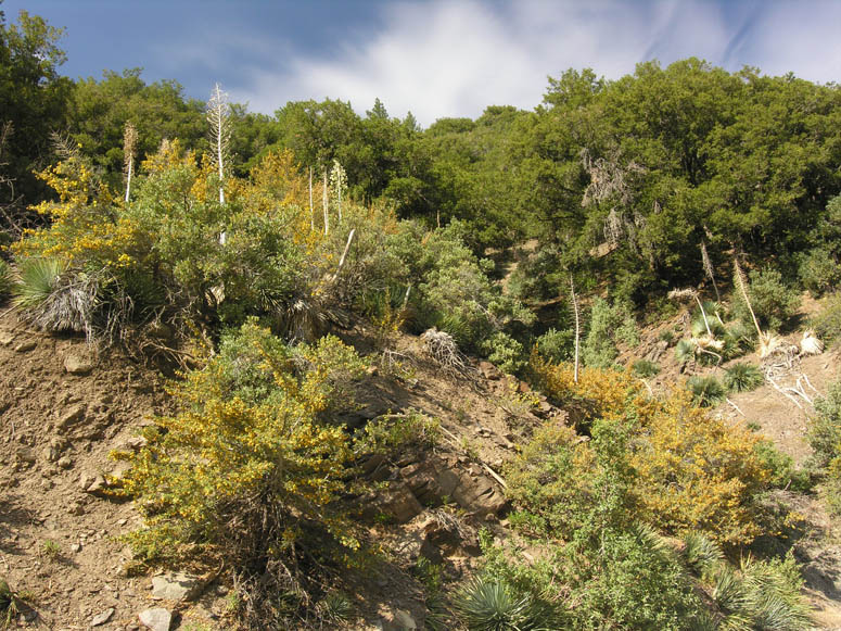
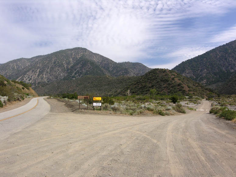
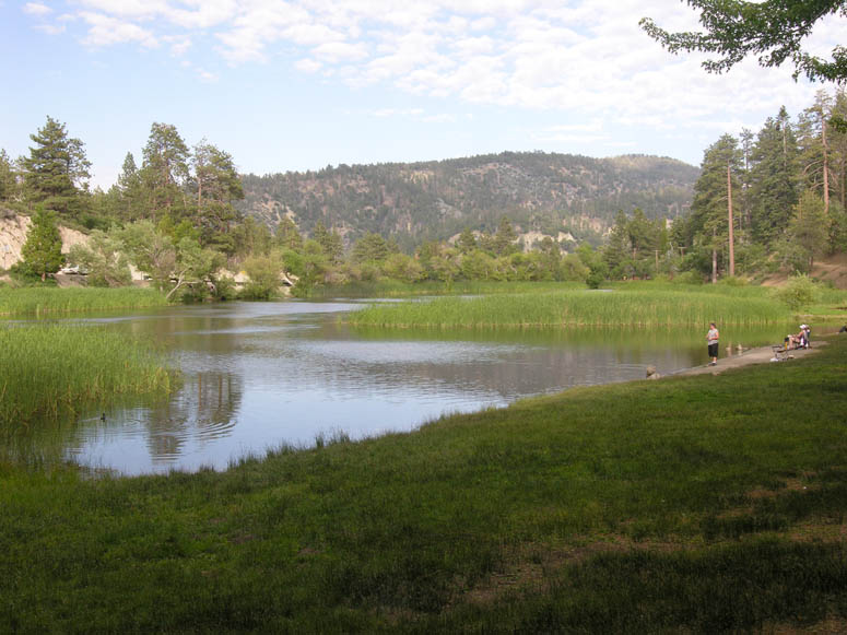
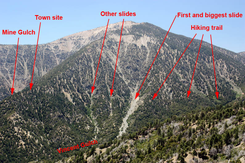
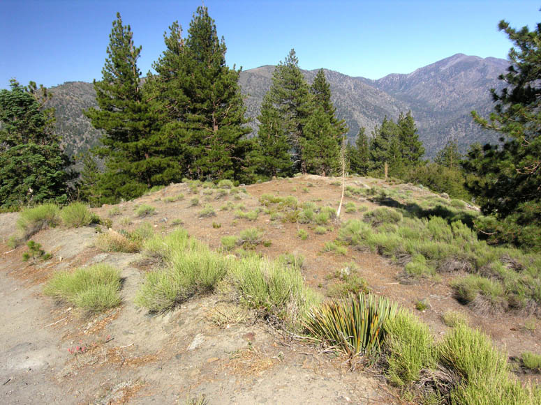
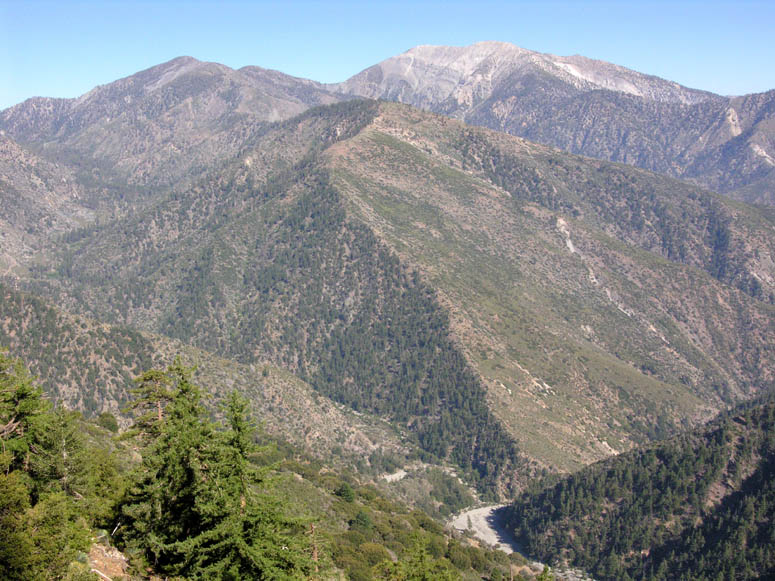
Past the five-point intersection, Inspiration Point (also known as Lightning Ridge) is reached in 1.8 miles. This is one of the largest viewpoints along the entire length of Angeles Crest Highway. Turnouts on both side of the highway allow you to park your vehicle and enjoy the vistas. When we visited here in July, we were able to see Catalina Island – some 80 miles distant. The large canyon just to the south of the viewpoint is the east fork of the San Gabriel River. A significant gold rush occurred here starting in 1870 and dragged on until 1940. An information sign here points out all the places of interest. The large peak to your right is Mt. Baden-Powell, named after the founder of the Boy Scouts, and is the second highest peak in the San Gabriels. The highest “bald” peak to the left is Mt. Baldy, the highest peak in the San Gabriels. Both peaks are easily visible from SVL.
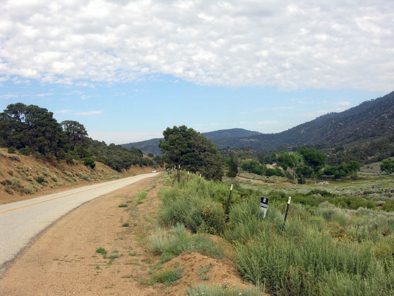
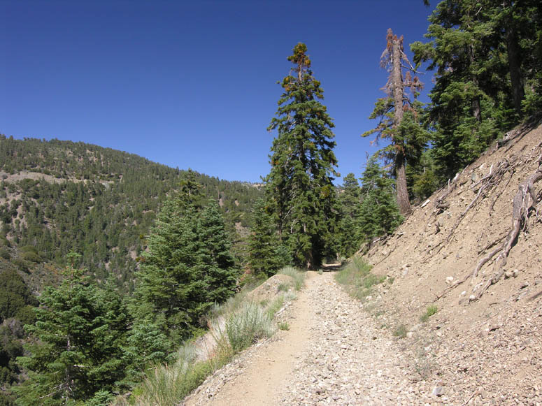
 Just
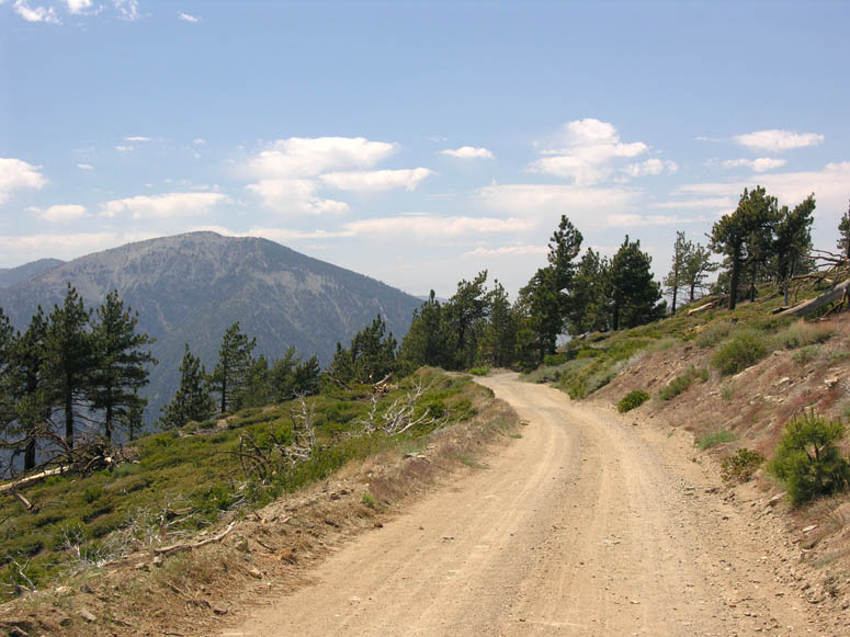
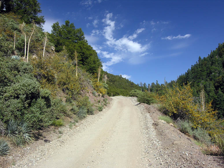
before reaching the turnouts, look for the turnoff to East Blue Ridge Road (F.R.
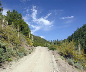
3N06) on the left. This is our first side trip off of Hwy 2. This narrow forestry
road ventures about 12 miles into the rugged San Gabriel Mountains. The first
3 miles is a mixture of broken and good asphalt, whereas the remaining distance
is dirt. As its name implies, the road follows what is known as Blue Ridge.
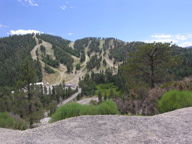
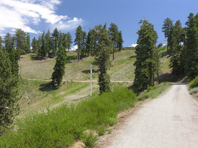
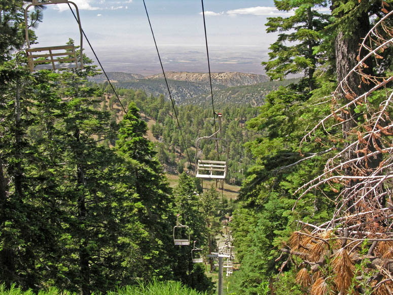
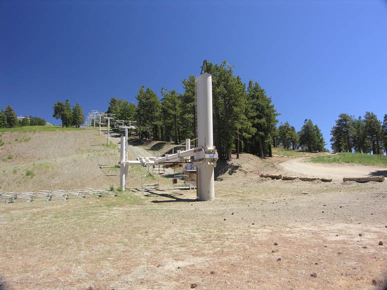
Along the way, there are great views in all directions. The road also passes
through two of the Mountain High ski resorts as it passes underneath chairlifts
[see picture]. You can
actually drive on the same spots where snow-skiers dash downhill during the
winter months. The road will continue all the way to the bottom of the San Gabriel
River Canyon, but the forestry service doesn’t always have this last portion
open.
Just
before reaching the turnouts, look for the turnoff to East Blue Ridge Road (F.R.
3N06) on the left. This is our first side trip off of Hwy 2. This narrow forestry
road ventures about 12 miles into the rugged San Gabriel Mountains. The first
3 miles is a mixture of broken and good asphalt, whereas the remaining distance
is dirt. As its name implies, the road follows what is known as Blue Ridge.
Along the way, there are great views in all directions. The road also passes
through two of the Mountain High ski resorts as it passes underneath chairlifts
[see picture]. You can
actually drive on the same spots where snow-skiers dash downhill during the
winter months. The road will continue all the way to the bottom of the San Gabriel
River Canyon, but the forestry service doesn’t always have this last portion
open.
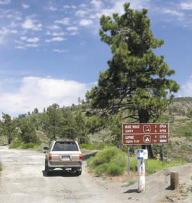
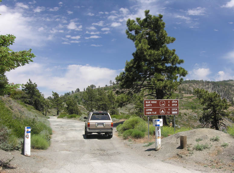
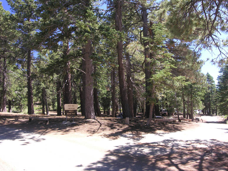
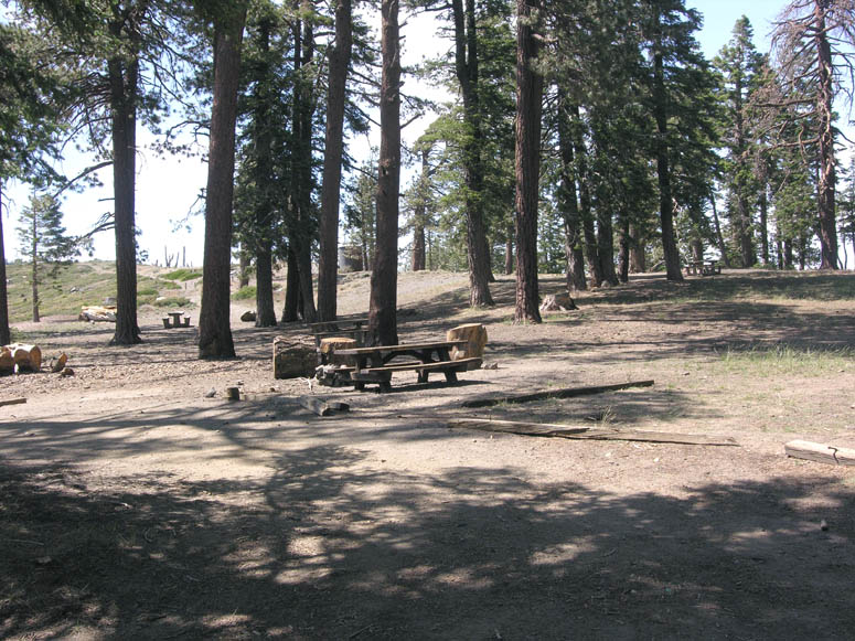
Blue Ridge Campground is the first campground encountered at three miles in from Hwy 2. It is located in a heavily forested area next to the top of the Mountain High East ski area. There are usually more people camping here.
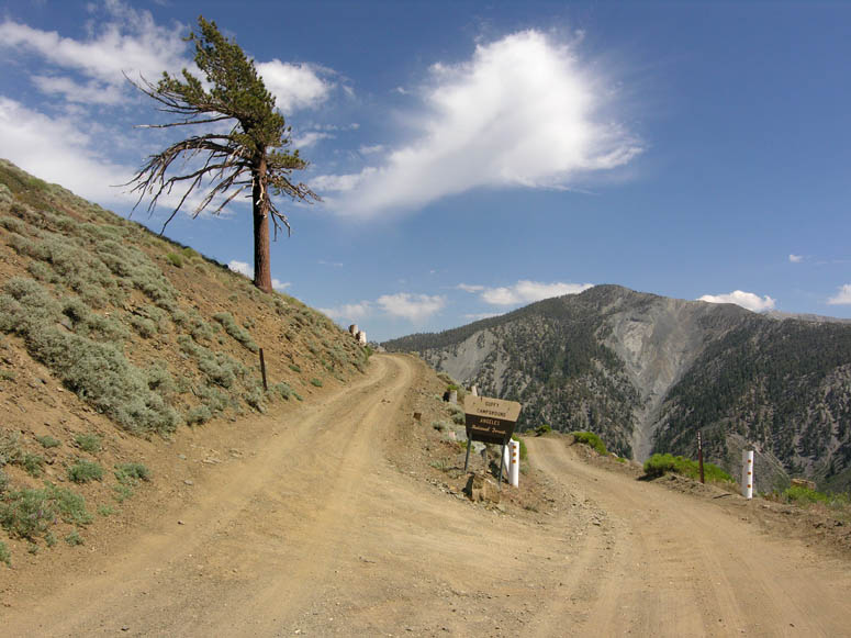
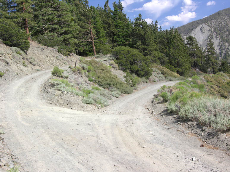
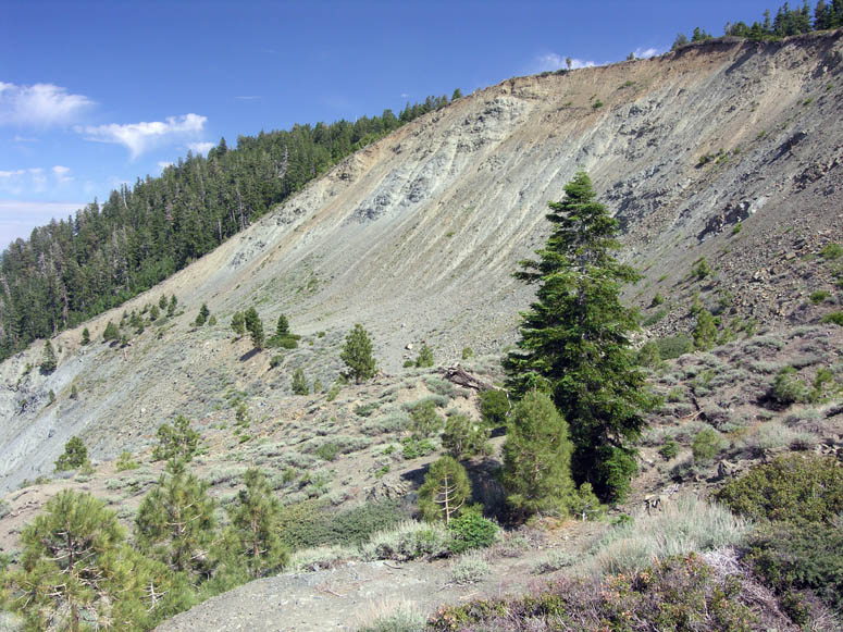
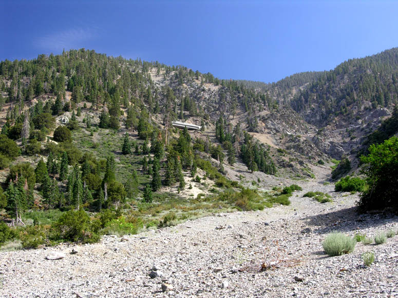
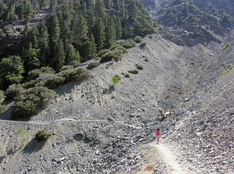
Guffy Campground, about six miles in, is a great spot to have a picnic. This campground typically has fewer inhabitants than the first. A half mile past Guffy, a fork in the road is reached. Going left (F.R. 3N06) will continue the drive along Blue Ridge. Going right (F.R. 3N39) will descend into the San Gabriel River Canyon and to a place labeled Cabin Flat on the map. 3N39 is often closed with a locked gate a short distance from the fork. If you continue on 3N06, the infamous Wrightwood slides are encountered 1.5 miles from Guffy. These large scars on the north side of Blue Ridge were created by a series of large landslides. The last one occurred in 1969. A significant slide occurred in 1941. These slides, which are still active, were triggered by both heavy rainfall events and movement along the San Andreas Fault. Similar to the warning we always hear about earthquakes, it is only a matter of time when Wrightwood experiences another devastating landslide. The slides are visible from Wrightwood [see picture]. 3N06 ends about a mile past the landslide. There is a trailhead for a strenuous hike to Mt. Baldy along the way.
For more information on the Wrightwood slides, see:
http://epod.usra.edu/archives/060309.html
Mountain Biking
The entire length of East Blue Ridge Road from Hwy 2 is also a great route for mountain bikes. If you are a mountain bike aficionado, you may wish to consider parking your vehicle at Inspiration Point and then using your mountain bike to explore Blue Ridge. As you can see from the topographical map, the first mile or so climbs considerably, then loses and gains altitude along the rest of the road, making this a great trip for bikers in medium athletic shape. Just remember that the road is mostly above 8,000 feet and the air will be thinner then what most people are used to.
The hiking trail to the Big Horn Mine can also be a challenging mountain bike route. There are several rocky portions along the way where you would most likely need to dismount and walk your bike. The last portion of the trail is fairly steep.
Vincent Gap
When you are done exploring Blue Ridge, return to Hwy 2 and turn left (west). In 0.6 miles, the Grassy Hollow visitor’s center is reached. Here is another picnic area, campground and restrooms. As of this writing, the center is open Saturday, Sunday and holidays from 10 to 4. The rangers that work here can certainly provide you with a lot more information than we can!
|
|
View document (PDF) on the Grassy Hollow visitor center |
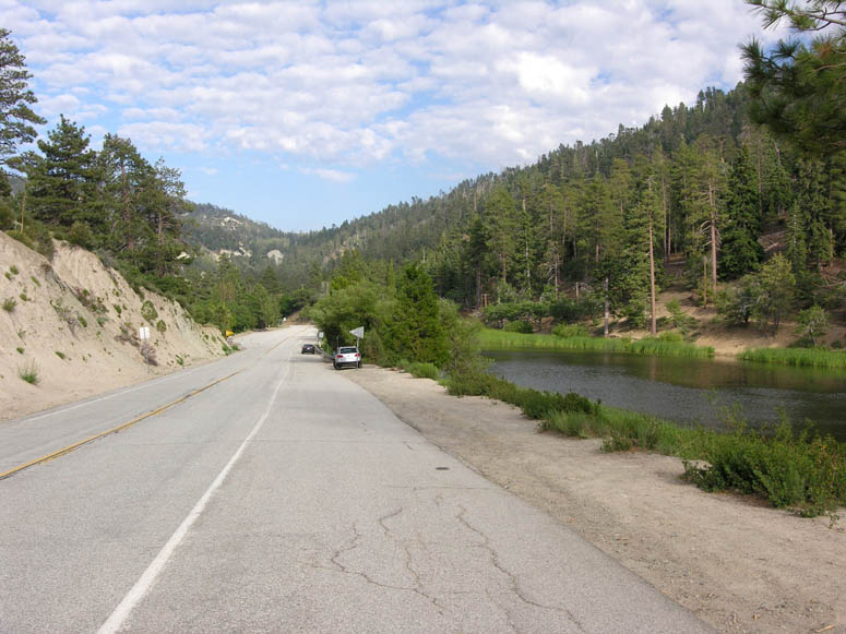
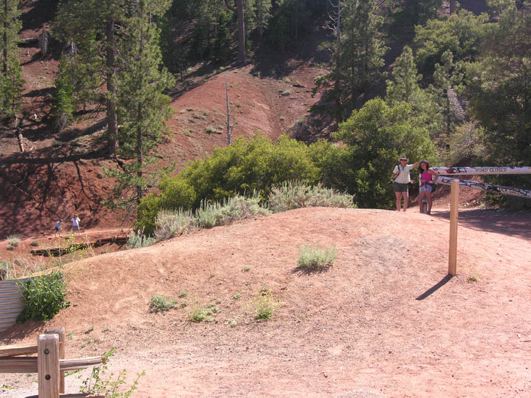
Continuing west on Hwy 2 from Grassy Hollow, Vincent Gap is reached. If you wish to take the hike to the Big Horn Mine, park your vehicle in the parking lot on the left. Hwy 2 was closed due to serious road damage from this point starting in 2004 and travel to La Canada was not possible until just a few months before this writing (July 2009).
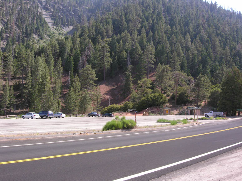
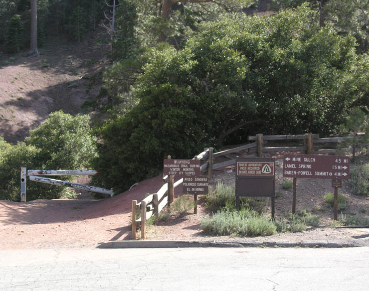
National Forest Adventure Pass When parking your vehicle for a period of time in the Angeles National Forest, such as Vincent Gap to go hiking, you must display a valid adventure pass in the rearview mirror of your vehicle. Otherwise, you are subject to a parking violation. Passes can be purchased at Jensons Market in Wrightwood. |
Hiking opportunities from the Vincent Gap parking lot include the Big Horn Mine (explained under The Hike section), a thigh-burning jaunt to 9,399 foot Mt. Baden-Powell or a trail down to Mine Gulch. Baden-Powell is an 8 mile round trip hike with an elevation gain of 2,800 feet. Mine Gulch is typically 4.5 miles one way, but backpackers take it all the way down to the San Gabriel Canyon, spending one or more nights. It offers access to the various mines and ruins from the aforementioned gold rush.
Named after the founder of the Big Horn Mine, Vincent Gap was an important pass that was originally used in the later half of the 1800s. It was an alternate route to the mines in Mine Gulch and the San Gabriel River Canyon and later a haul road for the Big Horn Mine. The road came up from Palmdale and followed the path that you will later take along Big Rock Creek Road. At Vincent Gap, it crossed what is now Hwy 2 and then followed the hiking trail used to get to the Big Horn Mine.
Big Rock Creek
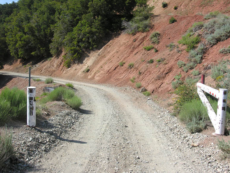
 When
you are finished with the Vincent Gulch area, cross Hwy 2 from the parking lot
and head down the dirt road labeled 4N11. This dirt road lasts for just
under 2 miles and is very steep. When we traveled it, it was passable for normal
automobiles but it had quite a bit of washboard on it, so remember to go slow
unless you would like to turn your vehicle into a rattle-trap! As this
road descends into Fenner Canyon, be sure to look up to your left to see the
engineering efforts used to attach Hwy 2 onto the side of the mountains.
You should also be able to spot the new bridge for Hwy 2 built during its closure
in 2004.
When
you are finished with the Vincent Gulch area, cross Hwy 2 from the parking lot
and head down the dirt road labeled 4N11. This dirt road lasts for just
under 2 miles and is very steep. When we traveled it, it was passable for normal
automobiles but it had quite a bit of washboard on it, so remember to go slow
unless you would like to turn your vehicle into a rattle-trap! As this
road descends into Fenner Canyon, be sure to look up to your left to see the
engineering efforts used to attach Hwy 2 onto the side of the mountains.
You should also be able to spot the new bridge for Hwy 2 built during its closure
in 2004.
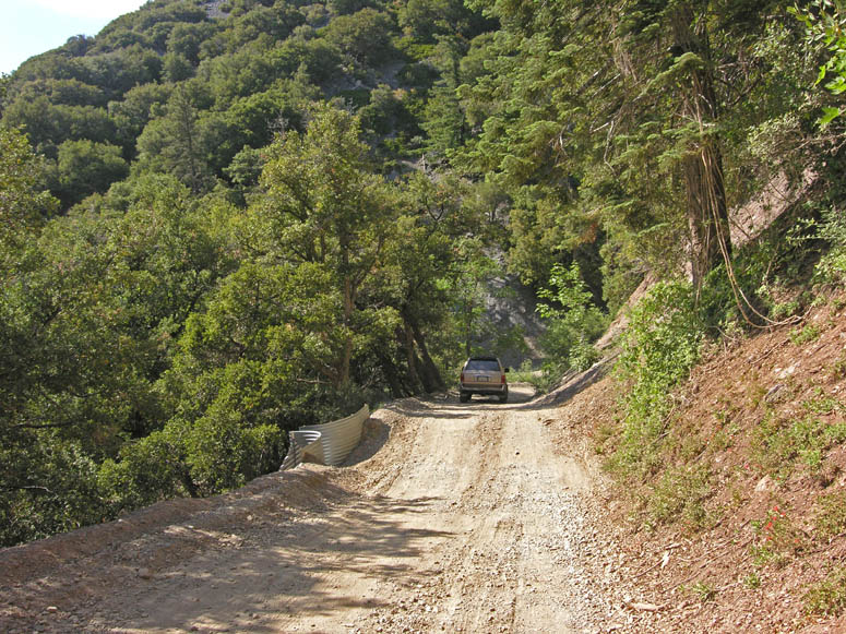
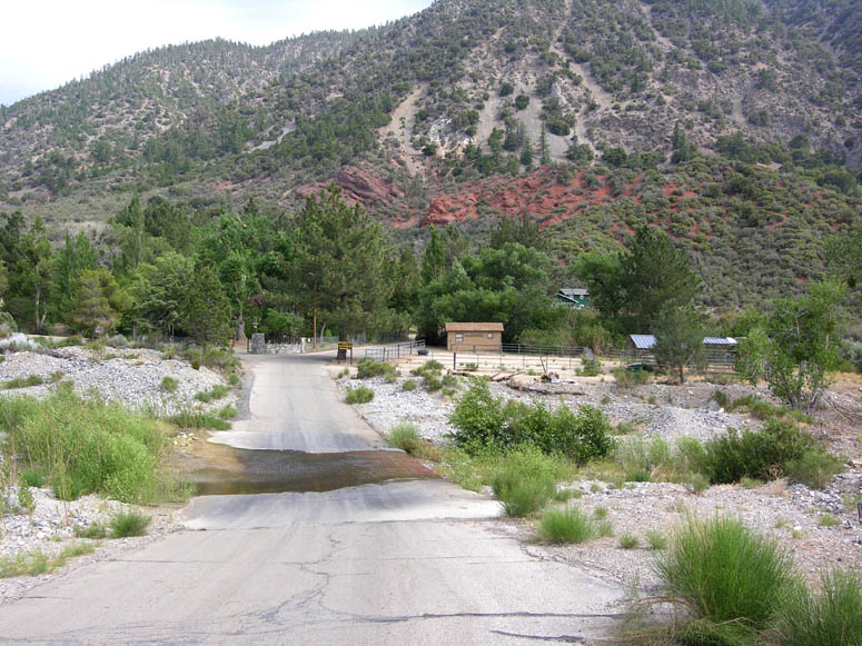
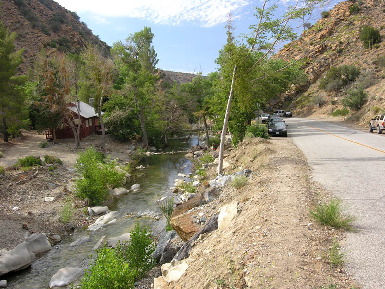
4N11 ends at Camp Fenner, which is a State Prison used for housing inmates that are used by the forestry service for various tasks. Here, the road turns to pavement and is called Big Rock Creek Road. Continue on this road down the canyon. You will notice that the mountainous vegetation slowly changes to desert-like.
About 2 miles from Camp Fenner, the small village of Paradise Springs will be seen on the left. There are several residences located here and a Christian retreat camp. From the 1920s until the ‘60s, Paradise Springs was a retreat for the Hollywood elite. Famous actors such as W.C. Fields, Charlie Chaplin and John Wayne frequently stayed at this hidden encampment.
For more information, see:
http://bigrockcreekcamp.com/index.php?option=com_content&task=view&id=17&Itemid=32
A dirt road leads to the left about 1.3 miles past Paradise Springs (3.3 miles from Camp Fenner). It is a sharp left turn. The road leads south back into the mountains and up a canyon. The road ends after about one mile. This area offers a campground and some nice hiking trails that goes further into the canyon or to neighboring Devils Punchbowl Park. You cannot drive to Devils Punchbowl from here; only hike.
Continuing down the canyon, between 3.6 and 5 miles from Camp Fenner, the road passes through a forest of sycamore and cottonwood trees starting at the appropriately named Sycamore Flats Campground. This is a wonderful spot to drive through in November when these trees are bright yellow. A good-flowing creek can be seen on the left side of the road. In many places, people have dammed the creek with rocks so that they can be enjoyed as small swimming holes.
Big Pines Highway
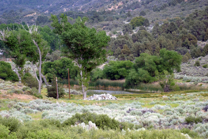
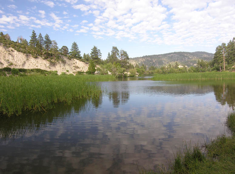
Big Rock Creek Road ends 5.6 miles from Camp Fenner on Big Pines Hwy. Turn right (east). This road heads back to Big Pines, near where the trip started. The road follows a long narrow valley which is the San Andreas Fault rift zone. Several small lakes will be seen along this portion of the trip and were formed by the fault. Geologists refer to these lakes as “sag ponds”. They form when spring water cannot penetrate the impermeable clays inside the fault zone, so the water simply surfaces and accumulates into the lakes seen now. Caldwell Lake, a sag pond, is reached 4.3 miles from the last turn.
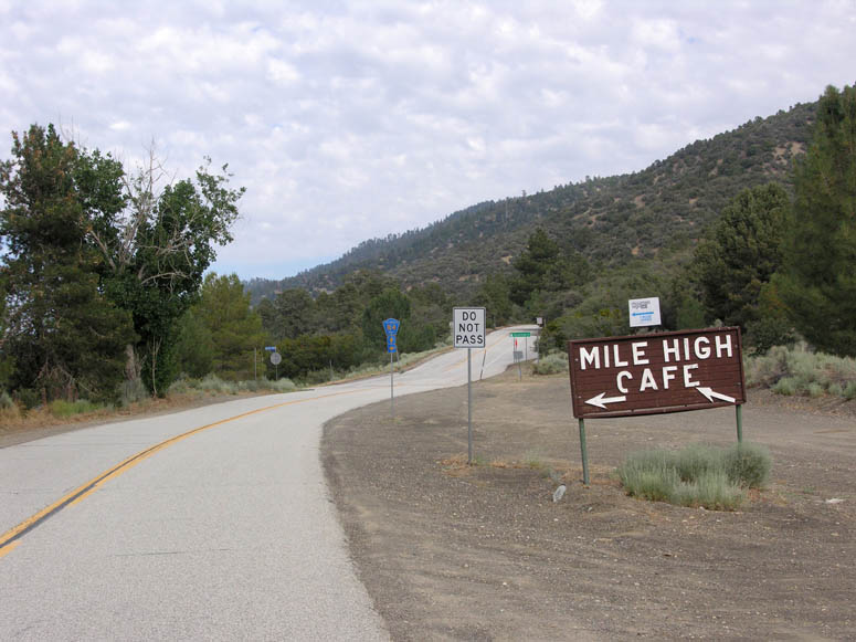
Mile High, a small village with a restaurant and a few ranches, is reached
at 4.8 miles from the intersection.
 The
elevation here is 5,280 feet – hence the name. Here, if you are tired
of the mountain driving, you can turn left (north) onto Largo Vista Road which
will quickly take you to Hwy 138 where you can turn right and then follow Hwy
18 into Victorville and on to SVL. Otherwise, continue straight on Big
Pines Hwy.
The
elevation here is 5,280 feet – hence the name. Here, if you are tired
of the mountain driving, you can turn left (north) onto Largo Vista Road which
will quickly take you to Hwy 138 where you can turn right and then follow Hwy
18 into Victorville and on to SVL. Otherwise, continue straight on Big
Pines Hwy.
At 3.6 miles from Mile High, Jackson Lake is reached. This is a fairly big sag pond compared to other sag ponds along this portion of the San Andreas. Jackson Lake is a popular attraction and is popular to fishing pole owners. Unfortunately, it also has claimed many lives over the years as people visiting the lake in the winter venture out onto the frozen lake and promptly fall through the ice.
The End
Our trip ends 6.5 miles from Mile High at the five-point intersection at Big Pines. From here, retrace your original route through Wrightwood, Phelan and back to SVL.
For more information on the San Gabriel Mountains, the book The San Gabriels by John W. Robinson contains a wealth of knowledge on this mountain range between I-15 and I-5. It is available at local bookstores and on-line at various websites.
The Hike
The hike to the Big Horn Mine is easy to follow as it is on a former mining road used by trucks. Hiking distance is 1.8 miles one way with an elevation gain of about 350 feet. The hike offers more wonderful views of the wild San Gabriels and, at the end of the road, the hiker is rewarded with views of a well preserved mining structure. Big Horn Mine is on a private claim, so realize that you are not on public lands when visiting this site.
Trail Description
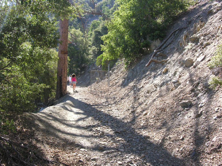
From the Vincent Gap parking lot, locate the large white locked gate to the left of the restrooms [see picture]. Begin walking on this road past the gate. As mentioned earlier, this was an old wagon (and later truck) road used to transport goods to Mine Gulch and the Big Horn Mine, so the hike is mostly on a wide and level path.
About a quarter of a mile in, a fork in the trail is reached. When we visited, there were two signs at this fork, but they were covered in graffiti and the original information was not visible. The trail to the left, which goes down, follows the bottom of the canyon on the left, which is named Vincent Gulch, goes past Mine Gulch and continues down the San Gabriel River Canyon. For our hike, continue straight on the main road.
On the trail to the Big Horn Mine (the one you are following), a second gulch or canyon will be seen just before reaching the mine itself after the trail makes a big right turn. Appropriately, this is named Mine Gulch. This is the canyon that many mines were located during the aforementioned gold rush. In this gulch and much of the San Gabriel River Canyon, most of the gold was found along the banks of the river's drainage. So it was only logical that the gold originally washed off quartz veins located on the east slopes of Mt. Baden-Powell - the place where the Big Horn Mine is located.
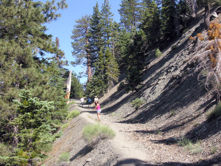
 Along
the hike, you will pass under a lush canopy of various conifer and oak trees.
There are plenty of good views of the mountain peaks and the canyon below.
When you find yourself out of the canopy, be sure to look up (to the right)
at the rugged face of Mt. Baden-Powell to appreciate the ever-changing geology,
which mainly includes the erosion and massive debris flows (slides) that occur
due to the steep slopes.
Along
the hike, you will pass under a lush canopy of various conifer and oak trees.
There are plenty of good views of the mountain peaks and the canyon below.
When you find yourself out of the canopy, be sure to look up (to the right)
at the rugged face of Mt. Baden-Powell to appreciate the ever-changing geology,
which mainly includes the erosion and massive debris flows (slides) that occur
due to the steep slopes.
There are a few places along the route where the debris flows have destroyed the road. Over time, hikers have established a new but much narrower trail. Be careful when hiking over these slides as footing is rough and you can easily slip and fall. The slides are very steep and go on for hundreds of feet, so you don't want to fall down! By the way, when snow accumulates on Mt. Baden-Powell in the winter months, these same slides become avalanche channels. You may wish to look for evidence of avalanches on the side of the slides. The evidence appears as broken trees and tree limbs. During winter, there has been occurrences of people being killed by avalanches in this area.
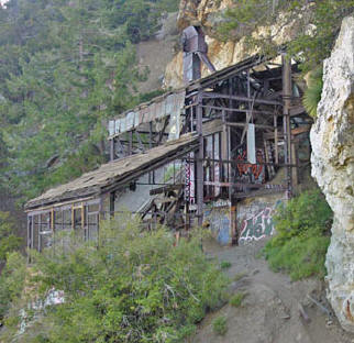
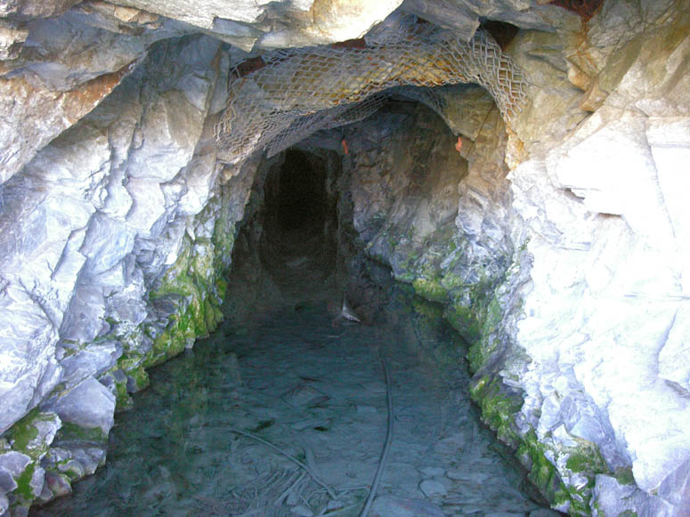
After hiking about two thirds of the way to the mine, you will encounter one of the three entrances to the mine [see picture]. The entrance is gated off, but you can easily look into the straight tunnel (adit). When we visited, there was quite a bit of water running out of the adit.
The last three-quarters of a mile before the mine, the road becomes fairly steep. Soon, the trail makes a sharp right turn as it rounds the ridge that separates Vincent Gulch from Mine Gulch. Here, you will see various terraces on the left. This is the location of the old town that sprung up to support the mine in 1905. If you venture off the trail to explore these terraces, you will find a few remaining foundations.
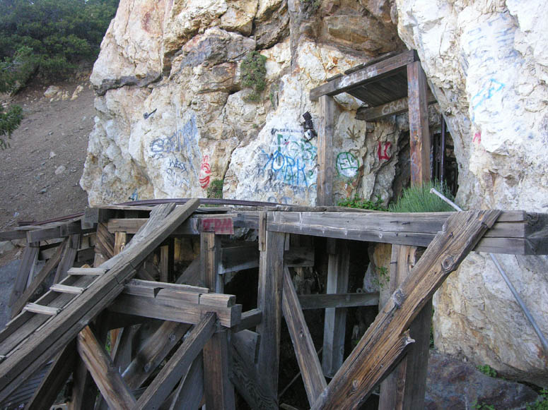
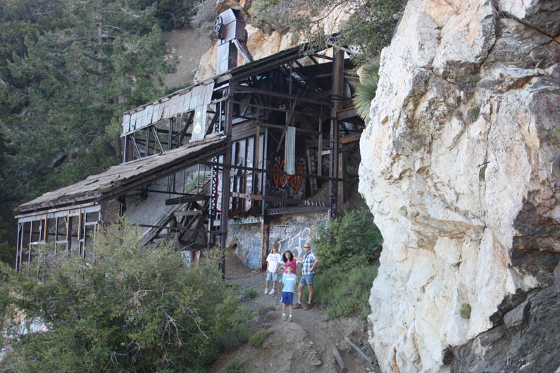
Continuing up the trail, you will shortly pass through a chain link fence that used to be locked many years ago and prevented people from getting closer to the mine. The trail makes one more bend and then the mill building comes into view.
On the right is the second entrance to the mine. If you wish to get closer to the mill building, it is a bit difficult and involves a precarious rock scramble across a slide. If you complete this scramble and get into the building, just remember that it is fairly unstable and not safe. So watch where you step and don't stand or lean on anything. If you are able to walk through the other side, you will see a railroad trestle used by ore cars that turns into the third entrance into the mine.
We have heard stories from several people that have entered the mine through these two entrances and walked through the fairly extensive tunnel system. However, as with most mines, entering the tunnels are very dangerous as this mine has several "levels" which are connected with vertical shafts that go straight up or down. When walking through the tunnels, these vertical shafts can be encountered unexpectedly which will cause a fatal fall. Hundreds of people have been killed while exploring abandoned mines over the past few decades from this activity.
Once you are finished looking over the Big Horn Mine site, retrace your steps back to the Vincent Gap parking lot using the same trail you hiked in on.
 History
of the Big Horn
History
of the Big Horn
Perched at 7,000 feet on the east face of Mt. Baden-Powell, the Big Horn is the “granddaddy” of all mines in the San Gabriel Mountains. Prospector and mountain man Charles Tom Vincent discovered the gold-bearing quartz vein in 1895 while hunting big horn sheep. He named the mine after the animal he was hunting.
The long story of this mine is very similar to so many gold mines that operated in California from 1850 to 1940. A “rich” vein was discovered by a poor prospector, he sells it to mine promoters for "next to nothing", the promoters rave to the public that it is the biggest gold strike ever, stock is sold to investors to raise cash, enough money is raised to build a mill and dig shafts to reach the ore, once the ore is worked it is found to be worthless and the mine operation ends up far from turning any profit.
The Big Horn was worked and then sat idle several times. Starting in 1902, enough money was raised to dig some tunnels and build a two stamp mill. By 1904, more tunnels were completed and a ten stamp mill was constructed. In 1905, the mill burnt down and was promptly rebuilt three months later. This is the mill building we see today. By now, a small town with a general store and post office was established near the mill site. But by 1907, it was realized that the ores were not as rich as the promoters said plus litigation brought all work to a halt. Work resumed by another owner in 1914 and then changed ownership several times until 1966. From 1914 to 1966, the various owners only did exploratory work but never mined gold. The current owner, Hanna Mining Company from Cleveland, Ohio, the one that bought it in 1966, attempted to start up the mine in the middle 1980s, but discovered it was too costly to do so and there was considerable objection from the residents of Wrightwood concerned about the increase in truck traffic along Hwy 2.
Photo Tour
Road Trip Photos
Click on picture to enlarge
Pictures taken: July 2009
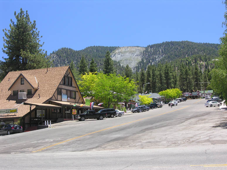 |
Park Drive in downtown Wrightwood. The large scar of the "Wrightwood slide" can be seen on the hill in the background. That hill incidentally is Blue Ridge. |
 |
Where the road turns from light to dark is the San Bernardino - Los Angeles county line. |
 |
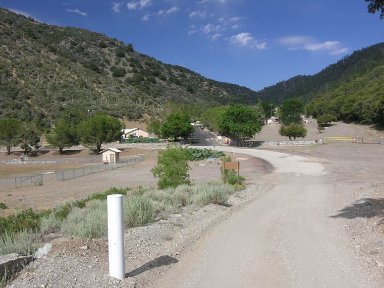
After passing Mountain High East ski area, the Big Pines visitors center and the remains of Davidson Arch is reached. View is looking toward the west. |
 |
How Davidson Arch looked in 1938. |
 |
Today, only the small tower on the north side of Hwy 2 exists. View is looking towards the site in the same direction as the 1938 picture. |
 |
Looking west at the five-point intersection at Big Pines. |
 |
Driving up the road to Table Mountain offers some great views. This is the view of the Mountain High West ski area. |
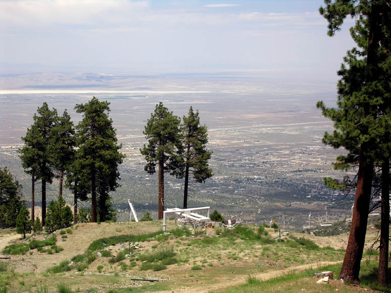 |
This view is from Mountain High North's parking lot. This is one of the only ski areas in the USA where one would ski downhill first from the parking lot, then take a ski lift back up to the parking lot. The resort is currently used exclusively for "tubing" rather than skiing. The view is looking north towards the desert of Phelan and the Victor Valley. |
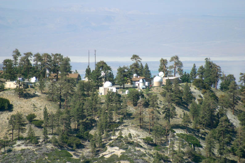 |
JPL’s Table Top Mountain observatory can easily be seen from East Blue Ridge Road, but not from Mountain High North's parking lot. |
|
|
Panorama showing the magnificent view at Inspiration Point. (you will need to use the scroll bar at the bottom of your screen to view entire picture) |
|
|
Same panorama as above, but with callouts. |
 |
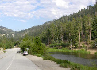
Looking down at the San Gabriel River Canyon (east fork) from Inspiration Point. |
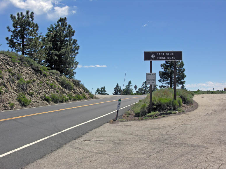 |
The sign pointing to the turnoff for East Blue Ridge Road is just before Inspiration Point. |
 |
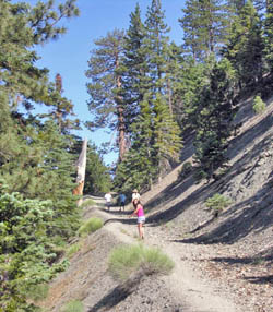
Starting eastbound on East Blue Ridge Road from Hwy 2. |
 |
The views from this road are spectacular. This is looking north over the vast Mojave Desert. The large white spot is Rogers Dry Lake on Edwards AFB where the Space Shuttle lands. On a very clear day, we've seen the Sierra Nevada's and Mt. Whitney. |
 |
Looking west towards Mt. Baden-Powell. Hwy 2 and the Inspiration Point parking lot can be seen in right center. |
 |
Driving over the ski runs at Mountain High West. |
 |
Passing underneath chairlift #6 at Mountain High West. |
 |
Not to many roads in California sport ski run signs. |
 |
Blue Ridge Campground: a great spot for a picnic. |
 |
The beginning of chairlift #8 at Mountain High East sits next to Blue Ridge Campground. East Blue Ridge Road can be seen leaving the campground on the right. |
 |
Passing by the reservoir used for snow making at Mountain High East. |
 |
A view of Pine Mountain in the foreground and Mt. Baldy in the background. |
 |
Looking back (west) at Mt. Baden-Powell. |
 |
A fork in the road is reached at about 3 miles from Hwy 2. The left fork goes to Guffy Campground. To continue on Blue Ridge Road, take the right fork. |
 |
Guffy Campground. |
 |
Past Guffy Campground, another fork is reached. Taking the left fork continues the trip on Blue Ridge Road. Taking the right fork will take you all the way down to Cabin Flat and the canyon's bottom. However, this road is often closed with a locked gate about halfway down. |
 |
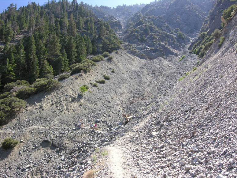
The road passes by the top of the Wrightwood slide. You can stop here and take a close look at geology in action. |
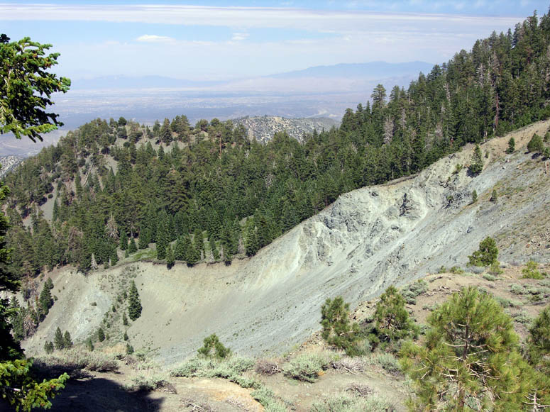 |
Looking down the Wrightwood slide. Hesperia and Apple Valley can be seen in the background. |
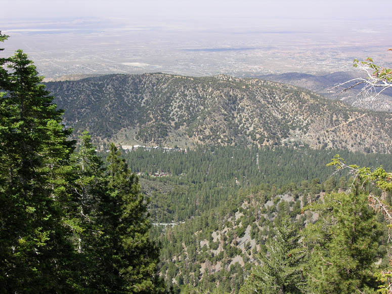 |
Can you see the town of Wrightwood? It's very well hidden in the trees in the center of the picture. |
 |
Looking beyond Wrightwood to the north, you can see Phelan, Adelanto and Victorville. |
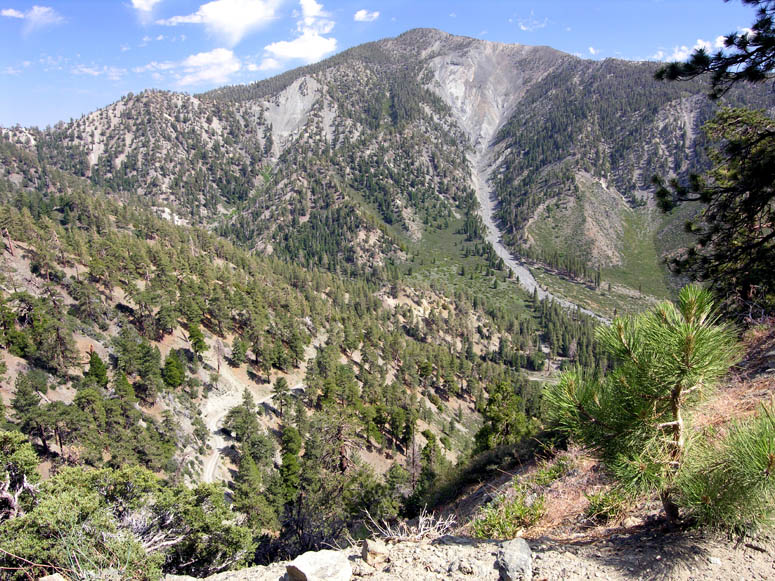 |
The road passes close to both sides of Blue Ridge for great views. Here, you can see Pine Mountain above and the road winding down to Cabin Flat below. |
 |
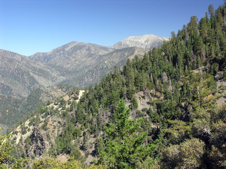
Near the end of East Blue Ridge Road is another view. This time it is looking southeast into Lytle Creek, San Bernardino and Mt. San Jacinto in the far distance. |
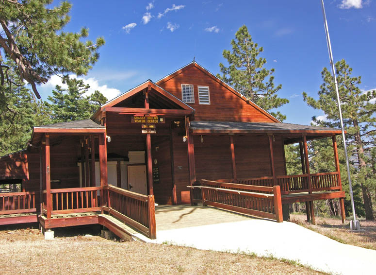 |
The visitor's center at Grassy Hollow. |
 |
Vincent Gap parking lot. |
 |
Crossing Hwy 2 from Vincent Gap, there are two different dirt roads to pick. You will want to take the one on the left. |
 |
The beginning of forestry road 4N11 which turns into Big Rock Creek Road. |
 |
4N11 is steep in places. |
 |
Looking back up (east) on road 4N11. |
 |
Here is some of the vegetation we saw along 4N11. The bushes with the yellow flowers are called flannel bush, also known as Fremontia. The cactus-looking plants are yuccas commonly named Our Lord's Candle. |
 |
When going down 4N11, be sure to look up on the left (south) side of the road at times. This is the north face of Mt. Baden-Powell. You will see Hwy 2 perched on the steep slopes. In this picture, you can see the new bridge built while Hwy 2 was closed from 2004-2009. |
 |
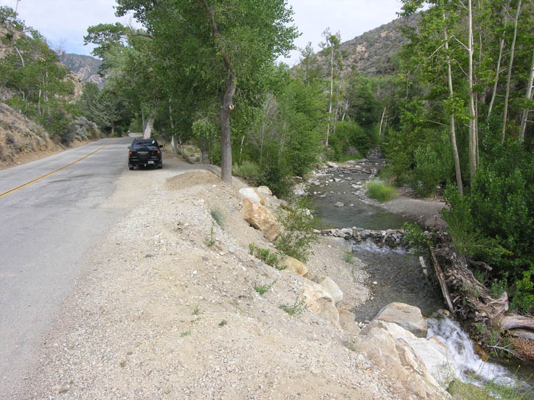
4N11 crosses several streams. The crossings are cemented, making the crossing easy. |
 |
At the end of 4N11 is Camp Fenner. This is the beginning of the paved Big Rock Creek Road. |
 |
Looking down the turnoff to Paradise Springs. |
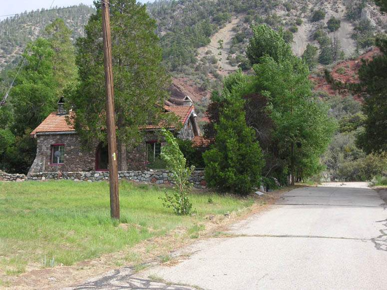 |
One of the homes in Paradise Springs. |
 |
Past Paradise Springs, there is a dirt road on the left that heads south up a canyon for a mile. This canyon offers a campground and some nice hiking trails and is close to Devils Punchbowl Park, but you cannot drive there from here; only hike. The dirt road is seen here on the right; Camp Rock Road is on the left. |
 |
Big Rock Creek Road passes by Sycamore Flats Campground and begins passing through a forest of sycamore and cottonwood trees. |
 |
When we drove this road in July, there was a roaring creek next to the road. |
 |
Towards the end of the aforementioned forest, people have dammed the creek with rocks to create swimming or wading areas. |
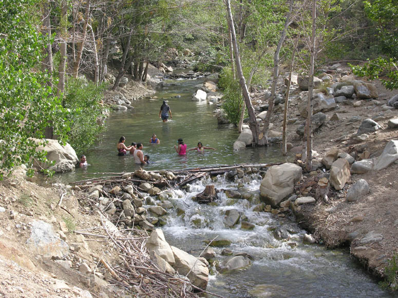 |
People enjoying the waters of Big Rock Creek. |
 |
Big Rock Creek Road ends at Big Pines Highway. |
 |
Big Pines Highway approaches the sag pond named Caldwell Lake. |
 |
A closer look at the secluded and private Caldwell Lake. |
 |
The small enclave of Mile High. |
 |
There is a park popular with fishermen located at Jackson Lake. |
 |
A closer look at Jackson Lake. |
 |
Big Pines Highway passes real close to Jackson Lake. |
 |
Our road trip ends when Big Pines Highway ends at the five-point intersection at Big Pines. |
Back to Photo Tour, Top of Page or Sample Trips
![]()
Hike to Big Horn Mine
Click on picture to enlarge
Pictures taken: July 2009
 |
The hiking trail can be viewed from Inspiration Point on the east face of Mt. Baden-Powell. |
 |
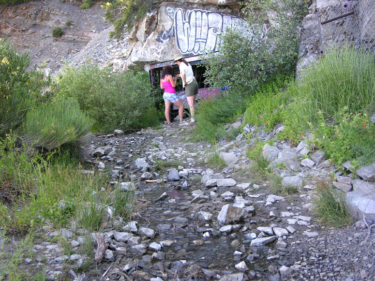
Several hiking trails begin at Vincent Gap. The hike to the mine begins by following the road past the white gate on the left. |
 |
The beginning of our hike. You can see that the trail makes a sharp left turn to where the people on the left are standing. |
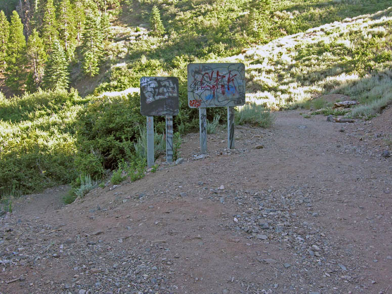 |
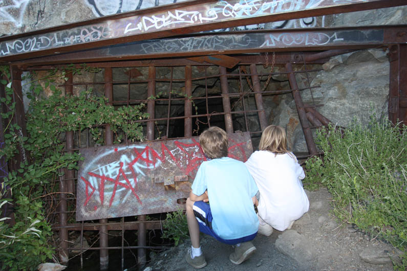
Soon, a fork in the trail is reached. Going left and down leads to Vincent and Mine Gulch. Our hike continues straight (right). Unfortunately, the signs have been defaced by un-respectful people. |
 |
The first half of the trail is flat (no elevation gain) and often in the shade. |
 |
Continuing on the easy hike. |
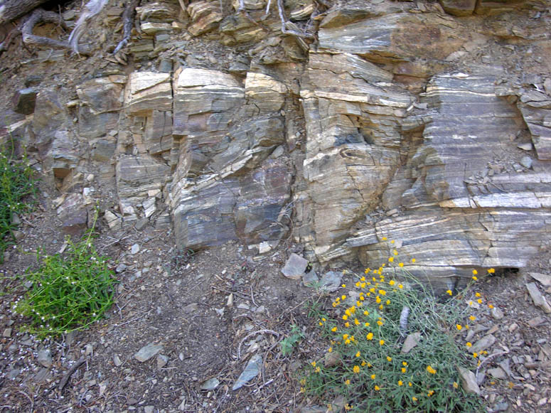 |
Along the way, take a close look at the rock outcroppings. Some of the rock, such as these, are known as metamorphic rock and not very common. This type of rock is usually very old and was created deep inside the Earth. Metamorphic rock was pushed up out of the Earth when the San Gabriel Mountains were created by the San Andreas Fault. |
 |
This slide has destroyed the original road. Hikers have since made a new trail. Be careful with your footing along this portion of the hike. If someone were to fall here, it would not be easy to stop from sliding a long way down. |
 |
Looking up closer at the steep mountain slope above the slide. |
 |
Looking across at Mt. Baldy from the hiking trail. |
 |
About two-thirds of the way, one of the three entrances to the Big Horn Mine is reached. A small stream pours out of the tunnel. |
 |
Peeking inside the gated mine entrance. |
 |
What it looks like peeking through the gate. |
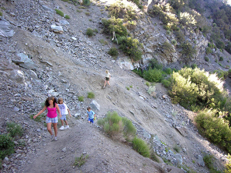 |
Just past the mine entrance, another slide is encountered and the trail again becomes very narrow. |
 |
The last part of the hike is fairly steep. |
 |
As the trail makes a sweeping right turn, another road leads off to the left. Taking this left fork will lead you to the mine's town site. |
 |
The terraces you see is where various buildings used to stand in the early 1900s. |
 |
The view of Mine Gulch and Mt. Baldy just over the edge of the terraces. |
 |
The walk between the town site and the mine passes through an old chain-link fence. |
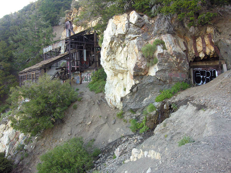 |
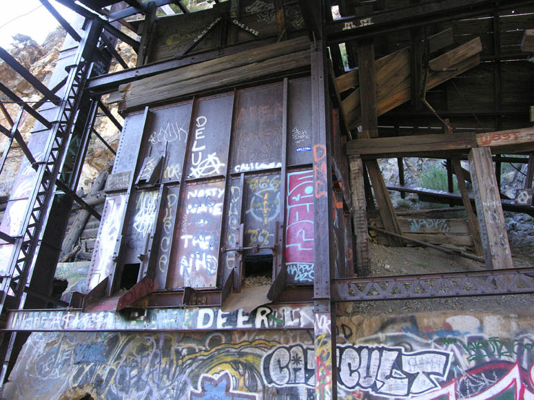
The Big Horn Mine. The second of three mine entrances is pictured at right and at the very end of the hiking trail. The mill building is on the left. The third mine entrance is located behind the mill. |
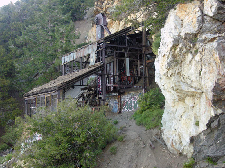 |
Closer look at the mill building. See how it is built right into the large white quartz rock outcropping. Gold is usually found in quartz. |
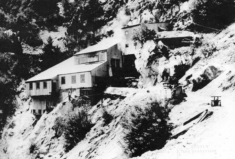 |
A picture of the Big Horn from 1935 when it was operating. |
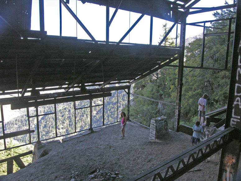 |
Inside the mill building. |
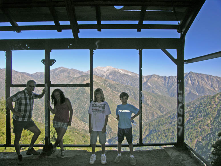 |
This is certainly a room with a view! |
 |
Ore chutes inside the mill building. |
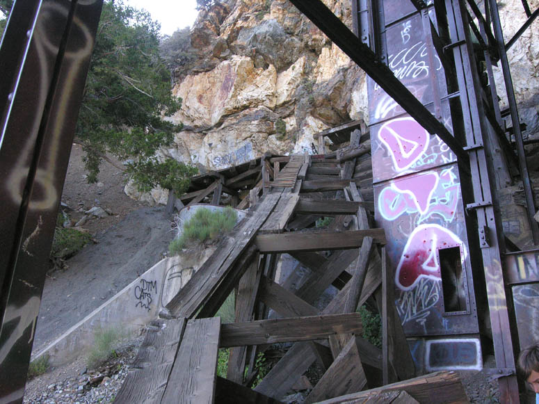 |
This precarious looking ladder leads up to the third mine entrance. |
 |
The third mine entrance. We certainly did not use the ladder! We carefully walked under some collapsed workings inside the building. |
 |
Time to leave this wonderful historic site just as we found it. Unfortunately, as you can see from the pictures, many people did not. Instead, they left their own version of "art" known as graffiti. |
Back to Photo Tour, Top of Page or Sample Trips
Last updated November 06, 2011.