|
|

"Knowledge for the western back roads explorer..." |
|
|
Maps: Cajon Pass and Hwy 66
|
|
|
Here are two aqueduct maps to help you plan your trip and give you an overall idea of the area:
|
|
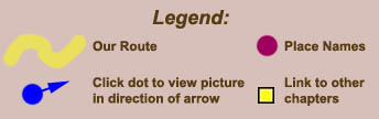
The Area Map shows the route and various place names mentioned in Road Trip. Locate and click on the blue dots to see a picture looking in the direction of the arrow. |
|
|
The Interactive Google Map points out the various places along the trip in more detail. If you have not used Google maps before, be sure to read the instructions below. |
How to use Google Maps
For more directions, see the Google Maps help page. Return to Interactive Google Map. |
![]()
Area Map
After you click on the hyperlink to see the map below, you will need to use the scrollbars on the bottom and right sides of the window to see the entire map.
Each brown square on the map's grid represents one mile.
|
|
Click here to view map full screen |
Base map data is from the United States Geological Survey (USGS) provided by ArcGIS Explorer from ESRI. ArcGIS Explorer is available for free download at ESRI's website and provides a program similar to Google Earth, but also gives topographical and historical maps for the USA.
![]()
Interactive Google Map Read instructions on how to use this map.
Back to Top of Page, or Cajon Pass and Hwy 66, or Sample Trips
Last updated February 24, 2011.