|
|

"Knowledge for the western back roads explorer..." |
|
|
A Hike up Deep Creek
|
 You may remember our articles in the Breeze. Providing there is continued
interest, they will continue in Shooting the Breeze. The
article you read here is different, being more detailed, than the one that
appeared in Shooting the Breeze.
You may remember our articles in the Breeze. Providing there is continued
interest, they will continue in Shooting the Breeze. The
article you read here is different, being more detailed, than the one that
appeared in Shooting the Breeze.|
Article Index |
Features |
||||||||||||||
|
|
Books That We Recommend:
Getting There
Directions to the start of this hike are similar to our first story which went through Summit Valley and the Cajon Pass. At the SVL entrance, make a right turn on Bear Valley Road and then an immediate left onto Peach Ave. Follow Peach to the traffic light at Main Street and turn left. Continue on Main Street as it turns into Arrowhead Lake Road until it reaches Mojave Forks Dam.
There are two ways to get to the start of this hike. One is by starting at the entrance to the top of the Mojave Forks Dam and the other is to start using the Pacific Crest Trail from Hwy 173.
Via the Dam
If you decide to start the hike from the top of the dam, just be aware that you will be trespassing on County property. However, many people enjoy this scenic hike over the top of the dam and we’ve never heard of people being cited for it.
Arrowhead Lake Road climbs over the right side of the dam. Park near the entrance at the top of the dam. Be sure to not park your car on the road that leads east onto the dam, as it will be ticketed or towed. Instead, carefully park your vehicle on the east side of Arrowhead Lake Road. When you park, be very careful with the traffic that is coming from the south as they travel fast and it is difficult to see them coming. After you park your vehicle, walk east on top of the dam towards the large spillway that is almost two miles from the entrance. The walk is on pavement on a flat surface and offers great views of the Victor Valley.
Via Hwy 173 & Pacific Crest Trail
From the top of the dam, continue south on Arrowhead Lake Road and then turn left (east) at the stop sign reached in a mile from the dam. The road going east/west at the stop sign is Hwy 173 and incidentally is the only unpaved state highway (number labeled) in the entire state of California. Continue on this road until the pavement ends. At the end of the pavement, there is a wide parking area. You will find signs here for the Pacific Crest Trail (on the left side of the road) as it heads northeast towards the dam. The trail also heads south from this point and follows the base of the mountains to the south just in case you wish follow this hike on another day. Follow this trail as it goes behind the dam, over a bridge (as of May 2010, this bridge was washed out and hikers have to walk through 3 feet of water) and then up and over the dam’s large spillway.
The Hike
Using either either of the starting points mentioned above, head for the dam's large spillway on the east side. Once you are at the spillway, cross it and look for the Pacific Crest Trail (PCT) marker along with several signs explaining Deep Creek’s ecosystem. Look up and you will see the trail climb the north side of the canyon. This is the only portion of the hike that requires climbing. Once you are at the end of the climb, the trail turns to the right (east) and follows the old Hesperia Aqueduct and is entirely flat (no climbing).
You will notice a cement shack at the top of the trail. This was part of the aqueduct. Although the PCT goes to the right, you may wish to to see where the aqueduct crossed the Mojave River and made a beeline to Lime Street Park in Hesperia. To make this small side trip, turn left. A walk of about a quarter mile will take you to the end of the open aqueduct where the water went into a pipe. You can see the pipe descend the hill to the west. Looking further, you will see a trench where the pipe used to be as it went under the sands of the Mojave River. If you wish to learn more about the Hesperia Aqueduct, there are pictures and information available at the Victor Valley Museum located on Apple Valley Road just south of Bear Valley Road.
At the cement shack, turn right and follow the PCT into the canyon. For those that are timid of heights, there may be some difficult spots along the trail as it hugs the steep canyon wall. Below is usually a fairly good flowing river and, in May, that river will probably be flowing so well, the roar of rushing water will be heard. During this portion of the hike, the trail is either inside of the old aqueduct, with its rock walls acting as a guardrail against the deep canyon, or it is on the outside of the aqueduct – where there is no guardrail! In some places, the aqueduct was inside a large pipe as you will see large openings at some points.
If you decide to take this hike in May, you will be rewarded by a lot of blooming plants. Near the spillway, there are a lot of bush poppies (dendromecon rigida) growing which have large vibrant yellow flowers. Along the trail you will see a wide variety of wildflowers. This is also the time when rattlesnakes become active after hibernation and the rocky surfaces in the canyon are great habitat for them. So keep a watchful eye out for them. Remember that rattlesnakes can’t hear but they can certainly feel the vibrations of you coming. So try to use a heavy foot (stomp your feet in places) when you walk to scare them off by letting them know you are coming. As you may have heard many times, rattlesnakes are more scared of us then we being scared of them; so with that thought in mind, they will hear you coming from quite a distance. Furthermore, the Pacific Crest Trail is usually heavily used by people so most snakes probably have learned to steer clear of the trail. But don't let that fact allow your guard to come down!
Another plant to be aware of along the trail is poison oak. Be aware of what this plant looks like [see picture] and simply do not go near it. To be double sure, try not to touch any plant along the way. It seemed that the poison oak began appearing about halfway between the spillway and the large bridge.
After about four miles of hiking from your vehicle (4.3 miles from Hwy 173), a large bridge that spans Deep Creek will be encountered. The aqueduct continues upstream (on the left) another quarter of a mile to where water was diverted from the stream and into the aqueduct. If you cross the bridge and continue up the PCT, the Deep Creek Hot Springs will be reached in another two miles. For this hike, we turned around at the bridge as there was plenty of great canyon scenery to see in the first four miles. If you plan on hiking to the hot springs, expect to see some “different” types of people there, with many not wearing any clothes sitting in the pools of warm to hot water.
Our Experiences
We've experienced this hike many times and have always enjoyed what it has to offer. Probably the best part of this hike is the access to rugged mountain and wild river scenery so close to home.
It is a grueling hike all of the way to the hot springs. After the trail crosses the big bridge, it begins to climb and descend in several places as it no longer follows the historic aqueduct. You will definitely want to be in good shape in order to accomplish the hike to the hot springs. Furthermore, you will wish to make sure that your hiking boots are matched for your feet so that no blisters appear on your feet like one of us experienced.
When you make this hike, realize that some of the people that you see on the trail carrying large backpacks might be attempting to hike the entire 2,650 mile-long trail. On a recent hike, we encountered and had a fascinating conversation with a young man from Scotland that was attempting to hike its entire length. He started at the Mexican border, hiked through the Anza Borrego desert, had to hike around the San Jacinto Mountains near Palm Springs because there was too much snow on the trail and spent the previous night at the Deep Creek Hot Springs. He didn't have a time frame on when he was going to finish his trek at the Canadian border. He was very concerned that, like the San Jacintos, the High Sierras were going to have too much snow which would cause him to detour a good portion of the most scenic portion of the trail. However, he was looking forward to eating at McDonalds in a day or two, which is where the Pacific Crest Trail crosses I-15 in the Cajon Pass.
Once, one of us used our mountain bike to follow the same trail to the hot springs. The only legal "thing" that you can use on the trail are your own two feet or a horse. Therefore, riding a mountain bike is not legal on the trail. But using the trail on a weekday, one can bet that no ranger would be patrolling a very remote portion of the Pacific Crest Trail. Riding the bike on the trail, especially past the steep drop offs, was quite a challenge, but very exciting and fun. Part of that excitement was getting away with something that was mildly illegal. So it was with much pleasure that someone was encountered also using illegal transportation over the same trail. These people were training a pack of lamas for use on other hiking trails in the Rocky mountains of Colorado. When encountered, the group of lamas that were "in control" were stopped on the trail forming a traffic jam, with the lone mountain biker now at the end. The trainer or owner of the pack was hoping to fetch the one lama that was out of control. He asked to hold onto the lead lama so he could fetch the one rouge lama. He assured that if the reigns of the lead lama were held, the others in the group would also stay put. So as the reigns were held by the lone mountain biker, the trainer successfully fetched the rouge lama. The lone biker and the lead lama proceeded to have a stare-down. Fortunately, it didn't take long for the trainer to round up the rouge lama. He then hitched it up to the end of the line of other lamas and had them all step aside to let the mountain bike by. The trip continued on to the hot springs and then back without further incident.
Each time we've visited the hot springs, many of the same category of people are seen. Most are not the variety of people that would win a beauty contest. Most are overweight. And these are the people that are not wearing any clothes. Other people, maybe some of them are wearing clothes, are usually smoking something that isn't legal. None of them are certainly the type of people that would be seriously hiking or backpacking. So our recommendation is that if you decide to hike up to the hot springs, be prepared to see some scenes that you don't normally see every day!
Photo Tour
Click on picture to enlarge
Pictures taken: May 2009 & 2010
Via the Dam:
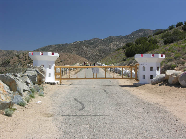 |
The entrance to the Mojave Forks Dam. These are the gates located next to Arrowhead Lake Road. |
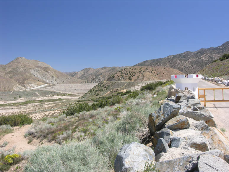 |
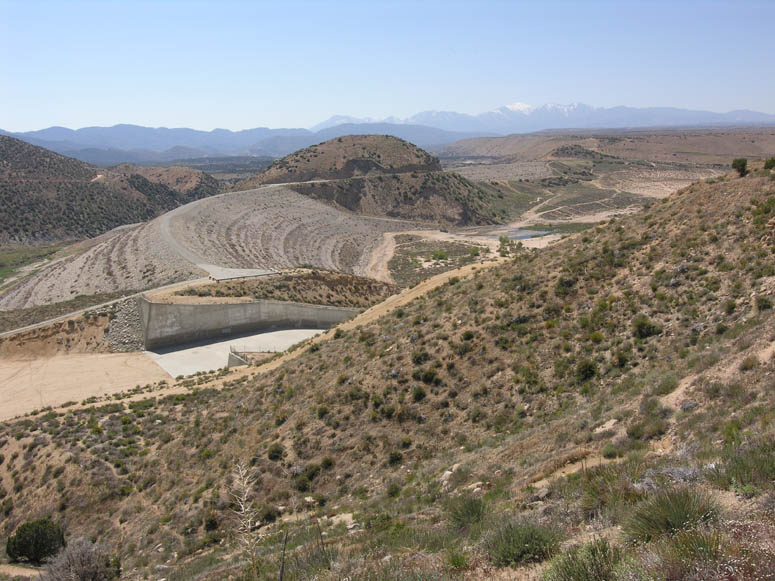
Same spot as above but with a view looking across the entire two mile long dam and into the canyon of Deep Creek. |
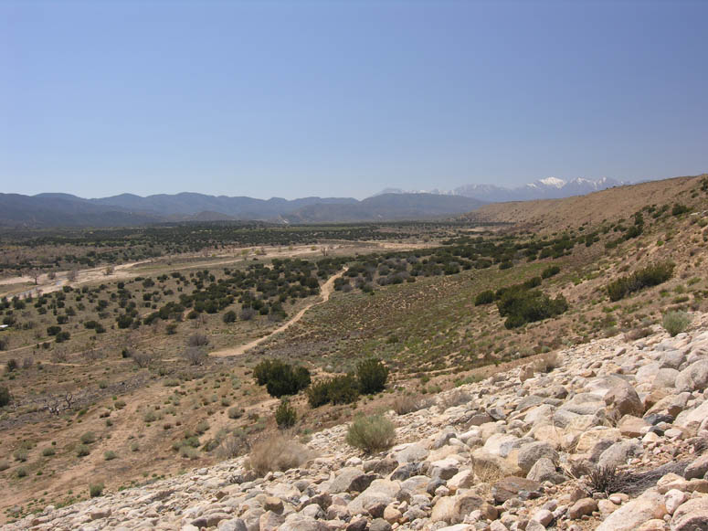 |
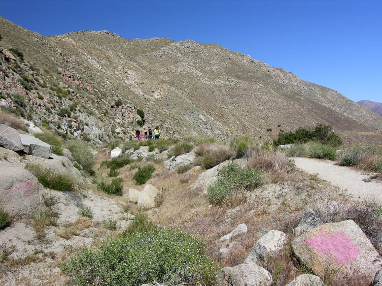
Walking over the dam and looking southwest over Summit Valley. |
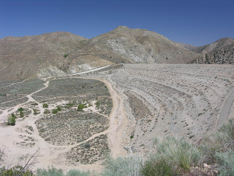 |
Approaching the second section of the dam. The spillway, where the Pacific Crest Trail is located, can be seen on the far end of the dam. |
 |
Looking north down the Mojave Desert and the Victor Valley. Below is where the water of the Mojave River begins its long course to Baker. |
 |
Looking south and down at the confluence of Deep Creek and the Mojave River. The Pacific Crest Trail can be seen just beyond the river and Hwy 173 can be seen above. |
Via Hwy 173:
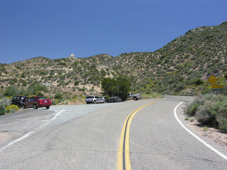 |
This is where the pavement ends on Hwy 173 and the parking area for the beginning of the hike is located. |
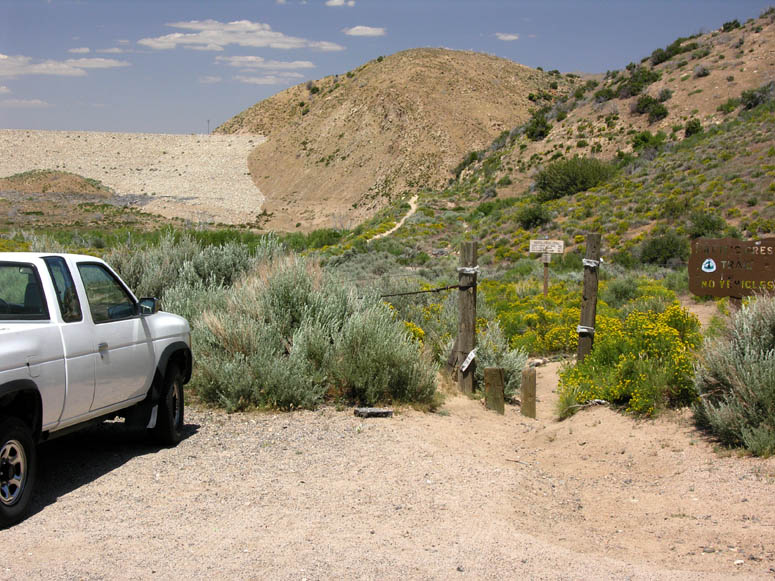 |
The trail begins here and heads towards the back side of the dam. |
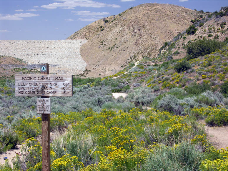 |
As the sign says, it is 6.3 miles to the hot springs in Deep Creek. |
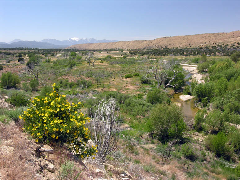 |
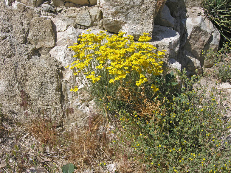
Looking southwest towards Summit Valley. A bush poppy plant is blooming in the foreground. Bush poppies are common in this area and are easy to spot with their bright yellow flowers. |
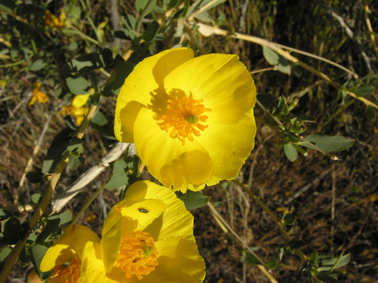 |
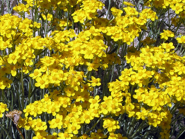
Close-up of a bush poppy. |
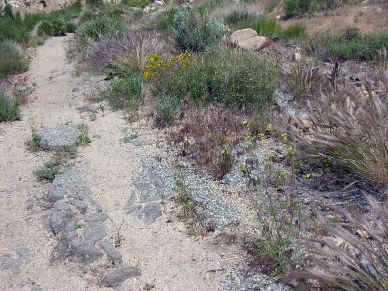 |
While walking down the Pacific Crest Trail towards the dam, you will notice pieces of broken up pavement. Before the dam was built in 1970, this used to be the road bed for Arrowhead Lake Road which has since been rerouted on the west side of the dam. |
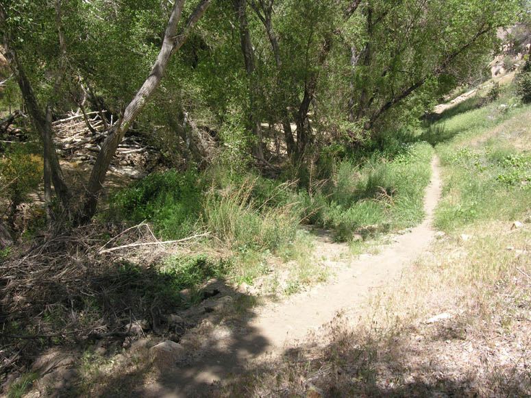 |
The trail heads down into a wooded area next to the Mojave River. |
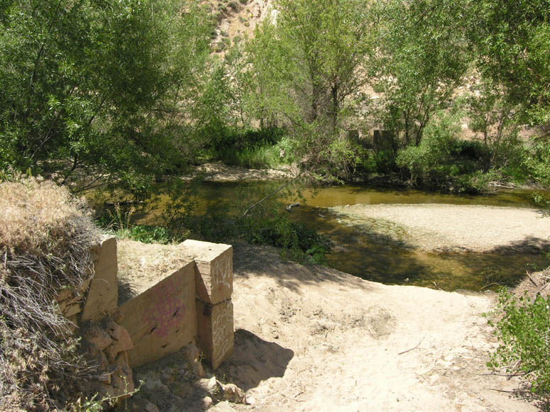 |
Just after entering the wooded area, these cement foundations will be seen on both sides of the river which supported the bridge over the Mojave River for Arrowhead Lake Road. |
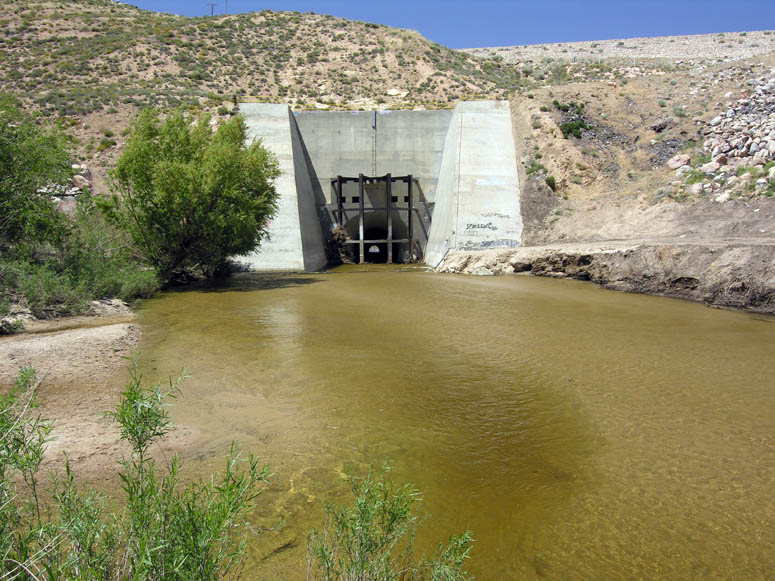 |
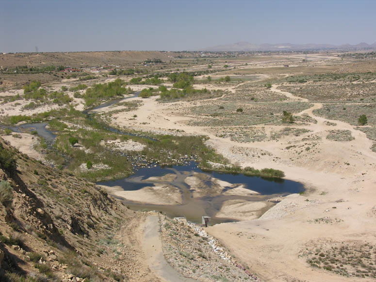
As mentioned in a previous picture, this is the confluence of the two rivers. In this picture, you can see where the Mojave River goes under the dam through this tunnel. Yes, this dam has no floodgate. The water freely goes through this tunnel whether or not there is a flooding condition. |
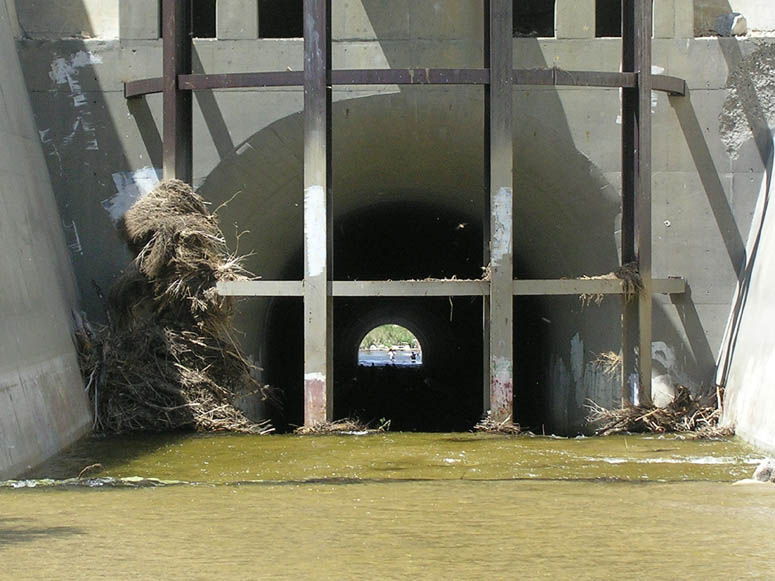 |
Looking through the tunnel reveals people playing in the water on the other side. |
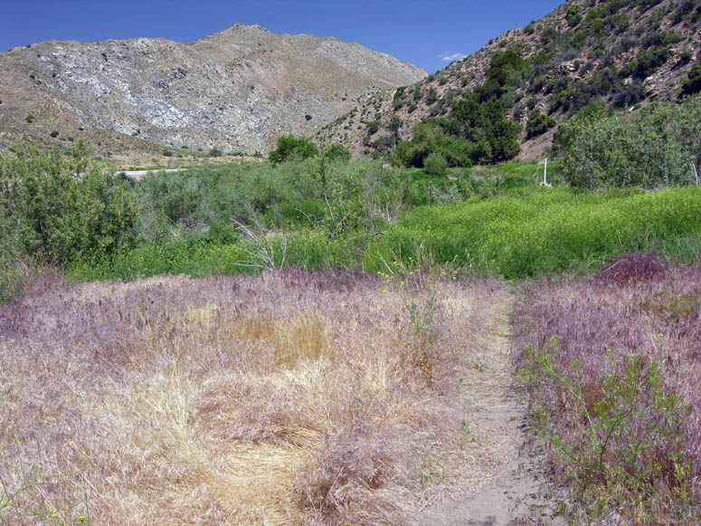 |
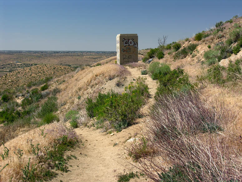
Where did the trail go? This portion of the trail is difficult to follow as there is a lot of vegetation growing here. Actually, the white pole in the distance is a marker for the trail. |
 |
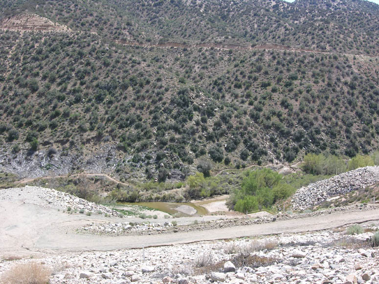
In 2009 and before, there was a bridge located in this spot for crossing Deep Creek. In 2010, it was washed away and it is uncertain when it will be replaced. As in its name sake, the water is rather deep here - 3 to 4 feet. This would be a reason for using the route over the dam. |
Starting at the Spillway:
 |
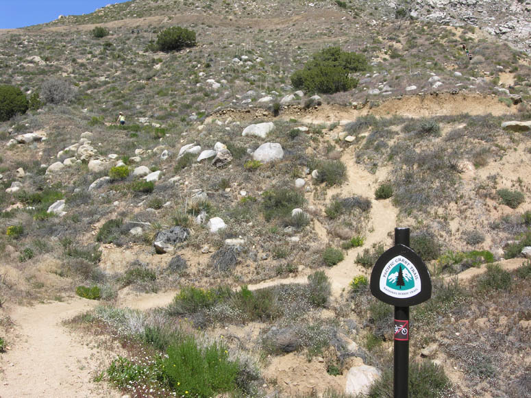
This is the view of the dam's large spillway. Ahead of where the people can be seen walking are the signs explaining Deep Creek's ecosystem. |
 |
The start of the climb from the spillway to the old Hesperia Aqueduct. |
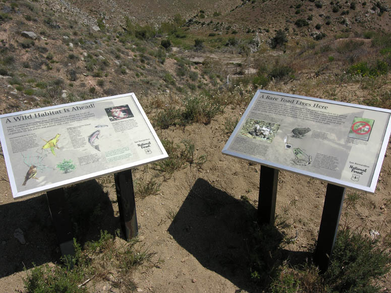 |
The signs explaining Deep Creek's ecosystem. |
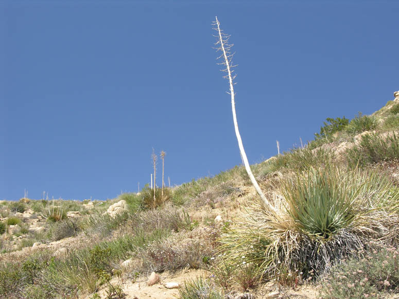 |
Scattered sparsely along the hike is this particular type of cactus. This is known as Hesperoyucca whipplei (Yucca whipplei with many sub-species), with common names of Our Lord's Candle, Spanish Bayonet or simply the "common yucca". What an appropriate botanical name for the town it's near! |
 |
Climbing towards the aqueduct, this view is looking back west at the spillway and dam. |
 |
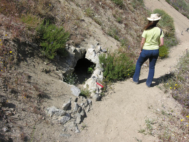
The cement shack located at the top of the climb. |
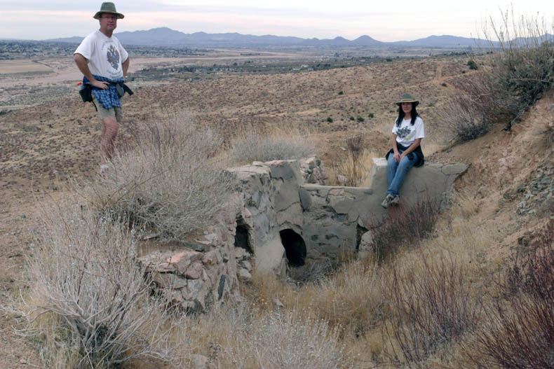 |
Turning left or west at the cement shack and following the aqueduct trail for about a quarter of a mile will take you to where the water entered a long pipeline to Hesperia. The rooftops of Spring Valley Lake can be seen in the far distance. |
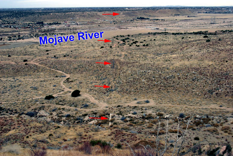 |
Arrows point to the remains of the pipeline which ended near Lime Street park in Hesperia. |
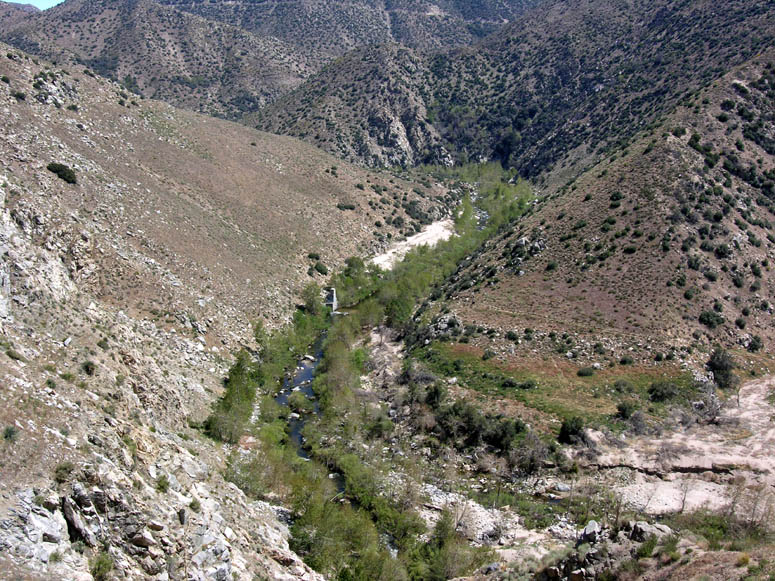 |
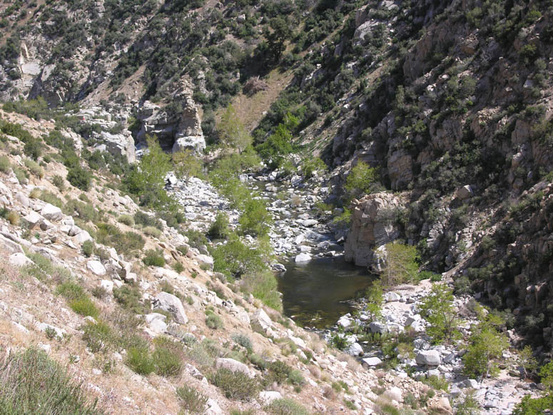
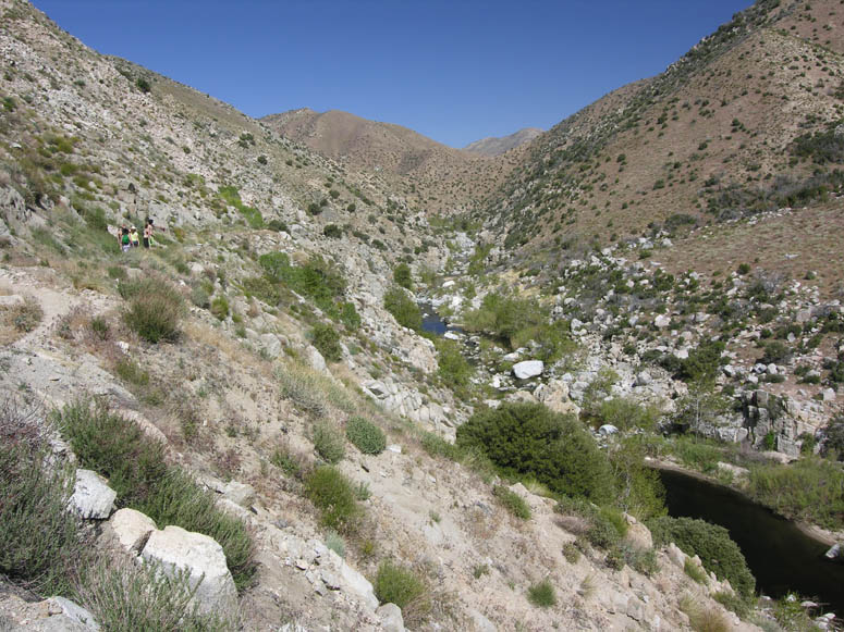
Looking into the beginning of the large canyon of Deep Creek. |
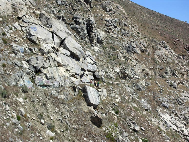 |
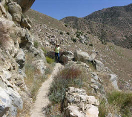
Can you find the hikers in this picture? This is an example of the steep terrain the trail goes past. |
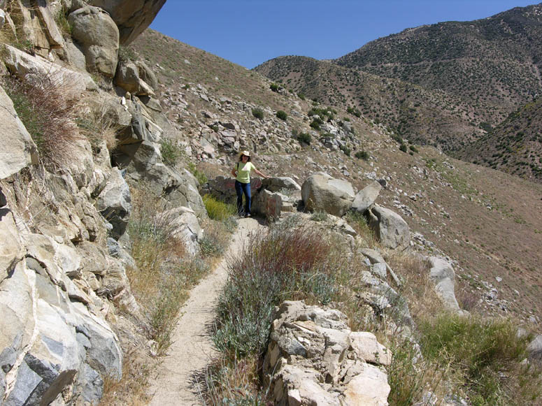 |
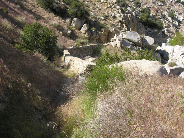
Along some portions of the trail, the old stone walls of the aqueduct serve as a guard rail between the trail and the drop-off into Deep Creek. |
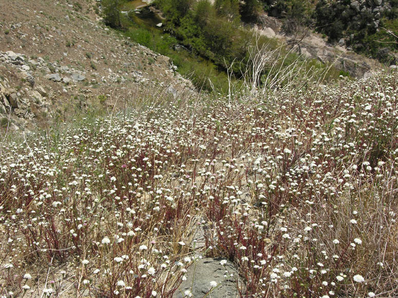 |
Masses of small white wildflowers coat the canyon walls. Many plants are in full bloom between the months of April and June. |
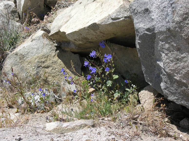 |
Desert Canterbury Bells or Phacelia campanularia, can be seen growing along the trail. |
 |
Many yellow flowers, including this paper daisy or Psilotrophe cooperi, can be seen growing in all sections along the trail. |
 |
Close-up of the paper daisy flowers. |
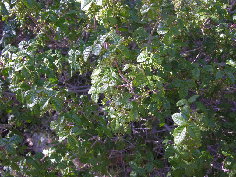 |
Poison oak is something to watch out for along the trail. We found it growing starting a mile into the canyon. In some areas, it grew close to the trail, so make sure you don't brush your open skin against it! In our experiences of traveling around California, poison oak has been appearing where we didn't remember it growing before, including Deep Creek. |
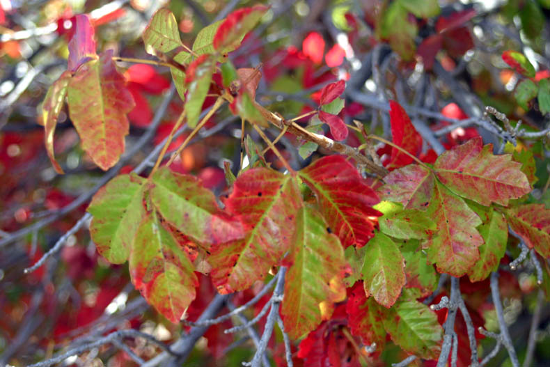 |
Poison oak will look like the previous picture with its shiny leaves in spring. In summer and fall, it will have reddish colored leaves, such as seen in this picture, making the plant much easier to identify. |
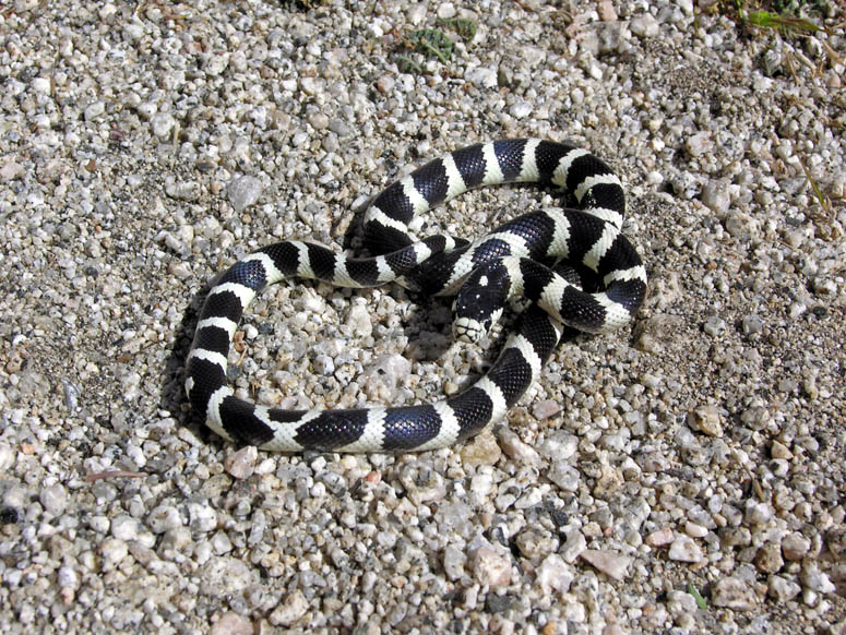 |
Although we have warned about rattlesnakes regarding this hike, we have never encountered one here. But on one hike, we encountered a snake we've never seen in the wild - a California Kingsnake, which is non poisonous. Kingsnakes actually hunt and kill rattlesnakes. |
 |
Continuing on the hike up Deep Creek. Here the aqueduct is in a ditch to the left of the trail. |
 |
Here, the aqueduct is inside a large pipe. Pipelines seemed to be used through steep sections of the canyon. |
 |
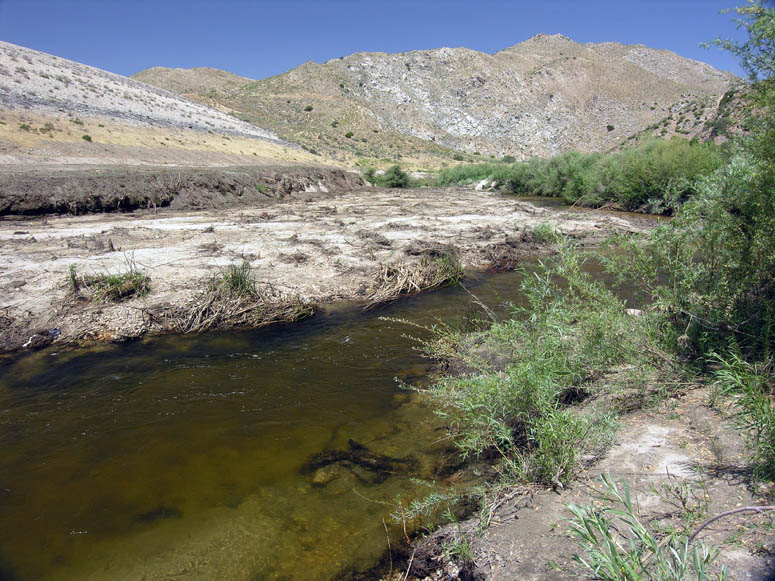
Looking down at the rushing river below. There are many boulders, so in spring, the water makes that classic rushing water sound as it cascades over the boulders. In some places along the river there are large pools of water which will invite any sweaty hiker to take a plunge. |
 |
Each time you round a corner in the canyon, you will see another stretch of new canyon ahead making you wonder when you will reach the big bridge. |
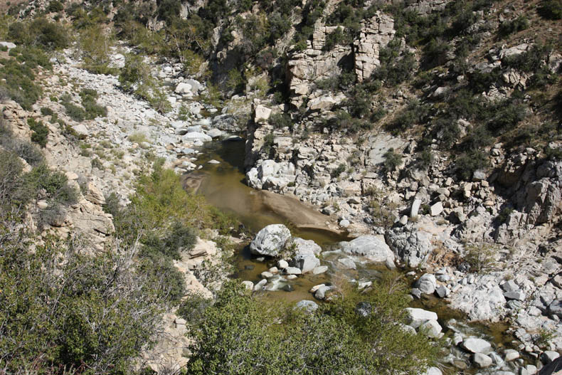 |
Another view of the rocky riverbed below. |
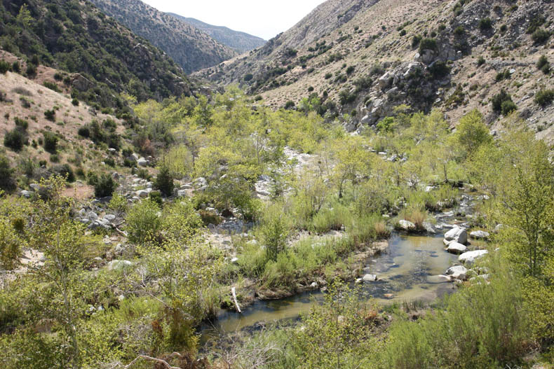 |
Yet another view of the canyon. As you hike further up the canyon, you will realize that the trail gets closer and closer to the level of the river. Remember, the aqueduct is flat while the riverbed is ascending while you walk upstream. |
 |
The aqueduct follows the trail all the way from the spillway to the bridge - a distance of about 2 miles. |
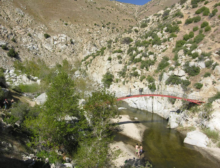 |
Finally, the bridge is reached. |
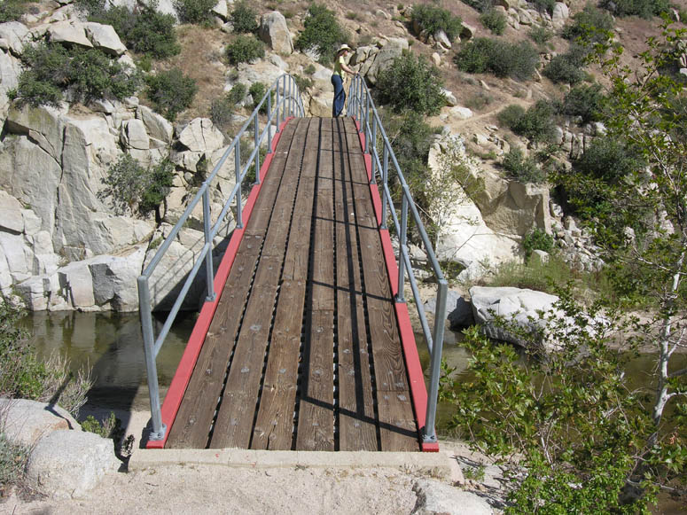 |
Enjoying the view from the bridge. |
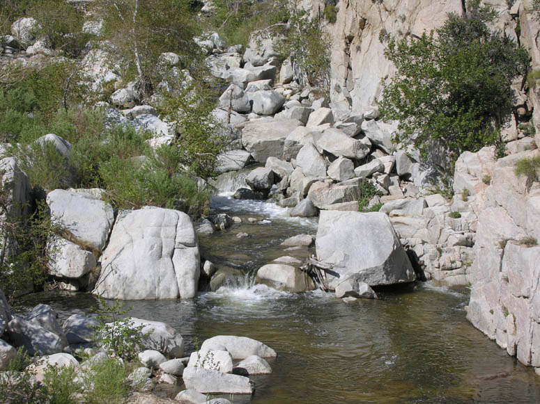 |
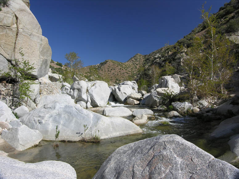
Looking upstream at the numerous cascades. |
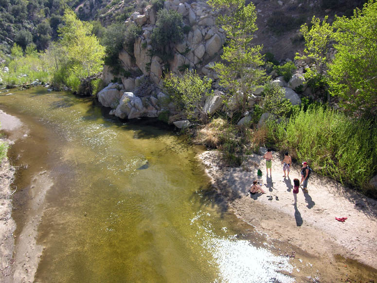 |
There are many sandbars along the river to enjoy as a small beach. |
 |
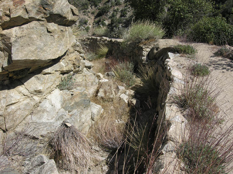
After the bridge, the aqueduct continues up the left side of the canyon. There is no trail to follow it, other than the aqueduct itself. About a quarter mile past the bridge, you can see where water was diverted out of the river and into the aqueduct. |
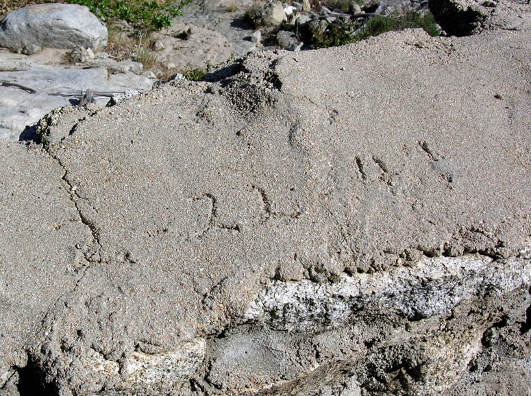 |
Not sure if this date was carved into the aqueduct's cement when it was built, but the date says 1941. |
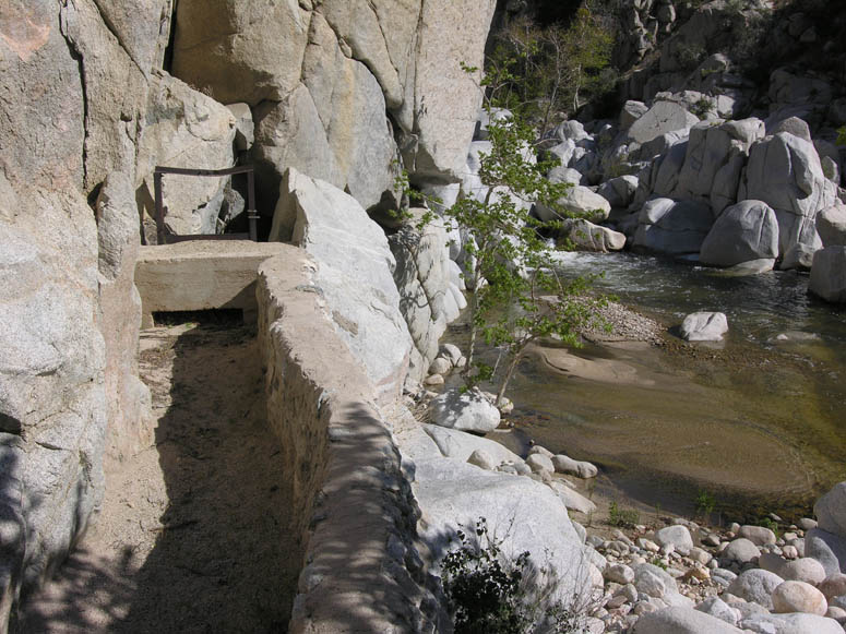 |
A sluice or floodgate control water entering the aqueduct. |
 |
Water cascading near the beginning of the Hesperia Aqueduct. |
Back to Photo Tour, Top of Page or Sample Trips
Last updated November 06, 2011.