|
|
|
|
|
|
Sample Trip
|
|
Difficulty Chart: |
||||||||||||||||||||
|
|
|
Books That We Recommend For This Area:
 Getting There
The only route to Cow Cove that is accessible to all vehicle classes is the one from the north via Interstate 15. This is the route identified in the Difficulty Chart above and can be difficult for non-4WD vehicles because of the soft sand (see map). For those with a 4WD vehicle, you have the option of getting to Cow Cove from the south via Kelbaker Road.
The area around Cow Cove is covered with a maze of dirt roads so, if you have a GPS system, this would be a good place to use it (see the Trip Log below). A visit to Cow Cove can easily be added to the Aiken Mine Road Trip and/or a trip to Cima Dome.
From the north (I-15):
From Interstate 15, go 26 miles north of Baker or 23.9
miles south of Primm, Nevada to the Cima Road exit. Go south on Cima Road for 0.3 miles
and turn right onto a dirt road. This is the north end
of Aiken Mine Road. Continue on this dirt road for 4 miles and, at the 4
mile point, you will reach an abandoned ranch with two windmills [see
picture]. Be aware that near this section of road there are patches of deep sand
so, if you are not driving a 4WD vehicle, be sure to keep your forward momentum
going!
Continue south and at 2 miles beyond the windmills, Aiken Mine Road will bend to the left and another dirt road will continue straight. You will continue straight, getting off of Aiken Mine Road and continue on the unnamed, dirt road for another 1.9 miles. At the 1.9 mile point, look for a gate on the right side of the road with an abandoned road on the other side that heads northwest. The unnamed road is wide here so park your vehicle off the road and near the gate to begin the hike.
From the south (Kelbaker Road near the Cinder Cones):
If you have a 4WD vehicle, you can access Cow Cove from
Kelbaker Road and the Aiken Mine Road. To get to this junction, you can
either take Kelbaker Road 19.5 miles southeast from I-15 or take Kelbaker Road
14.9 miles northwest from the Keslo Depot Visitors Center. Once at the
junction, turn north and stay on Aiken Mine Road for 13.6 miles. At this
point, turn left (west) near Button Mountain (labeled on most maps) and go 1.2
miles. Turn right (north) at the next dirt road and continue for another
1.9 miles. At the 1.9 mile point, you will see a gate on the left side of
the road with an abandoned road on the other side that heads northwest.
The dirt road you're on is wide here so park your vehicle off the road and near
the gate to begin the hike.
 The Hike
The hike to the petroglyphs of Cow Cove is easy with only a slight downhill grade to the ridge where the petroglyphs are. You will, however, have to do some rock scrambling once you get there if you want to see the the majority of the petroglyphs or want to see them close-up.
Hiking Info:
|
Level of Difficulty: 2 (see
chart) Length: 3.0 miles round trip |
Elevation Gain: 80 feet - gradual downhill
hike to petroglyphs Main Attractions: petroglyphs, volcanic flows |
After parking your vehicle off the road, walk past the gate and follow the old, abandoned, double-track dirt road as it heads towards a series of short ridges in the distance. These ridges are the old lava flows where the ancient Native Americans preferred to etched their drawings.
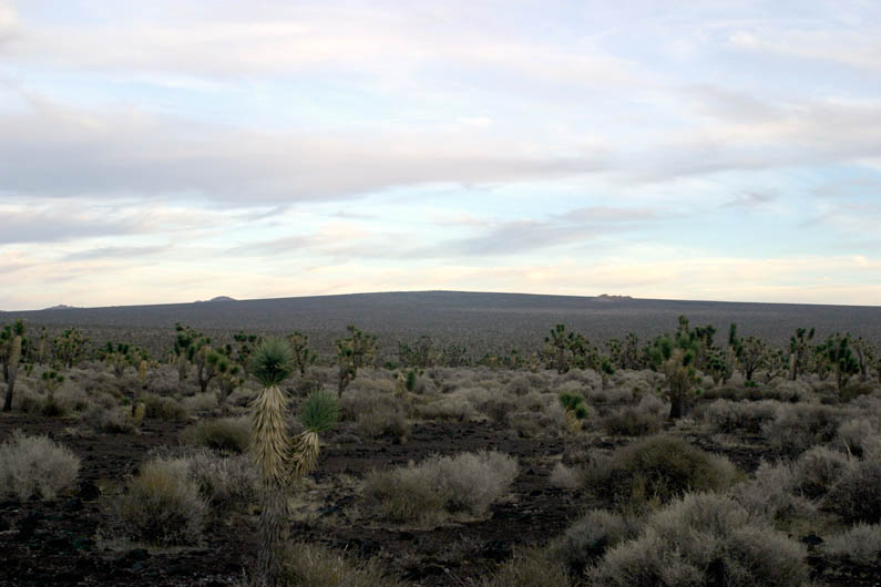
As you walk along, take your time and notice the different types of plants and animals that live here including the many Joshua Trees [see picture]. As you get closer to the dark, lava ridges, you'll reach a place that is the low spot along the route. The trail curves slightly to the left here and begins to climb slightly. You'll find the petroglyphs on the rocky, lower ridge; mainly along the left (western) end.
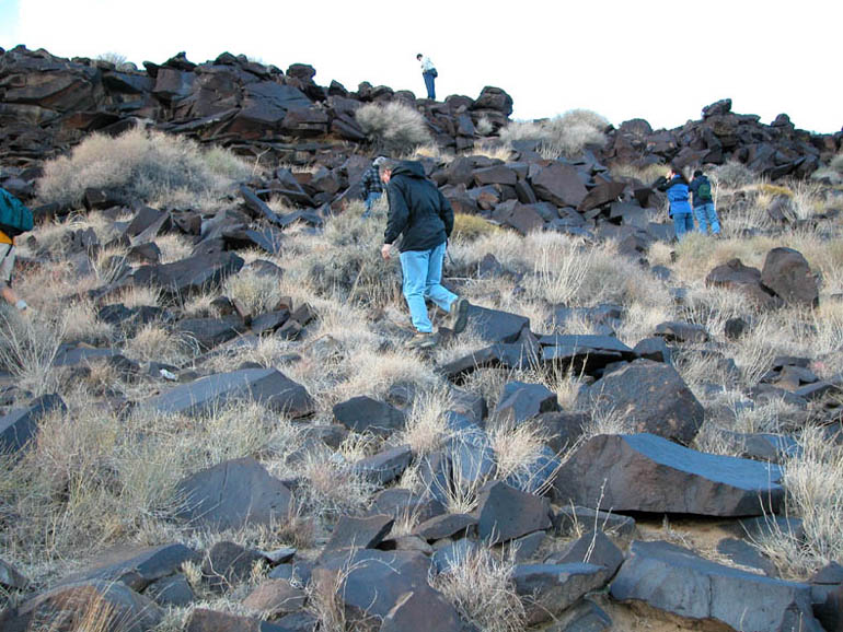
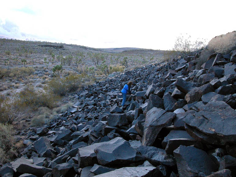
Once you reach the rocky ridge, climb up onto the rocks and take a close look around. The petroglyphs are easy to spot but be careful as you scramble around to find them. Many of the rocks are loose and can cause you to lose your balance or can give way underneath you.
As you continue your search for the petroglyphs, head west (to your left). Some people may find it easier to walk along the bottom of the ridge and look up for petroglyphs rather than scramble across the big rocks. If you choose this method and find a design that intrigues you, then you can scramble up the rocks at that point. Keep in mind that some petroglyphs may be hidden behind plants or other rocks.
Archeologists and historians have studied these petroglyphs for many years and can still only guess as to their meaning. Unlike the hieroglyphics found in Egypt, these seem to have no logical explanation. There are some common designs such as the wavy lines, the in-line dots and the crisscross pattern but their original meanings are probably lost forever. Although many of the etchings here at Cow Cove do not exactly match with the other petroglyphs found at the other, smaller sites in the Mojave Desert, we have noticed that there does seem to be some parallel "themes" to their designs.
For those who are particularity interested in petroglyphs, be sure to visit our website at www.backroadswest.com and pick up a copy of our Calico and Owens Valley Virtual Tour Guides.
The petroglyphs of Cow Cove are a rare and special part of the history of this area and it is a privilege to be able to visit them. We remind you that they are highly protected and that tampering with, destroying or removing any petroglyph at such a historical Native American site is not only a moral crime but also a Federal one. As with all the unique treasures of the Mojave Preserve, please be respectful and remember to "take only photographs and leave only footprints".
Photo Tour:
Click on picture to enlarge
Pictures taken: October 2002
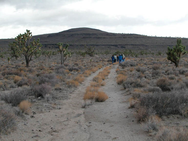 |
The abandoned, double-track road leading to Cow Cove. This picture was taken about halfway through the hike. |
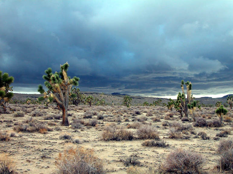 |
Looking westward along the hike as a storm approaches. |
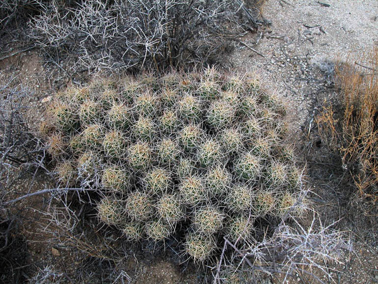 |
A fine example of a healthy Mojave Mound Cactus (see Plants & Animals). These are very common in this area and are very easy to spot in the spring when they display their clusters of bright orange-red flowers. |
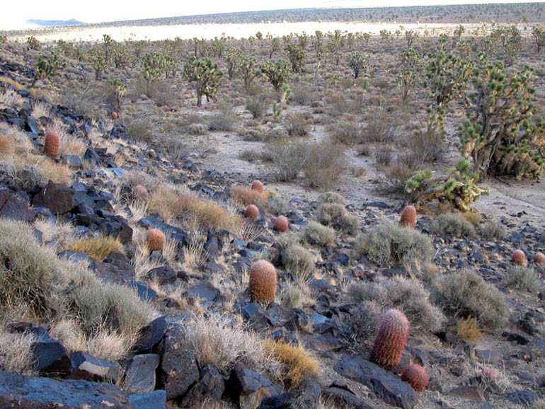 |
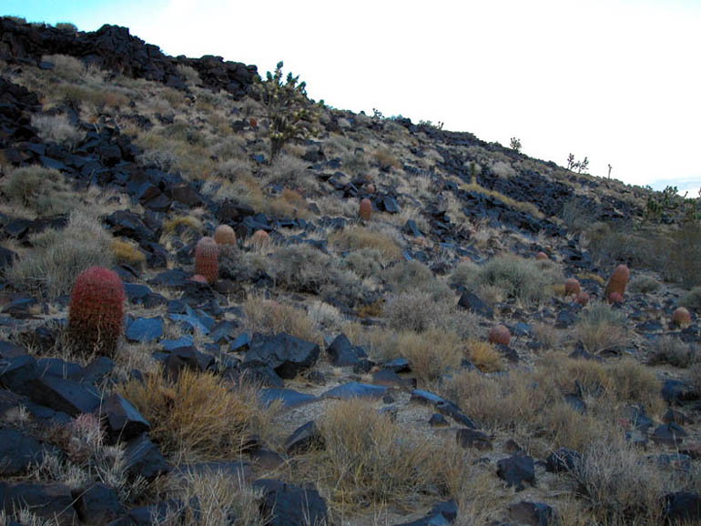
Once you reach the rocky ridge, you'll see plenty of these California Barrels (see Plants & Animals). They are also common on the Preserve and prefer these rocky hillsides. |
 |
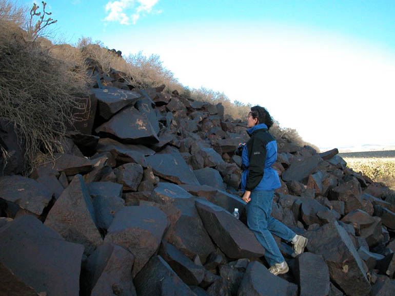
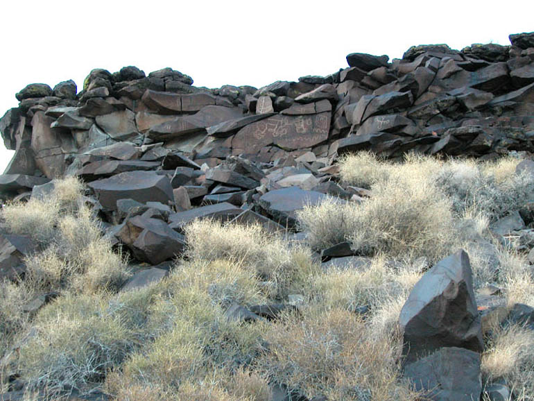
View of the ridge as you approach. The rocks at the top of the ridge are where you'll find most of the petroglyphs. |
 |
Once at the ridge, this is the view to the right. Look to the left or western end of the ridge for the petroglyphs. |
 |
As you scramble up the ridge, look closely for petroglyphs. They are often hidden behind bushes and other rocks. |
 |
Be very careful as you scramble over the rocks. Many of them are loose and it is easy to lose your footing. And, if you drop anything here, it will fall down in between the layers and layers of loose rocks and never be seen again! On a windy day, we lost a camera lens cap that way! |
 |
Look for petroglyphs on rocks with smooth, dark surfaces. Unlike typical rocks of a lava flow that have a rough surface which would make etchings impossible, this old lava flow has smooth surfaces and all the right elements for "desert varnish" to form the dark coating on the outside of the rocks. |
 |
This close-up of a petroglyph shows how it was created by chipping away the dark, "desert varnish" of the rock's surface and exposing the lighter rock underneath. |
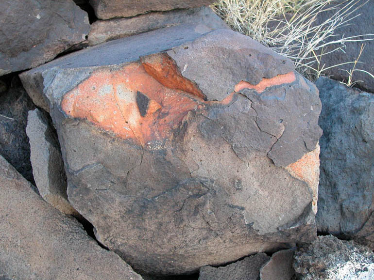 |
Here is an example of a rock that was recently chipped by nature and now has the lighter, orange-colored, internal material of the rock exposed. This is the same process used by the ancient Native Americans only they did it in their own specific patterns. |
 |
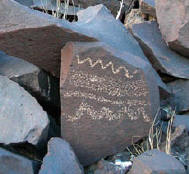
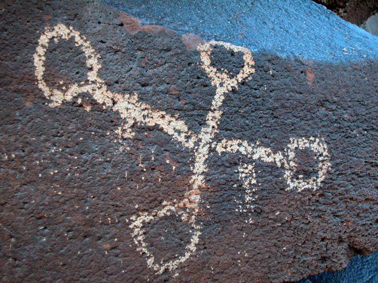
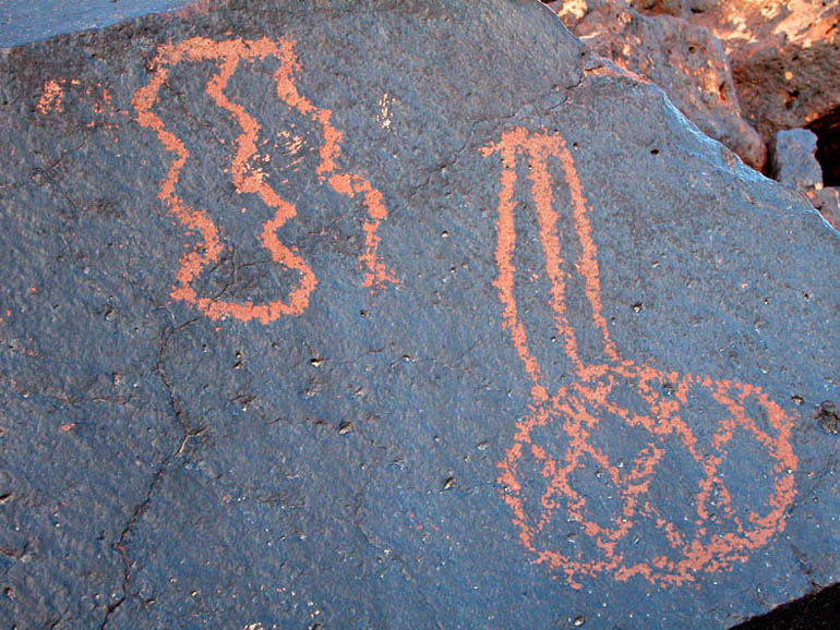
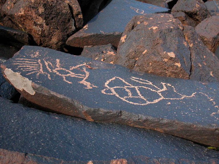
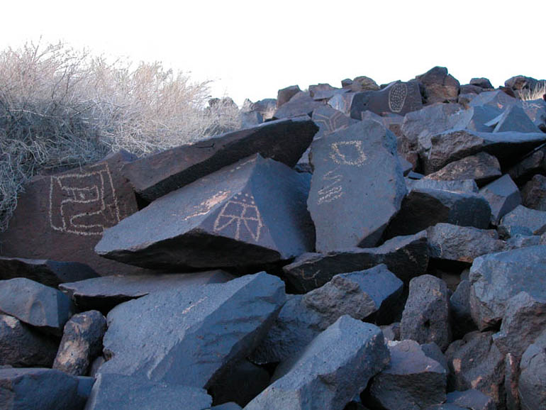
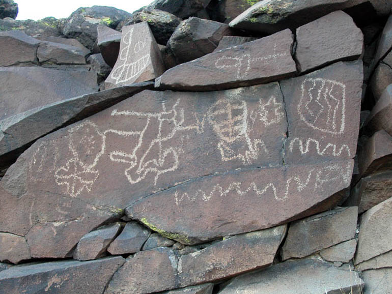
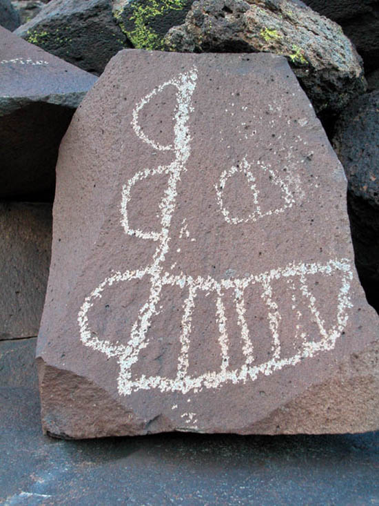
Some of the "etchings" found in Cow Cove. |
 |
This design looked like it might be something familiar to us. If turned clockwise vertically, it could be a human figure. If turned counter-clockwise, it could be an insect with antennae and wings. What do you think it is? |
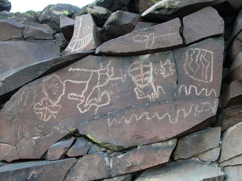 |
Here is another collection of petroglyphs. |
 |
More designs. Notice the common theme of squiggly lines. |
 |
Close-up of two of the drawings from the previous picture. These two have themes that seem to be common in many of the designs here: squiggly lines and a crisscross pattern resembling a woven basket. |
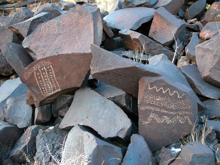 |
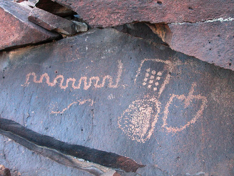
More squiggly lines and another common design: a series of in-line dots. |
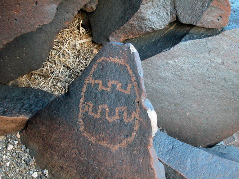 |
This one reminded us of an Easter egg. |
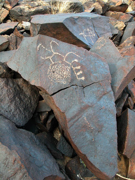 |
Here are some unique drawings. |
 |
Two more unique drawings. |
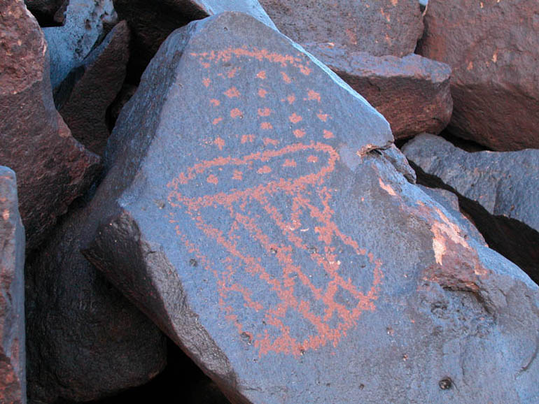 |
Here is an example of both the in-line dots and the crisscrossed lines that look like a basket. This drawing, like many others here, might be older because the etchings are more worn and the color is darker - as if the exposed rock of the etching has been exposed to the oxidation process longer than others. |
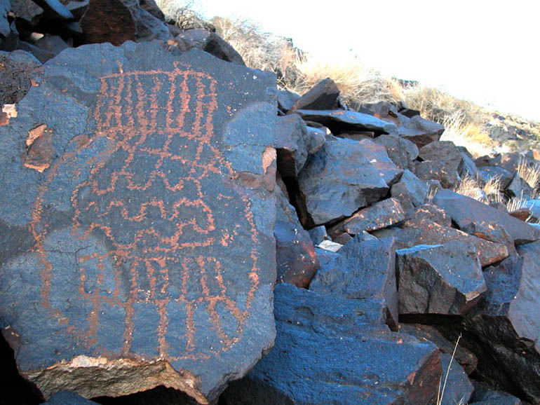 |
Another petroglyph with a similar "basket" design, but with no crisscrossed lines. |
 |
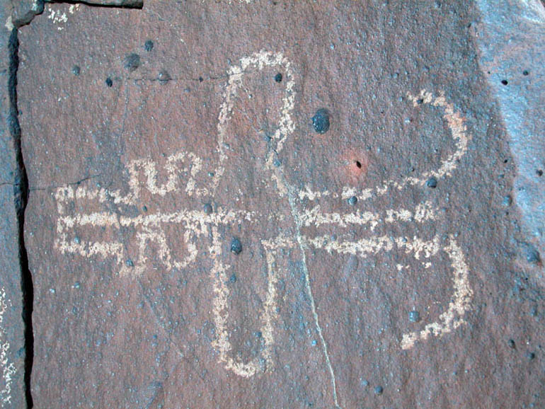
Close-up of the previous picture. |
 |
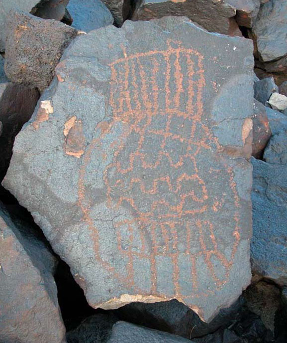
More strange and interesting drawings. |
 |
Looking west towards the end of the rocky ridge of Cow Cove. |
 |
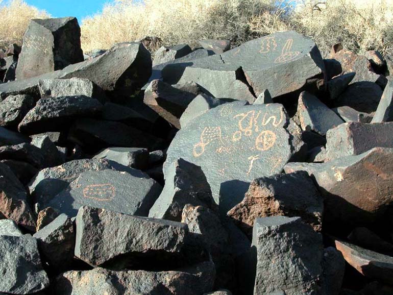
Some petroglyphs are large enough to be seen from the bottom of the hill. |
 |
Close-up of the previous picture. |
 |
A closer look at the petroglyph seen at the top of the previous picture. |
 |
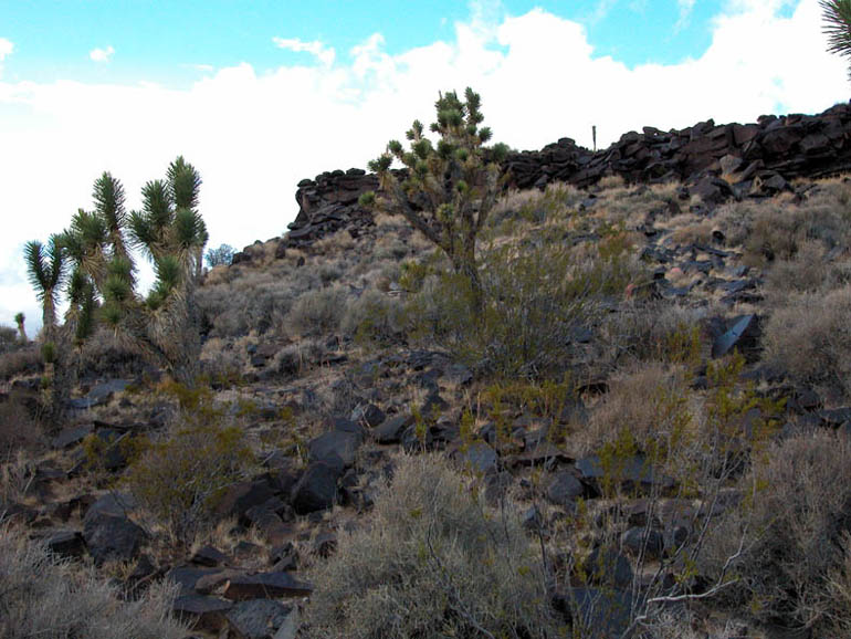
Views of Cima Dome are plentiful around Cow Cove. |
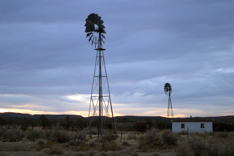 |
Remains of an old cattle ranch about 4 miles south of I-15. |
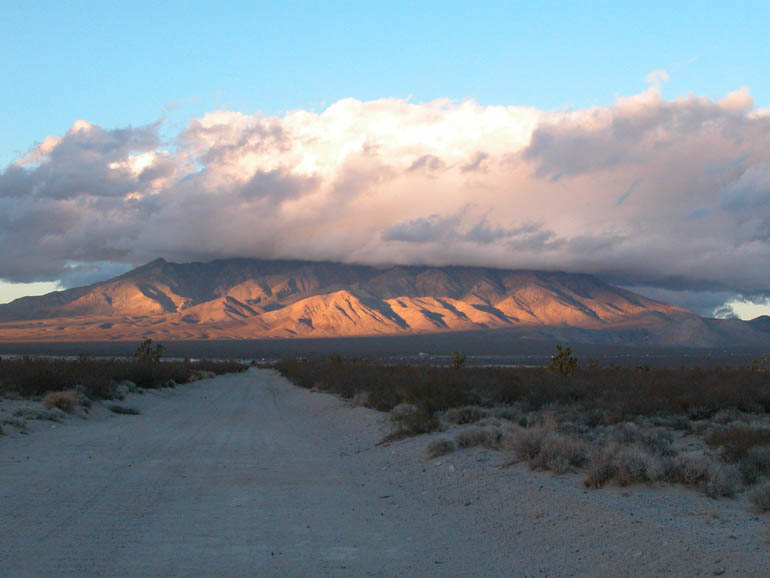 |
View the Clark Mountains while traveling north on Aiken Mine Road just before reaching I-15. |
Back to Sample Trips
Last updated November 06, 2011.