|
|
|
|
|
|
Cow Cove Petroglyphs Maps
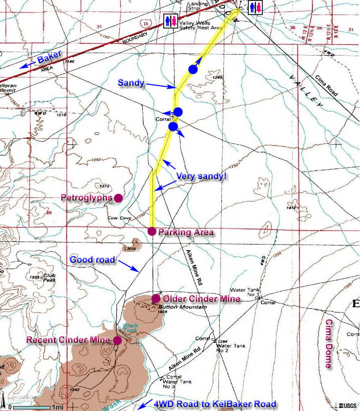
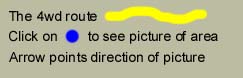
Area Map:
Back to top of page or Back to Cow Cove Petroglyphs
You may need to use the scrollbar at the bottom of your screen to see the entire map.
Back to top of page or Back to Cow Cove Petroglyphs
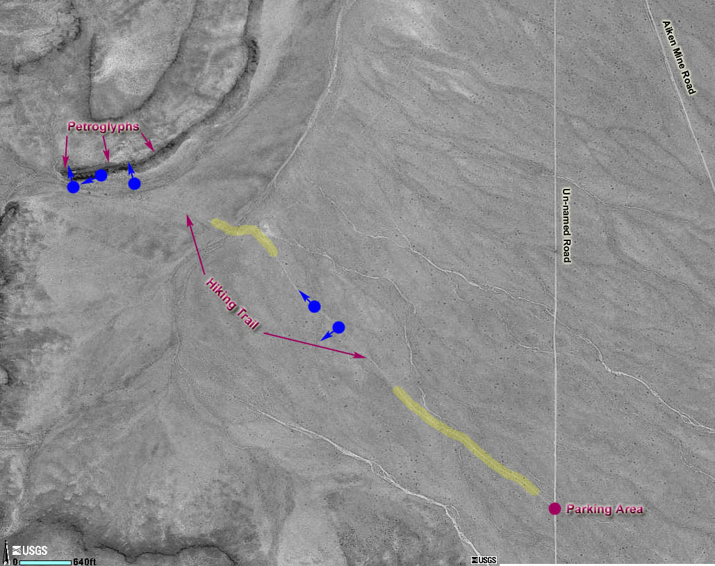
General Overview Map:You may need to use the scrollbar at the bottom of your screen to see the entire map.
Back to top of page or Back to Cow Cove Petroglyphs Back to Trip of the Month Last updated March 14, 2011. |