|
|
Akaroa
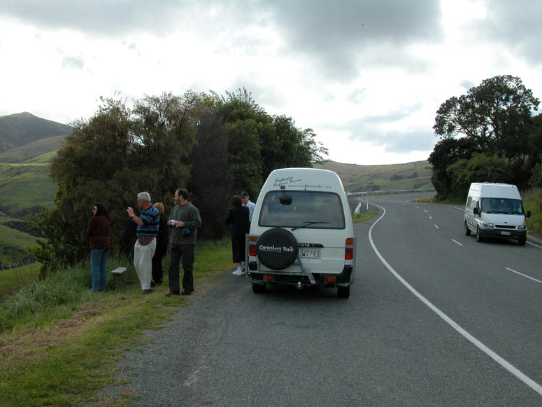
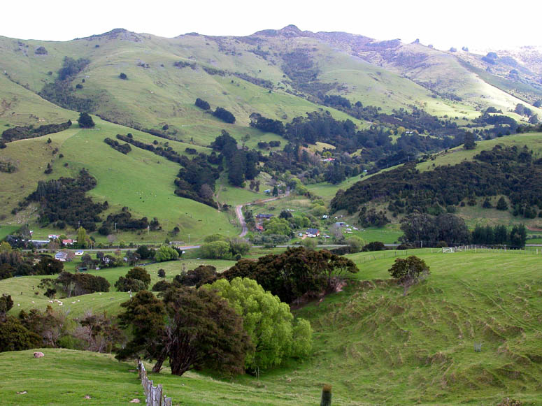
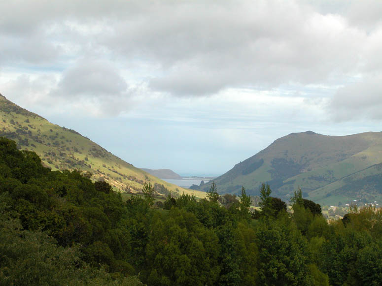
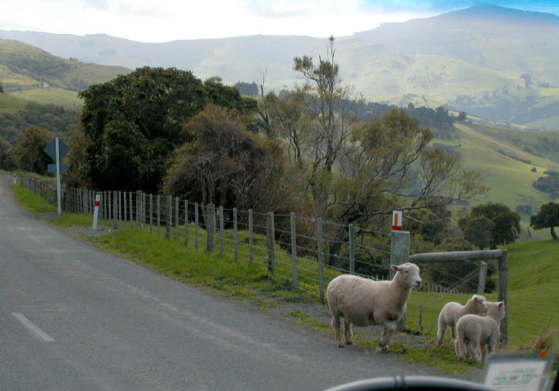
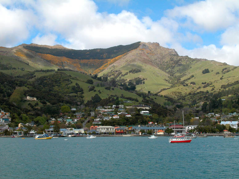
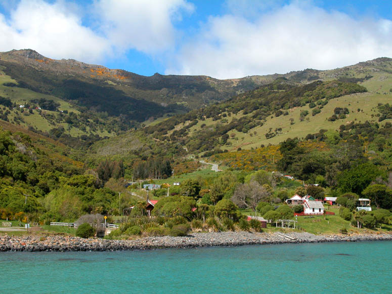
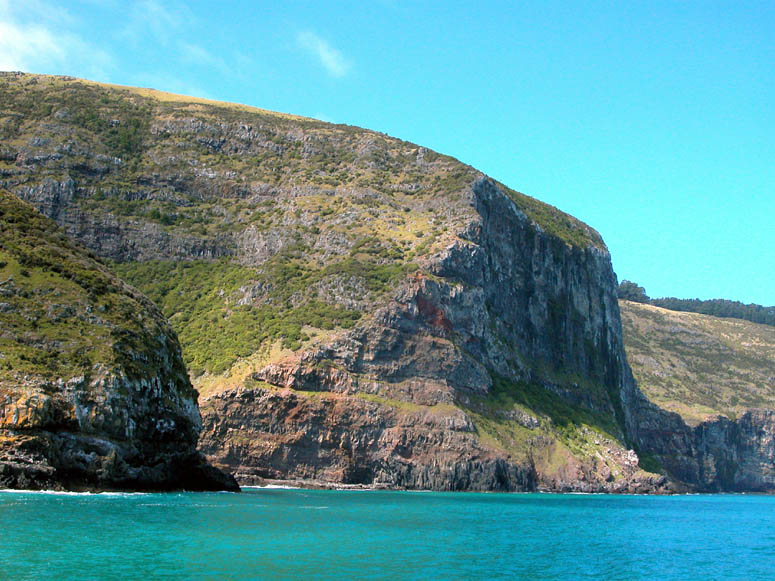
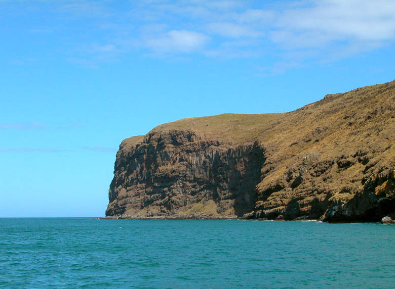
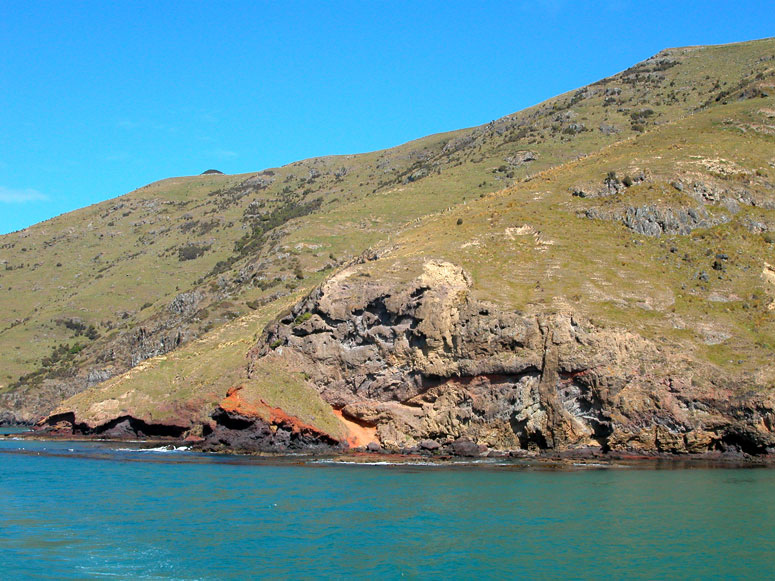
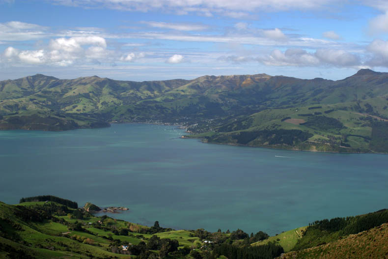
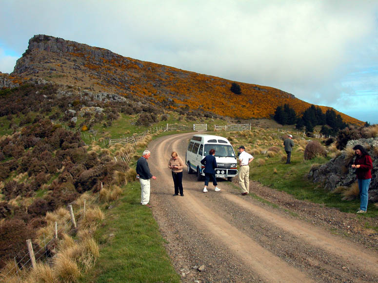
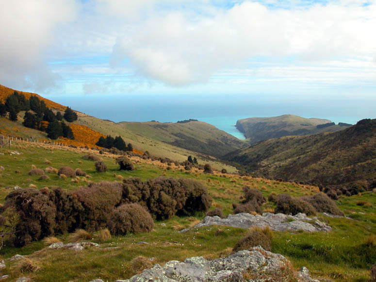
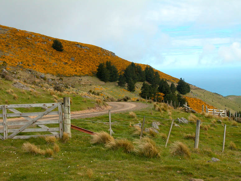
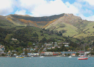
Getting ThereAkaroa is located inside a long bay (named Akaroa Bay) in the middle of the Banks Peninsula which is the large peninsula that juts out southeast from the Christchurch area. The peninsula and town are easily reached by Highway 75, which starts just southwest of downtown Christchurch. The distance from Christchurch to Akaroa via Highway 75 is about 50 miles (80 km) and takes about 1.5 hours to drive since the road is quite windy for half of the distance. Traveling to the Banks Peninsula and Akaroa can either be done by rental car or tour company. Many tour companies offer day tours out of Christchurch. You can inquire about such tours at any of the large hotels in Christchurch. Some tours include visits to the cheese factory at French Farm and travel on the many dirt roads explained below. While we were there, we did not see any public transit available. What's ThereIn our view, there were three attractions to Akaroa: the small village of Akaroa itself, the sea life that we encountered in the bay and the volcanically created landscape of the Banks Peninsula. The combination of these three attractions creates fantastic views all around the Banks Peninsula. Besides Akaroa, there are several other small villages located around the peninsula and on the shore of the long and narrow bay [see picture]. AkaroaThe town of Akaroa [Google search] was founded by French whalers in 1838. When a larger contingent of French whalers and settlers were sent to New Zealand in 1840, they found the British Union Jack flag flying over their little village. The French stayed, but so did the British rule. Today, Akaroa is a mix of both French and British cultural and architectural influences. In the town you will find quaint little shops and cafes. The town is not very big and can easily be covered on foot rather quickly. During our visit, we ate lunch at a cafe just across from the waterfront and experienced a fantastic recipe for pumpkin soup. The harbor cruise departs from the main pier near the center of town. Harbor CruiseGetting a view of the Banks Peninsula from the ocean requires taking an harbor cruise. A typical cruise goes around almost the entire bay. Along the way you will see the spectacular scenery of the Banks Peninsula. Be sure to notice the rocky and colorful shoreline [see picture] which was created when an erupting volcano spewed out molten lava millions of years ago. Often, the rugged coastline is inhabited with sea life such as seals and various seabirds. Near the entrance to the ocean, Akaroa Bay is lined on both sides with very high cliffs [see picture] that go straight up. During the cruise, keep in eye out for the rare and small Hector's dolphin [see picture]. This is supposedly the smallest of the dolphin species. We were lucky to encounter a school of about five dolphin. One playful critter did a series of flips near the boat, much to our enjoyment, similar to the Bottlenose dolphin commonly seen in aquariums around America. If the Hector's dolphin is not out playing during your cruise, you can always see a life-size statue [see picture] of one at the office on the pier of where you buy tickets for the cruise. Throughout the South Island of New Zealand, Akaroa is known for its farmed salmon. If you see Akaroa Salmon on a menu in a restaurant somewhere, try it! When you take the cruise, you will see the farming operation on the north side of the bay - roughly across the bay from Akaroa. The Back Roads of the Banks PeninsulaAll around the peninsula is a network of paved and dirt roads. The number of dirt roads easily outweigh the number of paved roads. The peninsula has many side canyons, mountain ridges and small valleys with different personalities making them all fun to explore. The tour company that took us to the peninsula included a different route back to Christchurch which explored some of these back roads taking us to see these various nooks and crannies. If you rent a car and visit the peninsula, be sure to take a detailed map that shows all the dirt roads. The dirt roads all seem to be in good, but that can definitely change after a good rainstorm, so inquire locally about road conditions. For visiting Americans, it is best to purchase a tour because there is nothing like the helpful knowledge of a local tour guide. We explored some of the dirt roads west of the bay. Our visit was in the springtime, so the hills were bright green. On several hillsides, there were plenty of livestock (sheep, cows, etc.) grazing away [see picture]. There were plenty of magnificent views of Akaroa Bay on one side of a ridge and the ocean or another valley on the other side. Photo Tour
|
 |
Highway 75 begins to climb the rolling green hills of the ancient volcano near the village of Cooptown. |
 |
Looking down into the village of Puaha from Highway 75. |
 |
Looking back at Lake Forsyth from near Puaha. |
 |
Scared sheep attempting to get away from the road. |
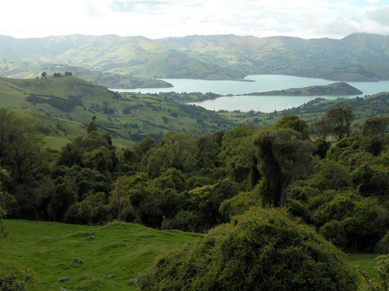 |
One of our first glimpses of the large bay in the middle of Banks Peninsula. |
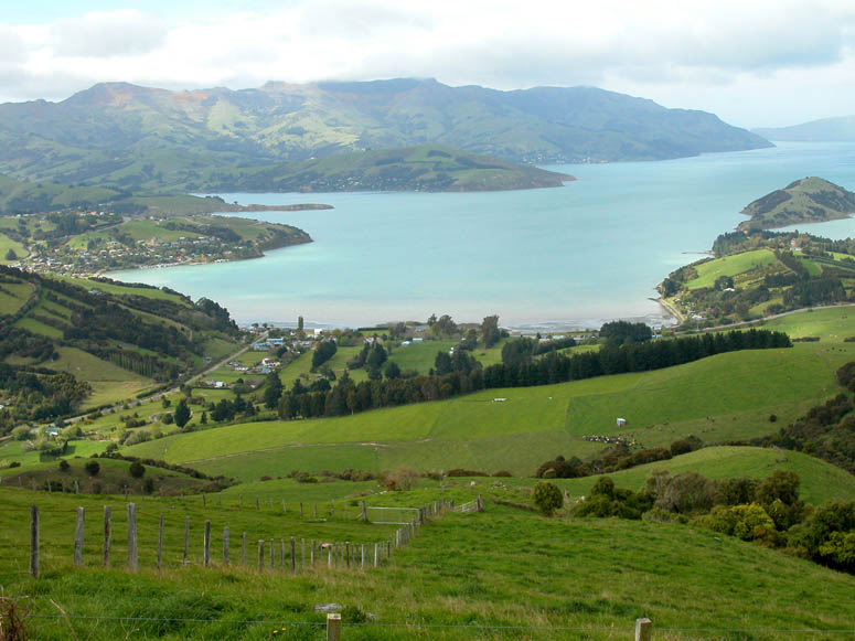 |
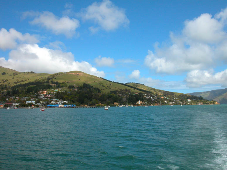
View of almost the entire length of Akaroa Bay. The village of Duvauchelle is at the very end of the bay and the village of Robinsons Bay is on the near left side shore. |
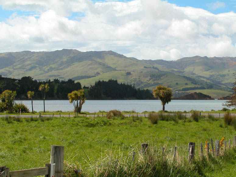 |
Looking out over Akaroa Bay from near French Farm. |
 |
Approaching Akaroa from Highway 75. |
Back to Photo Tour or back to Top of Page
Click on picture to enlarge
 |
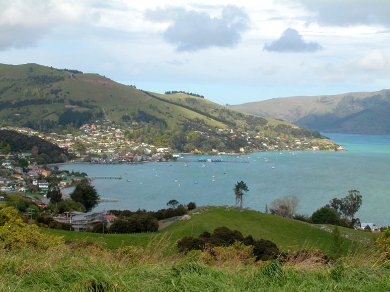
Downtown Akaroa as seen from a boat in the harbor. |
 |
Looking up one of the streets in Akaroa. |
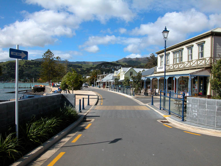 |
The waterfront of Akaroa. |
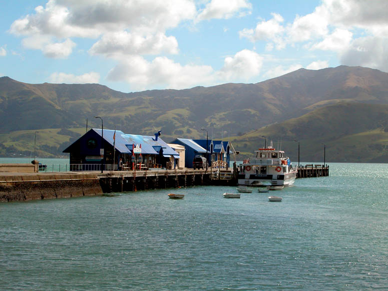 |
The main pier of Akaroa and where the harbor cruise departs from. |
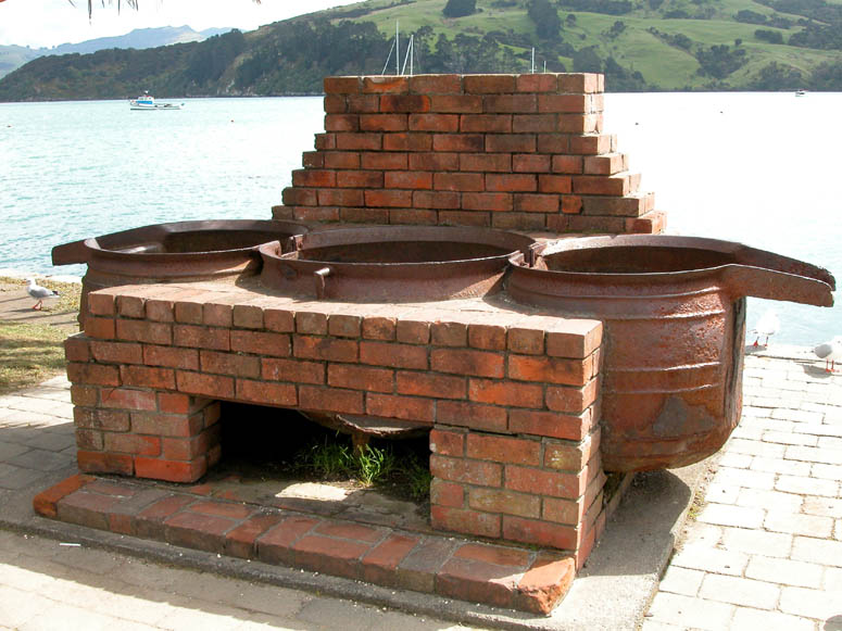 |
Remnants of the whaling industry of the 1800s. This is an old boiler that was used cook whale blubber. |
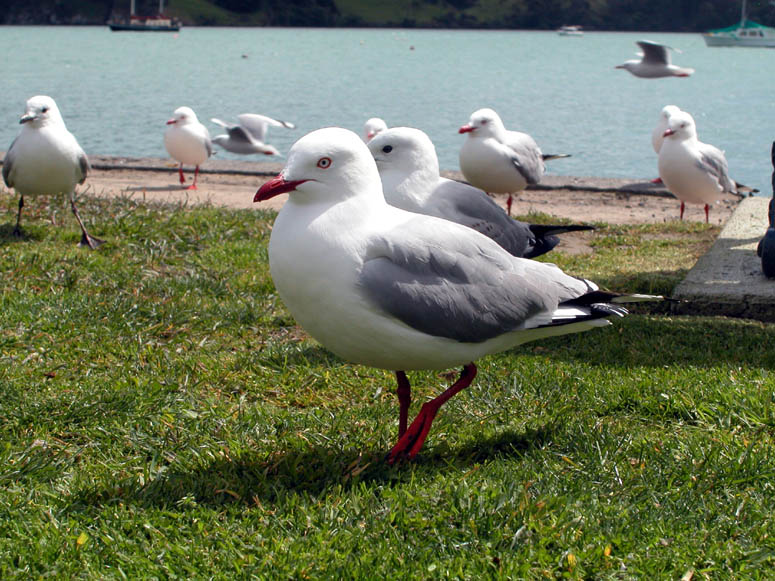 |
The seagulls of New Zealand's south island look a little different then the seagulls of the USA. |
Back to Photo Tour or back to Top of Page
Click on picture to enlarge
 |
View of some of the summer or weekend houses near Akaroa. |
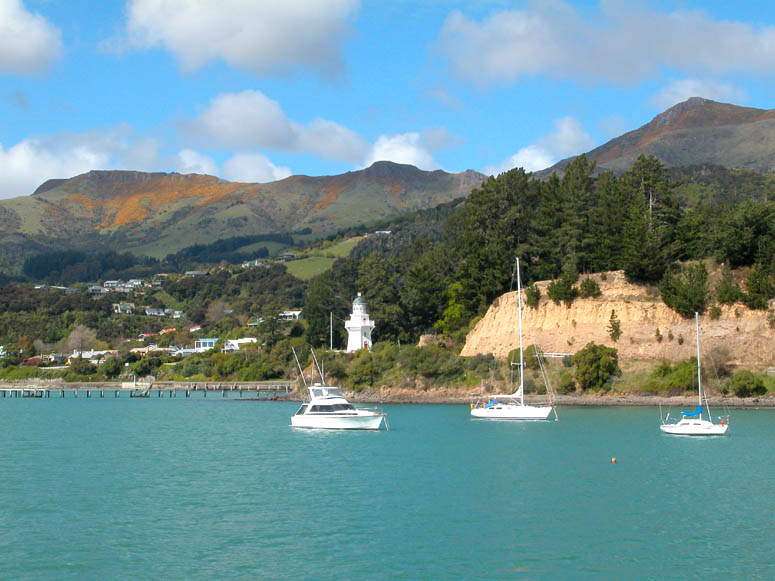 |
The lighthouse that guards the harbor of Akaroa. |
 |
Cruising up the bay (away from the ocean) with a view of Akaroa's pier in the distance. |
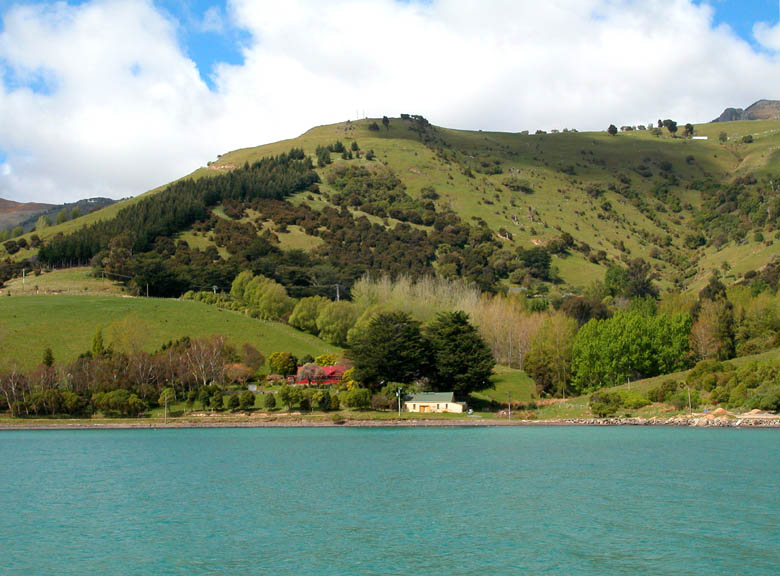 |
A small cottage along the bay west of Akaroa. |
 |
This was the last small settlement, labeled The Kaik on the map, along the bay before the opening to the Pacific Ocean. |
 |
Near the bay's entrance to the ocean, the shoreline is replaced with high cliffs. This is the east side of the bay. |
 |
Cliffs on the west side of the bay - Pacific Ocean is in the distance. |
 |
Much of the shoreline on the west side of the bay slopes down rather steeply into the water. Often, colorful lava rock is exposed near the shore. |
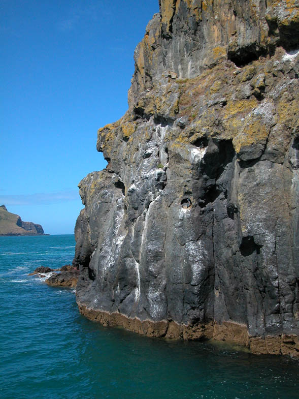 |
Close-up view of a portion of the rocky shoreline on the bay's west side. |
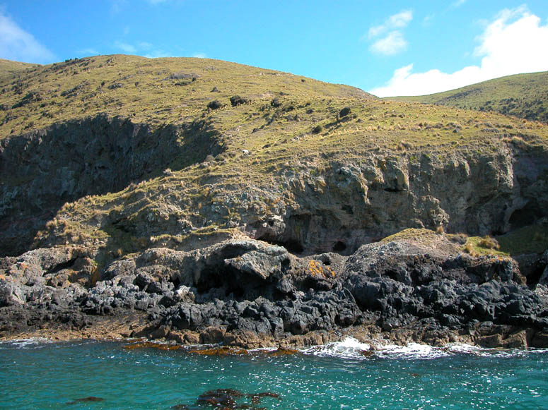 |
More rocky shoreline. |
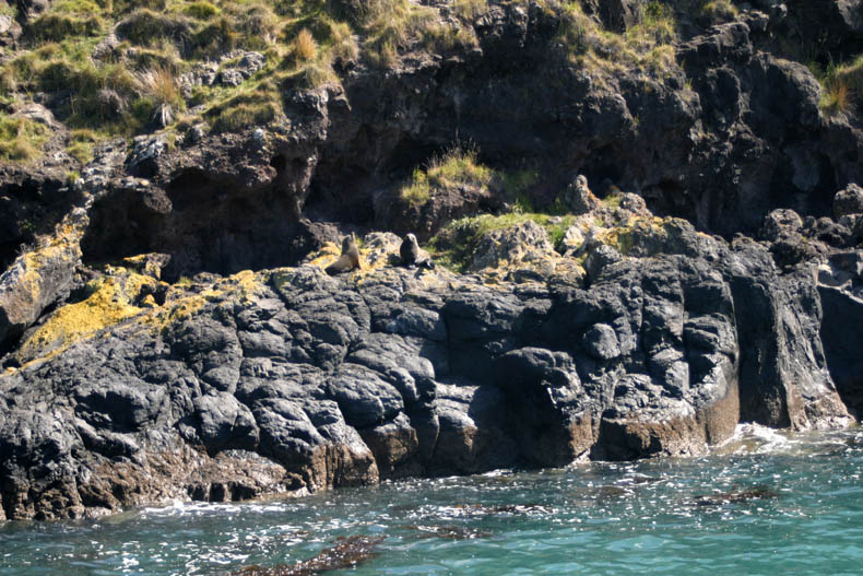 |
Be sure to look closely for wildlife on the rocks. |
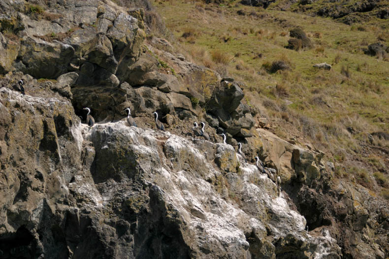 |
The rocks make an ideal nesting spot for many ocean-going birds. |
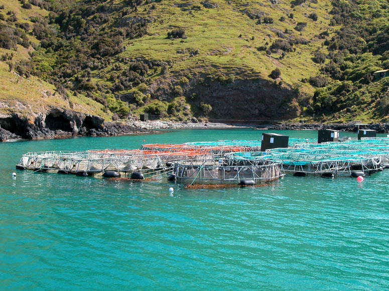 |
Salmon farms are also located along the bay's west side. |
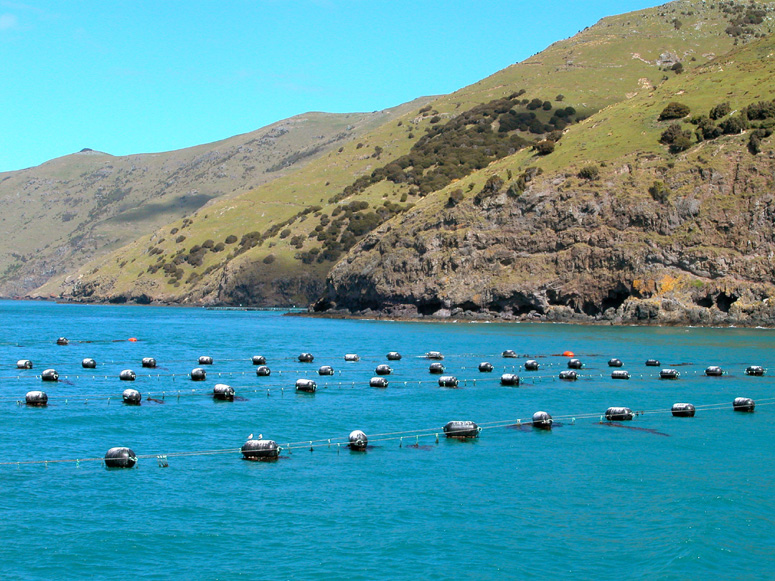 |
More of the Salmon farms. |
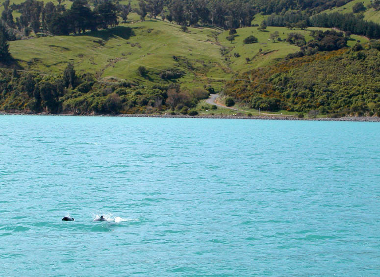 |
A pair of Hector's dolphins are seen in the distance. |
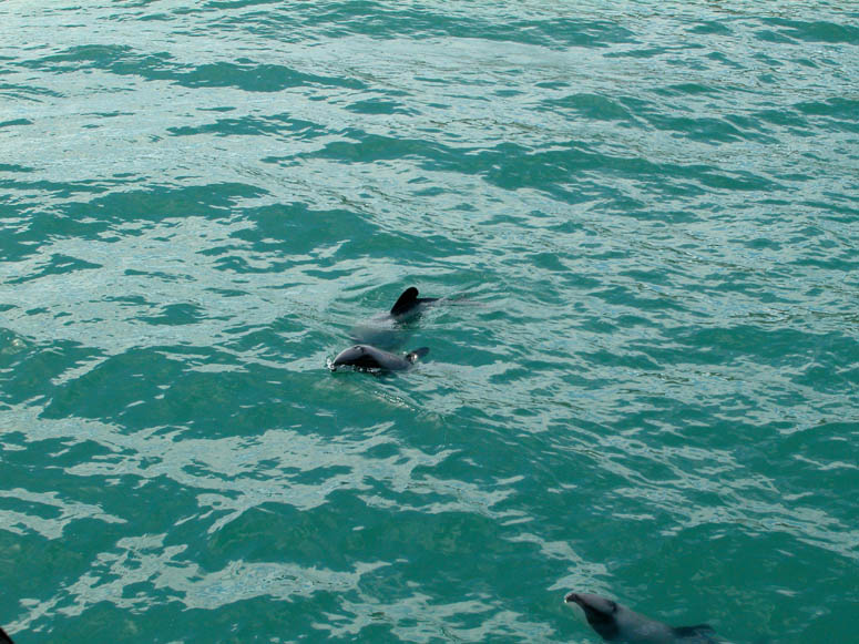 |
Hector's dolphins are checking out our harbor cruise boat. |
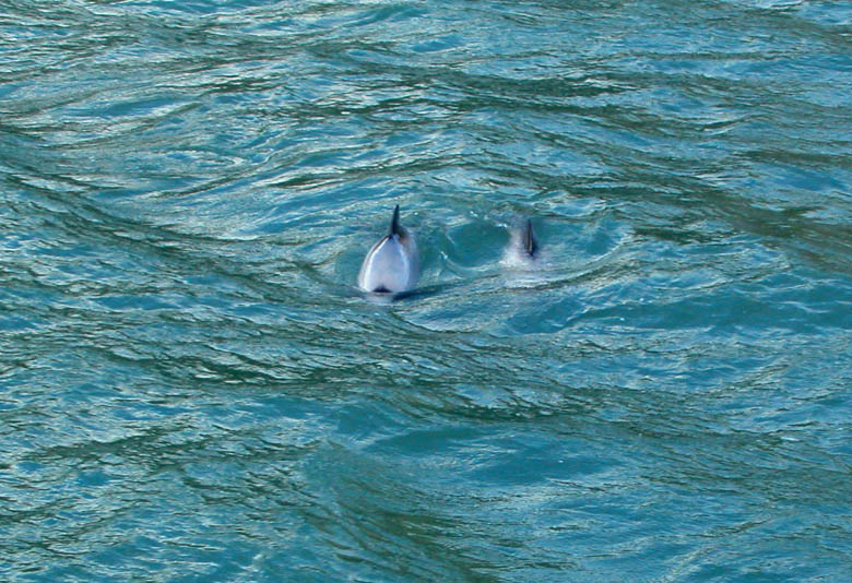 |
Many times, the dolphins simply zoom underneath the boat. |
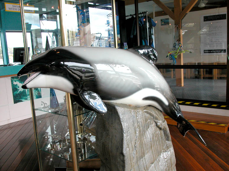 |
An actual full-scale statue of a Hector's dolphin can be seen in the harbor cruise's office which is located on the pier. |
Back to Photo Tour or back to Top of Page
Click on picture to enlarge
 |
One of the dirt roads on the Banks Peninsula hugs a ridge. |
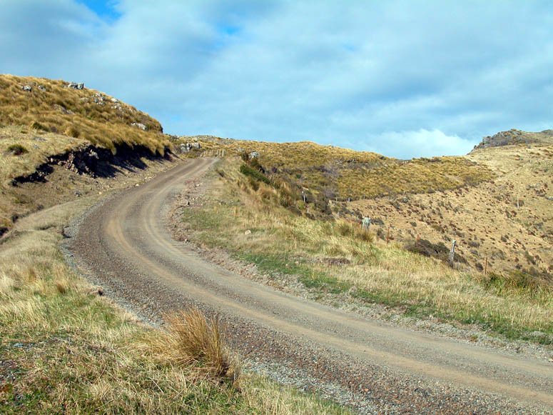 |
An example of a typical dirt road found on the peninsula. Most of the roads we saw can be driven on just about any type of vehicle. |
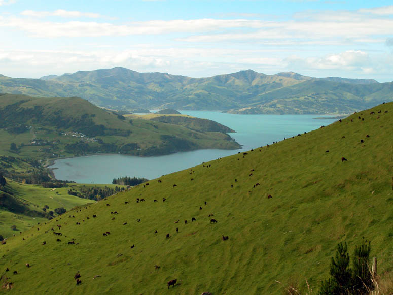 |
Some of the pastures we passed obviously caused the livestock to climb some steep hills. We wondered if some of the animals grazing here would eventual evolve with shorter legs on one of their sides. |
 |
Looking across the bay at Akora which is nestled on the right side of the smaller bay. |
 |
Be sure to stop often and take in the views - just don't enjoy the views by looking out your vehicle's windows. |
 |
Looking south over the Pacific Ocean. The next land fall in this direction would be Antarctica. |
 |
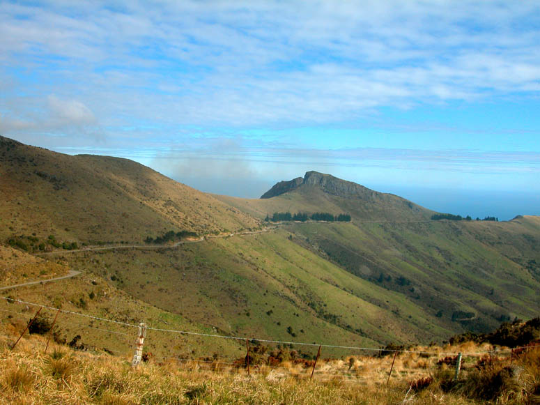
Once, Banks Peninsula used to be heavily wooded with trees like you see in the center of the picture. However, the peninsula was logged and the trees never grew back. |
 |
Another road meanders along a ridge and down to the ocean. |
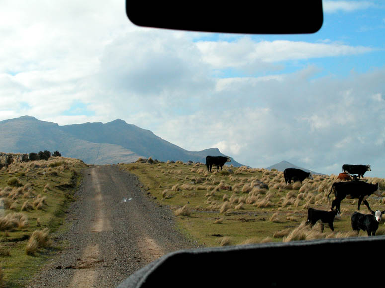 |
Expect to dodge some livestock if you travel these back roads. |
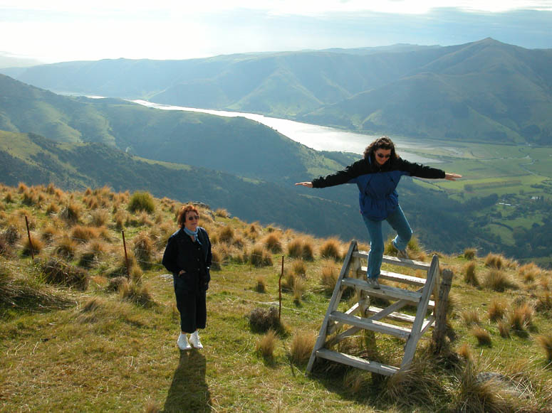 |
Taking careful steps over a fence while looking at a view of Lake Forsyth. |
Back to Photo Tour, back to Top of Page or Home
|
Copyright
© 2007, BackRoadsWest.com |
 Nestled in a bay inside an ancient volcano, this small seaside village
was originally settled by French whalers. Situated not far from
Christchurch on the Banks Peninsula, a trip to Akaroa makes for a great day trip
if you are staying in the Christchurch area. Famed Captain James Cook
accidentally mapped the peninsula as an island, but in reality it is a long
peninsula. It actually originated as an island which was created by a volcano a few
thousand years ago.
Nestled in a bay inside an ancient volcano, this small seaside village
was originally settled by French whalers. Situated not far from
Christchurch on the Banks Peninsula, a trip to Akaroa makes for a great day trip
if you are staying in the Christchurch area. Famed Captain James Cook
accidentally mapped the peninsula as an island, but in reality it is a long
peninsula. It actually originated as an island which was created by a volcano a few
thousand years ago.