|
|
"Knowledge for the western back roads explorer..." |
|
|
Summit Valley, Cajon Pass
and Hwy 66
|
 For those of you who have not used our Internet-based
|
Article Index |
Features |
||||||||||||||||||||||||||||||
|
|
Books That We Recommend:
Road Trip!
Estimated trip mileage: 62 miles
Estimated trip time: 3-4 hours (doesn't account for extended stops)
Start the trip by heading south out of the main SVL entrance on the
parkway. At Bear Valley Road, reset your trip odometer and turn right (west) on Bear Valley Road.
Then immediately turn left (south) on Peach Ave. Resetting your trip
odometer is important as it will help you follow along with the text about the sites to
look for along the way. All mileages given are from the SVL entrance.
Continue on Peach Ave for 4 miles until you reach Main Street’s traffic
light and turn left (east). Continue on Main Street as it turns south and
becomes Arrowhead Lake Road. In 6.4 miles (from SVL’s entrance) you will
reach Hesperia Lake Park. This park is operated by the City of Hesperia and
offers a nice little oasis along the way. Although it is early in this trip,
this spot is great for a picnic.
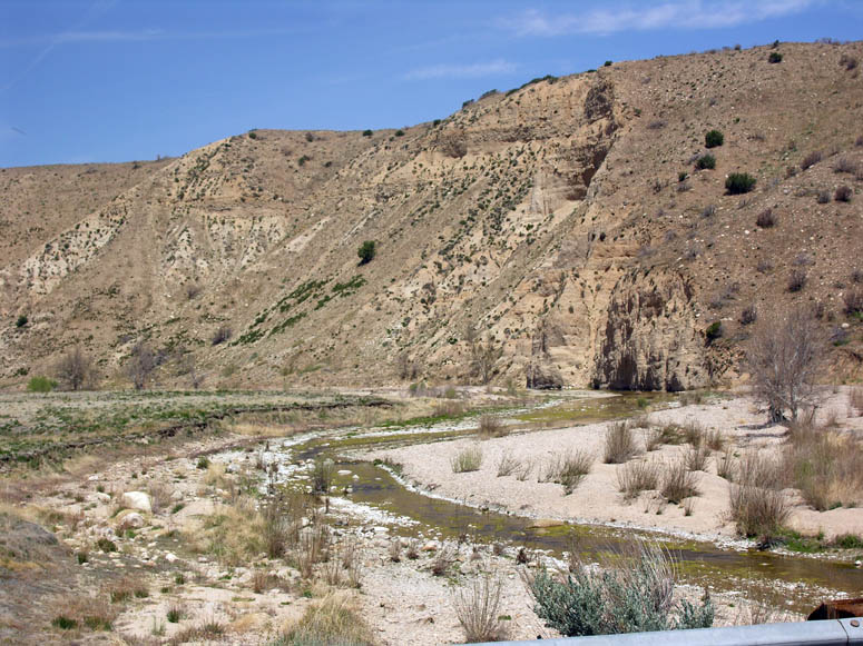
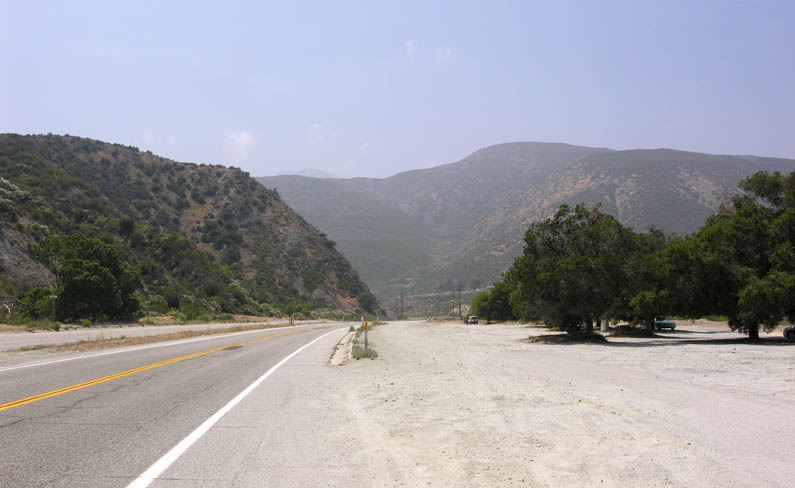
Continuing south, you will reach the Mojave Forks Dam at 9.2 miles [see
picture]. This will be a jumping off point for a hike in a later Breeze
issue. Before crossing the dam, try to look in the opposite direction for a nice view of the
Victor Valley. There is no place to pull over here so don't
attempt to do this while you are driving! After you cross over the dam, you will next be rewarded with
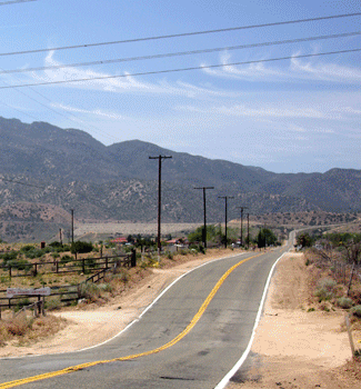
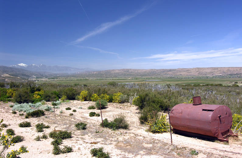
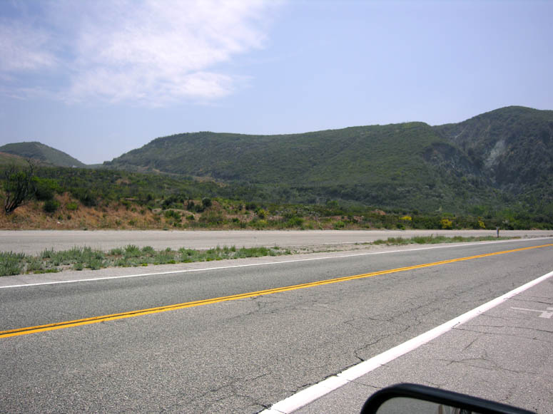
a sweeping view of Summit Valley [see picture] looking to the southwest.
Summit Valley
At 10.1 miles, you will be at a T intersection. This is State Route 173.
Turning left (east) takes you to Lake Arrowhead. But if you are in a
car, don’t even think about taking this road as the pavement ends in one mile. It
is also not a good road to take if you are afraid of heights. Incidentally,
this is the only designated state highway that is a dirt road in the entire
state of California! Turn right (west) to continue the road trip.
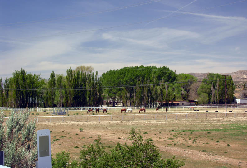
You are now passing through what is known as Summit Valley. For being so
close to an urban area like the Victor Valley, it is a nice rural area to
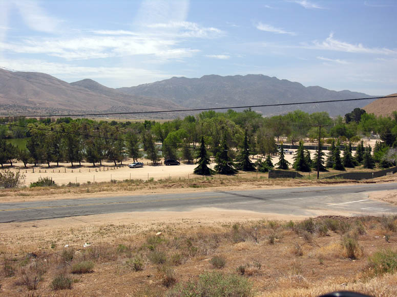
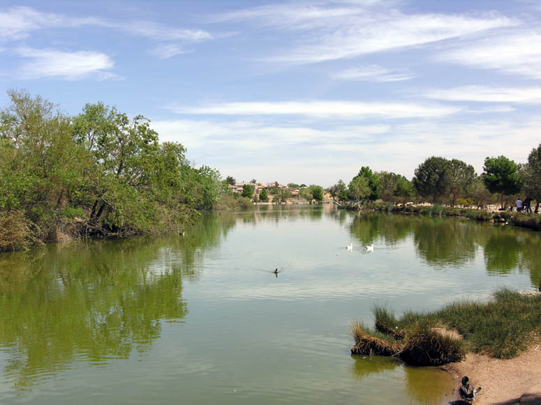
enjoy. At 11.0 miles, you will pass the rarely used Mojave River Forks
Campground on the left.
This makes for another good picnic spot. Along this portion of the road, you
might see glimpses of the Pacific Crest Trail that goes from Mexico to
Canada.
The white fences that you see along S.R. 173 were built by the Las Flores
Ranch. It is also referred to as the Summit Las Flores Development. This property
has had plans in place for the past two decades to build a large community
that would be part of Hesperia. Only time will tell when and if this
development becomes a reality.
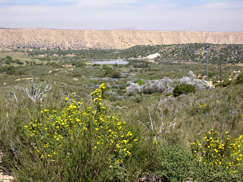
At 14.8 miles, turn left (south) to view Lake Silverwood and Cedar Spring
Dam [see picture]. You will also see more sweeping views of Summit Valley. Like the Mojave
Forks Dam you crossed earlier, this dam was built in the late 1960's as part
of the California Aqueduct. When you are finished enjoying the view, return
back to S.R. 173 and turn left (west). You will pass by the spillway of the
dam [see picture]. This, by the way, is the head waters of the Mojave River
that passes next to SVL. Soon, you will pass by a power plant that was
built in the late 1980's. At 18.7 miles, S.R. 173 ends at a T intersection
with S.R. 138. Turn right (west). Turning left takes you to the main
entrance of Lake Silverwood and the town of Crestline.
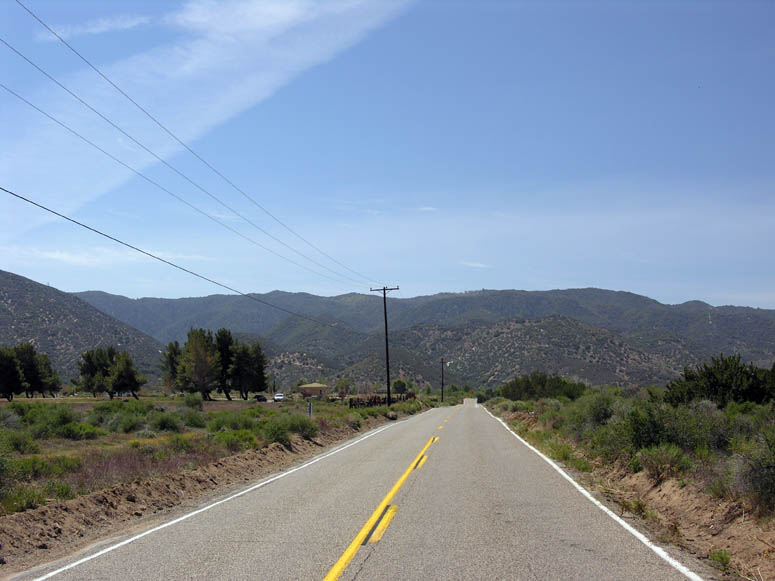
Now on S.R. 138, you will pass by more homes of people that enjoy the rural
living of Summit Valley. The valley ends and, at about 23.6 miles, locate
the large turnout on the right [see picture] and pull into it for a good view.
Summit and the Railroad
This is the highest spot on the railroad. Here you will see the train
tracks directly below you on the right (north). This point is officially
known as Cajon Pass. Across the tracks and to the right was the site of a
small railroad town named Summit [see picture]. The town was removed when
the Santa Fe Railroad realigned the tracks around 1970 and it was no longer
needed with the more advanced railroad equipment of that day.
Now known as Burlington Northern Santa Fe (BNSF) Railroad, their three main tracks are the ones below you. The first line was built in 1885. The second line was built in 1913. And the third line was built just last year – 2008. You will see both BNSF locomotives (either with an orange, a red and silver or a blue and yellow color scheme) and Union Pacific locomotives (colored yellow) on these tracks. The reason why you will see both BNSF and UP locomotives on the BNSF tracks is because the Union Pacific has usage rights on the BNSF rails between the end of the UP line at Yermo (Barstow) and another UP line near Riverside. In exchange, and this is not the complete answer why there are usage rights, BNSF trains can run on the UP line over Tehachapi between Mojave and Bakersfield.
Another odd story is why the two BNSF tracks separate here at Summit and come back together near the truck scales along I-15. The original line built in 1885 followed a steeper route. This is the line that is furthest to the south (it is the line that goes under I-15 closest to the intersection with S.R. 138). Here at Summit, this line was actually rebuilt several times between 1885 and 1900. To eliminate the steep grade, a deeper cut was dug into the mountain and the track re-laid. But this caused land slides onto the tracks. Eventually, the cut was made wider and the landslide problem was solved. The new line built in 1913 follows a grade which is less steep, but is a whole two miles longer than the 1885 line, resulting in a reduced grade. After the 1913 line was built, southbound trains would go down the steeper 1885 line, whereas northbound trains would climb up the Cajon Pass using the new and less steep 1913 line. This made for trains needing to run on the left side rather than the right. So for several decades, the Cajon Pass was one of the only places in the United States where trains on double track could be seen running “left-hand”.
The trains left San
Bernardino already running on the correct or left track and then switched
over to the right side using a cross over bridge right next to our own
Spring Valley Lake. This cross over bridge can be seen from Ridgecrest Road
about half a mile south from the entrance to the Mojave Narrows Park. In the 1970's,
remote control track switches for high-speed trains were perfected and now
there are various track switches located between San Bernardino and Spring
Valley Lake which allow for trains to switch to either the up or down track. By
the way, the new 2008 line follows the same path as the 1913 line. Today,
because of the abundance of track switches, trains can be seen using any of
the three lines depending on the demand of traffic in either direction.
The second set of tracks were originally built by Southern Pacific in 1967 as
a bypass route for trains to get around the Los Angeles area – from Palmdale
to Colton. These tracks can be seen above the BNSF tracks. All through the
pass, these tracks are always located above the BNSF tracks. Since
Union Pacific acquired Southern Pacific in 1996, you will now only see the
yellow UP locomotives run on these upper tracks; no longer will you see the
black and red colored Southern Pacific locomotives. Just west of Summit, a
transfer track was built around 2003 where UP trains can leave the BNSF line
and transfer to the UP line. You can see this new line when you travel on
the last (dirt road) segment of this trip.
Carefully, pull out of the turnout and return to westbound S.R. 138. Past
the summit, the road descends into Cajon Pass and becomes very crooked. There
have been plans for some time to straighten out and widen this part of S.R.
138. Many people in the Victor Valley have hoped for a four lane highway to
be built through this area, so that it could be an alternate to I-15. But so
far, these plans have been far down on the list of priorities – including
the widening of S.R. 138 between I-15 and S.R. 14 in Palmdale.
Cajon Pass
At 24.8 miles, a dirt road leaves the pavement sharply to the right
(north). This is the original Highway 66. If you are planning to take the
off-road portion of this trip, then we will return to this point later in
the trip.
At 25.7 miles, a dirt road leaves the pavement on the left (south). This is
also the original Highway 66. This section of the road follows a wash
through a narrow canyon and comes out where the truck scales are located
along I-15. Before the first road was built for automobiles, there was a toll road
through the Cajon Pass. It was known as the Brown’s Turnpike. It was built
in 1861 out of necessity to transport heavy equipment by horse and wagon
teams to the mines in the Big Bear area, Death Valley and the Sierra Nevadas.
For the Big Bear destination, the Brown’s Turnpike connected with the Van Dusen Road that went from Apple Valley to Big Bear; but that’s another
story. There were two tollhouses on the turnpike. Tolls were collected from travelers that
were in wagons or herding livestock through the Cajon Pass. Just south of
this point is where the upper tollhouse was located. They were located in
areas where the canyon is quite narrow so that travelers couldn’t go around
the tollhouses if they wanted to avoid paying the tolls. The other tollhouse
was located near Blue Cut, which is a stop ahead on our trip. The turnpike
operated until 1882. Both tollhouses have been destroyed by various brush
fires and there is nothing left to see.
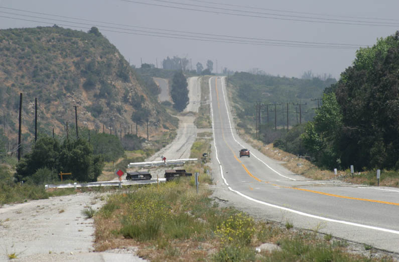
Soon after the previous point, S.R. 138 straightens out and turns into a 4
lane highway. It cuts through a mountain and then descends down to I-15.
This large road cut was made in 1985 in order to obtain dirt for two new bridges
built on S.R. 138 that same year. These bridges cross the railroad tracks
just west of I-15. Before 1985, “at-grade” railroad crossings existed which
snarled traffic when trains passed.
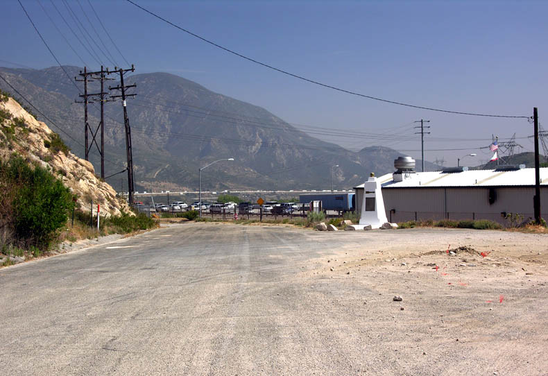
Cross the freeway and jump on to I-15 southbound (the entrance is on the
right side of S.R. 138). Pass the truck scales and take the next exit named
Cleghorn. Turn right, and then make another immediate right. Go to the end
of the paved road and turn around (180º). After turning around, you should
see the railroad tracks on the right side. Just across the tracks was
another small railroad town named Cajon [see
picture]. Similar to Summit, this town was
used during the day of steam engines. Helper locomotives were often used for
the increased grades between Cajon and Summit, so the locomotives were
turned around at these two sites. At Cajon, there was even a turn around
track for the helpers. These tracks were removed in the late 1970's.
At the end of the paved road, a dirt road extends beyond and crosses the
tracks. You can take this road if you wish to explore the site of Cajon.
Often, the railroad uses this large open area to store construction
equipment, as it did during construction of the 2008 line. Providing you
have a 4WD vehicle and Cajon Creek does not have much water in it, you can
go further for a great view of this part of the Cajon Pass. A few of the
railroad lines take a sweeping turn above this point around a large rock formation.
This is known as Sullivan’s Curve and is a favorite spot for train watchers.
There is also a historical site that is literally a stone’s throw from the
southbound I-15 truck scales – just on the other side of the railroad tracks.
This site is property of the San Bernardino County Museum and, the last time
we visited it, has a caretaker living on-site. This site was one of the
buildings originally built during the days of the turnpike.
You may wonder where the name Cajon came from. For those that know Spanish, then you should know that "cajon" means "box". Cajon Pass indeed is a "box canyon". This was always a challenge to the engineers that built the railroad and highways through the pass. It was easy to build a roadbed in the lower (south) portion of the canyon, but to get out of the "box", the upper (north) side, was the challenge. So engineers used the route you see today: snake the roadbed over to one side of the box (the west side), slowly climb the north edge of the box to the other (east) side and then over the top and into the desert.
Get Your Kicks On…
Continue back on to the road that the freeway exit dumped you on. At the
stop sign, reset your odometer again. All mileages from this point forward will be
from this point. Turn right. You are now on the original alignment of
Highway 66. North of this point, modern day I-15 was built on top of old 66,
except for a portion near the summit. North of the summit, old 66 doesn’t
reappear from underneath I-15 until it reaches Seventh Street near the Green
Tree Inn in Victorville.
On the first bridge you cross over, notice that the railing has the year
1930 stamped on it [see picture]. This bridge was from when Highway 66 was a two
lane highway through the pass. It was upgraded to a divided highway in
sections in the early 1950's. What remains today is the divided highway, two lanes in each
direction, going south from this point to the I-15 / I-215 split in Devore.
After Devore, it follows the path of Cajon Blvd. The road you are driving
today only uses the southbound lanes. You will see the abandoned northbound lanes
on the left side of the road. The modern road crosses over to the northbound
lanes about 1.4 miles from the freeway off ramp and then shortly after,
crosses back over again.
To see some pictures of Highway 66 through the Cajon Pass during its
heyday, see:
http://www.gbcnet.com/ushighways/US395/395pics4.html
At 1.7 miles from I-15, a paved road will be found leading to the right
(west) named Swartout Canyon Road. This road crosses all of the railroad
tracks and turns into dirt. It then leads up Lone Pine Canyon and all the
way up to Wrightwood. This is a nice side trip, that passes by Lost Lake,
that you may want to take some other time.
What we know as Highway 66 was originally named National Trails Highway. This was before our government put number designations on highways. National Trails Highway was one of the first transcontinental routes constructed for automobiles. The portion of the route that starts at the mouth of Crowder Canyon and reconnects with I-15 at Oak Hills Road was when the road was known as National Trails Highway. In the 1920s, when the road was realigned, it was also given the designation U.S. 66.
Blue Cut
At 2.5 miles, you will encounter a wide spot on the right side of the
road [see picture]. Turnout into this area. This was the Blue Cut rest area along old 66.
There is a historical marker that explains some details about this area. The
old-looking wall on the side of the road was built for the rest area and is
also reminiscent of 1930's design. The turnout and former rest area actually
continues on for just over a quarter of a mile, so you may wish to drive a
little further and get out again to look around. At the end of the turnout,
the railroad tracks are rather close to the road and there is an old-style
arch bridge that the tracks sit on. The drainage you will see between the
road and the railroad tracks is called Cajon Creek and usually has water
flowing in it year-round.
This is also the location of where old 66 crosses the infamous San Andreas
Fault. Here, you can cross the boundary of two gigantic tectonic plates: the
North American (east side) and the Pacific. The next plate boundary to the
east (the opposite side of the North American plate) is in the middle of the
Atlantic Ocean. The next plate boundary to the west is on the opposite side
of the Pacific Ocean – running roughly between Japan and New Zealand. The
fault line itself is really not visible and is considered a wide “fault
zone” of a few hundred feet across.
If you want to see the San Andreas Fault zone, then you will need to get a view of Lone Pine Canyon. You cannot see it from Blue Cut or Highway 66. The best way to see it is from either I-15 (when on I-15, look for Blue Cut and then the long narrow valley behind it) or by taking Swartout Canyon Road (mentioned previously), cross the two sets of railroad tracks and then drive the dirt road up the middle of Lone Pine Canyon. You will pass a "sag pond", named Lost Lake, which is constantly being fed spring water by the fault. The pond sits right on top of the fault. Lone Pine Canyon is about a half mile wide and about 10 miles along. The town of Wrightwood sits at the bottom of its north western portion.
Another way to view the San Andreas Fault is on your computer. Go
to our Interactive
Google Map, locate and zoom into Blue Cut on the map (you may wish to
read the map
instructions on how to do this) and then switch the map to Satellite
view. On the map, you will see several red balloons. They point
out features on the satellite imagery where the terrain has been pushed up
by the fault's movement. You will notice that it is all in a very
straight line, from crossing I-15, to Lost Lake. This somewhat
straight line of the fault's trace can be followed northwest fairly clearly
all the way to and beyond San Francisco! It can also be traced to the
southeast into the Salton Sea.
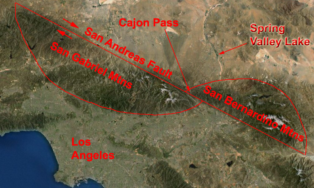
Incidentally, it is the San Andreas Fault that actually created the Cajon
Pass itself. The Cajon Pass is the point that separates the San Gabriel and
San Bernardino Mountains. Originally, both mountain ranges used to be one
and shaped like a football. But the gradual movement of the San Andreas, the
west side moving northwest and the east side moving southeast, split the mountain
range into two. The San Gabriels moved north, while the San Bernardinos
moved south. So now the football looks like it is cut in half with the
opposite ends almost touching each other [see
picture].
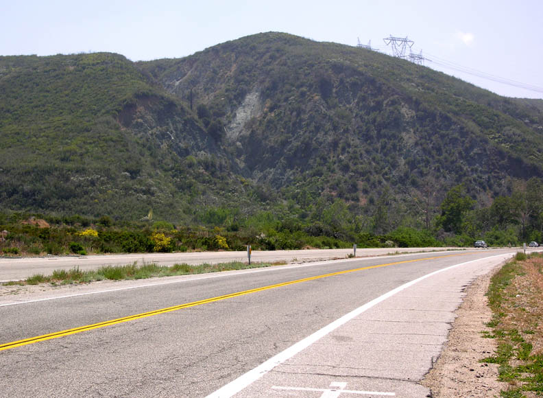
Just before reaching Blue Cut, on the left (southeast) side of the road looking up on the hillside, you
will see what appears to be a highly eroded area [see picture]. This is not
the fault. You will notice that the eroded area has a sort of blue tint to
it. This is the reason why this area of the Cajon Pass is known as Blue Cut
because of this bluish eroded hillside you are looking at.
Continue your journey southbound on old 66. Just after the Blue Cut rest
area, the road and the railroad tracks go through another narrow part of the
pass. Just beyond here is where the lower tollhouse was located on the
Brown’s Turnpike. Again, this area was ideal because it was difficult for
any traveler to go around this point to avoid paying the toll.
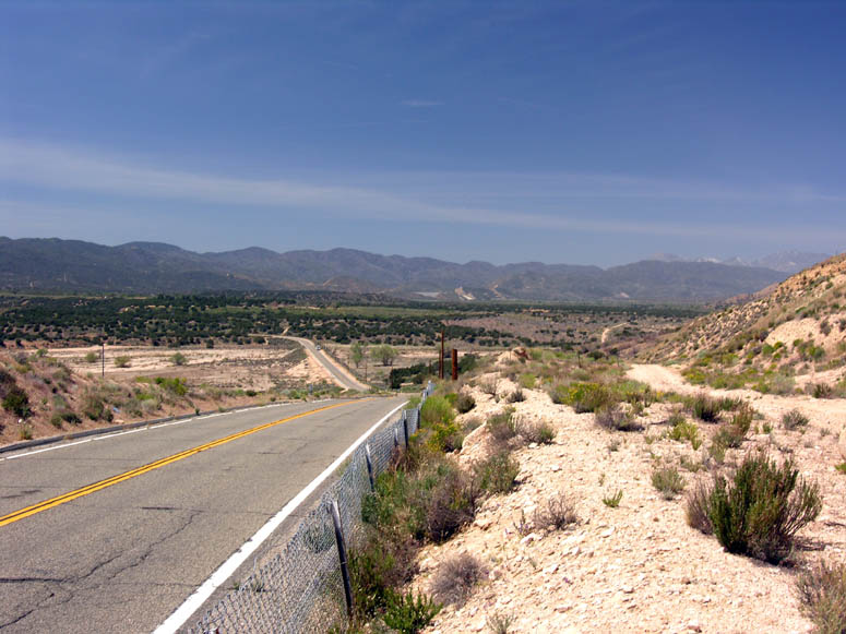
At 3.9 miles, the road straightens out as the Cajon Pass opens up near its
mouth at Devore. Here, you can easily see the old divided Highway 66. At 4.2
miles, a paved road leads to the right named Keenbrook Road. You can take this road to cross
Cajon Creek to see what is on the other side of the canyon. Don't be
surprised if you find people panning for gold here. At 6.3 miles,
this portion of Highway 66 ends and you have to turn left to return to I-15
on Kenwood Avenue. Just before turning left on Kenwood however, if you look
straight (in the continued direction of old 66), you will see how much the
old divided highway eroded away [see picture] since it has no longer been used
since I-15 was
completed in the late 1960's.
Crowder Canyon
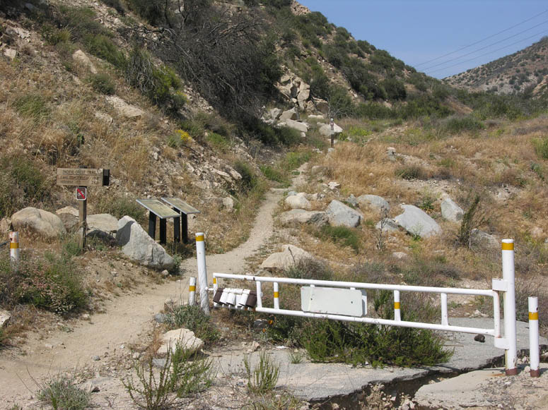
From here, either return back up old 66 (the way you came) for a different view of the pass or jump on northbound I-15 by driving up Kenwood a short distance and then turn left onto I-15. Once back on I-15, exit at S.R. 138. Turn right and then turn right again towards the McDonalds and Chevron station. Continue on this paved road until it ends just behind the northbound truck scales. There is a white historical marker next to the road [see picture]. Park your vehicle here and continue on foot on the paved road as you cannot turn around ahead.
This is the mouth of Crowder Canyon. Here you will find several historical
markers and information plaques about the area [see picture]. This is also
where the original path that both the Brown’s Turnpike and Highway 66
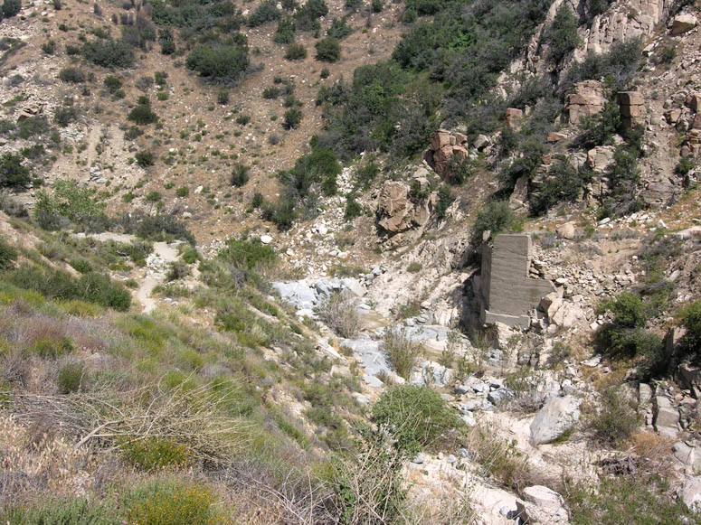
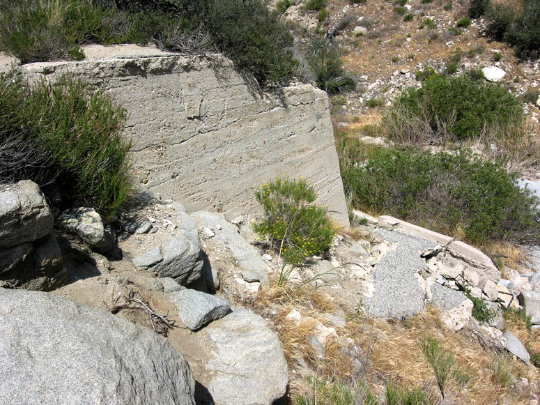
followed. If you walk into the canyon following the hiking trail (this is a
portion of the famed Pacific Crest Trail) a short distance, you will see the
cement footings and foundations of a bridge that was built for the original
Highway 66 [see picture]. The bridge was probably constructed around 1909.
If you feel ambitious, you can follow this well-maintained hiking trail for the entire length of
Crowder Canyon and you will see remains of asphalt blocks that were from the original
roadbed.
When you are finished looking over this area, return to S.R. 138. If you are
not taking the off-road portion of this road trip, which
continues to follow the original path of Highway 66, then return to Spring
Valley Lake via northbound I-15. Certainly, you can find your way home from
here. Otherwise, read on.
More Kicks From 66
Do not take a regular car or automobile on this section of the trip! There are deep ruts along this road and a high-clearance truck or SUV is needed. Four-wheel drive (4WD) is not necessary.
At the stop sign for S.R. 138, reset your odometer once more and turn right. As
mentioned previously, about in the area where the four lane highway narrows
to two lanes is where the original Highway 66 came out of Crowder Canyon.
From this point until you turn off the pavement, S.R. 138 was built on top
of the Highway 66 roadbed.
At 2.2 miles, look for the dirt road that goes off at a slight angle to the
left (north). Turn onto this road, being careful when turning left because
you cannot see on-coming traffic on S.R. 138 very well here. This road
is labeled (signed) as Forestry Road 3N45.
You are now on the original roadbed for old 66. This alignment was used from
the 1910's until it was realigned following I-15’s path, which was less
steep, in the late 1920's (as explained previously). This original alignment was too steep for the new
technology of that day – the automobile. However, this route was just
fine for the current technology: horses pulling wagons.
From S.R. 138
to the first railroad crossing, there used to be many blocks of asphalt that
were randomly dispersed along this portion of the
road, making it a bit difficult to drive it. These blocks of asphalt
were of the same vintage as those you saw in
Crowder Canyon. Just within the last five years however, the Forestry
Service refinished this road and removed much of the asphalt. You may
spot a few pieces, but they are now difficult to find. The asphalt was
originally laid down in the 1910's and what remains now are chunks that have
not eroded away. Along this stretch of road, if you look up slightly to
the left, the large cuts in the mountainside are those of I-15 climbing to
its summit. You can probably spot some big trucks crawling up the
grade.
At 2.8 miles, you reach the first railroad crossing. This is the original
1885 line. Just after that, you will go underneath
the 1913 and 2008 line. A short distance later, a second railroad crossing is reached for the
Union Pacific line built in 1967. Look to the east and you will see where
you were about an hour earlier – at the old site of Summit. You might also
be able to spot the new crossover line between the BNSF and UP tracks.
Continue climbing this road and at 3.7 miles it reaches an intersection with
another dirt road. Turn left (northwest). At 4.2 miles, look for a turnout
on the left for a fantastic view of the upper Cajon Pass. See if you can
retrace the route you just took through the pass. You can barely see Summit
to the left (southeast). You cannot see past the hill that Crowder Canyon
cuts through near the truck scales.
This concludes our trip through Summit Valley and the Cajon Pass. From here,
continue the short distance on the dirt road until you reach the Oak Hills
Road intersection with I-15 and find your way home to Spring Valley Lake.
Be sure to take the Photo Tour below and click on the picture to make it
larger. We hope you enjoyed your Road Trip!
Photo Tour
Click on picture to enlarge
Pictures taken: May 2009
 |
Hesperia Lake Park on the left side of Arrowhead Lake Road. |
 |
Looking at Hesperia Lake. |
 |
Driving south on Arrowhead Lake Road past Hesperia Lake Park. The entire Mojave Forks Dam (two segments) can be seen in the distance. |
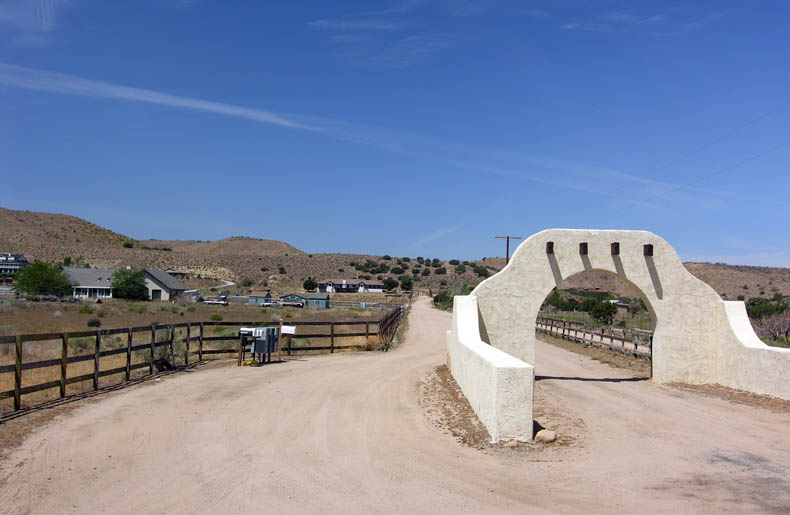 |
One of the ranch entrances. |
 |
Beginning to climb over Mojave Forks Dam. |
 |
Looking north, back towards the Victor Valley. |
 |
View of Summit Valley after crossing Mojave Forks Dam. |
 |
Driving over the Mojave River past the dam. |
 |
Approaching the Mojave River Forks Campground. |
 |
View along side S.R. 173. |
 |
S.R. 173. makes several sharp turns. |
 |
The sweeping views of Summit Valley. |
 |
Several small lakes can be seen in Summit Valley. |
 |
Driving west on S.R. 173. |
 |
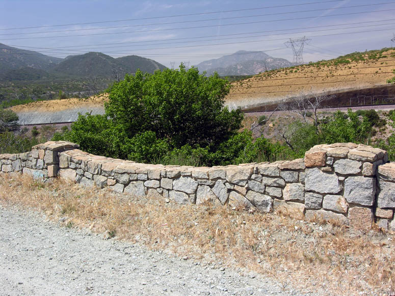
The future entrance of the Las Floras Ranch residential development. |
 |
The white fences of Las Floras Ranch. |
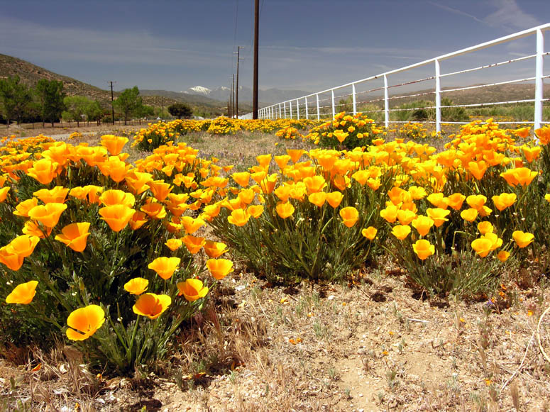 |
California poppies blooming along S.R. 173. |
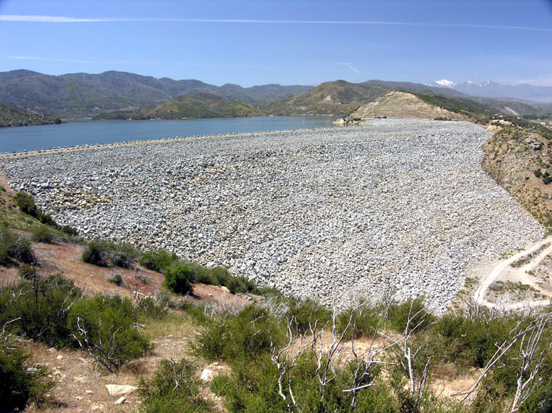 |
Cedar Spring Dam. |
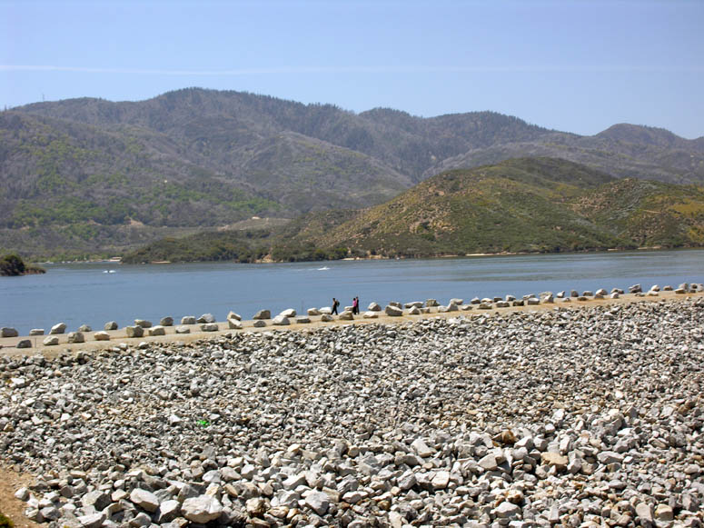 |
Closer look at Cedar Spring Dam and Lake Silverwood in the background. |
|
|
Panorama of Summit Valley looking northeast from Cedar Spring Dam overlook. |
|
|
Same picture as above but with callouts. |
 |
Looking west from the overlook towards the western end of Summit Valley. |
 |
Cedar Spring Dam's spillway. Certainly, the skateboarders seen playing around the SVL Post Office would love to skate down this chunk of concrete! It is, of course, illegal to do so. |
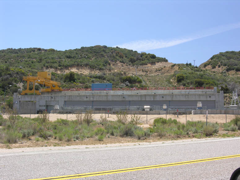 |
The Mojave Siphon Powerplant that generates electricity solely for the pumps along the California Aqueduct. |
 |
Passing by the headquarters of Las Flores Ranch. |
 |
This building used to be an elementary school. It is seen just before S.R. 173 ends at S.R. 138. |
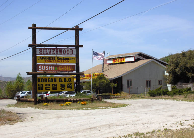 |
If you are driving through Summit Valley and you have an urge to eat some Sushi, then you will be in luck! |
 |
Once on S.R. 138, you will notice more residences in this part of Summit Valley. |
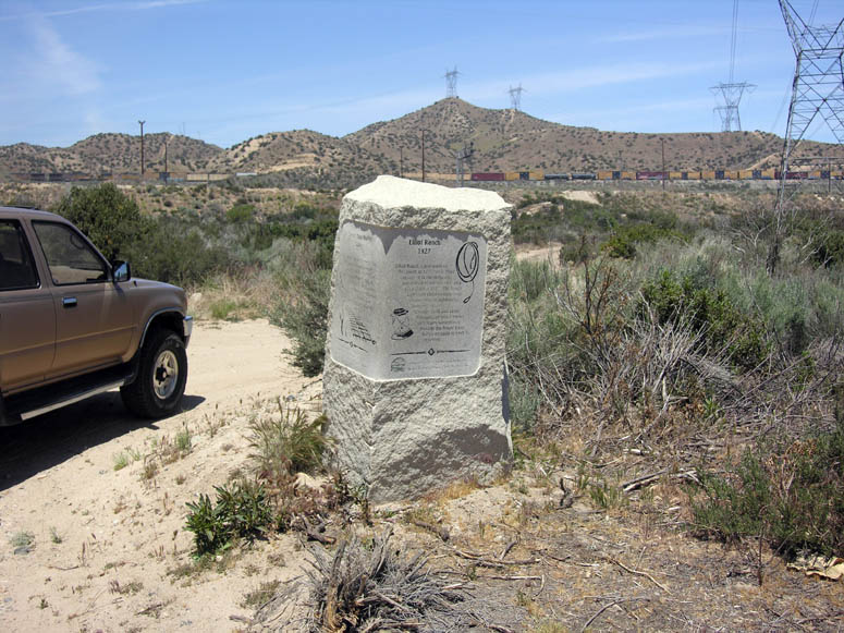 |
Just before reaching Summit, there is this monument on the right side of the road. It mentions the "Summit train station" and Elliot Ranch. |
 |
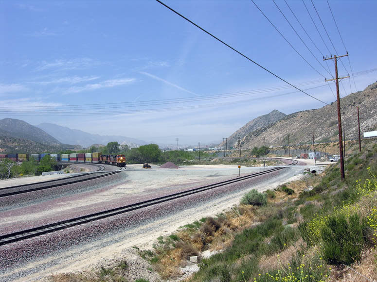
This is the large turnout at the summit of S.R. 138. Pull over to the right here and you can look down over the edge onto the railroad tracks. Don't get too close! It is about a 60 foot drop-off. |
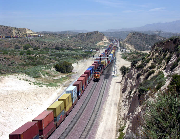 |
Looking over the edge from the turnout. View is to the east. The train on the right is using one of the track switches to transfer from the 1885 to the 1913 line. The train on the left is on the 2008 line. |
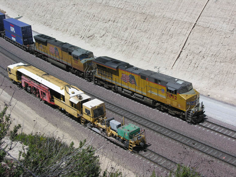 |
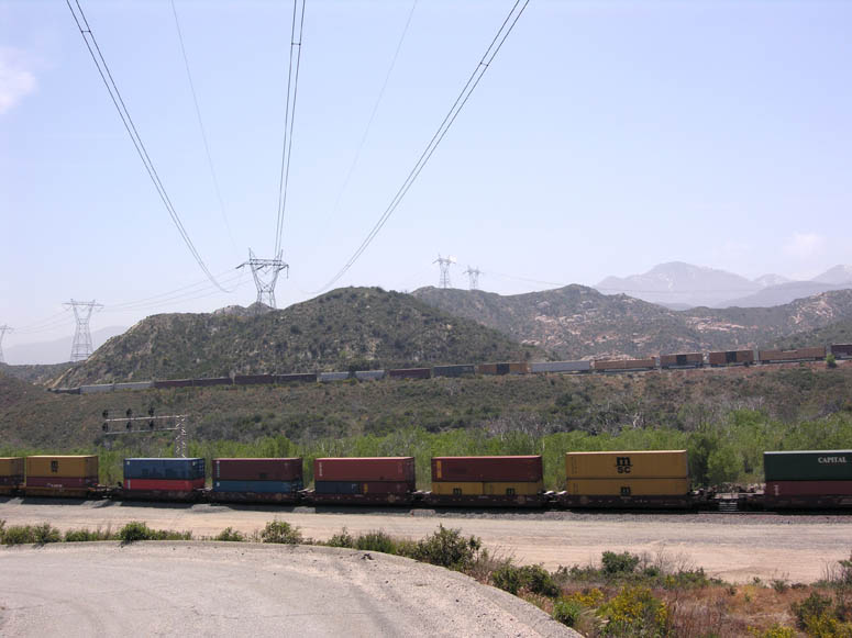
A Union Pacific stack-train is racing a small construction train over the summit. For those that like details, the first UP locomotive is an AC6000CW built by General Electric and puts out 6,250 horsepower, while the second is an SD70M built by the Electro-motive Works of General Motors and puts out around 4,300 horsepower. |
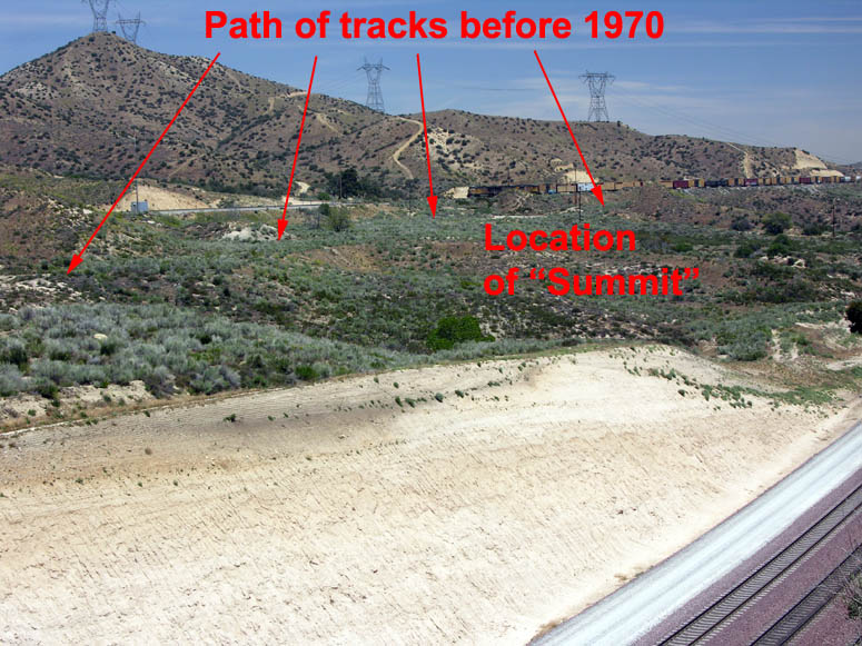 |
To eliminate a tight turn which caused numerous derailments, the BNSF tracks were completely realigned in 1970. This occurred at the same time that the railroad removed the town of Summit. This picture points out approximately where the small town used to be located. |
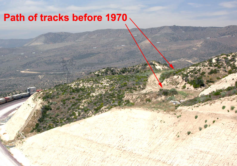 |
Looking towards I-15, you can see where the path of the tracks were before 1970. |
|
|
Panorama of the Cajon Pass from the turnout on S.R. 138. (you may need to use the scroll bar at the bottom of your screen) |
|
|
Same picture as above but with callouts. |
 |
The site of Cajon as seen from the short paved road just after exiting I-15. |
 |
Looking west at the rocks above Sullivan’s Curve. You spot the tracks going through the curve just below the large rock formation. |
 |
Looking northwest towards the I-15 truck scales and where the 1885 railroad line rejoins the 1913 line. |
 |
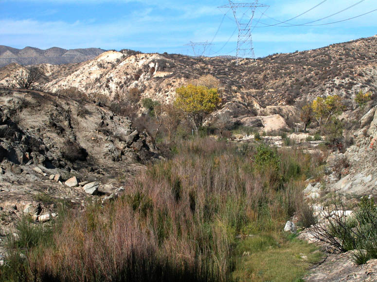
One can think that the Cajon Pass is just full of trains and power lines. But because of its location, the Cajon Pass is a very important transportation corridor. |
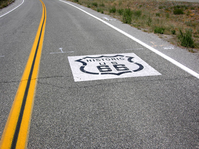 |
Historic 66 highway signs are painted on the pavement. |
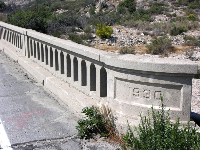 |
A bridge, located less than one mile south of I-15's Cleghorn exit, still sports the "1930" stamp of when it was built. |
 |
Approaching Blue Cut which was named for the eroded hillside with the slight bluish tint seen in this picture. |
 |
A wider picture left of the same eroded area. The base of this ridge is roughly the non-visible fault line of the San Andreas. |
 |
Satellite image and diagram showing the San Andreas Fault's role in creating Cajon Pass and splitting the San Bernardino and San Gabriel mountain ranges. |
 |
Approaching the old Blue Cut rest area. |
 |
The old, fancy walls built along the rest area. Our current-day highway department definitely doesn't make 'em like they used to! |
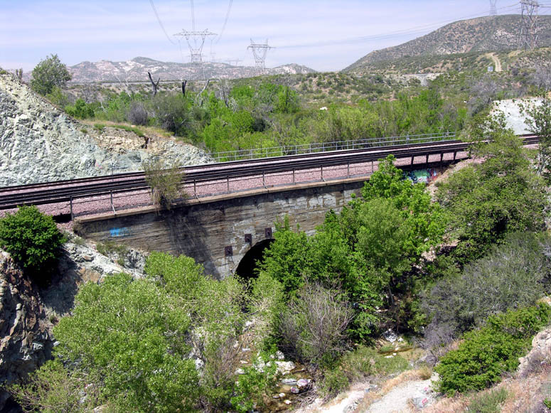 |
At the end of the rest area (south side), you can see this old-style arch bridge that the BNSF tracks sit on. |
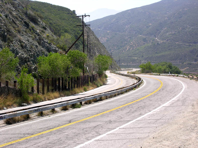 |
The original divided Highway 66 snakes through a narrow segment of the pass just south of Blue Cut. |
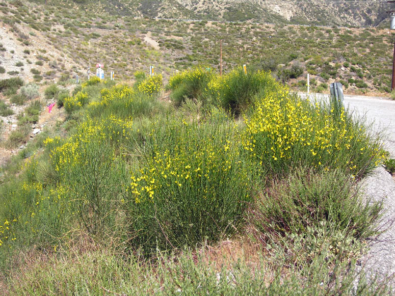 |
During the months of May and June, you will see an abundance of bushes with these yellow flowers in the Cajon Pass. This is Spanish Broom (Spartium junceum). If you are not familiar with this plant, it has a great smell. So be sure to stop and take a whiff of this plant if it is blooming. |
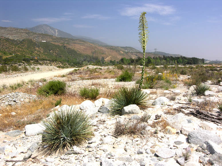 |
Also during May and June, you will certainly see lots of these stalks. This is known as Hesperoyucca whipplei (Yucca whipplei with many sub-species), Our Lord's Candle, Spanish Bayonet or simply the "common yucca". Their white blooms will be very abundant in the lower part of the Cajon Pass. |
 |
A common bush that you may see is the bush poppy (Dendromecon rigida). Its brilliant yellow flowers can be spotted from a distance. Because this plant does well pioneering in new areas that have been affected by fire (it doesn't like to compete with other plants), the numerous fires over past few years have helped this plant get well established now in the Cajon Pass and Summit Valley. It was not common 5-10 years ago. |
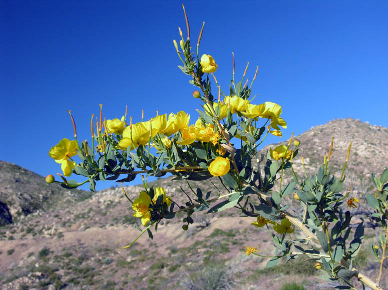 |
A closer look at the bush poppy's leaves and yellow flower. The flower and seed pods look like a typical poppy flower. |
 |
Highway 66 follows a more straight path as it goes through the lower part of the pass. |
 |
If you look over the barrier where the drivable portion of Highway 66 ends at Kenwood Avenue, you will see the eroded pavement of the divided highway. |
 |
Meanwhile, back to the middle of the Cajon Pass, this is the scene behind the northbound truck scales of where you can park your car and walk up Crowder Canyon. |
 |
The beginning of the trail through Crowder Canyon. Several information plaques explain the ecology of the area. |
 |
Not more than a hundred feet into the canyon, you will see a cement footing that used to hold a bridge of the original Highway 66. |
 |
Close look at the cement footing on the other side of the canyon. |
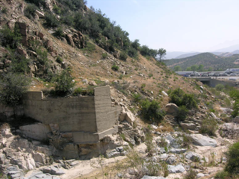 |
You can see how close this site is to I-15. |
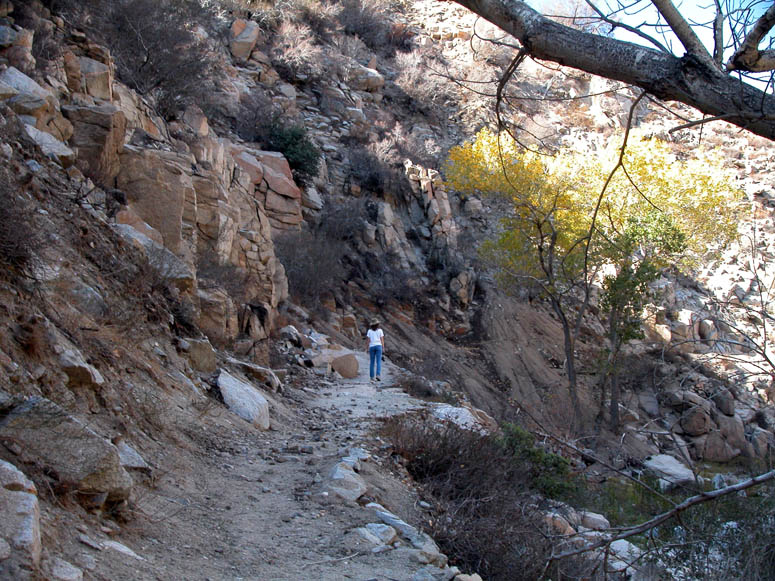 |
If you feel ambitious, you can follow the Pacific Crest Trail, which sits on the old Highway 66 roadbed, for the length of the canyon. |
 |
Hiking out of the north end of Crowder Canyon. I-15 can be seen in the upper left. |
 |
After leaving Crowder Canyon, this is the turn-off from S.R. 138 onto the old Highway 66. It is now known and signed as Forestry Road 3N45. |
 |
Approaching the railroad crossing of the 1885 line. Just after that, the 3N45 road goes underneath the other two BNSF lines. |
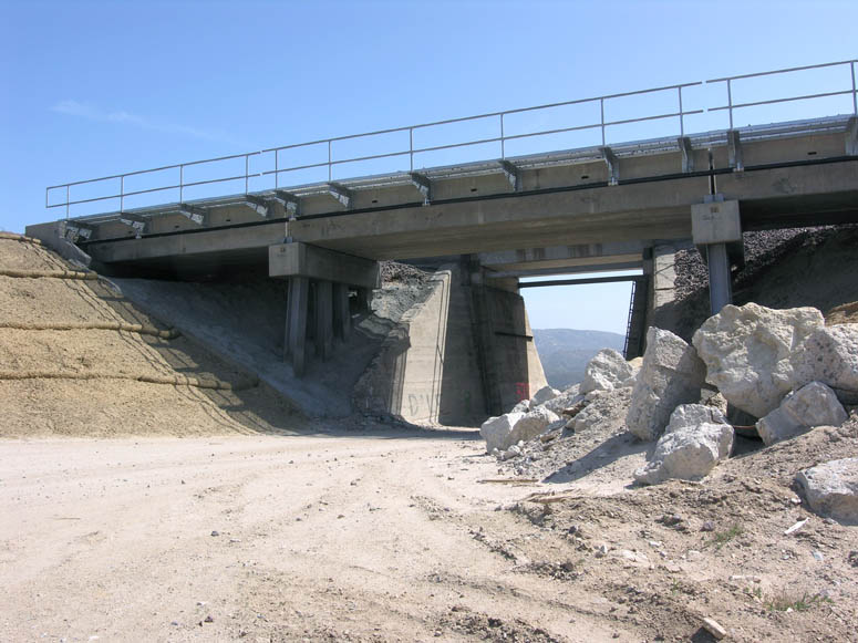 |
BNSF railroad bridges over 3N45. |
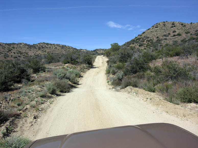 |
After crossing the UP line, the old roadbed of Highway 66 continues to climb rather steeply. |
 |
Almost at the top of the Cajon. |
|
|
The turnout with the view of the Cajon Pass just before
reaching Oak Hills Road. (you may need to use the scroll bar at the bottom of your screen) |
|
|
Same picture as above but with callouts. |
Back to Photo Tour, Top of Page or Sample Trips
Last updated November 06, 2011.