|
|

|
|
|
|
|
 Aiken
Cinder Mine
Aiken
Cinder Mine
|
|
|
Books That We Recommend For This Area:
Getting There

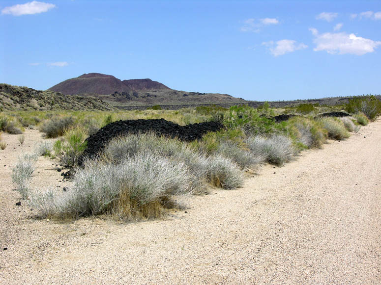
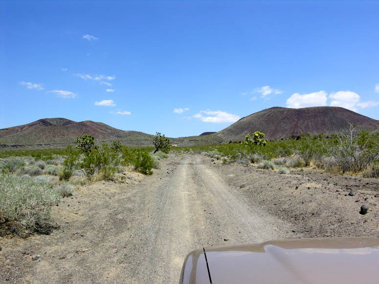
Aiken Cinder Mine is 7.3 miles (11.7 km) north of Kelbaker Road or 16.4 miles (26.4 km) south of the intersection of I-15 and Cima Road. The only way to get there is via Aiken Mine Road which is described in the Aiken Mine Road Trip chapter and you will need at least a high-clearance vehicle.
History
Before the Mojave National Preserve was created in 1994, there were only two active cinder mines in this area (the Aiken and Cedar Cima) and, of those two, only the Cedar Cima Mine was still operating in 1994. Today, the owners of the Cedar Cima are still conducting what looks like a losing battle with the N.P.S. [glossary] regarding further leasing and ownership rights.
In addition to the two active mines, there were many claims on other cinder cones in the area where only minimal assay work took place. Annual assay work was essential for miners who didn't want to lose their mining rights to someone else and evidence of this work is visible on just about every cinder cone in the Preserve. Unfortunately, even this minimum work has left permanent scars on these colorful cones in the form of road cuts and notches.
As with many mines in the area, detailed information about their history is hard to come by. To the best of our knowledge, the following information is true. The Aiken Cinder Mine was owned by the same people who owned the nearby Cedar Cima Mine and rented or leased the mines to others to operate. In 1990, the operators of this mine, the Aiken Cinder Mine Company, could not pay their rent and the mine was abruptly shut down. In their haste to leave, the operators simply walked away, leaving all of their equipment behind and that is what you see there today.
The Aiken Cinder Mine encompassed one large and one small cinder cone. By 1990, more than 9.2 million tons of cinder had been mined from these two cones, however, 7.8 million tons of that is still laying in piles around the mine today. Only the other 1.4 million tons went to market. About 22,000 tons of cinder was sold to a company in Las Vegas which in turn used it for building the sidewalks and walkways of the now-famous Las Vegas Strip. Of the cinder used to build the Strip, 70% of it came from the Aiken Cinder Mine.
Cinder, a type of small volcanic rock, has many uses in today's world. Some of those uses include being decorative rock for landscaping, briquettes for barbeques, material for road construction, traction for snowy roads (instead of salt) and the main ingredient for various home building supplies. With the population explosion in the southwest over the past 50 years, demand for these cinders has been quite high.
Not all cinder cones produce the type of cinder that can be mined and there are only a few of these special cinder cones in the southwest. Two of them along I-40 between Barstow and Ludlow, Pisgah Crater and Malpais Crater, have been active for many years (see Other Mojave Desert Cinder Mines Photo Tour below). There is also a large cinder mine (Red Hill) along U.S. 395 between Ridgecrest and Lone Pine that has been operating for decades.
Because of all of the leftover machinery here, looking around the mine site is very interesting. You can actually drive your vehicle into the cinder cone and see how the miners rigged different apparatuses to extract the cinder. Unlike most mine sites, there are no dangerous vertical shafts to watch out for here but there are still dangers. Stay off of the machinery and watch for sharp objects on the ground.
Currently, the N.P.S. regards the mines as just another chapter in the Preserve's historic past and, at this time, has no plans to remove any of the decaying equipment.
 Photo Tours
Aiken Cinder Mine
Click on picture to enlarge
Pictures taken: November 2003 and May 2006
 |
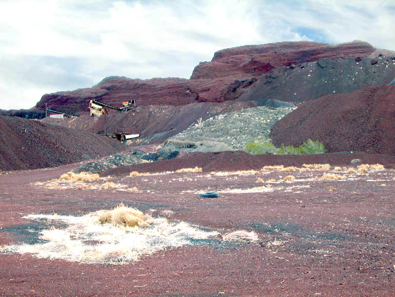
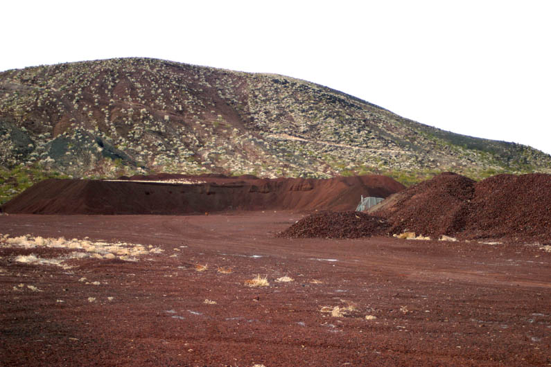
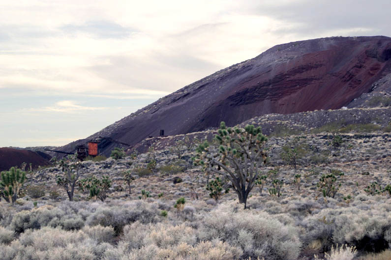
Just south of the mine, along Aiken Mine Road, notice the various piles of cinder dumped by the miners for some reason. The cinder cone that was mined is in the background. |
 |
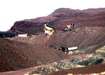
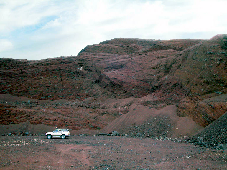
Approaching the two cinder cones mined at Aiken. The dark area in the middle distance of the picture are tailings [glossary]. |
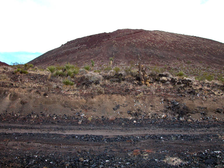 |
The side of this cinder cone doesn't look unusual but... |
 |
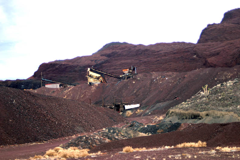
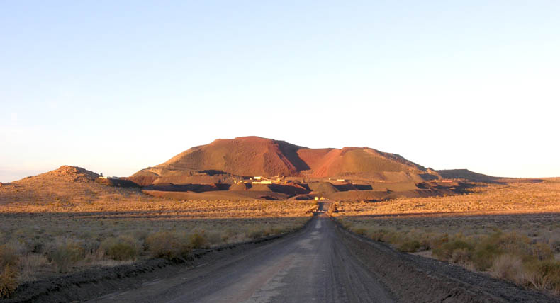
...the other side does. It is the Aiken Cinder Mine that has been gnawed at by miners for decades. |
 |
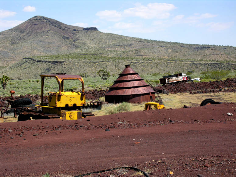
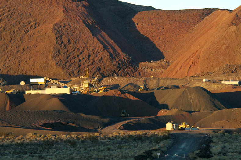
When we visited the mine in 2006, it was easy to drive around and see all the workings. |
 |
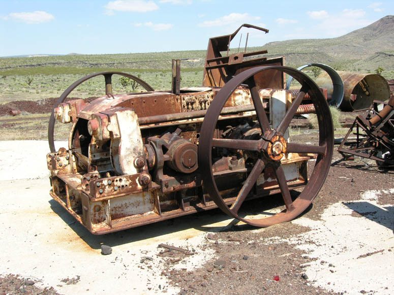
Most of the equipment seems to have been left behind by the mine owners. Hopefully, the equipment will still be there for future explorers to enjoy. |
 |
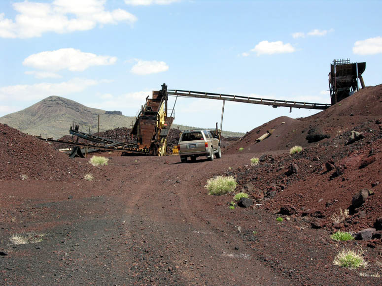
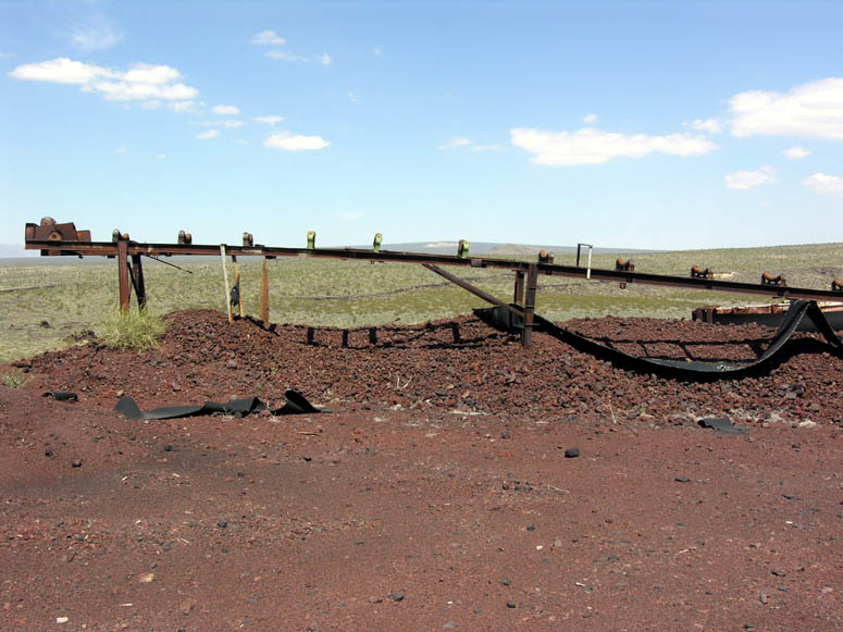
These conveyer belts, which come out of tunnels from an upper level of the mine, dumped ore into waiting trucks. |
 |
The next level up from the previous picture is where the rock crusher and other milling equipment is located. |
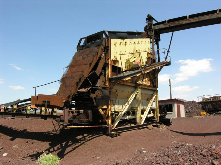 |
This was the one large rock crusher used at the mine. Its job was breaking down chunks of lava rock into small cinders of about 2 to 3 inches (5 to 8 cm) in diameter. |
 |
This Caterpillar diesel engine looked like it might be able to be revived, giving power to the rock crusher once again. |
 |
At the upper level, there are various conveyers pointing in various directions. |
 |
Another conveyer track pointing to an abandoned pile of cinder. |
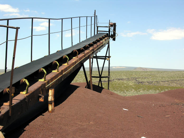 |
This conveyer still had its rubber belt in tact. Yes, that is Cima Dome in the background and, although the angle of the picture makes it look like this conveyer dumped ore and created the Cima Dome, it is, of course, just an illusion. |
 |
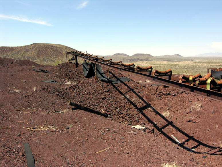
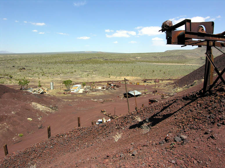
Looking northwest at the smaller cinder cone that was also mined and the conveyer belts used to load trucks below. |
 |
Near the western end of the mine site, large piles of red and black cinder are ready for market and await a haul track that will probably never arrive. |
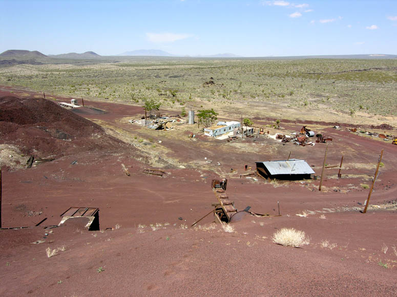 |
Looking north over the mine's decaying office and maintenance shop. |
 |
Looking north by northeast from the upper level - Cima Dome and the Ivanpah Mountains are in the far distance. |
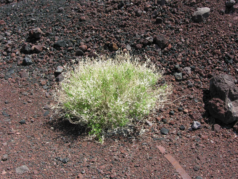 |
The small plants that grow here appear bright and stand out like a fluorescent beacon compared to the stark red and black cinder . |
 |
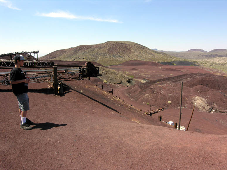
From the upper level, you can walk or drive further in to where the cinder was mined and be deep inside a cinder cone that was created many thousands of years ago. |
 |
It is easy to see here how much cinder was mined by looking at how much of the cone is missing. |
 |
This portion of the mine is now a "drive in" volcano! |
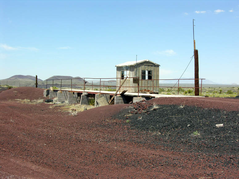 |
The truck scale used to weigh product before it went to market. |
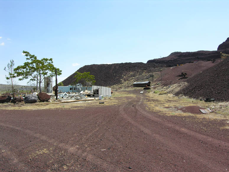 |
Road leading around the mining office. |
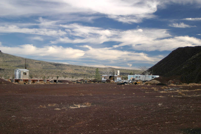 |
Another view of the mobile home/office and truck scale. |
 |
More piles of cinder waiting to be hauled away. |
 |
More equipment left behind by the miners. |
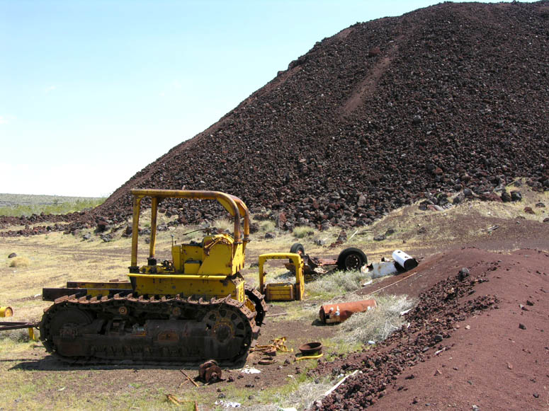 |
Perhaps it was this bulldozer that was responsible for creating the large tailings of cinder in the background. |
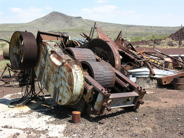 |
Near the shop is a pile of battered equipment. |
 |
Another piece of equipment resting in the big pile - who knows what its job used to be? |
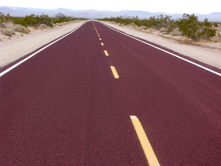 |
Cinder was obviously used as road base on various portions of Kelbaker Road and many other roads throughout the Mojave Desert. Maybe this cinder came from the Aiken Cinder Mine? |
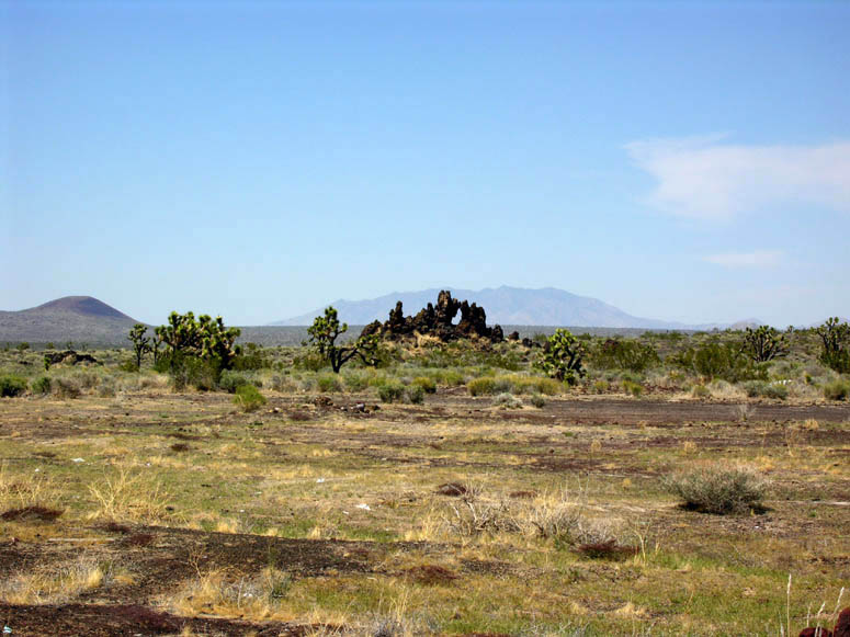 |
About 200 feet (60 m) north of the mine office is this peculiar looking lava formation. It is well worth the short walk out to take a closer look. The Clark Mountains are in the far distance. |
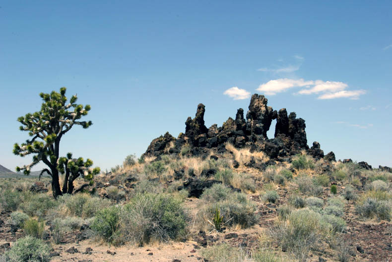 |
Joshua Tree growing next to the lava formation. |
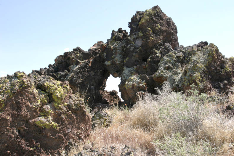 |
Peering through the small hole of the lava arch. |
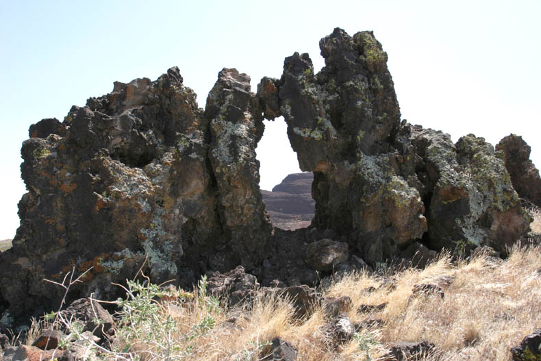 |
Looking through the opening at the Aiken Cinder Mine. |
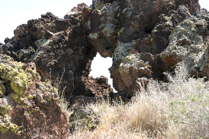 |
Another look at the lichen-covered formation. |
 |
The formation from another angle. |
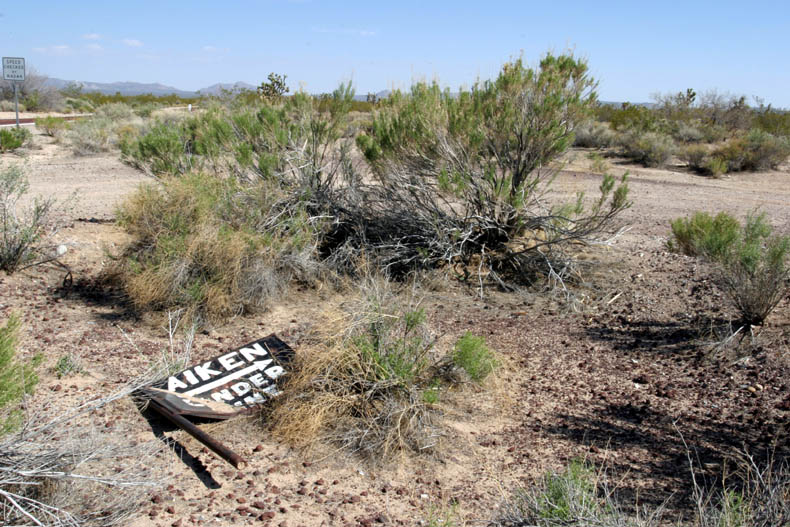 |
At the northern end of Aiken Mine Road, this old sign once pointed the way for truck drivers to get to the mines. |
Back to Aiken Cinder Mine photo tour or back to Top
![]()
Other Mojave Desert Cinder Mines
Click on picture to enlarge
Pictures taken: 2006
 |
The Cedar Cima Mine located just south of the Aiken Cima Mine. |
 |
Malpais Crater, southeast of Barstow, has also been mined for decades. |
 |
Closer look at the mining operation inside the isolated Malpais cinder cone. |
 |
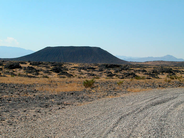
Pisgah Crater, as seen from I-40, is located west of the small town of Ludlow and was another heavily mined cinder cone. |
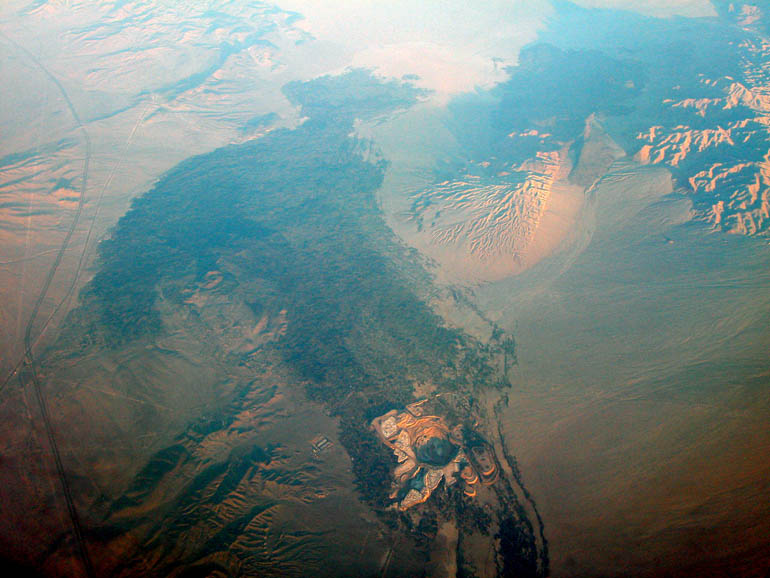 |
Aerial view of the Pisgah Crater and the Hector Mine mine (which is not visible from I-40). Although cinders are mined at the crater, the lava that spewed out of Pisgah Crater contained something even more valuable - a mineral named Hectorite. |
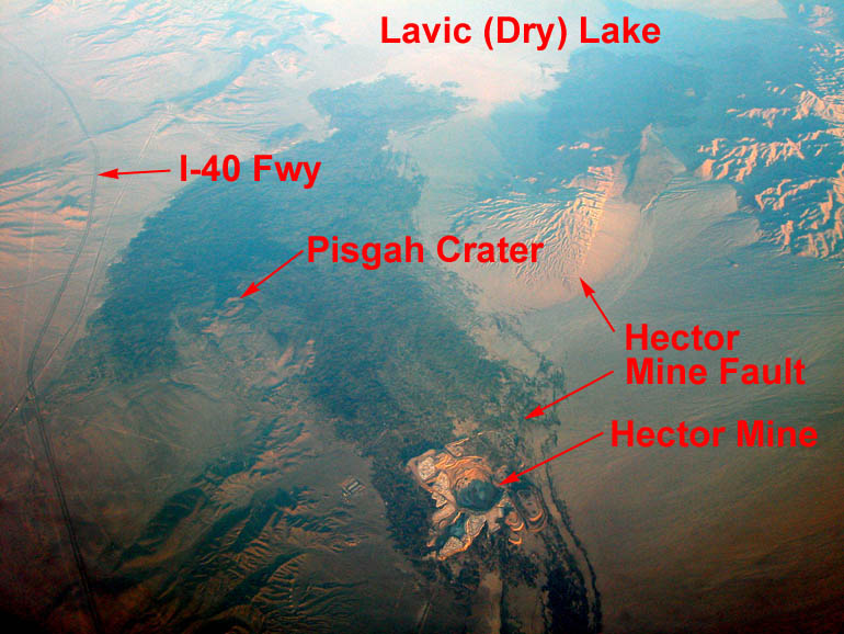 |
Same picture as above but with callouts including the Hector Mine/Lavic Lake Fault that caused the large 7.1 magnitude Hector Mine Earthquake in October of 1999. |
 |
The only un-touched cinder cone is Amboy Crater. With the exception of the very small Split Cinder Cone in Death Valley, Amboy Crater is the only cinder cone in the Mojave Desert that hasn't been mined. |
Back to Other Mojave Desert Cinder Mines, Photo Tours or back to Top
Last updated November 06, 2011
Back to Sample Trips
Last updated November 06, 2011.