Smoky Mountain & Smoky Hollow Road Trip

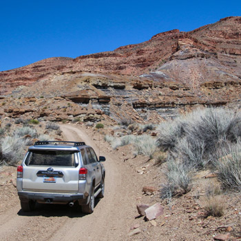
This road trip is a rather adventurous dirt road trip through some amazingly colorful and simply stunning Utah scenery. Our road trip is a loop that will take the average driver most of the day to complete. It starts and ends in the small town of Big Water, Utah, near Lake Powell, about 16 miles from Page, Arizona.
Trip Specs
Length
- Driving:54 miles (86 km) roundtrip
Attractions
- Outstanding colorful scenery
- Expansive views of the Lake Powell area
- Fascinating geology
- Unique canyon hike
Difficulty
- All dirt roads
- High-clearance vehicle needed
- 4WD not necessary but preferred
- Remote area – no services
- Limited cell phone service
- Easy to follow roads
Elevation Gain
- About 1,400 feet (423 m)
Our Trip
The route of our road trip mostly traverses Smoky Mountain Road, also known as BLM road 300. It uses the southern 27 miles (43 km) of the road, however Smoky Mountain Road spans from Big Water to the town of Escalante, a length of 77 miles (123 km).
The route passes through two separate units of the National Park Service (NPS). The first half passes through the Glen Canyon National Recreation Area that includes Lake Powell. The second half loops through the Grand Staircase-Escalante National Monument, which is administered by the BLM. See our separate article on the Grand Staircase to learn more about this area rich with things to see.
Geographically, the road passes around the northwest edge of Lake Powell over a fairly flat area for 12 miles, passing the towering cliffs of the Kaiparowits Plateau on the left side. It then begins climbing a long winding canyon into the plateau. After reaching the top of the Kaiparowits Plateau, the route descends steeply down the side of a cliff.
Traveling the route we recommend is a great way to experience the “overlanding” craze that has been popular over the past several years. One can wake up in a comfortable hotel in Page, Arizona, spend the day taking our road trip, then return to Page. No camping is necessary. However, one can spend two or more days exploring the Kaiparowits Plateau region off Smoky Mountain Road.
Getting There
As mentioned, the route begins and ends in Big Water. Get there using US Hwy 89. Big Water is reached by driving northwest from Page for 16 miles (25 km) or by driving east from Kanab, Utah for 56 miles (89 km).
Locate the Grand Staircase-Escalante National Monument Visitor Center on the south side of Hwy 89. The beginning of Smoky Mountain Road is directly across Hwy 89 from the visitor center. Stop in at the visitor center to check on road conditions of both Smoky Mountain and Smoky Hollow Roads. The visitor center also has a wealth of information about the Kaiparowits Plateau, mainly in our understanding of dinosaurs, that you may wish to learn about before leaving on the trip.
Take the road heading north across from the visitor center. The street sign is labeled Ethan Allen. Continue north for three blocks. Look for the somewhat hidden sign pointing the direction to Glen Canyon National Recreation Area that’s hidden between two warehouses. There is no sign that indicates the way to Smoky Mountain Road or Escalante. When you pass between the two warehouses, our road trip officially starts. Reset your trip counter here to coincide with mileages listed in this article.
Shelf Above Lake Powell
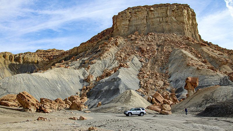
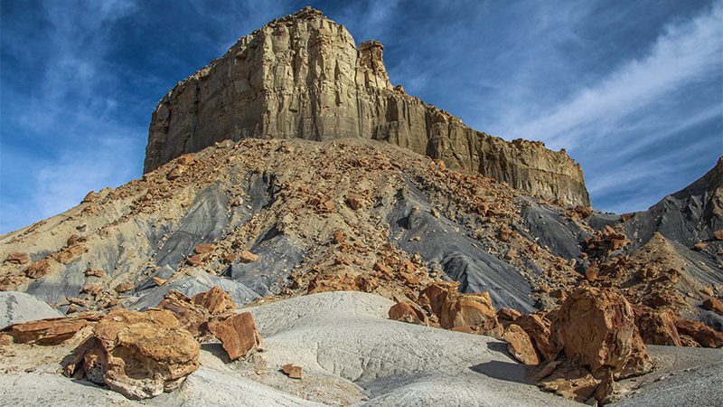
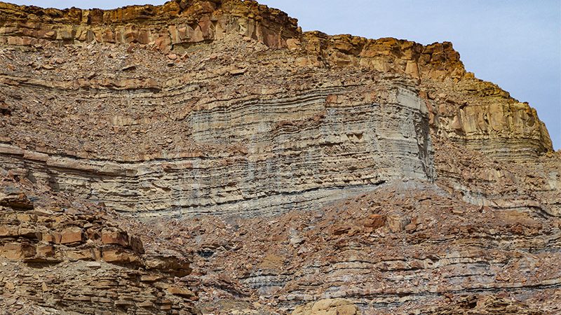
The first 12 miles of our journey passes above Lake Powell on a fairly flat shelf atop the white-colored Entrada Sandstone geologic rock layer. The road passes by the rolling gray hills of the Tropic Formation. Just above these rolling hills are the near vertical cliffs of the Kaiparowits Plateau made up of the Straight Cliffs Formation.
Wahweap Creek
After leaving Big water, the paved road descends into a ravine carved out by Wahweap Creek. When you look at a map of Lake Powell, the creek forms the most southern arm of the lake pointing west. Its headwaters are all the way near the town of Henrieville along SR Hwy 12 near Bryce Canyon National Park.
Usually, crossing Wahweap Creek is easy and straightforward. However, because its drainage covers a large geographic area, if there was a recent storm in that area, Wahweap Creek could be a raging river. If it is, do not attempt to cross it! When Lake Powell was more full, sometimes the waters would backflow all the way up to this crossing.
Balanced Rock
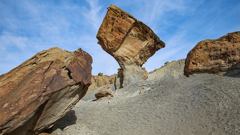
About 2.5 miles from crossing Wahweap Wash, an area with a bunch of large fallen boulders will be seen on the left nearby one of the towering cliffs of the Kaiparowits Plateau. There will also be a large balanced rock (providing its base hasn’t eroded away by now). This is a fun little area to explore on foot with its maze of boulders.
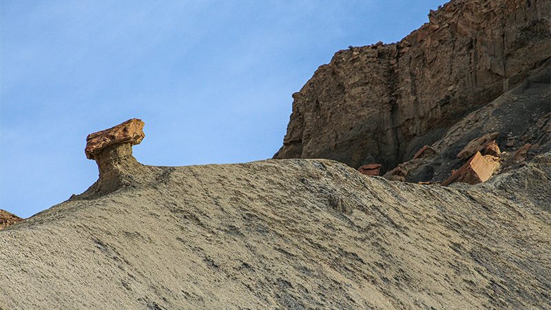
If you closely examine the balanced rock, the following explanation is most likely how it formed. Notice the rock is a boulder that fell from the cliffs above, as the cliffs are the same color. The rock’s pedestal is made up of the grayish Tropic Shale that erodes real easily. When the boulder first fell and landed, the Tropic Shale was much higher. As shale erodes away rather quickly, mostly from rainfall, the boulder protected the shale below it like an umbrella. As all the shale around the pedestal eroded away, the shale protected by the boulder remained. Some day though, the pedestal made of shale will erode and the boulder will fall to where the level that the shale is today. Who knows, by then, the process may have repeated itself with another one of the fallen boulders.
Wiregrass Canyon
About 4.7 miles from Big Water, a trailhead and small pull-out will be seen on the right side of the road. If you have an hour to spare, it’s worth exploring—this canyon features striking, weathered rock walls shaped in ways you won’t see elsewhere.
You can hike down the canyon as far as you would like. To see its best features, plan on walking about two miles roundtrip from the trailhead.
From the trailhead, look for the trail on the other side of the drainage. The trail leads down a wash for about half a mile to an impassable pour-off (small cliff). Look for the bypass trail on the left just before the pour-off. This trail will lead over a ridge and then drop down into the canyon on the other side. This drop is a little steep but very manageable.
When the bottom of the canyon is reached, turn right (up canyon) back towards the pour-off. Along this short section, the canyon walls are highly decorated with very unique honeycombed rock we haven’t seen anywhere else. These honeycombs were created in the Entrada Sandstone, the same geologic formation that formed the toadstools in the nearby White Rocks area.
Turning left (down canyon) will pass through canyon walls that get higher and higher. About another half mile down the canyon, another canyon passes very close to the Wiregrass Canyon. Water erosion created a hole between both canyons, so you can pass through the hole and explore both canyons if you wish.
See the video above to see examples of the honeycombed walls and the rest of the canyon. When you’re done exploring, return to your vehicle following the same route you came in on.

Smoky Hollow
At 12 miles from Big Water, a road junction is reached. Smoky Mountain Road heads to the right; we’ll return to this point later. Our route has us bearing left onto Smoky Hollow Road or BLM Road 330. Shortly after the intersection, you’ll see a sign marking the entrance to Grand Staircase-Escalante N.M. and exit from Glen Canyon N.R.A.
Smoky Hollow starts out as a very wide canyon with several tributaries that are also wide. One of those tributaries contains another road, Tibbet Canyon Road, that crosses another section of the Kaiparowits Plateau and returns to Big Water. We have yet to explore this road.
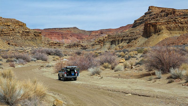
As the canyon becomes more narrow, the road becomes more rough. On the several occasions we’ve driven it, our Toyota 4Runner handled it with ease—we didn’t even need to engage four-wheel drive. Overall, the roads appear to be well maintained.
Coal Seams
About 23.5 miles (37.6 km) from Big Water, on the right, look for a black band of horizontal rock underneath a beige rock overhang. This black band is a coal seam and is the best seam that we’ve seen to easily look at along our entire route.
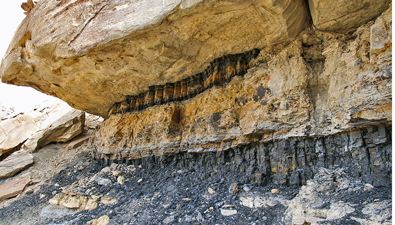
This is real, genuine, coal. It’s this coal, found in seams like this throughout the Kaiparowits Plateau, that was part of the reason why this area is now a national monument. Because of the abundance of coal on the plateau, several coal mines were proposed in the 1970s. However, because the plateau was difficult to access and the coal was far from a market, the economics of mining the coal was not feasible. But that could change depending on the market.
Environmental groups used this reason and others to develop plans to create the national monument we have today. It became reality in 1996. Learn more about the monument and the issues in the GSENM article.
With this coal seam close to the road, it’s easy to get out and inspect it. We’ve taken a chunk of coal home and tried to ignite it, but it wouldn’t burn. Keep that in mind, as well as how far you’ve climbed up Smoky Hollow so far as this will be useful knowledge at an upcoming stop.
This coal was created during the Cretaceous period, some 70-90 million years ago. During that time, this area consisted of swampy wetlands, similar to current-day Florida and Louisiana. When the organic material, mainly peat from swamps, died and was buried and compressed, then over many years under pressure and heat, the peat morphed into coal – hence the name “fossil fuel”.
Atop the Kaiparowits Plateau
Smoky Hollow Road, now in a much narrower canyon, continues to slowly climb to the top of the plateau. Some of the wash crossings become increasingly more tough and possibly require 4WD.
Junction With Smoky Mtn Road
A few miles past the coal seam, we finally reach the top of the plateau. On top, the plateau seems very flat – because it is. The plateau is massive – it covers an area of approximately 1,650 square miles (4,300 sq km).
The road turns east and, in half a mile, Smoky Hollow Road T’s into Smoky Mountain Road. Turning left will reach the town of Escalante in 51 miles (81.6 km) – a long drive on a dirt road. We’re going to turn right to continue our touring route. Reset your trip meter again here.
Why it’s Called Smoky Mountain
In 4¼ miles after turning right onto Smoky Mountain Road, turn left onto road 332 heading northwest. Continue for a little less than a mile.
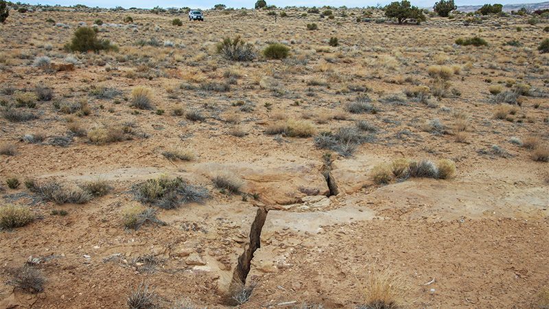
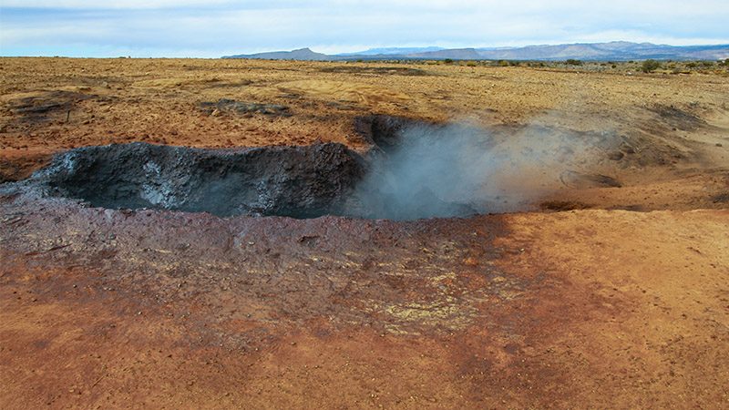
On the right side of the road, there will be a large area where there is noticeably less vegetation as compared to the other side of the road. Providing the weather conditions are favorable, mainly temperatures below 70 degrees Fahrenheit (21 C), you may see places where there is smoke raising out of the ground roughly 100 feet (30 m) from the road.
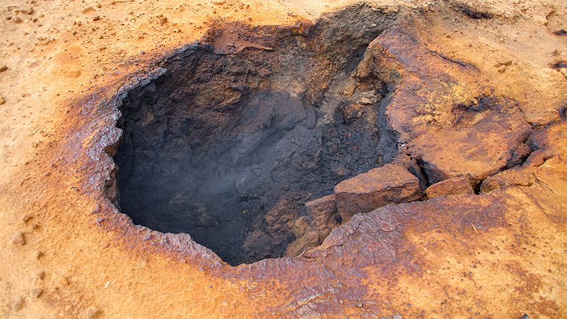
Scattered around this area are several vents where smoke from underground coal fires can be seen. If you decide to walk out to these smoky vents for a closer look, be extra careful and don’t get too close. These are very deep holes and the fumes are noxious. Try not to breathe it in.
For reference, remember about how far up in elevation the coal seam mentioned earlier is located. It’s roughly three quarters of the way up to the top of the Kaiparowits Plateau. The vents are at the top of the plateau. Think of how deep those coal seams are buried underneath the plateau. Geologists believe that lightning ignited the coal through cracks in the ground, hundreds of feet below the surface. Pretty amazing, huh?
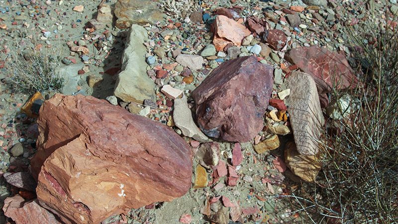
The vents are certainly a unique geologic feature and interesting to look at. You’ll find that the rocks surrounding the vents have been stained yellow and black from the smoke. While holding your breath and standing from a distance, you can look down these vents to see the smoke bellowing up.
When finished looking at the smoky vents, return to Smoky Mountain Road and turn left.
Help fund our next trip and your next adventure by purchasing a subscription to Gaia GPS. We will receive a small commission from your purchase.

Kelly Grade
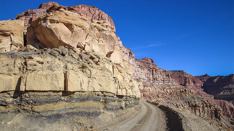
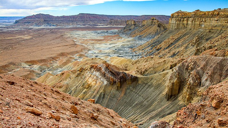
About 1.3 miles from road 332, Smoky Mountain Road begins its grand descent down the side of Smoky Mountain. This is the beginning of the Kelly Grade. There’s a couple of pullouts just before the descent. Be sure to stop here to take time to take in the view. Below is a panorama of colorful mountainsides and beyond are views of Lake Powell along with Page and even Glen Canyon Dam if you look real closely.
If there was a road that descended into the Grand Canyon itself, in our opinion, the descent down the Kelly Grade provides a similar experience. It’s absolutely stunning.
The first half of the grade winds through various side canyons and drainages. The second half begins when the road emerges from one those side canyons and clings onto the side of Smoky Mountain. For people that are uneasy with heights, this would be the scariest part of the road trip. This half mile long section of road clings to the side of an approximate 600 foot-high (182 m) cliff.
At the end of the scary section, Smoky Mountain Road starts a very steep descent to the base of the Kaiparowits Plateau. Be sure to take the drive slow and check out the two viewpoints along the descent.

Final Leg
After Smoky Mountain road finishes its descent from Smoky Mountain, the road heads southwest for two miles. Make sure to stop and look back at the face of Smoky Mountain. Remember, you just descended down this formidable mountain.
Croton Road & Colorful Hills
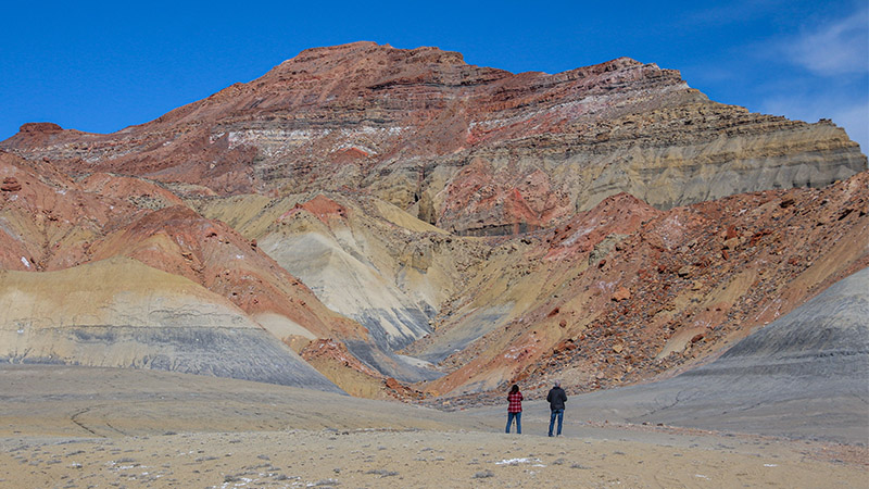
At the end of those two miles, look for a well-defined road that leads due east. This is BLM Road 340, also known as Croton Road. Turn left here if you’d like to see some very colorful hills.
Continue on 340 for 2.5 miles. On the left, you will see some very colorful hills. In our opinion, they are more colorful than world-famous Artist Palette in Death Valley. It’s definitely the best display of colors caused by mineral oxidization along this entire road trip. If you travel down the road another half mile, you’ll see more colorful hillsides. We’ve continued east and north on road 340 for about 10 miles and didn’t see anymore colors such as those seen at this site.
Another side trip from here is continuing to Alstrom Point on a very rough 4WD road. This road is found by turning right on a road heading southeast about 1.6 miles from the colorful hills. Alstrom Point is reached on this dead-end road in about seven miles.
Return to Civilization
Return back to Smoky Mountain Road and bear left. In a short distance, the turnoff to Smoky Hollow Road that was passed earlier in the trip will be passed; again, bear left. Continue back to Big Water the way we headed in. The trailhead to Wiregrass Canyon and the balanced rock will be passed.
Trip Map
The following map points out major milestones along the Smoky Mountain Road road trip.
Some of the maps in the video were created using Gaia GPS. Click the ad below to purchase a Gaia GPS subscription giving you many additional features and we’ll earn a few dollars to fund our next trip.

Use the full-screen button in the upper-right corner to view the map using the entire screen and for easier scrolling. Press the Esc key to exit full-screen mode.
Learn more about our maps.
Beginning of Smoky Mtn Rd trip
Junction of Smoky Mtn Rd & Smoky Hollow Rd - bear left
Junction of Smoky Hollow Rd & Smoky Mtn Rd - turn right
Support Us
Help us fill up our tank with gas for our next trip by donating $5 and we’ll bring you back more quality virtual tours of our trips!
Your credit card payment is safe and easy using PayPal. Click the [Donate] button to get started:
Subscribe
See all our comprehensive virtual tour guides at:
