White Pocket
Located along the Arizona/Utah border and within Vermilion Cliffs National Monument is a field of twisted and colorful sandstone known as White Pocket. This area has become more popular to visit recently due to its proximity to another place with twisted sandstone called The Wave, as well as all the other crazy sandstone features found in North and South Coyote Buttes. White Pocket is equally as beautiful and has it’s own unique features and colors compared to those in Coyote Buttes.


Trip Specs
Latest Updates
This section lists any latest news and conditions about visiting White Pocket that we know of.
- 2022 August – The section of House Rock Valley Road between Hwy US 89 in the north and the Arizona/Utah state border in the south has been heavily damaged by several thunderstorms. The road is very rough – much rougher than normal. As suggested in the video, begin your trek to White Pocket from US 89A to avoid this section of House Rock Valley Road.
- 2022 June – Increased visitation to White Pocket over the past few months, along with tourists that are not versed in driving in deep sand, have caused the access road between the ranch and the White Pocket trailhead to be clogged at times as vehicles have no way to pass other vehicles that are stuck.
Introduction
We first learned about White Pocket in 2010 while visiting the BLM visitor center in St. George, Utah. Being photographers, we first asked about The Wave. The very helpful staff at this facility explained the process where only a limited number of permits are issued per day and on some days, there are hundreds of people for those limited permits! The staff then told us about another place that’s not too far from The Wave that is just as spectacular and doesn’t require a permit. The catch is that it requires a good 4WD vehicle with an experienced driver and someone with sharp navigational skills. It is even labeled on most maps – White Pocket.
When we first visited White Pocket around 2012, it was a navigational challenge. There were many turns to make. You had to have a good map showing the latest road numbers to find your way. There also were not many people out there to ask directions or make it obvious you’re headed the right way.
For the last five years, White Pocket has become more popular and the BLM has placed many signs pointing the way, so it is much easier to find. Plus, because of the increased vehicle traffic on the road, the deep sand has been compacted down more and the sharp rocks have been smoothed out. However, vehicles still get stuck in the deep sand and tires still get shredded on sharp rocks, so using a 4WD high-clearance vehicle is still required.
A 4WD Adventure
Do not attempt driving to White Pocket unless you possess the following:
- A reliable 4 wheel drive vehicle with high clearance
- Experience with driving in deep sand
- Experienced with off-road navigation and a good sense of direction
- Have the ability to lower the air pressure in your tires to around 20 PSI and able to pump them back up again with a portable compressor
The reason your vehicle will need high clearance in the deep sand is that some portions of the road tracks in the sand have a high crown and, if your vehicle isn’t high enough, the chassis will drag in the sand which will further hinder your efforts. Plus, lowering your tire pressure will lower your vehicle. Remember – when you are in the deep sand, keep your forward momentum going – don’t stop! And just to make it all a little more interesting, one of the deep sand areas is uphill plus there are rocky outcroppings mixed in with the sand that you have to watch out for. Does this sound challenging yet!?
Also be advised that roads in this part of Utah and Arizona can be very muddy and treacherous if they are wet from a melting snow pack or long periods of rain. They can be so slippery that you loose all traction and your ability to steer. Even 4WD is rendered useless – we’ve experienced this ourselves. The deep sand on this road, however, actually improves after a light rain because the sand hardens. Dry sand is more challenging. So, winter and spring months are more desirable, whereas dryer months are not.
This area is also far from any town that has towing services so being rescued from the road to White Pocket will undoubtedly be an expensive experience. We highly recommend that you travel with another 4WD vehicle – like we did.
More…
Pictures


Panoramic view showing the center of White Pocket

Getting There
The easiest way to navigate to White Pocket is using Google Maps on your phone. Before you leave a Wi-Fi connection though, be sure to download the map area between Highways US 89 and 89A between Page, Arizona and Kanab, Utah. White Pocket can be found on both Google Maps and Gaia GPS. Find White Pocket on your favorite map app and simply navigate to it.
The most direct way to reach White Pocket from a paved road is from US 89A from the south, not US 89 from the north. See the video above for directions and distances to different turns.
Once you turn onto House Valley Rock Road, find a safe place off the road to air down your tires to around 20-25 PSI. Although you won’t be in deep sand yet, House Rock is a fairly rough road and the lower air pressure will give you a more comfortable ride. If coming from US 89, there’s a good place to air down just after turning off the pavement. If coming from 89A, a good place is at the Condor Viewing Site, which is located about 3 miles north of the 89A turn-off.
If you don’t air down at these points, you’ll definitely want to air down after turning left at the ranch house from BLM Road 1017 to 1087. From this point until reaching the White Pocket trailhead, the road frequently passes through deep sand. Lowering the tire pressure gives the tires more surface area that will grab more sand and hopefully not get stuck.
White Pocket
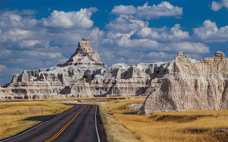
As you get closer to White Pocket, you’ll see the tall rock outcroppings about 5 miles in the distance. After crossing over a cattle guard, you’ll see the BLM White Pocket sign and the parking area and trailhead will be on the left.
At the trailhead, walk through the entrance in the fence and, after walking through some more of that wonderful deep sand, you will soon be walking on the twisted, swirling formations of White Pocket. As soon as you encounter the red and pinkish sandstone swirls, look for a trail on the right (north by northwest) that has been etched into the sandstone. This was mostly etched into the sandstone by many cows heading to water “tanks” or pockets as discussed in the video. There are also dinosaur tracks that can be found here, so it is confusing on which tracks are which.
Head towards two large white and yellow colored mounds, then pass by them on the right to reach the core of White Pocket. Once you start descending past the two mounds, the view before you reveals an even more wild and contorted landscape. It is breathtaking and you will probably do what we did – say “Wow” out loud!
Most of the unique features of White Pocket can be found within a mile northwest of the parking area. Some of the features to look for are the long, grooved swirls of red, pink, orange and white sandstone, mounds of warped and colorful stone, “brain rock” that look like heads of cauliflower, crossbedding of rock layers and, in general, sandstone gone wild and crazy!
And just about the time you get to the middle of White Pocket, you’ll undoubtedly ask yourself, “What the heck happened here?” or “How did all this get formed?” There are not many geological explanations of what happened at White Pocket but there are some good guesses. One geologist believes that the landscape was caused by a huge sand-slide, back when this area was covered with large sand dunes during the Jurassic period (roughly 150-200 million years ago). This slide mixed in with other layers of sand, as well as picking up already laminated layers of sand along the way, and then the whole mass became petrified over millions of years. During those millions of years, the area around White Pocket was underwater for long periods of time, certainly adding to the chaos you see today.
Other theories start with the area being submerged under water, the sandstone becomes more pliable or plastic, then gets warped by either a tidal wave or earthquake. Wind most likely was another factor in forming the shapes we see today.
Since White Pocket is at a high spot in the Vermilion Cliffs region, a clear day will bring great views of the Colorado Plateau region. You’ll see the pink cliffs of Bryce Canyon to the north as well as the tall promontory of Powell Point. Closer to the west, you’ll see the orange Coyote Buttes to the west with the depression of Buckskin Gulch to the northwest.
A visit to White Pocket will be an unforgettable experience. The couple we took with us (in the other 4WD) had no idea what to expect (they saw no pictures previous to the visit) and were awestruck by what they saw. Now they talk about it all the time. We are hopeful that, because it is difficult to access, White Pocket will remain a secluded and preserved area like it was when we visited in 2012.
Trip Map
To help plan your trip, either use our interactive Google Map below or download our GPX file that points out the places to see that are mentioned in this chapter.
Click here to download our GPX file that follows our tour of White Pocket. We recommend using a GPS mapping app, such as Gaia GPS, to view these points on your computer or to locate them using GPS with your mobile device or phone. Click the ad below to purchase Gaia GPS using our discount code which offers up to a 50% discount.

Learn more about our maps.
The hiking trail into White Pocket starts here.
Turn off House Rock Valley Road, BLM 1065, and head east onto BLM 1017.
Bear left onto BLM 1087, which is next to a small ranch.
Along this stretch of road, past the ranch, is very sandy. Keep your momentum up!
Support Us
Help us fill up our tank with gas for our next trip by donating $5 and we’ll bring you back more quality virtual tours of our trips!
Your credit card payment is safe and easy using PayPal. Click the [Donate] button to get started:
Subscribe
See all our comprehensive virtual tour guides at:
![]()