|
|
Franz Josef Glacier
Getting ThereFranz Josef is located in one of the isolated regions of New Zealand's South Island. It is situated approximately halfway along the west coast making it convenient for travelers to use as an overnight location. If you are not traveling by aircraft, Franz Josef is located by driving Highway 6 from either the south or the north. From the north, Franz Josef is located 107 road miles (172 km), about a three hour drive, from Greymouth, which is the terminus of the TranzAlpine railroad trip. From the south, Franz Josef is located 220 road miles (354 km), about a five hour drive, from the major tourist center of Queenstown. Highway 6 between Greymouth and the town of Wanaka covers a distance of 275 miles (443 km) with just the small towns of Hokitika, Franz Josef, Fox Glacier and Haast along the way. Expect to see some remote country with not very many people along and not many services. For more detailed information on this route, see our West Coast Drive chapter. If you are incorporating a visit to the island's west coast with a trip on the TranzAlpine train, there is regularly scheduled bus service between Greymouth and Queenstown with all the towns in between, including Franz Josef. Check with your travel agent for details, because you will definitely want reservations on these buses ahead of time. What's ThereThe town of Franz Josef is small and quaint. The downtown section is situated along a half mile (0.8 km) stretch of Highway 6. There are roughly ten to twenty hotels and inns located in Franz Josef. There are campgrounds nearby for those that wish to rough it. About ten cafes and eateries offer local and international cuisine. There is a grocery store in the middle of town that sells all kinds of goods. The town of Fox Glacier is located about 15 road miles (24 km) southwest on Highway 6 from Franz Josef which has more services. Hiking on the Glacier
You can book a half , 3/4 or full day hike. Naturally, the longer the duration, the further up the glacier you will go. But remember, a longer hike means a more strenuous and difficult hike. For the easy and expensive solution, see Aerial Tours. Whether it is sunny or rainy on the day of your hike, you will want to bring the right gear. The guides will most likely provide you with boots, ice crampons (that strap onto your boot), waterproof trousers and a hooded jacket. Wool gloves or mittens will also be available since you will be touching the ice often and it doesn't take much time for your hands to become numb. However, the wool tends to get wet, so you may wish to bring leather ski gloves. Also, whether it is sunny or raining, you may wish to bring a hat to shade your face and eyes. A daypack will be needed to carry your drinking water, snacks to eat and camera. If walking on ice or taking a guided tour isn't your thing and you simply wish to look up at the awesome glacier, you can park at the parking area located roughly a mile (1.6 km) south of town. If you don't have a car, there is usually a shuttle from town to the parking area. From here, you can walk about 1.5 miles on an easy trail that follows the floor of the valley to the toe of the glacier. The views from the bottom of the valley are awesome. Aerial Tours
One of the more popular activities is "helihiking", which involves taking a helicopter to the top of the glacier and then continuing on a one or two hour guided hike to explore different parts of the glacier. Such a tour will take you much higher on the glacier and into the mountains then a hike from the bottom. When you're finished hiking, you will be flown back off the glacier. During your flight, you will also experience more of the alpine scenery out of the window of the helicopter. More on the GlacierOddly enough, Franz Josef Glacier [Google search] was named by a German explorer and geologist Julius von Haast in 1865. At the time, Franz Josef was the popular emperor that governed Austria in the late 1800s up until the beginning of World War I. The native Maori named the glacier Ka Roimata o Hinehukatere which means "The Tears of Hinehukatere" in their language, which stems from a local Maori legend about a tribesman that lost his lover to an avalanche. Glaciers [Google search] form when snow accumulates and does not melt off before the next winter season. As more snow falls, the older snow is compacted by the weight of the new snow. The compacted snow eventually turns into glacier ice. Because it is in a mountainous region, gravity begins to deform the compacted ice and the mass begins moving down-slope. Like a river, the glacier follows the least path of resistance as it flows down the side of the mountain. Glaciers are typically responsible for carving valleys and other geologic features into mountain ranges. The affects of old glaciers that have long disappeared can be seen in many mountain ranges around the world. Keeping in mind that Franz Josef reached all the way to the ocean, the narrow valley that it sits in is testimony to its carving abilities. You can see many narrow valleys leading out of the Southern Alps that were obviously created by glaciers that no longer exist. Milford Sound is a classic example of a glacially carved valley.
When you are near or on the glacier, you may hear what sounds like gunshots nearby or in the distance. This is a sign that the glacier is moving. These sounds are typically created when large sections of glacial ice cracks or settles. Photo Tour
|
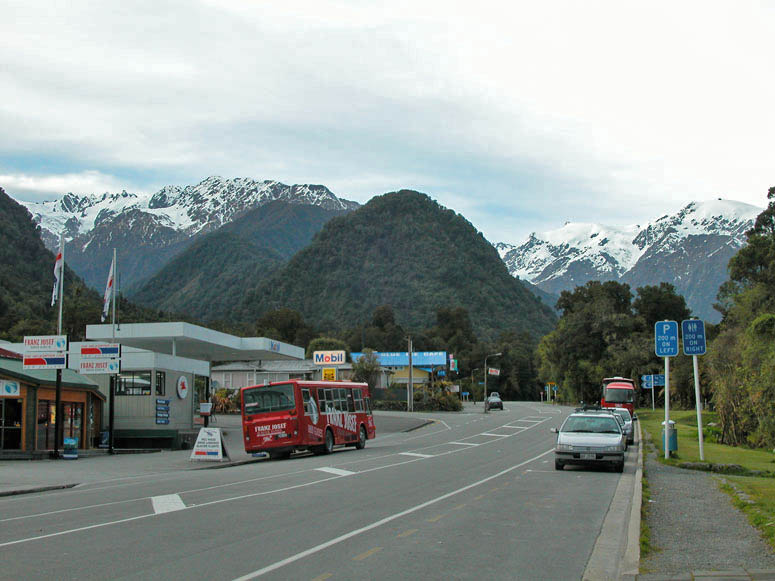 |
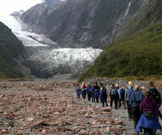
The main road (Highway 6) as it goes through Franz Josef. The length of the town is about a half mile (0.8 km) and includes 10-20 hotels, several cafes, a grocery store and several businesses catering to glacier tours. It is one of the only towns along the long stretch of Highway 6 on the west coast. The location of the glacier is in the canyon located in the picture behind the blue signs on the right. |
 |
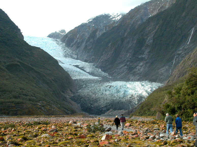
On the drive up to the parking area for the glacier, you might see the top of the glacier peeking above the treetops as seen in this picture on the left. |
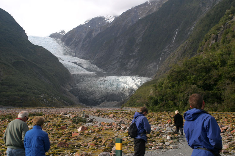 |
Following the hiking trail out of the parking lot and out of the trees, you will come to a clearing where the glacier is in full view in the distance. |
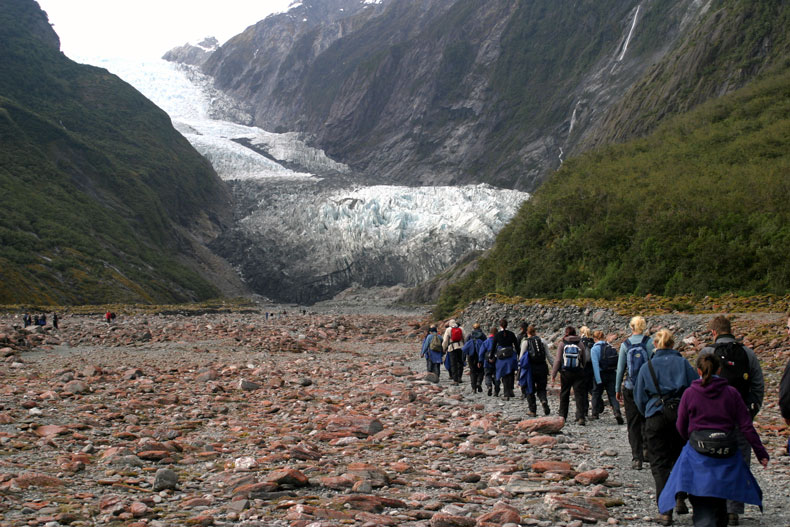 |
The walk to the glacier from the parking area is about 1.5 miles (2.4 km). |
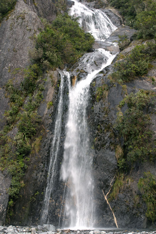 |
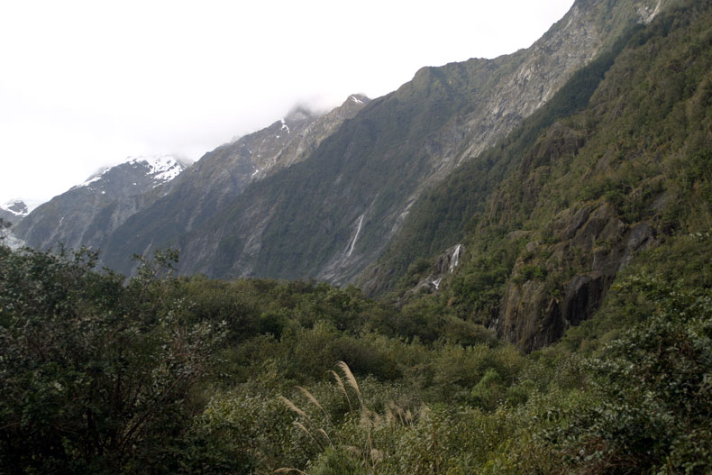
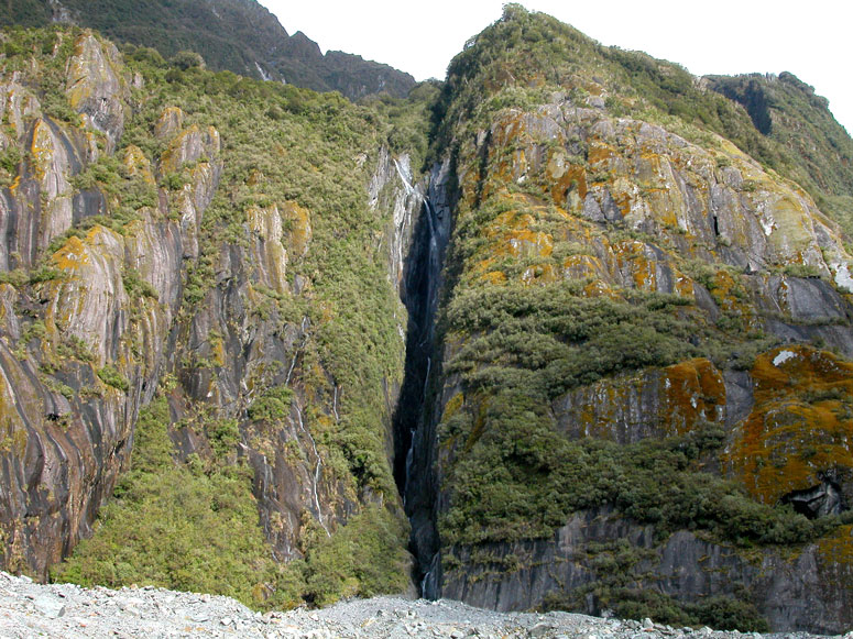
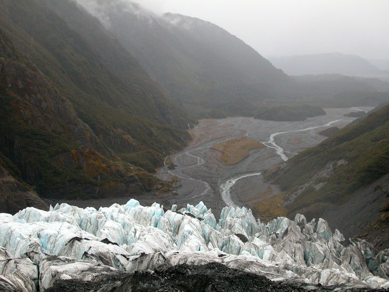
The narrow valley which Franz Josef Glacier is located in is typical of glacially carved valleys found in the USA, such as California's Yosemite Valley. There are sheer rock cliffs on both sides of the valley with many waterfalls tumbling out of them. The uniqueness of Franz Josef is that the valley and much of the surrounding cliffs are coated with trees and ferns of a temperate rainforest. |
 |
Getting closer to the toe of the glacier. The trail to the toe of the glacier is well defined and maintained. During the early 1800s, the glacier used to come down to the point where this photo was taken. Along the trail, there are markers showing where the glacier's toe was during certain years. Since the 1800s, the glacier retreated a significant distance and then advanced quickly to its current position in the late 1900s. |
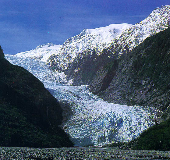 |
A picture of the glacier in 2001 from the on-line Wikipedia encyclopedia. Our pictures were taken in 2005. This is a good comparison of how the glacier changes shapes over the years. |
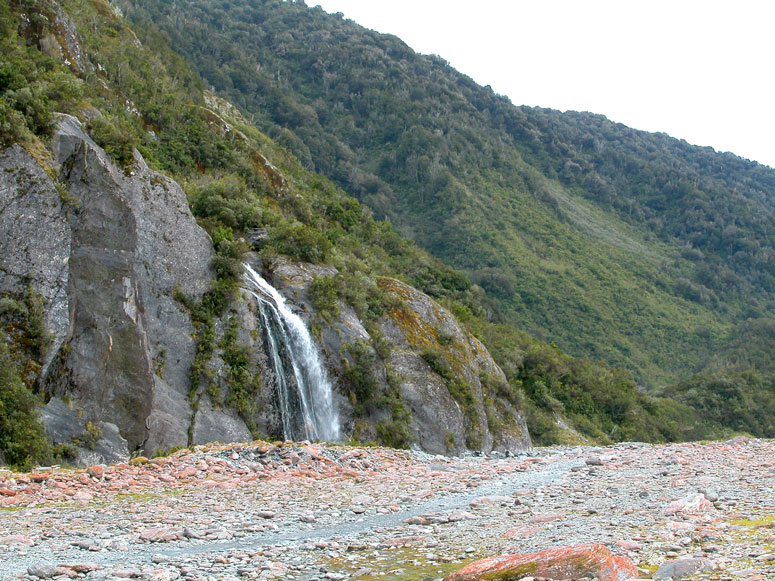 |
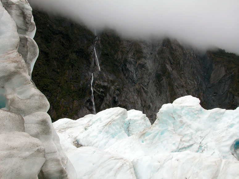
Another waterfall gurgles out of the rainforest above. |
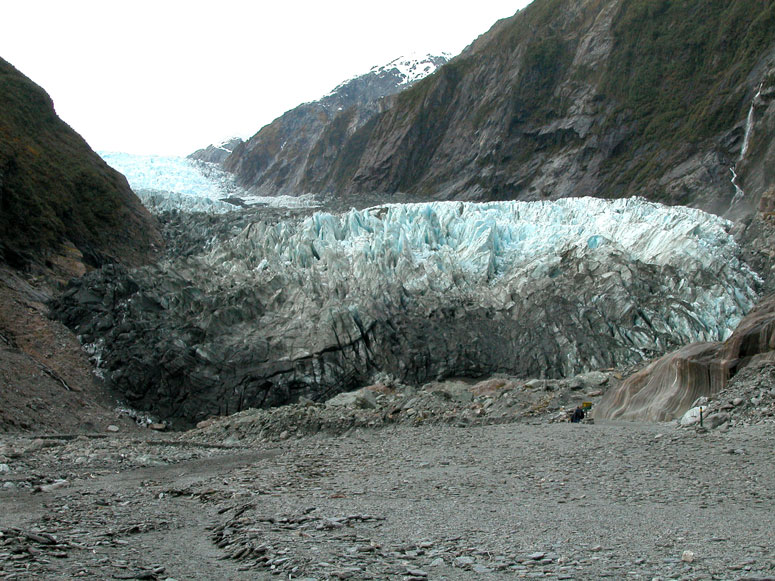 |
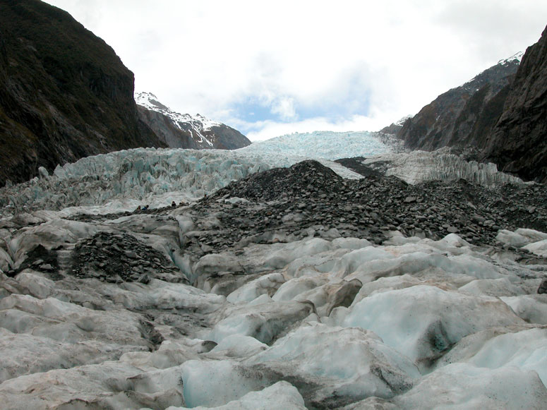
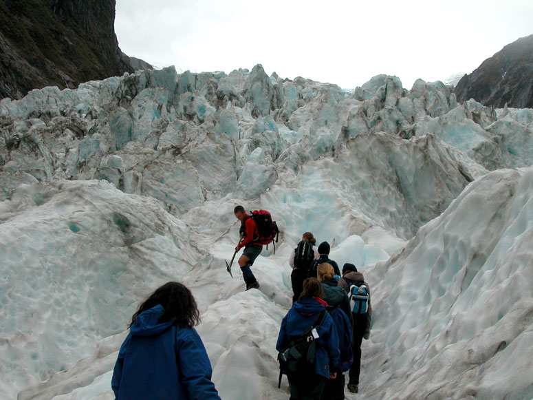
The ominous size of the glacier becomes real as you slowly approach it. |
 |
The trail begins to wind through large rock debris that was left behind during recent advance and retreat cycles the glacier has gone through. |
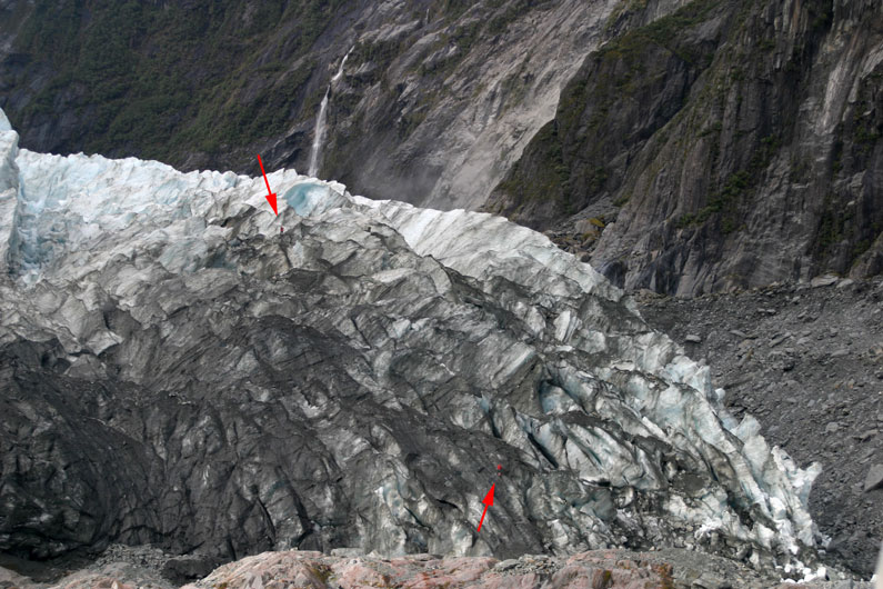 |
Arrows point to two people climbing on the glacier. |
 |
Can you find the lone hiker in this picture? Hint: he is located in the lower right corner. |
 |
When walking up the narrow valley, be sure to look back. Some of the waterfalls are hidden in small crevices like this. |
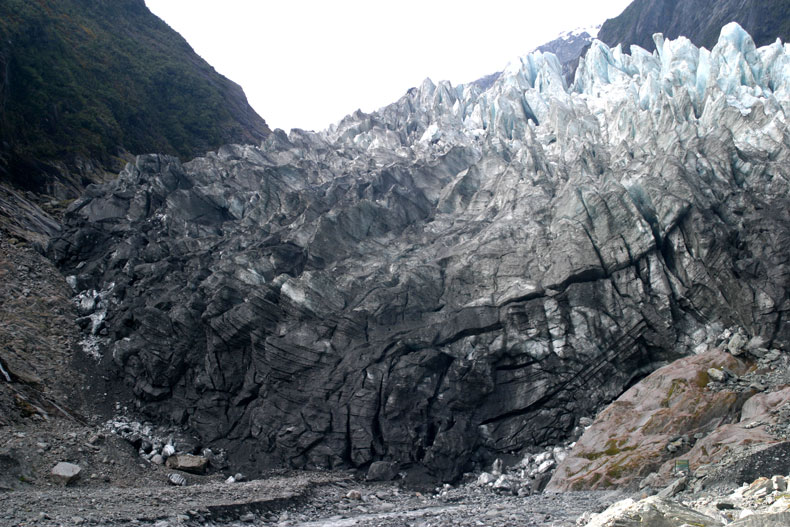 |
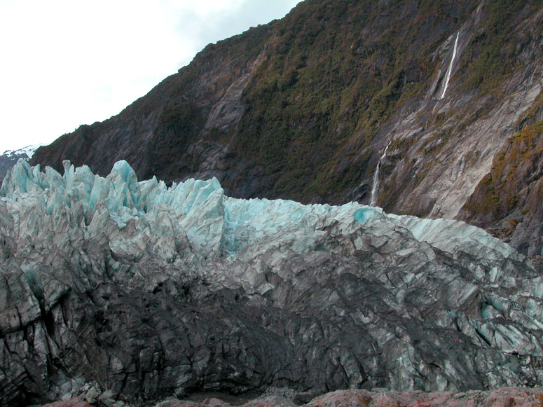
Now, the toe of the glacier looks ominous and intimidating and much different then when it was first sighted on the hiking trail. |
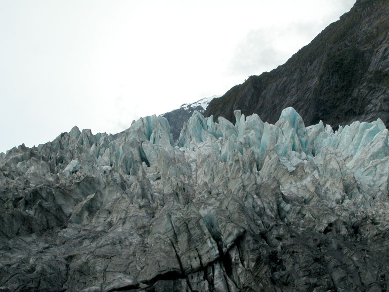 |
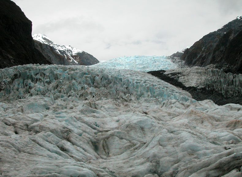
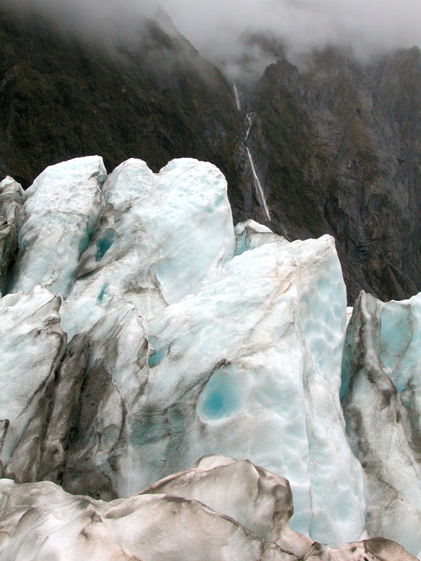
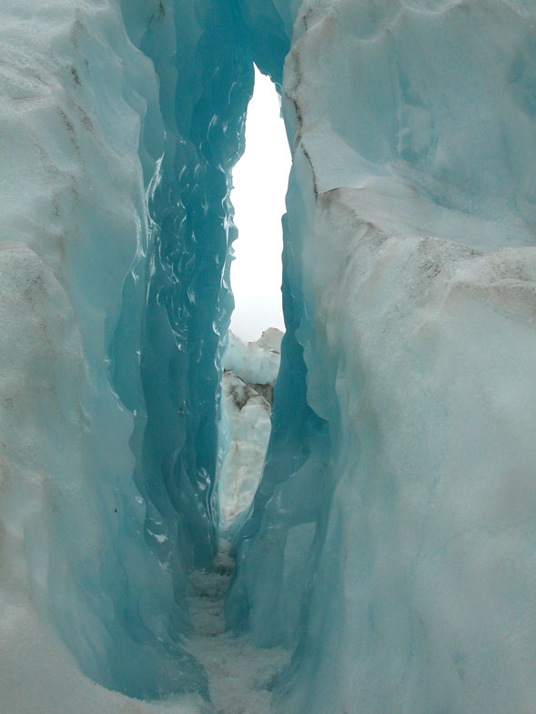
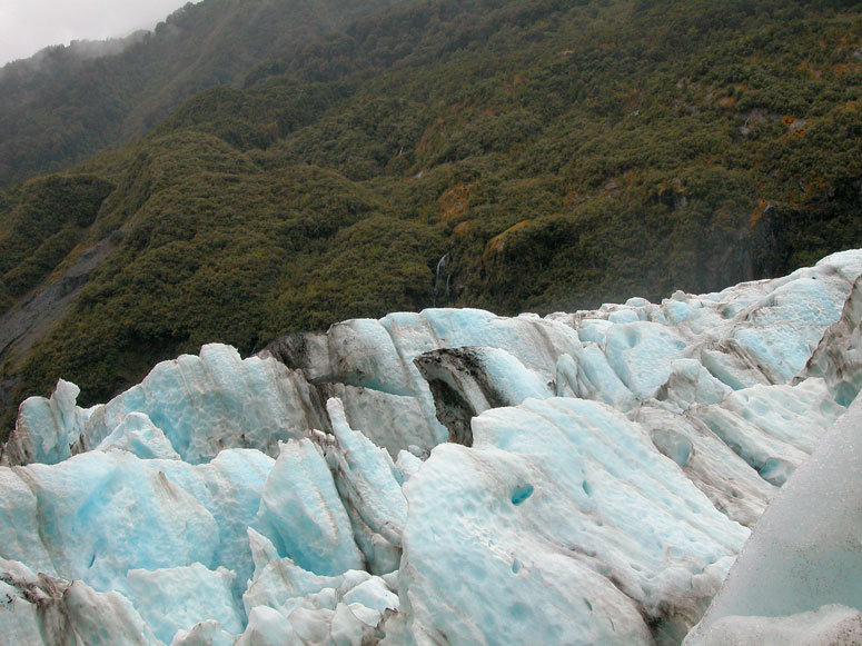
Looking straight up to the top of the glacier. Be sure to read the More on the Glacier section to learn why the ice of the glacier appears with a light-blue color rather then white. |
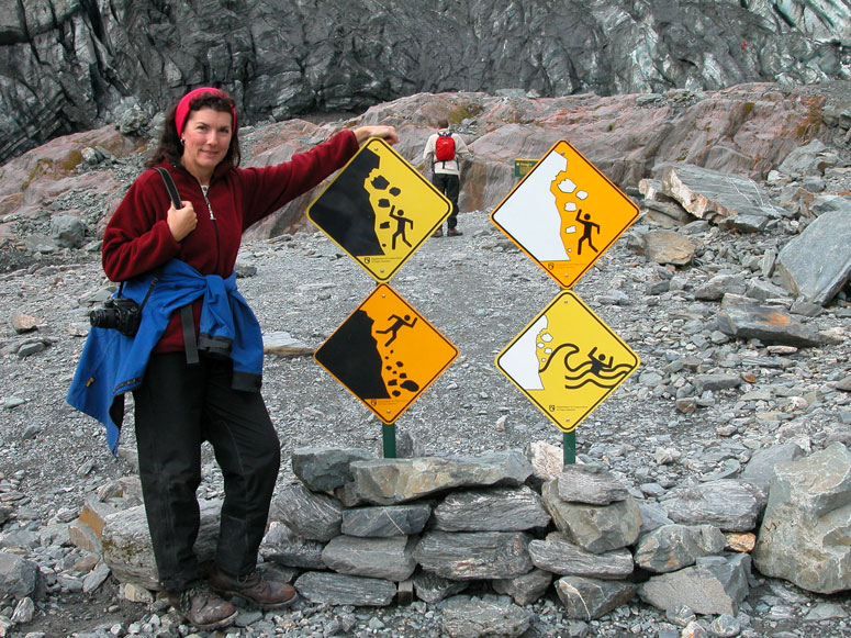 |
This is the end of the hiking trail. Obviously, by the look of the signs, it isn't safe to continue anyways. Attempting to continue past this point with no experienced guide is very dangerous. |
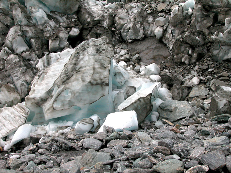 |
Chunks of ice that have fallen off the face of the glacier are littered all along the glacier's toe. |
 |
Looking up at the chaos of ice at the beginning of the steep climb up the glacier. |
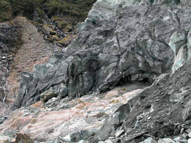 |
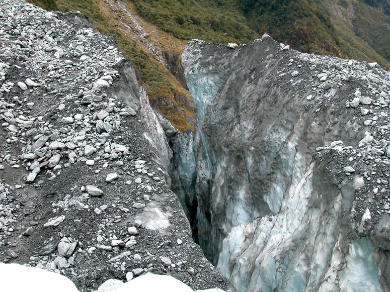
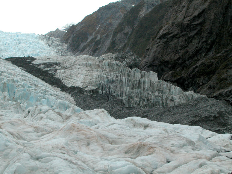
Here, the toe of the glacier is slowly grinding against the brownish-colored rock located at the bottom of the ice. This is what makes the rock debris seen in an earlier picture. |
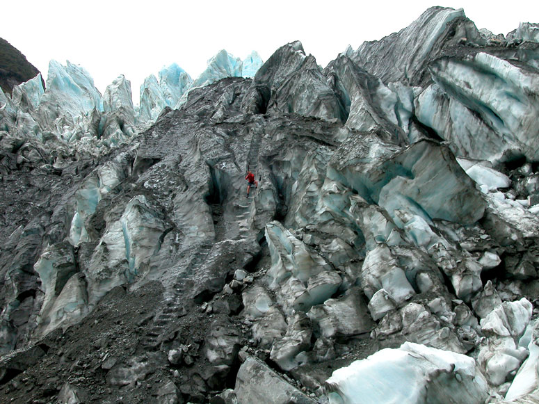 |
One of the guides carve out steps in the ice with a pick. Yes, those are the stairs we climbed to get to the top of the glacier. Typically, because the ice is always moving, these steps have to be recreated every morning. |
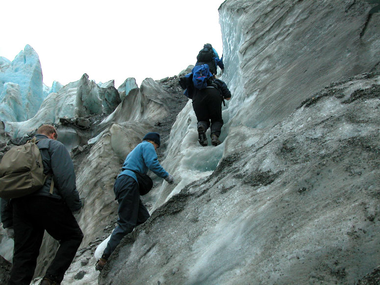 |
Walking on the ice steps now, the crampons tied to our boots really help. |
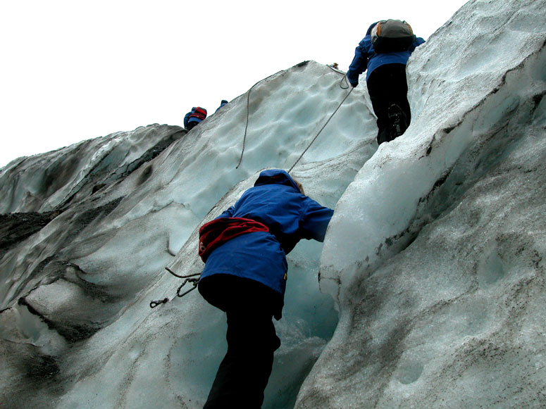 |
Some of the steeper sections have ropes to aid in your traction and balance. |
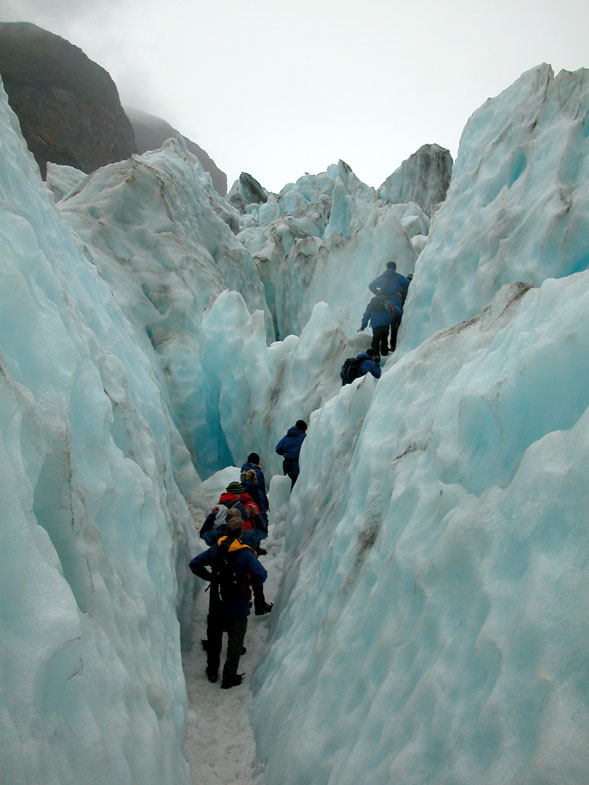 |
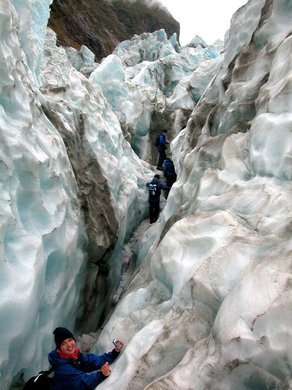
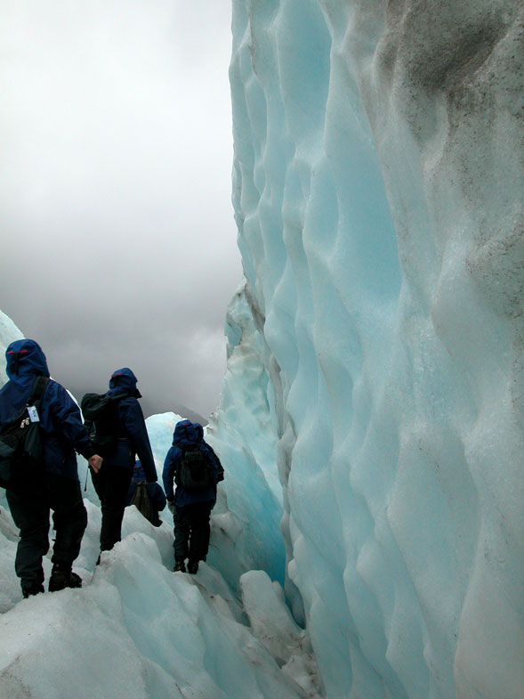
Along some parts of the glacier there is crevice after crevice, which the trail descends into and then out again. The trail follows other crevices, such as this one, for small distances. |
 |
This is an example a deep crevice found nearby the trail. The guides steer you clear of these because you can easily slip and fall into one. At some points along the trail, the trail builders have put down ladders down over crevices for us to walk over. Naturally they tell us, "do not stop and look down". |
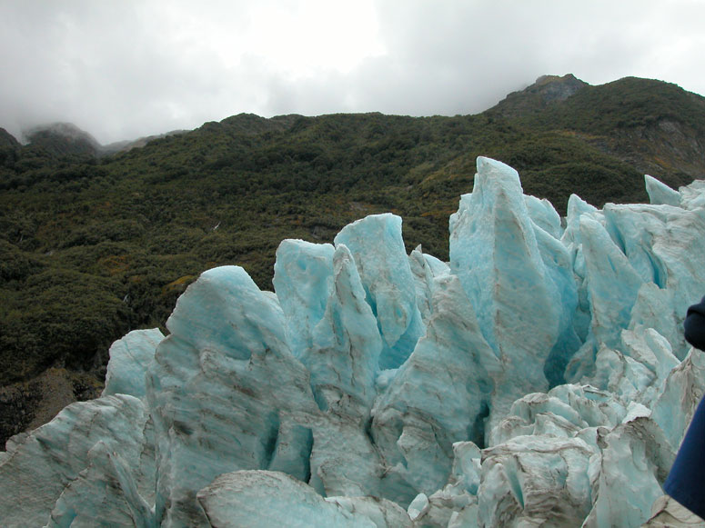 |
Looking at some of the craggily ice on top of the glacier. |
 |
Phew! We finally made it to the top of the glacier. But there is still a long ways to go... |
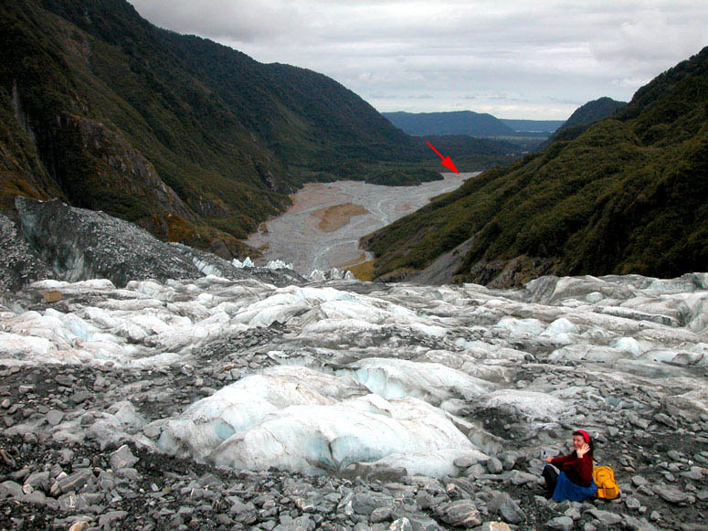 |
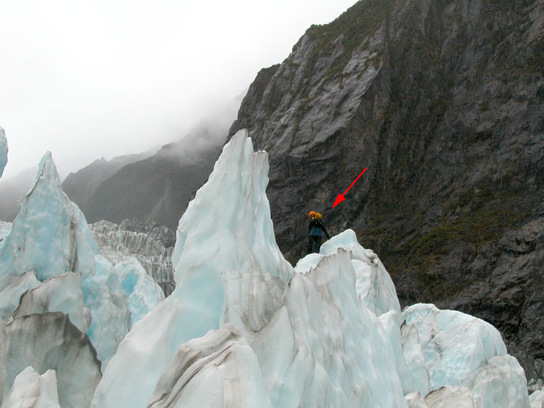
After we completed the exasperating climb up the ice steps, our guide lets us stop for a snack as we sit and gaze at the valley we just hiked through. The arrow points to where the next picture was taken. |
 |
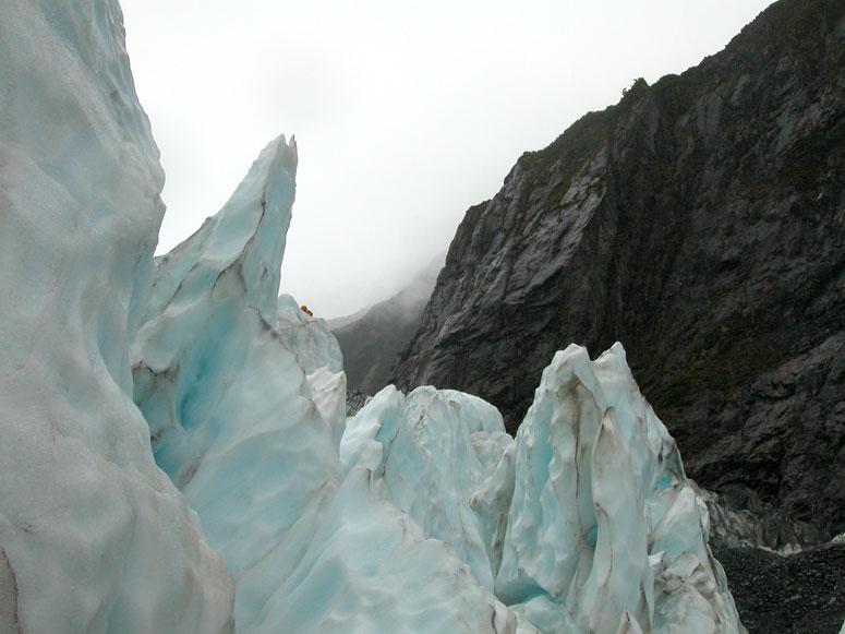
This picture was taken from where the arrow points to in the previous picture. It also points out the various points along our hike over the glacier. |
 |
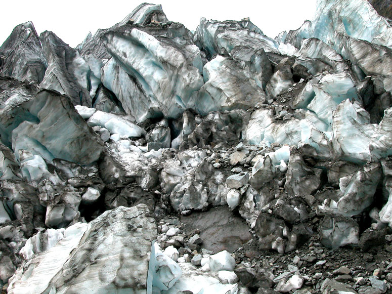
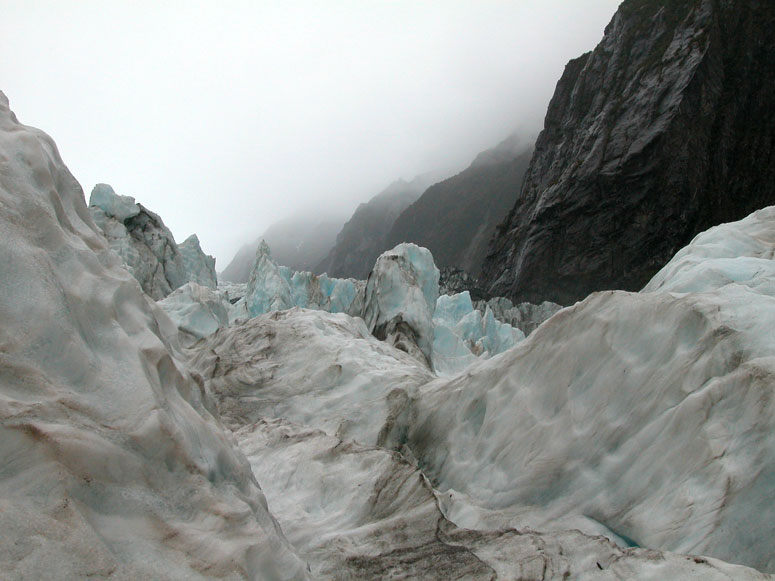
Up ahead in the glacier (in the middle of the picture) is an "ice fall". The natural contour of the land below the ice here drops steeply causing the glacier to drop quickly which creates many crevices. It also creates a big labyrinth of trails and passageways - which is where we are headed. |
 |
Most glaciers have an obvious grayish-black stripe running down the middle. This is an accumulation of rock and dirt debris that the ice picked up on its slow slide down the mountain. The debris gets pushed to the middle of the glacier. Here, you can see the debris ahead. This debris makes our hike in some areas much easier since we are temporarily off the ice. |
 |
More waterfalls along the glacier. |
 |
We start walking towards the ice fall. |
 |
The going begins to get rough as we approach the ice fall. Our guide uses a pick to create a trail for us. |
 |
The clouds hug the tops of the mountains surrounding the glacier. During our hike, it rained about half the time. Rainy weather is normal in a rainforest such as this. |
 |
The contrast between the ice and the rocky sides of the narrow valley is quite a sight. |
 |
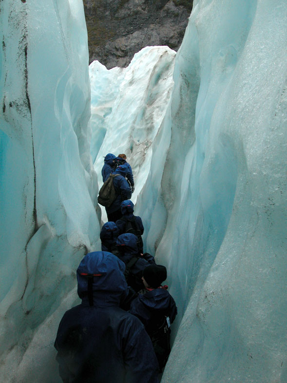
As we make our way through the ice fall, there are not only many tight squeezes to make, but we have to be careful not to step in puddles of water that are 1 to 3 feet (0.3 to 1 m) deep. |
 |
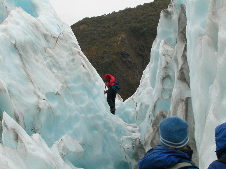
Our fearless guide in the red jacket looks ahead for an easy route for us to take. |
 |
Everybody has to wait for the photographer to catch up. |
 |
Our guide finds another narrow passage to get us further up the glacier. |
 |
Some of the routes our guide leads us on turn out to be impassable. |
 |
Walking sticks (hiking poles) are available at the beginning of the hike and are optional (we didn't use them). These sticks come in handy at places like this where it is difficult to keep your balance over the uneven ice. |
 |
We wait as our guide uses his pick to create a new trail for us. |
 |
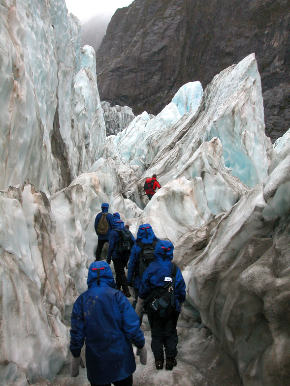
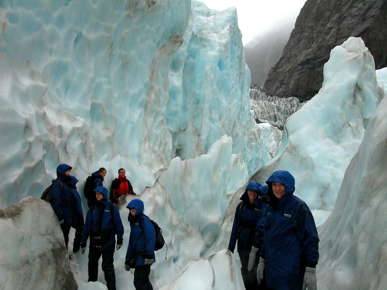
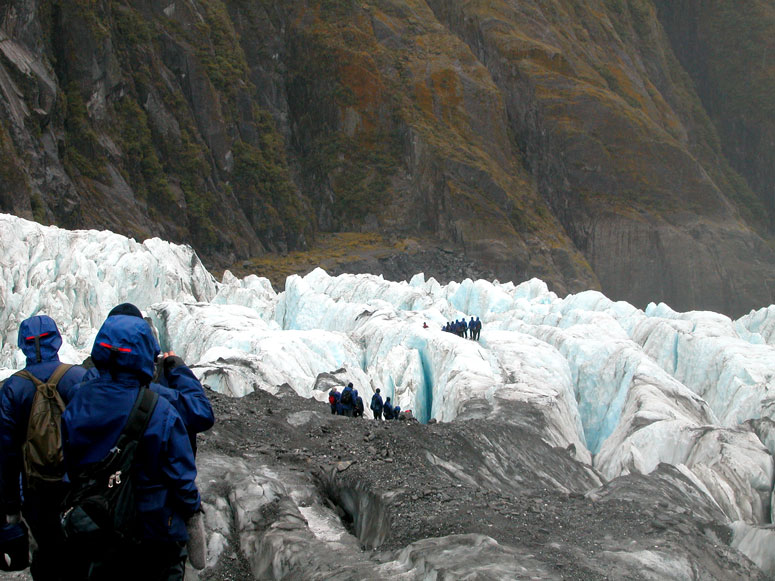
The arrow points to an ice climber from another group. People that sign up to hike on Franz Josef Glacier are separated into groups of ability and aspiration. Abilities include the hike's duration, which of course determines how much of the glacier you will see. Aspiration includes what the visitor wants to do: simply hike on the glacier, explore icy crevices or climb ice spires which is similar to rock climbing. |
 |
Here are more spires creating more challenges for someone to climb. |
 |
More challenging icy terrain ahead making it difficult for our guide to stake a trail for us. This is about were we turned back. |
 |
If you are lucky, your guide will find a natural narrow tunnel in the ice for everyone to walk through. |
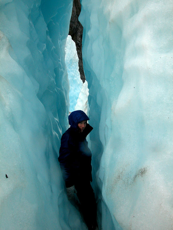 |
Just how narrow is the tunnel? Well, you will probably have to turn sideways to fit. What happens if you get wedged in and stuck? Our guide told us that if this would happen to us, our own body heat would melt the ice and we would become free. Knowing that the entire glacier moves a fair distance every day, might we be squashed if the glacier decides to move the very moment we walk through the tunnel? The guide didn't answer that question... |
 |
Now for our long hike back down the glacier. It was definitely easier and quicker going down. |
 |
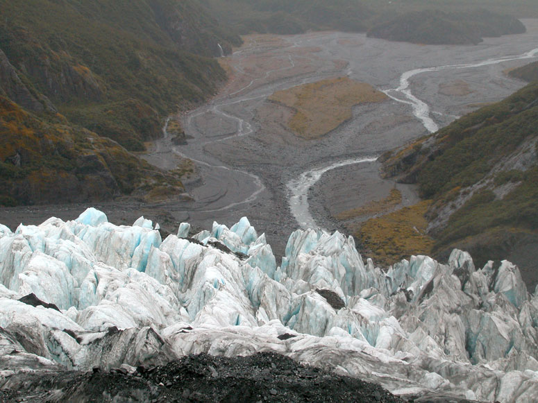
Here, we are approaching the edge or toe of the glacier where a previous picture [see picture] points out "area of crevices". |
 |
Another view of the craggily glacial ice against the lush rainforest along northern side of the narrow valley. |
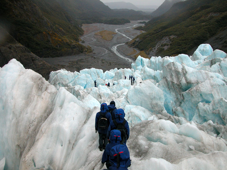 |
Walking down over a maze of crevice ridges. |
 |
Here, the glacier gets steeper and steeper - a view we didn't see on the way up. It is so steep, we can't even see the bottom. |
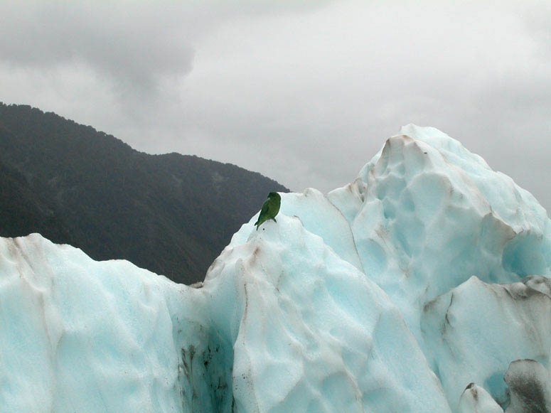 |
Somewhere along our hike, we encountered an alpine parrot, also known as a Kea. They can only be found on the west coast and mountainous regions of the South Island. It is the only parrot in the world that is known to live in alpine regions. These bold, inquisitive and cheeky birds are well known among the hiking guides here. They know how to operate a zipper to open a backpack and steel a hiker's lunch. |
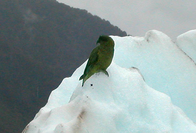 |
A closer look at the Kea that was checking us out. |
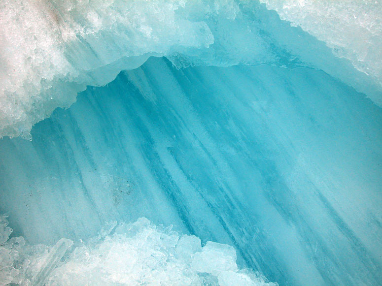 |
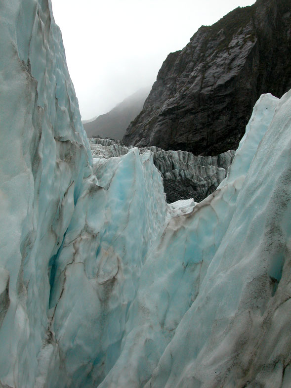
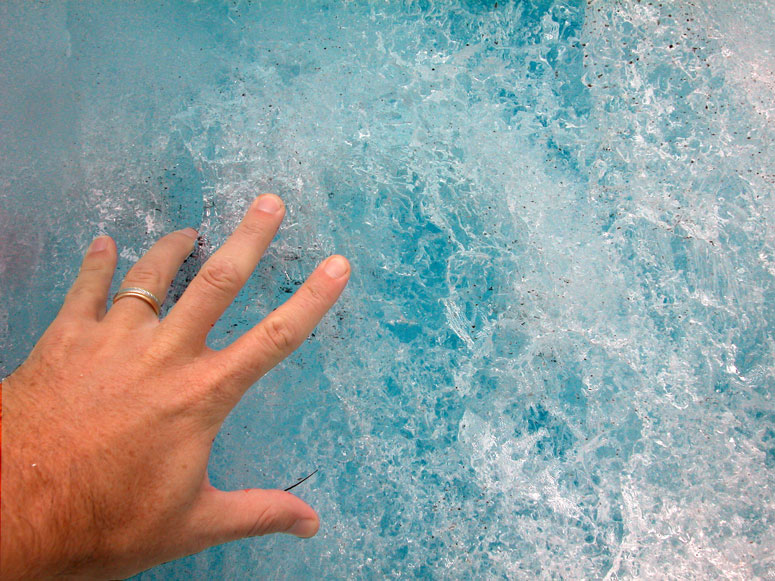
Be sure to take the time to stop at different places for a good close look at the ice. If you look closely, you will find endless amounts of striking patterns and designs. |
 |
Another close-up look at the ice. Read the More on the Glacier section about why the ice appears light blue in color. |
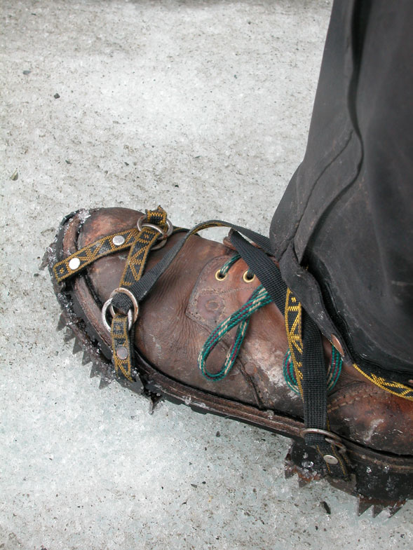 |
Without these crampons tied onto our boots, we wouldn't have been able to get very far on the ice without slipping all over the place. Guided hikes on the glacier include the use of gear such as these crampons and boots, as well as waterproof trousers and a hooded coat. |
Back to Photo Tour, back to Top of Page or Home
|
Copyright
© 2007, BackRoadsWest.com |

 Rare when compared to other glaciers in the world, Franz Josef Glacier
reaches from the high mountains to almost sea level and is fairly easy to reach
for most people. Similar to Fox Glacier just 12 miles (20 km) to the
south, Franz Josef descends from
the lofty heights of the Southern Alps and slopes down to below 800 feet (250 m) above
sea level . The bottom reaches of both glaciers are located in a
temperate rainforest which is also not common for glaciers. Because Franz
Josef is easy to access and located around spectacular scenery, it is a key
tourist attraction in New Zealand. Walking up to the glacier for a close
view is popular as is several guided tours of walking on the glacier with an
expert guide. The town of Franz Josef is one of the few towns along
the isolated west coast of the South Island which is another reason why tourists
are drawn to this area.
Rare when compared to other glaciers in the world, Franz Josef Glacier
reaches from the high mountains to almost sea level and is fairly easy to reach
for most people. Similar to Fox Glacier just 12 miles (20 km) to the
south, Franz Josef descends from
the lofty heights of the Southern Alps and slopes down to below 800 feet (250 m) above
sea level . The bottom reaches of both glaciers are located in a
temperate rainforest which is also not common for glaciers. Because Franz
Josef is easy to access and located around spectacular scenery, it is a key
tourist attraction in New Zealand. Walking up to the glacier for a close
view is popular as is several guided tours of walking on the glacier with an
expert guide. The town of Franz Josef is one of the few towns along
the isolated west coast of the South Island which is another reason why tourists
are drawn to this area.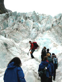 In order to hike
on the glacier, you must be accompanied by a professional guide. If you
attempt to climb on to the glacier by yourself, someone will stop you because
walking on the glacier or even being close to it is very dangerous.
There are a handful of companies that offer guided tours and hikes of the Franz
Josef Glacier. Since this is a popular activity in Franz Josef, it is
recommended to make arrangements and reservations (bookings) for the day you
plan to visit Franz Josef. The company we used,
In order to hike
on the glacier, you must be accompanied by a professional guide. If you
attempt to climb on to the glacier by yourself, someone will stop you because
walking on the glacier or even being close to it is very dangerous.
There are a handful of companies that offer guided tours and hikes of the Franz
Josef Glacier. Since this is a popular activity in Franz Josef, it is
recommended to make arrangements and reservations (bookings) for the day you
plan to visit Franz Josef. The company we used,
 An option to
experiencing the glacier is to take an airplane or helicopter tour of the
glacier and surrounding mountains. There is a small airport located near Franz Josef with several air tour companies. Again, it is recommended to make
reservations for such a trip as this is also a popular activity. Expect to
pay between $200 and $400 US for such a flight and slightly more for a hiking
tour.
An option to
experiencing the glacier is to take an airplane or helicopter tour of the
glacier and surrounding mountains. There is a small airport located near Franz Josef with several air tour companies. Again, it is recommended to make
reservations for such a trip as this is also a popular activity. Expect to
pay between $200 and $400 US for such a flight and slightly more for a hiking
tour.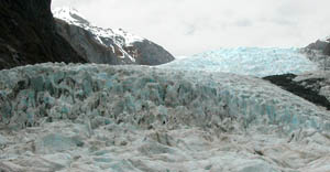 A glacier is always moving. Franz Josef is a fast moving glacier
compared to the other glaciers of the world because it is situated on a steep
slope. Along the path of the Franz Josef, there are several steep
drop-offs in the natural terrain below the glacial ice. These form "ice
falls" on the glacier's surface which creates the jagged texture seen on some of
the pictures below and also creates many deep crevices. Many glaciers move
around a foot (30 cm) per day, but Franz Josef is considered a fast moving
glacier sometimes moving up to several feet per day. Franz Josef is also
unique when compared to other glaciers because it has retreated and advanced
large distances in the past 200 years.
A glacier is always moving. Franz Josef is a fast moving glacier
compared to the other glaciers of the world because it is situated on a steep
slope. Along the path of the Franz Josef, there are several steep
drop-offs in the natural terrain below the glacial ice. These form "ice
falls" on the glacier's surface which creates the jagged texture seen on some of
the pictures below and also creates many deep crevices. Many glaciers move
around a foot (30 cm) per day, but Franz Josef is considered a fast moving
glacier sometimes moving up to several feet per day. Franz Josef is also
unique when compared to other glaciers because it has retreated and advanced
large distances in the past 200 years.