Black Mountains and Inscription Canyon Petroglyphs
The Black Mountains cover a very remote portion of the Mojave Desert northwest of Barstow and make a great one-day exploring trip. Our road trip starts on Harper Dry Lake (where Howard Hughes once tested aircraft), takes you into Black Canyon to look for petroglyphs, past an old stagecoach stop, through an area known for its opals, to Inscription Canyon with it’s large collection of petroglyphs and, all along the way, you can enjoy the beautiful panoramic desert vistas.


Trip Specs
Length
Attractions
- Petroglyphs
- Desert wetlands
- Drive over large dry lake
- Historical aviation site
- Opal mining area
- Long desert views
- Modern solar power plants
Difficulty
- High clearance vehicle, 4WD required
- Challenging to navigate
- Lots of side roads, easy to make a wrong turn
- Very remote area – cell phones will not work
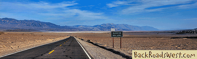
As mentioned, this trip is in a very remote area so be sure you leave with a full day’s supply of fuel, water and food. The last time we took this route, we left the pavement in the morning and our tires didn’t touch pavement again until the sun was going down. Part of the route passes over Harper Dry Lake. If it has rained recently and the dry lake appears wet, do not attempt to cross it. Seek an alternate route around the lake or run our suggested route in reverse.
The Trip
Our trip starts by heading north from the junction of Hwy 58 and Harper Lake Road. If you are coming from I-15 and the Cajon Pass, take Route 66 to Silver Lakes/Helendale, then take Helendale Road north to the junction. Once at the junction of 58 and Harper Lake Road, reset your odometer to zero.
In 6 miles, you reach Lockhart Ranch Road. Just a quarter mile further used to stand the small community of Lockhart that supported a large family-owned ranch that was known for its quality beef. It once had a small store and several large buildings that supported the farming. The ranch has been replaced by another type of farm – solar. A large-scale solar power plant was built by an Israeli company in the late 1980s just north of the old community and is still operating today. In 2014, a Spanish company began building a much larger solar power plant which seems to stretch for many miles. Both plants use the same technology – parabolic mirrors concentrate the sun’s rays onto a tube of liquid that becomes super-heated gas and turns a generator.
Harper Dry Lake
Heading east (turn right) on Lockhart Ranch Road, as you pass the countless fields of parabolic mirrors, Harper Dry Lake will come into view on the left. Located on the dry lake’s shore are two wildlife viewing areas built by the BLM. The first one is at 7.7 miles, the other one a half mile further. The marshes here are popular with migrating birds. However, since the late 1990s, more water has been pumped out of the surrounding area and the marsh has decreased in size.
Continue east on Lockhart Ranch Road, which is now dirt. To avoid driving onto the dry lake, you may have to follow a more improved road that leads off to the right just before the second viewing area. Continuing east will lead to a prominent road at about 10 miles from Hwy 58. This road goes straight north and south. Reset your odometer again to zero here, turn left (north) and start over the dry lake. Incidentally, most of these roads were plotted on our off-the-shelf Magellan GPS.
It was on Harper Dry Lake that Howard Hughes tested his secret D-2 airplane in the 1940s. The lakebed also saw the first flight of aircraft using the “flying wing” design pioneered by Northrop, whose design was later in their B-2 bomber. It was also where the first flight by an American rocket-propelled airplane took place.
Continue north on the arrow-straight road and you’ll pass a lone, big athel tree on the left. Eventually you leave the lake bed and at 8.2 miles, you begin to enter Black Canyon and the Black Mountains. Even from Hwy 58, the stark, ancient lava/basalt flow that is the Black Mountains stands out in the far distance.
Black Canyon
Just after entering the canyon, there is a patch of petroglyphs on the left that are easy to spot. The meaning of these etchings, along with the others you’ll see in this trip, remains a mystery and are part of an intriguing puzzle that historians and archeologists have yet to put together.
More petroglyphs can be found by exploring the half mile section from this point, including both sides of the road. They are easy to spot in the dark basalt rock. One particular unique panel of petroglyphs is across the road from the main panel (near the small sign). Here are petroglyphs of stick figures, most likely people, and sheep with bent rear legs (most sheep etchings have straight legs).
Sadly, this is a site where petroglyphs have been removed, stolen and/or vandalized. If you look around, you’ll see rocks that appear to have been chipped. This gives the parts of the rock a lighter color. Petroglyphs used to exist where these chipped rocks are today.
There are also many “modern” petroglyphs. Some are dated 1911 and 1947. Most of these graffiti-like etchings were probably done by fools that felt they had to compete with the ancient ones.
Although no known scientific dating has been performed on the etchings here, experts believe that these petroglyphs, and the ones you’ll see later at Inscription Canyon, are between 500-2,000 years old. The band of Native Americans that are believed to have created these etchings are the named the Kawaiisu. They lived in the nearby Tehachapi Mountains and the central Mojave Desert (where Black Canyon is located).
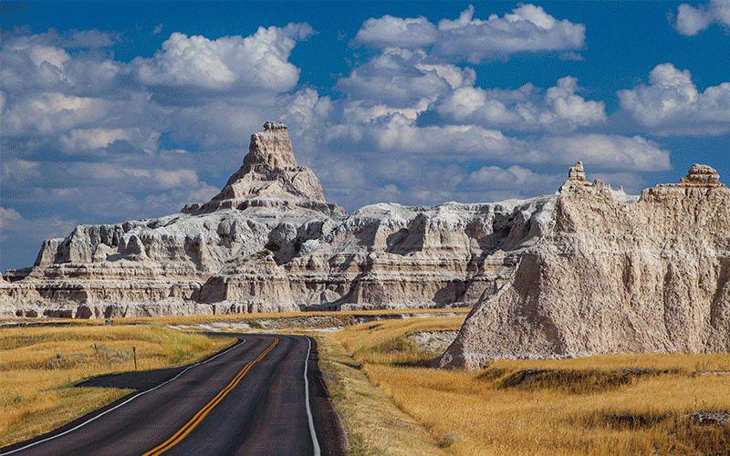
Before reaching the next point of interest, the geology along Black Canyon changes from basalt rock to mudstone formations. Eroded cliffs on the east side of the road rise up about 100 feet. Just beyond (east) of these cliffs and out of view from the road are the large basalt flows that makes up the Black Mountains.
More…
Support Us
Help us fill up our tank with gas for our next trip by donating $5 and we’ll bring you back more quality virtual tours of our trips!
Your credit card payment is safe and easy using PayPal. Click the [Donate] button to get started:
Pictures
Below are some pictures of what you will see along the way.


Stagecoach Stop
At about 12.7 miles, there will be a long and skinny cistern made of rock and mortar on the left. This is the remains of an old stagecoach stop. The cistern was to water the horse team. Located close by is the well that filled the cistern.
This was one of a couple of stops along a road between the Cajon Pass and Panamint City near Death Valley. During the 1870s, there was a silver rush on the west side of the Panamint Mountains near the ghost town of Ballarat. The road through Black Canyon that you are traveling on was part of the stagecoach route.
A short distance past the stagecoach stop is wildlife “guzzler”. It is accessed via a restricted dirt road on the right. It can be spotted from a topo map. The area is restricted as to not disturb the wildlife. They are designed to catch rainwater and divert it into a catch basin. From the basin, birds and small animals have easy access to water. Guzzlers are built by conservationists and sometimes, hunters. There are 3-4 guzzlers located in the Black Mountains.
Scout’s Cove
At 13.6 miles, a road heading to the right leads to Scout’s Cove in about one mile. Originally, this was the site of the Black Mountain Opal Company. Since the 1940s, this area, now renamed Scout’s Cove, has been popular with rock hounds and gem collectors. Green and orange opal used to be plentiful here, as was thomsonite, agate and jasper. Now however, this area is so picked over that you’d be hard-pressed to find anything valuable. If you are determined enough, you might find some precious nuggets.
Scout’s Cove consists of a small valley with mounds of white rock. It is the white rock that the opal and other gems are found. If you look over the white mounds, many diggings will be found. One of the mounds even has a small dugout that miners may have lived in.
From Scout’s Cove, there are a few options to continue on. Continuing north past Scout’s Cove will return you to Black Canyon Road. However, the last half mile of this road is rough and difficult but might be fun for people that enjoy challenging 4WD roads. A quicker but longer route is to return to Black Canyon Road following the road you came in on, then turn right.
Once back at Black Canyon Road following the way you came in (not using the rough 4WD route), reset your odometer to zero. The road will hug the western and northern portion if the Black Mountains until the road is heading due east.
Inscription Canyon
At 2.9 miles from the Scout’s Cove turnoff, take the road that branches to the right. At this point, don’t miss the small panel of petroglyphs on the right, along with some very colorful rock lichen.
We’ve seen many rocks covered with lichen during our travels across the Mojave Desert. Most are usually on basalt rock. But we’ve never seen large patches of lichen with such vivid colors as we’ve seen along here and at Inscription Canyon.
At 3.6 miles, the entrance to Inscription Canyon is reached. It is aptly named because of all the etched petroglyphs found here. Supposedly there are about 1,000 of them. It is one of the few petroglyph sites in California that includes classic drawings of big horn sheep. There are numerous designs, including patterns, wiggly lines and various shapes. Although the experts can’t say exactly what they symbolize (except for the sheep), you can certainly take a guess as to what you think they are. We think that some look like baskets, or maybe snakes and one looks like an elaborate teapot.
Interestingly, the canyon isn’t very long. Unlike the entrance to Black Canyon we saw earlier, Inscription Canyon didn’t seem like it would have been a through-traveled route. To our knowledge, there is no spring or source of water close by. There are other similar and longer canyons close by that have no petroglyphs. So why was this place picked over other sites?
One of the sheep etchings has an unusual red color surrounding it. Although there are colorful lichens close by, none of the lichens are this color. Unfortunately, this color was from red dye that was used by someone to create a “rubbing” of the petroglyph, which resulted in unintentional vandalism. Hopefully, future visitors to this and other petroglyph sites will respect their historical significance and only view them and not touch them. One can only hope…
Return to Civilization
There are a few options for returning to Civilization. We opted to find Opal Mountain Road which leads to the paved Hinkley Road, which connects to Hwy 58 and Route 66. An optional route is to visit the dry lake beds just east of Inscription Canyon and head to Barstow via Copper City Road.
We opted to take Opal Mountain Road which passes by more small opal mines, dug into the aptly named Opal Mountain. It is a more direct route back to Hwy 58. However, just after leaving Inscription Canyon, there are a few rough spots in the road where 4WD is required.
Trip Map
To help plan your trip, use our interactive Google Map below. Be sure to switch to Satellite view to see the terrain.

Learn more about our maps.
Turn left (north) here.
Comments
Read and leave comments about this post on YouTube.
Support Us
Help us fill up our tank with gas for our next trip by donating $5 and we’ll bring you back more quality virtual tours of our trips!
Your credit card payment is safe and easy using PayPal. Click the [Donate] button to get started:
Subscribe
See all our comprehensive virtual tour guides at:
![]()