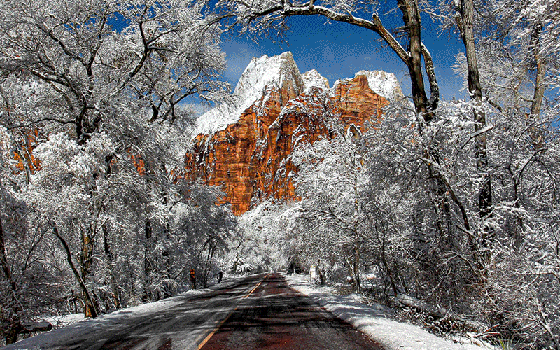
Blue Ridge in the San Gabriel Mountains
This is a great summertime trip because it takes you into the cooler regions of the San Gabriel Mountains of the Los Angeles area. This entire trip can be done in a single day and is broken into two sections. The first section explores a dirt road that runs along Blue Ridge above Mountain High and Wrightwood. The second section is a hike to a gold mine called the Big Horn Mine that was built in 1905 and located on the slopes of Mt. Baden-Powell.


If you live in the Los Angeles area, more specifically the Inland Empire or the High Desert region, then you are probably looking for ways to escape the heat. And this trip is perfect for doing just that because much of the trip will be at altitudes above 6,000 feet.
Getting There
Our trip begins in the mountain community of Wrightwood. You get to Wrightwood by taking I-15 to Highway138 west and then taking Highway 2 west.
Once you are in Wrightwood, there are several things to do. A two block-long downtown area on Park Drive is full of shops and cafes and is located just off Hwy 2. Park Drive is located just past Jenson’s Market (the market is on the right and Park Drive is on the left).
More shops and eateries are located on a few side streets off of the main street. The Wrightwood museum is located on Cedar Street, just one block east of Park Drive and two blocks south of Hwy 2. Before embarking on our trip, you can stop in at Jenson’s Market which offers a deli and unique snacks that you may wish to bring with you.
Big Pines
Continue on Hwy 2. The county line is soon crossed and you will next see the first ski area on the left. This is Mountain High East. This resort was originally known as Holiday Hill. A short distance later, the Big Pines recreation area is reached and you will pass through what remains of the Davidson Arch. What remains looks like a small castle. The arch used to span Hwy 2 [see picture] with a castle-like structure on both sides. The arch was removed to widen Hwy 2. Located here is a visitor’s center. The hours it is open changes often. There are restrooms available which seem to be open all the time. This spot incidentally is the highest point along the entire length of the San Andreas Fault (see our separate tour on the San Andreas Fault through this area).
Big Pines was originally developed by the Los Angeles County park system in 1922. By 1925, it became the biggest attraction in the San Gabriels and crowds became a problem. You wouldn’t believe it, but Big Pines was going to be the site of the 1932 Olympic Winter Games. However, not enough snow fell that year and it was moved to Lake Placid, New York. Big Pines was taken back over by the Forestry Service in 1940.
Just after passing by the arch site, a five-point intersection is encountered. Taking the first right goes to the former resort of Ski Sunrise, now known as Mountain High North, and also JPL’s Table Top Mountain observatory. The second right is the east end of Big Pines Highway. Taking the first left leads into the former resort of the Blue Ridge ski area, now known as Mountain High West. The second left is the continuation of Hwy 2 which ends up in La Canada and the 210 Freeway in 55 miles. Our trip continues following Hwy 2 (the second left), but you may wish to explore the road to Table Mountain as it offers great views of all the ski areas and the high desert to the north.
Blue Ridge
Reset your odometer at the five-point intersection. Inspiration Point (also known as Lightning Ridge) is reached in 1.8 miles. This is one of the largest viewpoints along the entire length of Angeles Crest Highway. Turnouts on both sides of the highway allow you to park your vehicle and enjoy the vistas. When we visited here in July, we were able to see Catalina Island – some 80 miles distant. The large canyon just to the south of the viewpoint is the east fork of the San Gabriel River. A significant gold rush occurred here starting in 1870 and dragged on until 1940. An information sign here points out all the places of interest. The large peak to your right is Mt. Baden-Powell, named after the founder of the Boy Scouts, and is the second highest peak in the San Gabriels. The highest “bald” peak to the left is Mt. Baldy, the highest peak in the San Gabriels.
Just before reaching the turnouts, look for the turnoff to East Blue Ridge Road (F.R. 3N06) on the left. This is our first side trip off of Hwy 2. This narrow forestry road ventures about 12 miles into the rugged San Gabriel Mountains. The first 3 miles is a mixture of broken and good asphalt, whereas the remaining distance is dirt. As its name implies, the road follows what is known as Blue Ridge. Along the way, there are great views in all directions. The road also passes through two of the Mountain High ski resorts as it passes underneath chairlifts. You can actually drive on the same spots where snow-skiers dash downhill during the winter months. The road will continue all the way to the bottom of the San Gabriel River Canyon, but the forestry service doesn’t always have this last portion open.
Blue Ridge Campground is the first campground encountered at three miles in from Hwy 2. It is located in a heavily forested area next to the top of the Mountain High East ski area. There are usually more people camping here.
Guffy Campground, about six miles in, is a great spot to have a picnic. This campground typically has fewer inhabitants than the first. A half mile past Guffy, a fork in the road is reached. Going left (F.R. 3N06) will continue the drive along Blue Ridge. Going right (F.R. 3N39) will descend into the San Gabriel River Canyon and to a place labeled Cabin Flat on the map. 3N39 is often closed with a locked gate a short distance from the fork. If you continue on 3N06, the infamous Wrightwood slides are encountered 1.5 miles from Guffy. These large scars on the north side of Blue Ridge were created by a series of large landslides. The last one occurred in 1969. A significant slide occurred in 1941. These slides, which are still active, were triggered by both heavy rainfall events and movement along the San Andreas Fault. Similar to the warning we always hear about earthquakes, it is only a matter of time when Wrightwood experiences another devastating landslide. The slides are visible from Wrightwood. 3N06 ends about a mile past the landslide. There is a trailhead for a strenuous hike to Mt. Baldy along the way.
More…
Pictures
Below are some pictures of what you will see along the way.


Panoramic view from Inspiration Point

Mountain Biking
The entire length of East Blue Ridge Road from Hwy 2 is also a great route for mountain bikes. If you are a mountain bike aficionado, you may wish to consider parking your vehicle at Inspiration Point and then using your mountain bike to explore Blue Ridge. As you can see from a topographical map, the first mile or so climbs considerably, then loses and gains altitude along the rest of the road, making this a great trip for bikers in medium athletic shape. Just remember that the road is mostly above 8,000 feet and the air will be thinner then what most people are used to.
Vincent Gap
When you are done exploring Blue Ridge, return to Hwy 2 and turn left (west). In 0.6 miles, the Grassy Hollow visitor’s center is reached. Here is another picnic area, campground and restrooms. As of this writing, the center is open Saturday, Sunday and holidays from 10 to 4. The rangers that work here can certainly provide you with a lot more information than we can!
Continuing west on Hwy 2 from Grassy Hollow, Vincent Gap is reached. If you wish to take the hike to the Big Horn Mine, park your vehicle in the parking lot on the left.
Hiking opportunities from the Vincent Gap parking lot include the Big Horn Mine, a thigh-burning jaunt to 9,399 foot Mt. Baden-Powell or a trail down to Mine Gulch. Baden-Powell is an 8 mile round trip hike with an elevation gain of 2,800 feet. Mine Gulch is typically 4.5 miles one way, but backpackers take it all the way down to the San Gabriel Canyon, spending one or more nights. It offers access to the various mines and ruins from the aforementioned gold rush.
Named after the founder of the Big Horn Mine, Vincent Gap was an important pass that was originally used in the later half of the 1800s. It was an alternate route to the mines in Mine Gulch and the San Gabriel River Canyon and later a haul road for the Big Horn Mine. The road came up from Palmdale. At Vincent Gap, it crossed what is now Hwy 2 and then followed the hiking trail used to get to the Big Horn Mine.
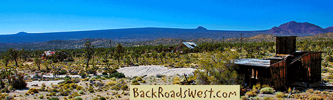
Big Horn Mine
Perched at 7,000 feet on the east face of Mt. Baden-Powell, the Big Horn is the “granddaddy” of all mines in the San Gabriel Mountains. Prospector and mountain man Charles Tom Vincent discovered the gold-bearing quartz vein in 1895 while hunting big horn sheep. He named the mine after the animal he was hunting.
The long story of this mine is very similar to so many gold mines that operated in California from 1850 to 1940. A “rich” vein was discovered by a poor prospector, he sells it to mine promoters for “next to nothing”, the promoters rave to the public that it is the biggest gold strike ever, stock is sold to investors to raise cash, enough money is raised to build a mill and dig shafts to reach the ore, once the ore is worked it is found to be worthless and the mine operation ends up far from turning any profit.
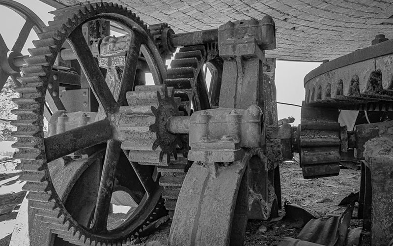
The Big Horn was worked and then sat idle several times. Starting in 1902, enough money was raised to dig some tunnels and build a two stamp mill. By 1904, more tunnels were completed and a ten stamp mill was constructed. In 1905, the mill burnt down and was promptly rebuilt three months later. This is the mill building we see today. By now, a small town with a general store and post office was established near the mill site. But by 1907, it was realized that the ores were not as rich as the promoters said plus litigation brought all work to a halt. Work resumed by another owner in 1914 and then changed ownership several times until 1966. From 1914 to 1966, the various owners only did exploratory work but never mined gold. The current owner, Hanna Mining Company from Cleveland, Ohio, the one that bought it in 1966, attempted to start up the mine in the middle 1980s, but discovered it was too costly to do so and there was considerable objection from the residents of Wrightwood concerned about the increase in truck traffic along Hwy 2.
Hike to the Big Horn
From the Vincent Gap parking lot, locate the large white locked gate to the left of the restrooms. Begin walking on this road past the gate. As mentioned earlier, this was an old wagon (and later truck) road used to transport goods to Mine Gulch and the Big Horn Mine, so the hike is mostly on a wide and level path.
About a quarter of a mile in, a fork in the trail is reached. When we visited, there were two signs at this fork, but they were covered in graffiti and the original information was not visible. The trail to the left, which goes down, follows the bottom of the canyon on the left, which is named Vincent Gulch, goes past Mine Gulch and continues down the San Gabriel River Canyon. For our hike, continue straight on the main road.
On the trail to the Big Horn Mine (the one you are following), a second gulch or canyon will be seen just before reaching the mine itself after the trail makes a big right turn. Appropriately, this is named Mine Gulch. This is the canyon that many mines were located during the aforementioned gold rush. In this gulch and much of the San Gabriel River Canyon, most of the gold was found along the banks of the river’s drainage. So it was only logical that the gold originally washed off quartz veins located on the east slopes of Mt. Baden-Powell – the place where the Big Horn Mine is located.
Along the hike, you will pass under a lush canopy of various conifer and oak trees. There are plenty of good views of the mountain peaks and the canyon below. When you find yourself out of the canopy, be sure to look up (to the right) at the rugged face of Mt. Baden-Powell to appreciate the ever-changing geology, which mainly includes the erosion and massive debris flows (slides) that occur due to the steep slopes.
Be careful if hiking this trail during the winter. The trail crosses several avalanche chutes! People have been killed by avalanches in this area!
There are a few places along the route where debris flows have destroyed the road. Over time, hikers have established a new but much narrower trail. Be careful when hiking over these slides as footing is rough and you can easily slip and fall. The slides are very steep and go on for hundreds of feet, so you don’t want to fall down! By the way, when snow accumulates on Mt. Baden-Powell in the winter months, these same slides become avalanche channels. You may wish to look for evidence of avalanches on the side of the slides. The evidence appears as broken trees and tree limbs. During winter, there has been occurrences of people being killed by avalanches in this area.
After hiking about two thirds of the way to the mine, you will encounter one of the three entrances to the mine. The entrance is gated off, but you can easily look into the straight tunnel (adit). When we visited, there was quite a bit of water running out of the adit.
The last three-quarters of a mile before the mine, the road becomes fairly steep. Soon, the trail makes a sharp right turn as it rounds the ridge that separates Vincent Gulch from Mine Gulch. Here, you will see various terraces on the left. This is the location of the old town that sprung up to support the mine in 1905. If you venture off the trail to explore these terraces, you will find a few remaining foundations.
Continuing up the trail, you will shortly pass through a chain link fence that used to be locked many years ago and prevented people from getting closer to the mine. The trail makes one more bend and then the mill building comes into view.
On the right is the second entrance to the mine. If you wish to get closer to the mill building, it is a bit difficult and involves a precarious rock scramble across a slide. If you complete this scramble and get into the building, just remember that it is fairly unstable and not safe. So watch where you step and don’t stand or lean on anything. If you are able to walk through the other side, you will see a railroad trestle used by ore cars that turns into the third entrance into the mine.
We have heard stories from several people that have entered the mine through these two entrances and walked through the fairly extensive tunnel system. However, as with most mines, entering the tunnels are very dangerous as this mine has several “levels” which are connected with vertical shafts that go straight up or down. When walking through the tunnels, these vertical shafts can be encountered unexpectedly which will cause a fatal fall. Hundreds of people have been killed while exploring abandoned mines over the past few decades from this activity.
Once you are finished looking over the Big Horn Mine site, retrace your steps back to the Vincent Gap parking lot using the same trail you hiked in on.
Trip Map
Support Us
Help us fill up our tank with gas for our next trip by donating $5 and we’ll bring you back more quality virtual tours of our trips!
Your credit card payment is safe and easy using PayPal. Click the [Donate] button to get started:
Subscribe
See all our comprehensive virtual tour guides at:
![]()