Hoover Dam’s Historic Railroad Tunnel Hiking Trail
This hike is a great alternative to visiting Hoover Dam and to see the views from its bypass bridge. Hoover Dam is one of the biggest tourist attractions for visitors to the Las Vegas area. For most people, this engineering masterpiece is accessed in a vehicle via two other masterpieces of engineering – a roadway that clings to the rugged landscape and the new bypass bridge perched high above the dam itself. But there is another way to visit Hoover Dam.


The Trail
Designated a “National Historic Trail” in 2015, the Historic Railroad Tunnel Trail takes you through five uncommon tunnels and offers outstanding views of Lake Mead along the way. Because this hike is on an old railroad bed, it is flat and level most of the way making the 7 miles round trip easy to walk, bike or even push a baby stroller on.
Using the Historic Railroad Tunnel Trail to hike to the dam is a great alternative to dealing with the ever-present traffic congestion that waits for you as you approach the dam. The trail ends at the Hoover Dam Visitor Center and, if you walk a little further, you can be out on the dam itself. It’s also a nice bonus that, since you left your car at the trailhead, you won’t have to pay the $10 parking fee at the Visitor Center.
Once at the Visitor Center, it’s only another one mile round trip to walk over the newly-completed bypass bridge (known as the Mike O’Callaghan–Pat Tillman Memorial Bridge) which will give you the best view of the entire Hoover Dam facility. This is a good option if you have the energy (making the hike a total of 8 miles roundtrip) and want to walk on the bridge. There is a small parking area available for those who want to drive to this point and then walk on the bridge but it fills up quickly. You’ll be taking your chances on finding a parking spot if you were to drive to this point.
Getting There
Getting to the trailhead is easy. From Las Vegas, take I-515 (US 93) to Boulder City. If you are reading this after the new freeway bypass around Boulder City is built (after 2017), be sure to take US 93 into Boulder City, otherwise you’ll miss the trailhead. After US 93 makes a left turn in the center of Boulder City, the entrance to the trailhead is about another 3.7 miles on the left. Look for a sign and head towards the Lake Mead Visitor Center. The trailhead parking lot is located just past the Lake Mead Visitor Center. There are restrooms at the trailhead.
History
Construction of the railroad began in 1931. Between Boulder City, the Hoover Dam construction site and places that are now under the waters of Lake Mead, almost 30 miles of railroad lines were built. Most of the building material used to build the dam, including cement and gravel, as well as all of the electrical hardware (i.e. generators, transformers, penstocks, etc.), was transported over the railroad bed that you are now hiking on. Think of that as you walk along – everything it took to build this incredible dam once took the same trek you are taking now. The railroad was last used in 1961 to transport the last generator that was installed that year and then the rails were pulled up a year later.
And as you walk through the tunnels, take a good look. These are not your ordinary railroad tunnels. They were built much wider and taller so that they could accommodate the huge pieces of equipment being transported to the dam. Walking through the tunnels is a delight. Although some of the tunnels have “shotcrete” to help stabilize them, other tunnels still look as they did when the trains passed through. You can easily see the colorful and complex rock formations that the tunnel builders had to bore through.
Something else interesting about the tunnels is that they make a good habitat for bats. So, as you walk through them, look up and try to find them. They are very small, dark spots on the ceiling. If you happen to be there during the sunset hours, you’ll certainly see some taking flight. Don’t be afraid, they eat bugs, not people and are an important part of the ecosystem.
Just after passing through tunnel #2, look for the information sign that explains how families lived during the dam’s construction period which was also during the years of the Great Depression. While husbands worked on the dam, wives and children endured the heat and cold of the seasons. They hauled water up from the Colorado River (remember there was no Lake Mead then) for drinking and washing. It was a hard life for all but at least they were working during those years and they made a good wage.
More…
Pictures
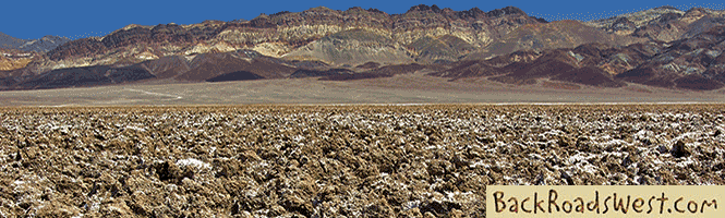
Below are some pictures of what you will see along the way.


ADVERTISING SPACE AVAILABLE
.
Advertise on our website! For more information, please contact us.
We can provide website visitation statistics and advertising rates.
.
Virtual Tour on YouTube
Make sure to watch video in full screen mode and HD 1080p quality!
Continuing the Hike
After going through all five tunnels, the trail passes by a utility area for the dam where there are much-welcomed restrooms, a water fountain and a shaded picnic table. The trail continues on next to the freeway and then turns left. Here you’ll have two choices for a route. The route bearing left is longer but is less steep and is the one we took. It goes by a boneyard of sorts with old equipment and parts once used at the dam. It’s kind of fun to inspect them and try to guess how each part was used.
The two trails join back together and pass through a large yard of electrical transformers. There are more old parts from the dam on display in this portion of the trail, each with a sign explaining what it is. At this point, there are towers and electrical transmission lines going in all directions making for a very chaotic scene.
At the end of the electrical yard, you will encounter an intersection. Turning right will lead you to the parking lot for the bypass bridge, which leads to the inclined walkway to the bridge itself. Going straight will take you down a flight of stairs to the top level of the Visitor Center’s parking lot. From here, you can descend through the center and walk out onto the dam itself.
The Bridge
As mentioned, after exiting the transformer yard, the road to the right leads down to the Mike O’Callaghan–Pat Tillman Memorial Bridge. If you want to add that mile onto your hike, you’ll be rewarded with a breathtaking view of the dam. If you made it this far, adding that extra mile is highly recommended.
If you are fearful of heights, you may wish to pass on the bridge. It is very safe indeed. Be forewarned that the guardrail between the walking path and the 900 foot (270 m) drop to the Colorado River below is a rod-iron barrier so that you can clearly get a good view. On the freeway side of the walkway, there is a four-foot (1.3 m) high concrete barrier. Just on the other side of the barrier is high-speed traffic making the walk a bit noisy. The walkway is about 4 feet (1.6 m) wide and usually sees many visitors.
Plants & Animals
When we took this hike in April, we saw a good mix of wildlife along the trial. We saw desert bighorn sheep on two occasions so be on the lookout for them. They are a treat to see because they are almost impossible to find if they are not moving. In one setting, three sheep were high above one of the tunnel openings walking on the steep cliffs with ease. It was amazing. We also saw several large lizards, including chuckwallas that, like the bighorn sheep, thrive on the rocky landscape.
Growing in the craggy red mountain slopes are small bushes, maybe 1-3 feet in diameter and a foot tall, that have spiny pale-green leaves. Don’t touch them! This is the rock nettle plant. As its name implies, it is similar to the nettle plant that is common in swampy areas. It stings on contact. Furthermore, the leaves of the rock nettle plant will instantly stick to clothing. Rock nettle loves to grow in this type of rocky soil. It is commonly found throughout the Mojave Desert growing in this type of terrain.
Trip Map
Support Us
Help us fill up our tank with gas for our next trip by donating $5 and we’ll bring you back more quality virtual tours of our trips!
Your credit card payment is safe and easy using PayPal. Click the [Donate] button to get started:
Subscribe
See all our comprehensive virtual tour guides at:
![]()