|
|

"Knowledge for the western back roads explorer..." |
|
|
What's in a BackRoadsWest.com Virtual Tour Guide?Our Virtual Tour Guides look and function much like this website. We use the power of technology to make it easy for you to navigate through our information-packed Guides with just the click of a mouse. All of our Guides include several types of maps that are used to give you the most accurate information for the locations of the dirt roads and hiking trails we describe. We also use those maps to show you where the many pictures included in each Guide were taken. These pictures are the very best from our own personal library of thousands. In addition to sharing our detailed knowledge of the roads and hiking trails of a region, our Guides include the history, flora and fauna and geology of that region. We also provide you with other valuable information like road conditions (including pictures whenever possible), area accommodations, travel tips, visitor information and much more. We have blended all of these elements together to give you an easy-to-use, insightful Virtual Tour Guide.
How the Guides are
organized Listed below are some of the different types of chapters and topics you'll find in every Virtual Tour Guide*:
*Note: Because each Guide is about a unique area, not all Topics will apply to every Guide. We have, however, provided as much information as we can about every area. To see what Topics are included in each Guide, click the Guides For Sale button and click on the Topics Included link for each Guide. We are, of course, very proud of our Guides as a whole but consider the Photo Tours and the Maps to be our most unique features. So, here are small samples of each. Click Sample Guide to see a complete Virtual Tour Guide sample.
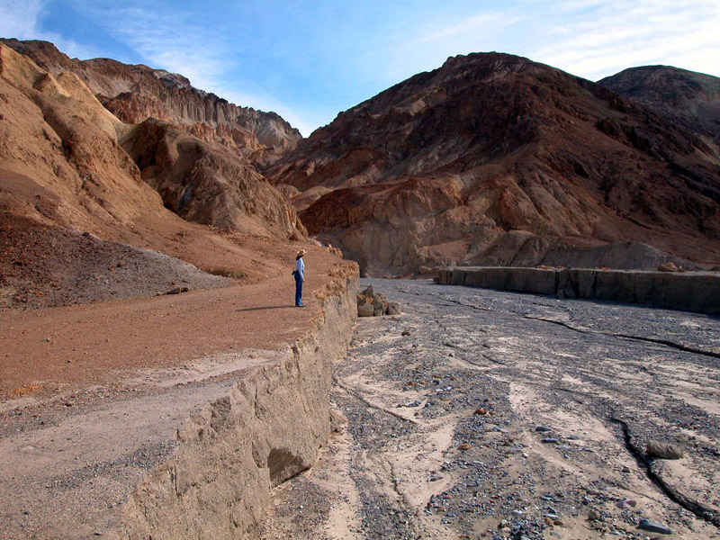
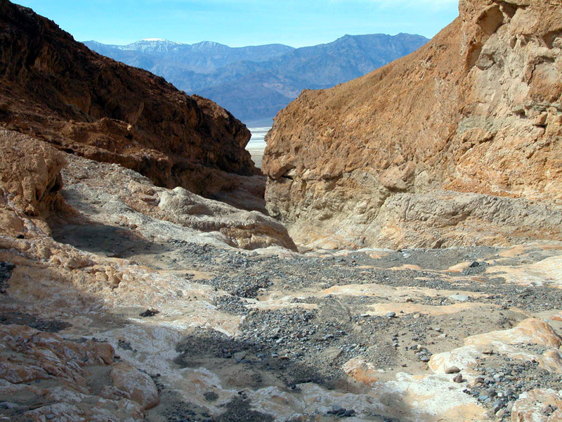
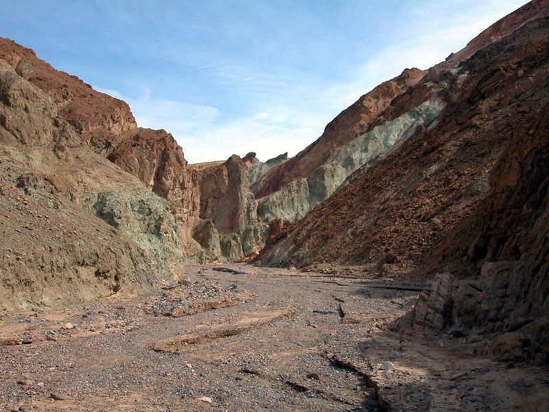
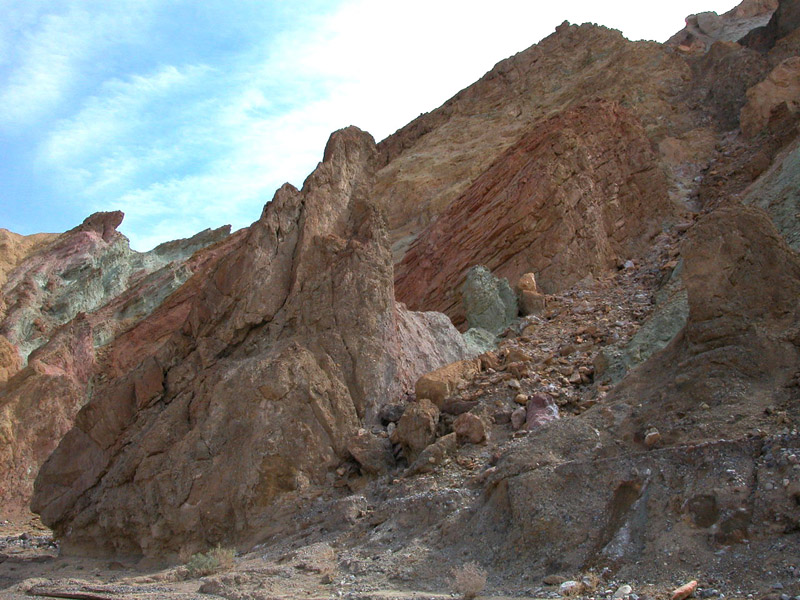
Sample Photo Tour With each Photo Tour, you will be able to follow along with us as we take you, in pictures and descriptions, to our destination. Below is a sample Hiking Photo Tour from the Gower Gulch chapter of our Death Valley Virtual Guide. Try clicking on a picture to see a larger view! To see a more complete Photo Tour, see our Sample Guide .
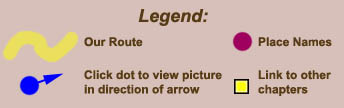
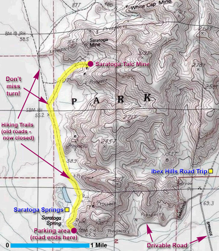
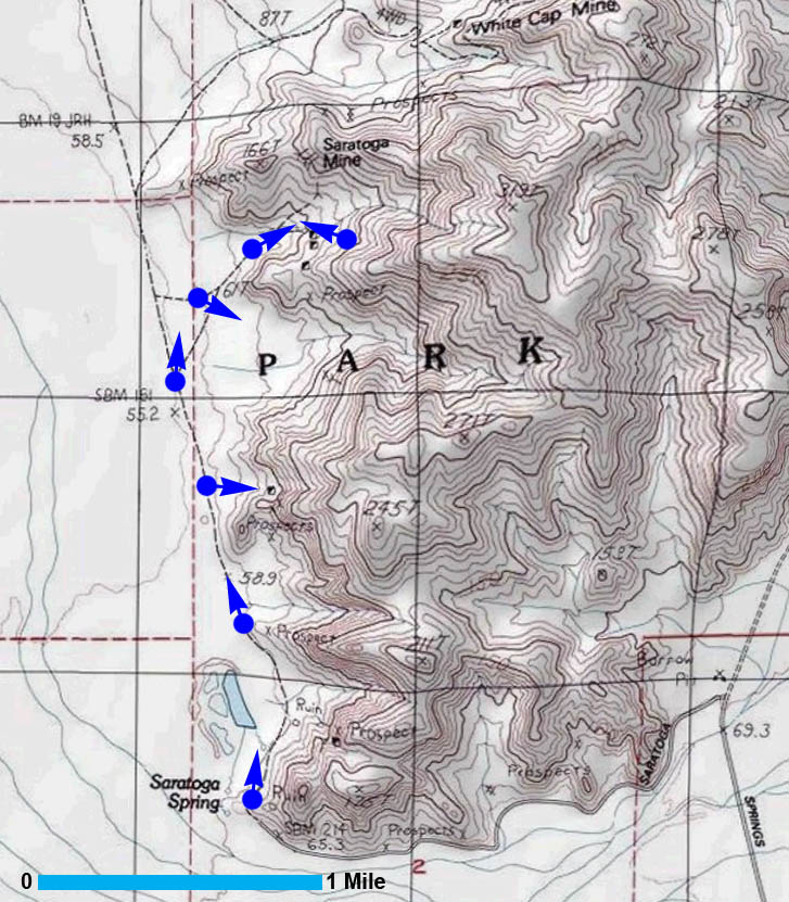
Sample Maps The Interactive View Map also shows you our route but includes our innovative "blue dot" feature. We created this feature as a way to show you, with pictures, what the area looks like from the blue dot marked on the map. To see more of our maps, go to our Sample Guide. Some guides also employ Google Maps to display trip information. Unlike the two static (fixed) maps below, these interactive Google maps are dynamic, giving you, the user, control of many aspects to the map.
As mentioned above, some of our guides employ interactive maps using the free Google Maps service. Not only will you be able to control the map, such as zoom level and what map layers to use (i.e. Satellite, Terrain, etc.), we have also programmed it to show different points of interest along a trip.
|
See a Sample Guide next or go back to Home