|
There is so much important information that
we want to share with you, about our Guides and about us, that we
decided to create a separate place for it all.
Here, we'll tell you about:
Why did we create
BackRoadsWest.com?
In a word: Frustration. Being back road explorers
ourselves, we were constantly frustrated by either incorrect information
and/or lack of any information at all. Most of the time, we just
wanted to know "what is there to see in this area?" or "why would we
want to go there?"
Finding the answer to those questions required
time-consuming research from so many different sources - books, the
Internet, old maps, etc. We spent many more hours on the researching of
an area than we did in all of the other parts of preparing for a trip. A
lot of the information we gathered wasn't written down at all; it was
gathered by word-of-mouth from other explorers we met along the way,
helpful Rangers or friendly people at the various Visitor's Centers.
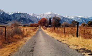
Having spent years gathering information this way for our
own travels, one day we thought how nice it would be
if there was a single-source for all this. As we searched for this
single-source, we quickly realized that such a thing did not exist. We
just knew that other explorers must be having the same problem and be just
as frustrated. So, why not create this single-source ourselves and
share it with our fellow explorers? Why not put all that knowledge we
had gained into a kind of travel/tour guide? A "virtual" tour guide!
As our idea took off, we realized that these Guides would
also be a great way for us to share the awesome beauty of
these out-of-the-way places with those who, for whatever reason, are not
able to get out and go there themselves. We enjoy and appreciate
nature so much - we are always amazed at what She can show us - her
wonders are endless. We try to "take you there in pictures" and
descriptions so that anyone using the Guides will get the "feel" of the
area and, hopefully, enjoy it as we have.
Our Photographs
We love to take pictures but sometimes we don't have very many (or
any at all) for a particular area. There are several reasons for this.
Sometimes the lighting conditions aren't very good so we take the best
pictures we can at the time; hoping we'll get back to that spot sometime in
the future to take some better ones (and get them to you via
What's New). Sometimes the beauty and grandeur
of a place is just too much for us to capture with our cameras and it
becomes one of those places you "just have to be there" to see. And,
sometimes we don't photograph everything because we want to leave you
a few surprises and let you enjoy the "wonder of discovery" for yourself.
We hope to provide you with just the right balance between information and
mystery.
Equipment We Use
We thought it would be helpful for you to know what equipment we use:
 | 1995 Toyota 4Runner (unmodified) |
 | Canon® EOS Rebel
35mm Film Camera (until April, 2003) |
 | Canon® EOS 10D Digital Camera (after
April, 2003) |
 | Nikon® Coolpix
5000 Digital Camera |
 | Nikon® Coolpix
8400 Digital Camera |
 | Delorme®
Earthmate GPS receiver |
 | Toshiba® Notebook
Computer(s) |
 | Delorme Topo USA®
3.0 |
 | ESRI ArcGIS Explorer (www.gis.com) |
 | USGS National Map (http://nmviewogc.cr.usgs.gov/viewer.htm) |
 | Adobe® PhotoShop
CS3 |
 | Microsoft®
FrontPage 2002 |
 | Photodex ProShow Gold® |
Computer System Requirements
Your
computer needs to be running Windows™ 98 or above and your screen
resolution should be set to 1024x768. Before viewing the Sample Guide or a Guide CD, we ask that you check
your monitor display settings and see what "resolution" you are using. Your computer's display screen has
the ability to let you view information at different "resolutions".
Typical resolution dimensions are: 640x480, 800x600, 1024x768, etc.
The higher the dimension values (resolution), the smaller the images get
because more information is being displayed on the screen.
We have found that our pictures look their best when your
screen resolution is set to 1024x768. If you don't know what resolution
your screen is currently set to, please take a moment to check and/or change it
before viewing the Sample Guide.
To check and/or change your computer's screen resolution,
follow these steps:
 | Click Start. |
 | Click Settings. |
 | Click Control Panel. |
 | Double-click the Display icon. |
 | The Display Properties window is
displayed. Click the Settings tab located in the top
right of the window. |
 | In the Screen Area , click the
slider and move it left or right until you see 1024 x 768
pixels displayed. |
 | Click OK. |
This should change your computer screen and give you the
best "look" for our website text and pictures.
Because the Sample Guide contains many pictures, it is best to have a
high-speed Internet connection such as a DSL or cable modem. The
Sample Guide will still work if you have a phone modem but will run slower.
Why we're
different
Something you may notice about our Guides is that they tend to talk
briefly or not include the more popular or well-known attractions
of the area. There are two reasons for this. One is that we
prefer to explore the less-crowded, off-the-beaten-path locations. The
other reason is that those popular spots have already been photographed and
written about many times and we want to offer you
something different.
Our Thanks
We would like to thank all those who have helped us along the way
in the creation of these Virtual Guides. We know that books have
"dedication pages" and wanted to do something like that for our Guides.
Thanks to all the helpful people we've talked to over the years -
in museums, in restaurants, in Visitor's Centers and alongside the road.
We have run into so many nice people over the years who were willing to
spend some time with us and share their information freely. And
special thanks to our friends - Jan, Bobbi, Connie and Ivan - who were
so patient when we asked them to "hold still" for the multitude of
pictures we've taken.
Other people around the Mojave Desert we would like to thank are Rob
Fulton of the Zzyzx Desert Studies Center for much of his input and
geologist Lauren Wright for his guidance on geology.
Back to top of page

Home | What We Do | What's Included | Sample Guide | Guides For Sale | Sample Trips | What's New | Other Stuff | Contact Us | Search | About Us
|