Castle Rock Hike in Big Bear
When it’s hot during the summertime, we all look to the mountains nearby for relief and if you head up to Big Bear in Southern California, one great hiking option is to Castle Rock. It is one of the most popular hikes in the Big Bear Lake region and for good reason: it passes through rugged granite rock outcroppings, offers great views of Big Bear Lake, gives access to other scenic areas if you wish to hike further and provides a great workout because of the hiking trail’s incline. You can’t help but breathe in all that fresh mountain air.


The trail starts out quite steep with a 500 foot elevation gain in the first half mile but it soon levels out. The distance to Castle Rock itself is one mile from the parking area however, our hike continues for another mile past Castle Rock taking you to Bluff Lake and the Champion Lodgepole Pine.
Since this trail is one of the most popular hikes in Big Bear, it can be a little busy, especially on the weekends, but not many people venture past Castle Rock so you might have the rest of the trail to yourself (like we did).
Getting There
The trailhead for Castle Rock is located along Hwy 18 and you can get there by driving either 1.1 miles east from the Big Bear Dam or 0.8 mile west from the parking area of the Boulder Bay Park.
There is limited parking at the trailhead. The best parking is on the south side of Hwy 18 (where the trailhead is located) with about 15 or so spaces just off the road. There is also a turnout east of the trailhead on Hwy 18, on the opposite side of the road, that can accommodate more parking.
Once parked, walk carefully, looking for traffic, to the east side of where Hwy 18 makes a near 180 degree turn. Look for the “Big Bear Lake City Limit” sign and right next to it is the sign marking the trailhead.
The Hike
As mentioned, the trail starts out steep and most of us are not used to the 7,000 feet (2,133 m) elevation. Take your time, stop often and breathe in all of that fresh, pine-scented air. When you stop to catch your breath, make sure to look up an enjoy all the pine trees. About halfway through this steep section are a couple of benches where you can sit and rest.
In about half a mile, the trail becomes less steep and meanders through a maze of granite rocks. It’s fun to spend some time here and look around. Be sure to look behind you for sweeping views of the lake and Big Bear area. There are lots of side trails here so, when you’re ready do continue, look for the signs that mark the true trail.
Castle Rock
Soon after this outcropping, you’ll pass Castle Rock on the right side of the trail. You won’t see it at first but it will peek out between the trees.
Follow the trail past Castle Rock on the left side and watch for rock climbers scaling its eastern face. There is also a trail that goes along the rock’s right side. If you’d like to test your rock scrambling skills, find your way to the south side of the rock, as there are places there where you can climb up to the top. You’ll be rewarded with an unobstructed view of the entire valley below.
More…
Support Us
Help us fill up our tank with gas for our next trip by donating $5 and we’ll bring you back more quality virtual tours of our trips!
Your credit card payment is safe and easy using PayPal. Click the [Donate] button to get started:
Pictures
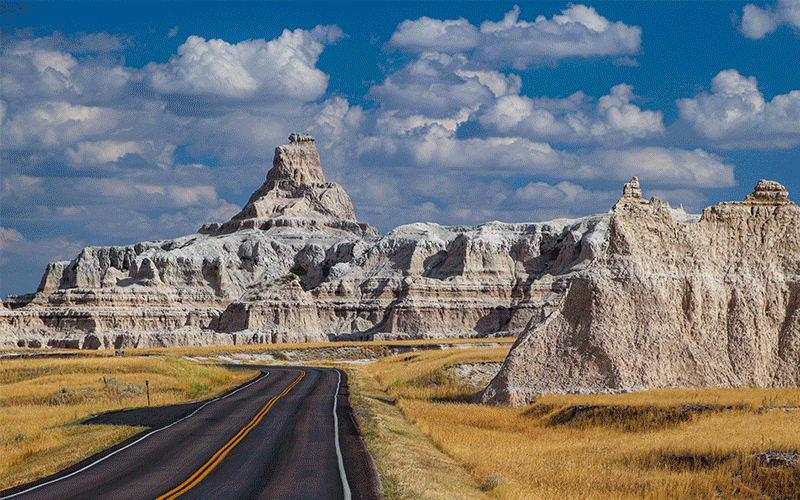
Below are some pictures of what you will see along the way.


Bluff Lake and adjacent meadow

Virtual Tour on YouTube
Beyond Castle Rock
Continue past Castle Rock and look for a main trail that passes down through a gully and then climbs the ridge on the east (left) side of the rock. Remember, the trail is well defined, so don’t try following a faint trail that might lead you the wrong way. The trail will climb significantly again to where it becomes even higher than Castle Rock itself.
Soon, the trail levels off and there are no more climbs for the rest of the hike (whew). The trail now passes through rolling terrain covered with pine trees and manzanita. Before you know it, the trail ends at Forestry Road 2N86 (Mill Creek Road), which is about 2 miles from where you parked your car.
Bluff Lake
From the end of the trail, it is a half mile to Bluff Lake and another half mile to the Championship Lodgepole Pine. Turn right onto the dirt road (2N10) but be aware that this road is open to vehicles and mountain bikes, so watch for traffic. Of course, you could also drive to this point and hike from here. The road makes a 90 degree bend and shortly you’ll see a road leading to the left (south). This is the road to Bluff Lake.
Bluff Lake belongs to the Wildlands Conservancy (www.wildlandsconservancy.org) and is a delightful small lake sitting inside a pristine mountain meadow. Although it is private property, you are allowed to walk through here and enjoy the scenery. There is a very “rustic” log cabin and some ruins located on the shore of the lake along with a picnic table that is a perfect place to sit and take in the quiet beauty.
It is a short distance from the lake to the Champion Lodgepole Pine, but we’ve run out of space here so you’ll have to visit our website for the rest of the directions. It is well worth the walk!
Champion Lodgepole Pine
Follow the trail on the right (west) side of the lake to continue your trek to the Champion Lodgepole Pine.
When you reach the end of Bluff Lake, look for a trail that goes to the right. Take this trail and then the next trail to the left. You’ll pass through a swampy area which is the drainage of Bluff Lake.
Look to your left for a wood-fenced area and a sign that marks where the giant pine tree is located. It is 440 years old and is as tall as an 11 story building – 110 feet (33 m). You really can’t appreciate the size of the tree until you walk into the meadow located west of the tree. Only from there, can you see how this tree towers above everything around it.
Going Back
Return to your car by retracing your route on 2N86 and past Castle Rock. As you head this direction, look for great views of Big Bear Lake and be careful as you descend on that last half mile of the trail.
Trip Map
Support Us
Help us fill up our tank with gas for our next trip by donating $5 and we’ll bring you back more quality virtual tours of our trips!
Your credit card payment is safe and easy using PayPal. Click the [Donate] button to get started:
Subscribe
See all our comprehensive virtual tour guides at:
![]()