Owl Canyon in Rainbow Basin
A hike up Owl Canyon will take most people by surprise. After crossing the wide open spaces of the Mojave Desert near Barstow, one would not expect a canyon full of odd geologic formations and wild colors. Owl Canyon is located inside what is known as the Rainbow Basin Natural Area. This “Natural Area” is managed by the BLM office in Barstow. Rainbow Basin itself speaks for itself – it is a big basin full of colorful geological layers that are warped into what geologists call anticlines and synclines.


Although there are more trips to be taken in this immediate area, the centerpiece of this trip focuses on the hike up Owl Canyon. Owl Canyon covers the eastern section of Rainbow Basin. In this section is the Owl Canyon campground, which is actually comprised of two – the main campground and an equestrian campground. As of 2011, the BLM did some significant upgrades to the entire campground, making it look first rate.
Owl Canyon, along with the entire Rainbow Basin Natural Area, is one of our favorite places to visit close to where we live. Living in the High Desert region of Southern California, there are many choices of places for us to choose from for hiking, sightseeing and enjoying the outdoors. We find ourselves returning to this area often because you can easily spend several days exploring the back roads and hiking through the canyons near Rainbow Basin. Visiting this area as a day trip can even be accomplished by people living in the L.A. Basin or it can be a great multi-hour stopover for people enduring the long drive to Las Vegas.
Getting There
First, travel to Barstow. The virtual video tour will give you good visual directions on how to get to Owl Canyon. Nevertheless, below are the directions. The directions also include suggested stops at two museums.
From I-15, take the Hwy 247 – Barstow Road exit. Turn north. The first traffic light past I-15 is Virginia Way (there is a fire station on the corner). If you turn left here, you can visit the Mojave River Valley Museum which is a great place to learn more about the area and find out about the current conditions of Rainbow Basin and Owl Canyon. Rainbow Basin is well known for its fossils and this museum has the best information to learn more about these fossils.
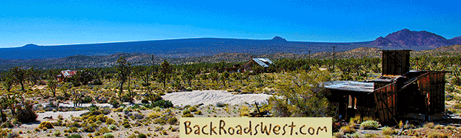
When done with the museum, get back on Barstow Road and continue north. You’ll go down a long hill. At the end of the hill, you will hit ‘ol Route 66. Turn left (west). Here, you’ll enjoy a quick jaunt through historic downtown Barstow. After a few traffic lights, turn right on 1st Ave. Look for the signs pointing to the train station and Harvey House. Soon, you will be crossing an old bridge that spans the many railroad tracks and you’ll see the classic Harvey House building on the right.
If you wish to visit the Harvey House, it houses two museums and Barstow’s Chamber of Commerce. But be aware that the museums are usually only open on the weekends.
Continue on 1st Ave and you’ll cross another bridge just after the Harvey House. The bridge crosses the great Mojave River. Just after this bridge, turn left onto Irwin Road (named after Fort Irwin). Continue north on Irwin Road for 6 miles.
At 6 miles, you will be in the middle of the desert with almost no civilization in sight. You will see the well-maintained dirt Fossil Bed Road leading off to the left (northwest). Turn left here and follow the signs to Rainbow Basin and Owl Canyon.
More…
Pictures
Below are some pictures of what you will see along the way.


The Trail
The nice thing about hiking Owl Canyon is that you can hike up the canyon as far as you wish. The entire length of the canyon is about 2 miles. Owl Canyon actually has a northern entrance where two different wider canyons join together. There are 4WD roads leading to this northern end. We’ve once started our hike into Owl Canyon from the north by driving to the end of one of these roads.
Once you reach the main part of the Owl Canyon campground, continue driving all the way through it. The trailhead is located at the end of the road – you’ll see the sign marking the trail. Once you reach the end, park off the road somewhere.
You will find the start of the trail close to the sign. It heads down into the wash that leads out of Owl Canyon. Other than the very beginning, there is no actual trail for Owl Canyon. It basically follows the canyon’s drainage.
The first part of the canyon passes through fairly jumbled terrain and is not very deep. In some spots, you’ll find many large boulders that have fallen and crumbled into the canyon that you’ll need to walk around.
About a quarter of mile into the canyon, be sure to look for a cave on the right (east) side of the canyon. Believe it or not, this is actually a tunnel. You might even see evidence of water running out of the cave which means that it probably entered from the other side. If you have a flashlight with you, continue to walk through the cave very carefully. We’ve done it several times, once with a geology class. Inside, it becomes completely dark until you see the light of the other side. The other entrance lets out into a small narrow canyon that you can continue to follow to the east. We’ve found about three tunnels, such as this one, in the canyons around Rainbow Basin.
Continuing up the main canyon, it will soon become quite narrow and you might wish to call it a slot canyon. The many characteristics of Owl Canyon will be realized as you pass by and see all of the different colors and geologic formations. Much of what Owl Canyon cuts into is what is known as mudstone. Similar to sandstone, this material used to be mud a long time ago which became strongly cemented together, but it isn’t as strong as sandstone. When water erosion occurred, it created the many random and chaotic shapes you see today.
Less than a mile into the canyon, you will reach the most difficult point to hike through. First, you’ll need to scramble over some steep surfaces. Then, you’ll need to lift yourself over a 6-8 foot high dry waterfall. Hopefully, someone in your hiking party will have some climbing experience to help the others over these points. You’ll see these difficult spots in the hike on the virtual tour.
A little over a mile into the hike, the canyon will dramatically open up. Here you’ll see formations that are somewhat reminiscent of those found in Bryce Canyon, Utah. This open area lasts for about a quarter of a mile.
The canyon narrows up once more and about two miles into the hike, Owl Canyon ends. Most hikers don’t go this far and turn around at the open area. If you are a real experienced hiker and trail finder, you can make a large loop hike by climbing the ridges to the west and dropping down into the various canyons of Rainbow Basin and then return to the Owl Canyon campground.
Trip Map
Continue driving through the Owl Canyon campground. The trailhead is located at the end of the road.
Here is where you turn off the paved Fort Irwin Road to the dirt Fossil Bed Road.
Turn right (north) to Rainbow Basin.
This is a main scenic area of Rainbow Basin.
The canyon becomes more narrow, like a slot canyon. Hike becomes more difficult.
After the narrows, Owl Canyon opens up. There are many odd geologic formations located here.
The main part of Owl Canyon ends.
Support Us
Help us fill up our tank with gas for our next trip by donating $5 and we’ll bring you back more quality virtual tours of our trips!
Your credit card payment is safe and easy using PayPal. Click the [Donate] button to get started:
Subscribe
Submit your email address and we’ll notify you when there is new content.
[subscribe2]
See all our comprehensive virtual tour guides at:
![]()