Zion’s Observation Point: Hiking it the Easy Way
Of all the wonderful places to hike and visit in Zion National Park, only one destination offers a spectacular view looking down the length of Zion Canyon. That destination is Observation Point.


Trip Specs
There are two ways to reach Observation Point: the challenging (hard) way and the easy way. The hard way requires an eight-mile roundtrip hike and includes three miles that climbs just under a half mile vertically. That’s really steep! In addition to the great view once you’re at the top, this hike also takes you through the spectacular Echo Canyon – a slot canyon that has been carved into Zion’s iconic red Navajo Sandstone. You have to be in excellent physical condition to take on this hike so we put it off until we could build up our endurance.
Well, we waited to long. In 2019, a major rock fall occurred at the top of Cable Mountain, which is immediately above the Weeping Rock trailhead and is the beginning of the trail to Observation Point. When that big slab of sandstone fell, it broke into big rocks and sand and buried the trail, along with the hikers on it. Luckily, only three people were injured in the event and nobody was killed. This trail is now closed and will probably remain closed through 2022.
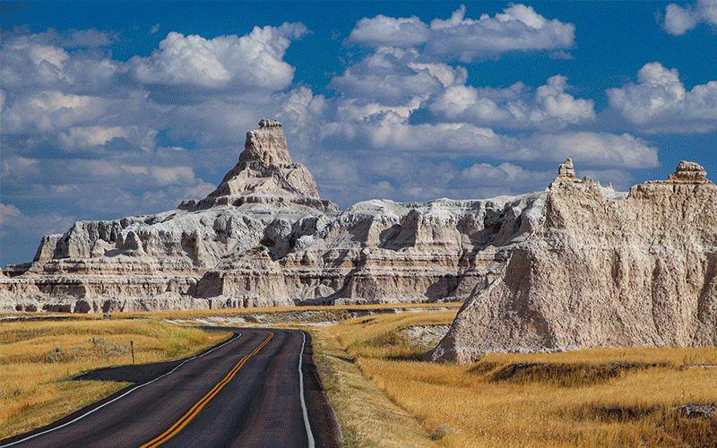
So, since the only way to get to Observation Point right now is the “easy” way, we thought we’d give it a try. It requires driving out of the east entrance of the National Park and then backtracking on a dirt road to what is called the East Mesa Trailhead. After finding a place to park amongst the trees, it is a 3.3 mile (6.6 mile roundtrip) hike to Observation Point. And the best part of this hike? It is almost level the whole way except for a few gradual climbs. Now, that sounds “easy”.
Although it doesn’t pass through a scenic slot canyon, this easier trail does offer views down into two deep side canyons that eventually drain into Zion Canyon. It is well worth the effort to locate them using your topo map or the mapping app you use on your phone’s built-in GPS and walk the short distances. Watch our video tour, details below, on how to download a file to load onto your phone that shows the places to see along this hike.
Once at the trailhead, walk due east and soon you’ll see the signed trailhead to Observation Point. Pass through a fence marking the boundary of the National Park and, just after that, you’ll see a kiosk sign that explains the hike.
Pictures
Below are some pictures of what you will see along the way.


Hiking Route
The trail is easy to follow. Its surface starts out a bit rocky but eventually turns to packed sand. The numerous pine trees that line the trail for most of the hike offer partial shade which is a nice bonus if you’re hiking this trail in the warmer months. Along the way, you’ll see the assorted vegetation that grows atop these highlands above Zion Canyon which average an altitude of 6,700 feet.
At about the 2.5 mile mark, you will see Zion Canyon through the trees in the distance. You will also see Observation Point jutting out over the canyon just to the right of the canyon.
At 3 miles, the trail intersects with the other trail (now closed) that comes up from the Weeping Rock trailhead. Turn right to continue the hike to Observation Point. Its only a short distance now and the trail skirts the side of the canyon.
By carefully looking straight down the cliff, it is easy to find the paved Zion Canyon Scenic Drive almost a half mile below. Just across the canyon you can make out the area called the Temple of Sinawava, which is the trailhead for the popular Narrows hike.
Finally, after 3.3 miles, the trail ends at Observation Point. From left to right, the panorama includes views of Echo Canyon, Cable Mountain, Hidden Canyon, the Great White Throne, Zion Canyon itself, Angels’ Landing, and West Temple – all well-known landmarks of Zion Canyon.
Hiking either trail to Observation Point, whether it be the hard one or the easy one, is a rewarding experience. Once you have taken all that there is to see at the viewpoint, simply return the same way you came in.
This trail is not advisable during the winter and spring months simply because the snow and rain turns the soil into deep, slick mud. This includes the road to the trailhead. Even with a high-clearance, 4WD vehicle, the road is impassable.
Trip Map
To help plan your trip, either use our interactive Google Map below or download our GPX file that points out the places to see that are mentioned in this chapter.
Click here to download our GPX file for the hike to Observation Point. We recommend using a GPS mapping app, such as Gaia GPS, to view these points on your computer or to locate them using GPS with your mobile device or phone. Click the ad below to purchase Gaia GPS using our discount code which offers up to a 50% discount.

Learn more about our maps.
Support Us
Help us fill up our tank with gas for our next trip by donating $5 and we’ll bring you back more quality virtual tours of our trips!
Your credit card payment is safe and easy using PayPal. Click the [Donate] button to get started:
Subscribe
See all our comprehensive virtual tour guides at:
![]()