Sevier Lake & Crystal Peak Road Trip
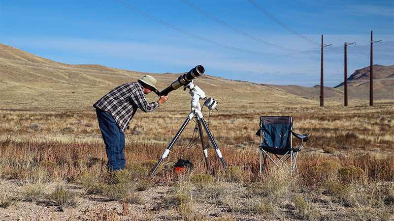
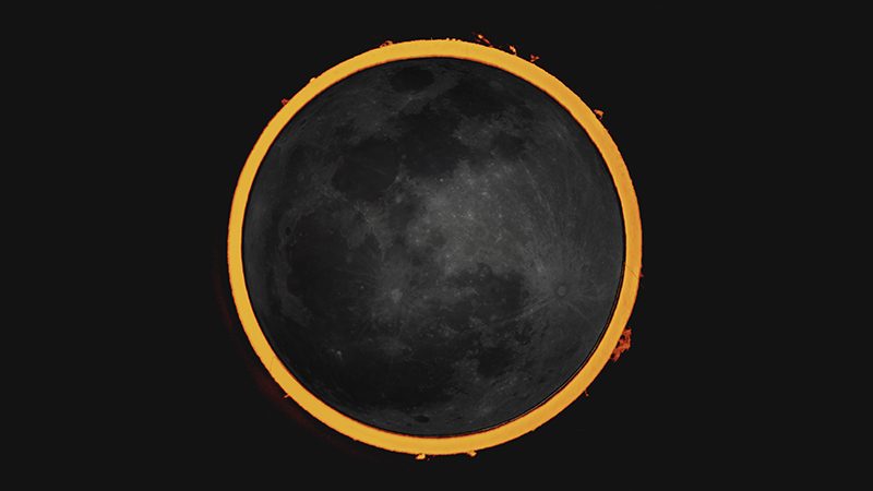
This road trip adventure takes us to the vast Great Basin Desert of western Utah. When we decided to find an ideal spot to view the October 2023 annular eclipse, we headed to an area north of the town of Milford, which is 50 miles north of Cedar City. After watching the eclipse, we noticed there was a direct dirt road that would take us to two places we’ve been wanting to visit, Sevier Lake and Crystal Peak.
Length
40 miles (64 km) one-way
62 miles from Milford, UT
Attractions
- Large dry lake surface
- Crystal Peak
- Vast open desert
- Remote mountain scenery
Difficulty
- All dirt roads
- Very remote area
- Nearest services in Milford
- No phone service
Elevation Gain
- Begins at 4,800 ft
- Ends at 6,270 ft
Get to Milford
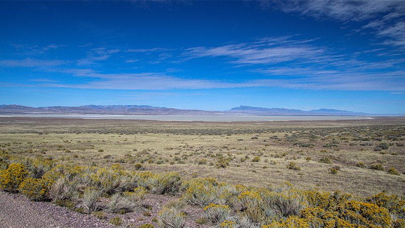
We headed over to Milford, Utah and continued north on Hwy 257 for 22 miles to a place on the map named Black Rock. We turned left on to Road 13. Our first view of Sevier Lake occurred 8.5 miles from the pavement of 257. Also, in the distance, Crystal Peak stood out on the horizon like a beacon, even though it was still 28 road miles away.
Get to the starting point of our road trip by using Google Maps to navigate to Black Rock, Utah. Black Rock is not a town; just a an old water stop on the railroad.
Sevier Lake
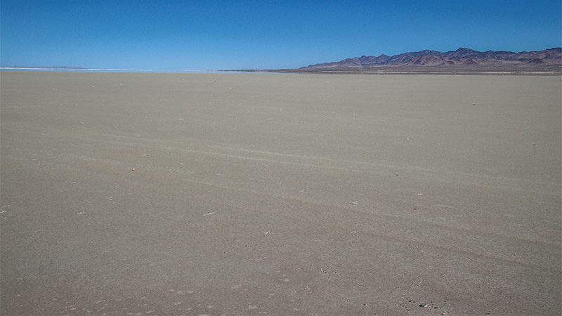
We’ve seen Sevier Lake another time on one of our travels. Normally, Sevier Lake is a dry lake or playa, which has always interested us. Technically, this type of lake is also known as an endorheic or terminal basin, which means water flows into the lake and there is no other way for the water to escape other than evaporation.
The lake is primarily fed by the river of the same name, the Sevier River, which originates near Bryce Canyon in Southern Utah, then heads north roughly following scenic Hwy 89, almost as far as the town of Nephi. From there, it makes a big U turn and heads southwest to the town of Delta, where it empties into Sevier Lake. It’s probably the second largest in Utah after gigantic Lake Bonneville, also known as the Great Salt Lake Desert.
Once we reached the shoreline of Sevier Lake, we found our way out onto a levy with a stable road on top that took us out onto the playa for a few miles. One does not want to drive their vehicle, or even walk, out onto the surface of the playa. It’s still a little damp, and the weight of a vehicle will cause it to sink in and get seriously stuck, and it’s a long way to the nearest tow truck.
Viewing the playa’s surface from the levy road is surreal. The ultra smooth surface, the distant mountain ranges, and the mysterious mirage often accompanied on playas. When we flew our drone for a birds-eye view, we noticed there were a few other levies. These were probably built during some type of mining or prospecting operation. Many playas in the Southwest are rich with alkaline-based mineral deposits. In 2019, a company has been given a permit to mine potassium from the playa. However, during our visit, we couldn’t find any evidence of recent human activity.
More…
Pictures
Below are some pictures of what you will see along the way.
Crystal Peak
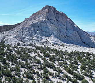
From Sevier Lake, we continued due west on Road 13 to reach Crystal Peak. Even from the long distance away, we continually saw the bright-white peak get closer and closer. The road was in such good condition, we thought we were on a paved road, allowing us to travel faster over the desolate terrain.
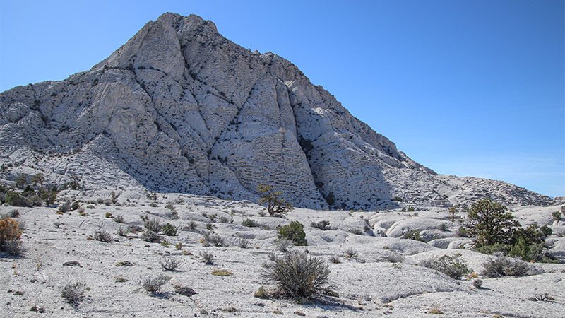
Crystal Peak is definitely a geologic oddity. Nothing like it exists for many miles around. It is stark white compared to the brown and gray hills of the Great Basin. Upon closer inspection, one can clearly see that the mountain is made up of a different type of material. This material is volcanic ash and was created from the remnants of a huge pyroclastic flow. What is seen today is a mere fraction of what used to exist.
Another interesting characteristic of Crystal Peak is that it’s full of small holes and cavities. The peak looks like a big chunk of Swiss cheese. These holes most likely formed when the super-heated ash quickly cooled and changed into a solid. The holes were probably formed by gas bubbles inside the ash. Not long after the eruption, the gas escaped, leaving behind the holes. But that’s only a guess.
The road passes by Crystal Mountain with not many access points or trails. If you’d like to experience its unique and bizarre terrain, look for a short road leading south from Road 13 on the east side of the mountain. Park here, then walk towards the mountain to whatever strikes your fancy. There’s a lot of interesting nooks and crannies to explore.
Continuing on Road 13 past Crystal Mountain a short distance will provide a view of Wheeler Peak, the second highest point in Nevada, which is inside Great Basin National Park. Return back to civilization by heading back on Road 13 the way you came in.
Trip Map
To help plan your trip, use our interactive Google Map below. Be sure to switch to Satellite view to see the terrain.
Learn more about our maps.
Comments
Read and leave comments about this post on YouTube.
Support Us
Help us fill up our tank with gas for our next trip by donating $5 and we’ll bring you back more quality virtual tours of our trips!
Your credit card payment is safe and easy using PayPal. Click the [Donate] button to get started:
