Kaiparowits Plateau Road Trip
The Kaiparowits Plateau is a remote mountaintop region in south-central Utah that is inside the Grand Staircase-Escalante National Monument and recently renowned for its treasure chest of dinosaur fossils. The plateau also offers a combination of road trips, either leaving out of the towns of Big Water or Escalante. On the trip showcased here, we’ll concentrate on the north half of the Kaiparowits by starting and ending in Escalante using Hole in the Rock and Smoky Mountain Roads.


Trip Specs
Length
Attractions
- Dinosaur trackway
- Area where many fossils are being found
- Spectacular geology
- Great views
- Seldom visited areas
Difficulty
- High clearance 4WD required
- Road prone to washouts
- Very remote area
- No phone service
- No services
- Navigation skills needed
Elevation Gain
Where the name Kaiparowits comes from
The name “Kaiparowits” comes from a Paiute name that means “Big Mountain’s Little Brother”. The Paiute are the Native American tribe that have inhabited southern Utah for the past several-hundred years. The Paiute may have meant that the Kaiparowits is little brother to the neighboring Aquarius and Paunsaugunt Plateaus, which are roughly the same size.
The Paiute language has been used for naming many places nearby, such as the original name of Zion National Park (Mukuntuweap National Monument) and the narrowest part of the Grand Canyon, Toroweap, where the suffix weap means “canyon” or “of the Earth” in Paiute.
Dinosaur Fossils
Since the 1990s, exciting discoveries have been made here of fossilized animal remains that once lived in the Late Cretaceous Period, which is the period that occurred after the Jurassic period. These fossils are found in rock layers and sediments laid down 82 to 70 million years ago. This area is full of paleontological treasures, the majority of which have yet to be discovered.
These fossils were deposited in the many geologic layers or formations of the Kaiparowits. Some of these formations include the Morrison, Tropic Wahweap, Straight Cliffs, and Kaiparowits (the plateau’s namesake). When traveling this road trip, you’ll see firsthand and pass through all of these different layers where prehistoric animals used to roam.
Learn more about the on-going discovery of fossils on the plateau at the national monument visitor centers located in both Big Water and Escalante. Big Water is located on Hwy 89, 17 miles west of Page, Arizona. Escalante is located on Utah SR 12, 45 miles east of Bryce Canyon National Park. Big Water’s visitor center specializes more on the discoveries made in the Kaiparowits with displays and information on the dinosaurs that lived during the Cretaceous.
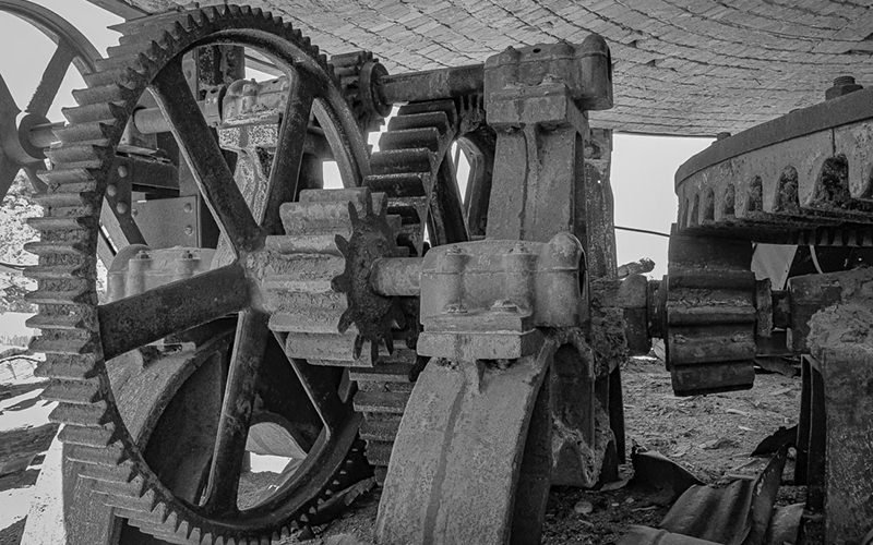
Dinosaur-related Pictures
Below are some pictures of what to see at the Grand Staircase-Escalante Visitor Center in Big Water, Utah, that focuses on the dinosaur fossils found throughout the Kaiparowits Plateau.


Grand Staircase
Taking this road trip into the Kaiparowits Plateau is a great way to experience the so-called “Grand Staircase”. This unique geologic feature is a series of steps starting at the bottom of the Grand Canyon and ending on the top of Bryce Canyon National Park.
Each step is a geologic layer or formation that literally is a recording of what was going on with the Earth’s history at a give period of time. The deeper the layer, such as in the Grand Canyon, the older the time. Bryce is topped with the last (or youngest) layer deposited and formed some 50 million years ago.
What is recorded in those layers are different sediments that gave clues as to what has happening on the Earth’s surface at that time. Was the land a forest? Was it a river delta? Was the land made of giant sand dunes? Inside those sediments, remains of plants and animals, including their footprints, were also left behind and fossilized.
When you travel into the Kaiparowits using the road trip explained below, you’ll be passing through one of the last steps in the Grand Staircase, before it reaches Bryce. Along the way, you’ll see many of these layers of rock and sediment. It’s anyone’s guess where these fossils can be unburied and revealed.
Dinosaur Trackway
To keep with the dino-theme, along this road trip we’ll make a stop at the Twenty Mile Wash Dinosaur Track Site. Here, you’ll find two (or possibly more) fairly long tracks or series of dinosaur footprints. There are two different types of tracks, made by two different animals.
Although our road trip focuses on the neighboring Kaiparowits Plateau that was deposited during the later-half of the Cretaceous Period (80-65 million years ago), the footprints in this trackway were actually made during the Jurrasic Period, around 150 million years ago. The footprints appear in the tan-whiteish-grey Entrada Sandstone formation that is common at the base of the Kaiparowits Plateau. Incidentally, scenic rock formations, such as arches and hoodoos, are found in the Entrada Formation just outside of both Big Water and Escalante on both sides of the plateau.
As mentioned, there are two distinctively different animal tracks. One is round and about the size an elephant would leave. The other seems to have been left by an animal with three toes.
Learn more about the trackway by reading this PDF/paper: Dinosaur Tracks and Trackways in the Escalante Member of the Entrada Formation.
More…

Pictures
Below are some pictures of what you will see along the way.


Road Trip
As mentioned, our trip begins and ends in Escalante. It consists of a loop trip on three named roads: Hole in the Rock Road, Left Hand Collet Canyon Road, and Smokey Mountain Road.
NOTE: Don’t miss the downloadable and interactive map below.
Before starting this trip, go to the national monument visitor center on the west side of town and check the road conditions of the three aforementioned roads. The road to be most concerned with is Left Hand Collet Canyon Road, as it sits on a major drainage and frequently washes out, making it impassable. Also, make sure to leave Escalante with a full tank of gas and enough food and water to last you through the journey. This trip is about 60 miles one-way on dirt roads.
Start by driving out of Escalante on Hwy 12 heading east. At about 4.5 miles from town, turn right onto Hole in the Rock Road and reset your trip meter. Continue on this well-used dirt road for about 12 miles to Devil’s Garden on the right. You should be a sign marking the entrance.
Plan to spend at least half an hour or more wondering around Devil’s Garden, which is a collection of hoodoos, arches and rock formations. These formations were formed near the junction of two members of the Entrada Sandstone formation, which are clearly visible as the lower member being grayish white, while the upper member is brownish.
Continue down Hole in the Rock Road for another two miles until the junction with Left-hand Collet Road is reached. Turn right. You’ll see the opening of Left-hand and Right-hand Collet Canyons cut into the Straight Cliffs ahead. After turning right, reset your trip meter again.
At 2.3 miles, turn right onto an unmarked road to visit the Twenty Mile Wash Dinosaur Track Site. Continue on this short road for about half a mile to the base of that same grayish white Entrada Sandstone we visited earlier. The tracks are found on the upper bench of sandstone.
When finished at the dino-track site, continue up Collet Canyon Road. Soon, you’ll enter the canyon. Notice all the different brown and beige-colored layers that were laid down around 75 million years ago. Some of the layers have created very striking rock formations and shapes.
As the canyon narrows, the road becomes rough and increasingly challenging. Keep in mind that this is a major drainage of the plateau and the road sits in the bottom of that drainage. This is why it is important to check on the road conditions before leaving Escalante.
At about 7.5 miles from Hole in the Rock Road, the road exits Collet Canyon and climbs up through a side canyon on the left to the top of the Kaiparowits Plateau. This road too sits in the bottom of a canyon and can be challenging with rock steps your vehicle will need to rock-crawl up.
Finally, at 10.6 miles, the road reaches the top of the Kaiparowits Plateau. From here on in, usually, the roads are in much better condition since the terrain is mostly flat. Being on top of the plateau, you’ll also have a great view in many directions, including seeing Powell Point (the highest spot in the Colorado Plateau) 25 miles to the northwest and the Henry Mountains near Capitol Reef, 50 miles to the east.
Keep bearing right at turns, following signs to Escalante. Shortly, you’ll be on Smokey Mountain Road (BLM Road 300), which comes up south from Big Water and Lake Powell. This is a major north-south road and is usually well-maintained. But it is still a very remote and seldomly-used road that also crosses a lot of drainages, making the road susceptible to washouts.
Smokey Mountain Road crosses over the tops of many of the tributary canyons that feed into Collet Canyon below. Looking down those canyons, one can only guess where to start digging to find the next big fossil treasure.
At about 32 miles from Hole in the Rock Road, Smokey Mountain Road reaches a summit and begins descending into a low-laying valley named Little Valley. This is the beginning of the drainage of Alvey Wash. For the next ten miles or so, the road gradually descends through the canyon created by this wash. You’ll recognize many of the same rock layers you passed by climbing Collet Canyon. Except for here, you’ll pass through them more gradually.
After existing the canyon, the town of Escalante will be seen ahead and, before you know it, you’ll be back on pavement.
Trip Map
To help plan your trip, either use our interactive Google Map below or download our GPX file that points out the places to see that are mentioned in this chapter.
Click here to download our GPX file that follows our tour of the Kaiparowits Plateau. We recommend using a GPS mapping app, such as Gaia GPS, to view these points on your computer or to locate them using GPS with your mobile device or phone. Click the ad below to purchase Gaia GPS using our discount code which offers up to a 50% discount.

Learn more about our maps.
Comments
Read and leave comments about this post on YouTube.
Support Us
Help us fill up our tank with gas for our next trip by donating $5 and we’ll bring you back more quality virtual tours of our trips!
Your credit card payment is safe and easy using PayPal. Click the [Donate] button to get started:
Subscribe
See all our comprehensive virtual tour guides at:
![]()